Overview
 |
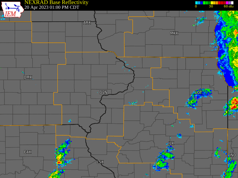
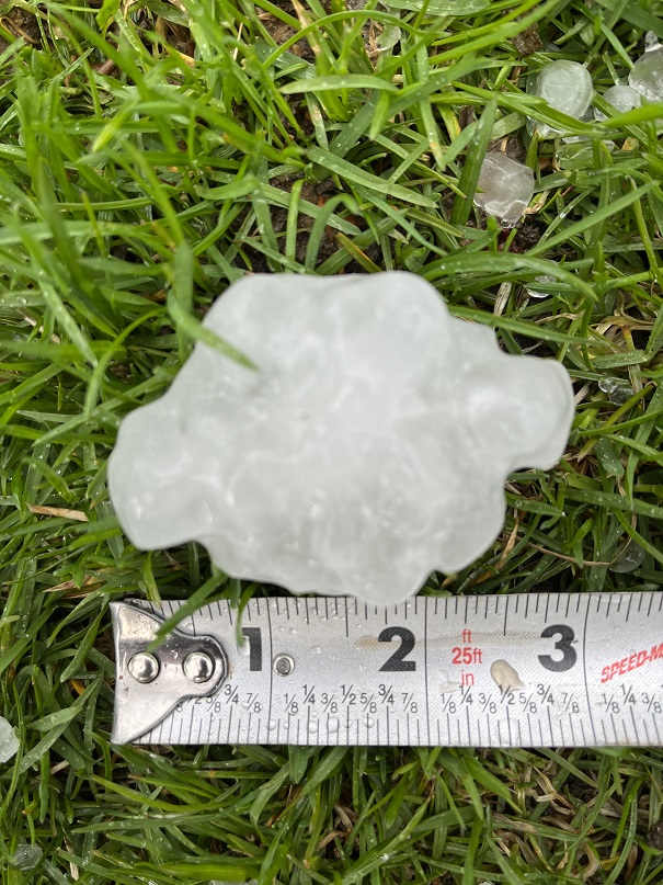
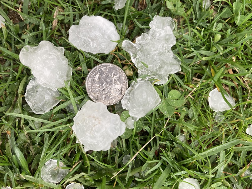
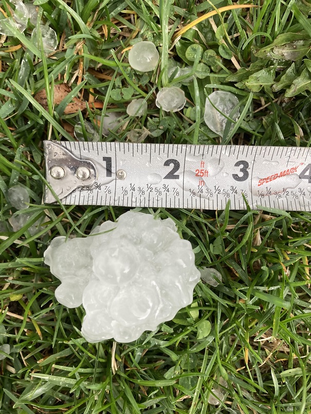
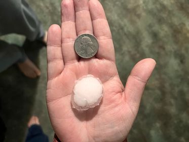
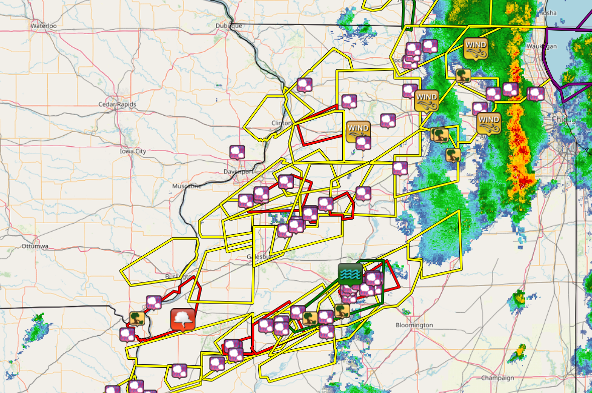
A powerful storm system moved northeast across eastern Iowa into southwest Wisconsin sweeping a strong cold front through the area during the afternoon hours of Thursday, April 20th. A line of thunderstorms developed quickly along the front, with some of them surpassing severe thresholds producing hail up to the size of a golf ball. |
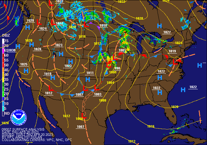 WPC Surface Fronts and Radar Map |
Tornadoes:
|
Tornado 1 - Morrison to Malvern, IL
Track Map 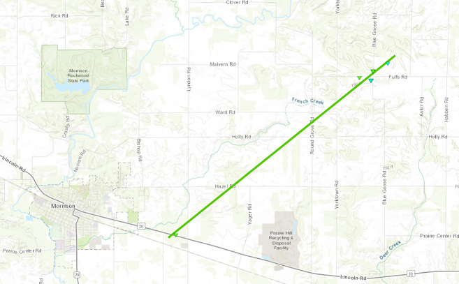 
|
||||||||||||||||
|
Tornado - LOCATION
Track Map
|
||||||||||||||||
The Enhanced Fujita (EF) Scale classifies tornadoes into the following categories:
| EF0 Weak 65-85 mph |
EF1 Moderate 86-110 mph |
EF2 Significant 111-135 mph |
EF3 Severe 136-165 mph |
EF4 Extreme 166-200 mph |
EF5 Catastrophic 200+ mph |
 |
|||||
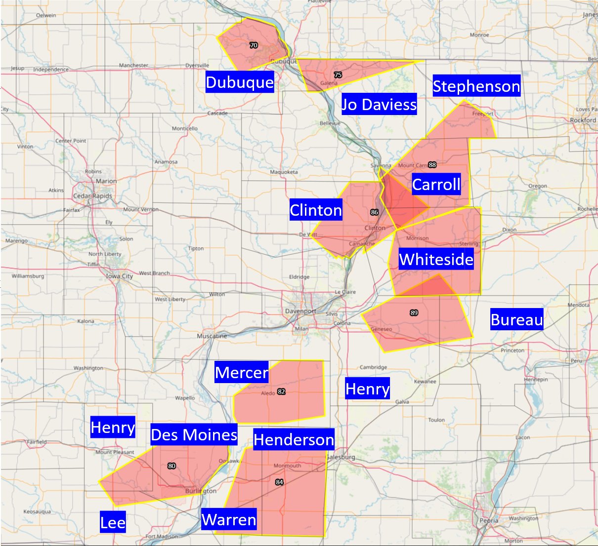
Hail
 |
 |
| 1 N Orion, IL P. Nilles |
1 N Orion, IL P. Nilles |
 |
 |
| 1 N Orion, IL P. Nilles |
Kewanee, IL E. Michael |
Storm Reports
| IEM Storm Reports | SPC Severe Weather Event: Apr 20, 2023 |
 |
 |
|
..TIME... ...EVENT... ...CITY LOCATION... ...LAT.LON... 0214 PM HAIL 1 N WAYLAND 40.41N 91.58W VIA SOCIAL MEDIA. TIME ESTIMATED USING 0230 PM HAIL 1 NNE FORT MADISON 40.63N 91.34W
0258 PM FUNNEL CLOUD 1 NE BURNSIDE 40.51N 91.08W
0258 PM HAIL 1 NNW ELDRIDGE 41.65N 90.59W
0308 PM HAIL INDUSTRY 40.32N 90.61W
0310 PM HAIL INDUSTRY 40.32N 90.61W HAIL LASTED 5 MINUTES AND NEARLY COVERED THE 0310 PM HAIL 1 W INDUSTRY 40.33N 90.64W
0312 PM HAIL 1 W INDUSTRY 40.33N 90.64W HAIL SIZE INCREASED TO QUARTERS. 0315 PM HAIL SHERRARD 41.32N 90.51W
0320 PM HAIL 1 N ORION 41.37N 90.37W SPOTTER REPORTED MOSTLY QUARTERS WITH A FEW 0320 PM HAIL ORION 41.35N 90.37W RELAYED VIA SOCIAL MEDIA. 0320 PM HAIL ORION 41.35N 90.37W RELAYED VIA SOCIAL MEDIA. 0320 PM HAIL ORION 41.35N 90.37W RELAYED BY BROADCAST MEDIA. VIEWER PHOTO. 0337 PM HAIL GENESEO 41.45N 90.15W MEDIA RELAYED A VIEWER PHOTO OF GOLF BALL 0339 PM HAIL GENESEO 41.45N 90.15W
0341 PM HAIL MOUNT CARROLL 42.10N 89.98W REPORTED VIA SOCIAL MEDIA. 0345 PM HAIL GENESEO 41.45N 90.15W
0402 PM HAIL 2 SW GALVA 41.15N 90.06W NICKEL HAIL 1.5 MILES SOUTHWEST OF GALVA. 0403 PM HAIL GALVA 41.17N 90.04W RELAYED VIA SOCIAL MEDIA. TIME ESTIMATED BY 0405 PM HAIL 2 SW GALVA 41.15N 90.06W QUARTER SIZE HAIL 1.5 MILES SOUTHWEST OF 0413 PM HAIL KEWANEE 41.24N 89.93W
0413 PM HAIL KEWANEE 41.24N 89.93W RELAYED VIA SOCIAL MEDIA. TIME ESTIMATED BY 0416 PM HAIL 1 S KEWANEE 41.23N 89.93W
0423 PM HAIL NEPONSET 41.30N 89.79W RELAYED VIA SOCIAL MEDIA. 0448 PM HAIL 1 SE PRINCETON 41.37N 89.45W |
|
 |
Media use of NWS Web News Stories is encouraged! Please acknowledge the NWS as the source of any news information accessed from this site. |
|