Quad Cities, IA/IL
Weather Forecast Office
Overview
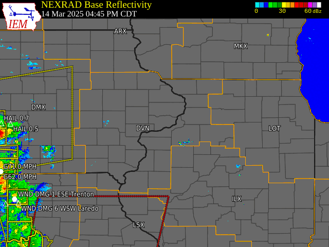
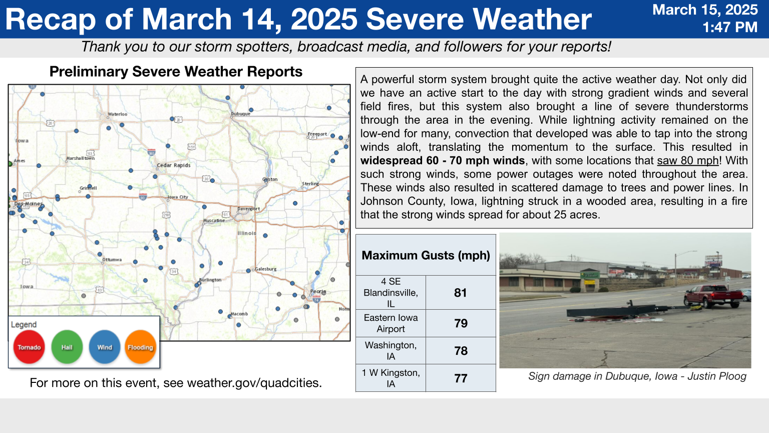
A strong storm system impacted the forecast area on March 14, resulting in a multitude of hazards seen through the afternoon and evening. Through the late morning and afternoon hours, the storm system created quite the strong wind field throughout much of the Midwest, resulting in widespread strong winds gusting upwards to 40-55 mph through the day. These very strong winds combined with dry antecedent conditions led to a very high fire danger area-wide, prompting a Red Flag Warning. Several fires resulted from these conditions, with gusty winds aiding the spread of the fires.
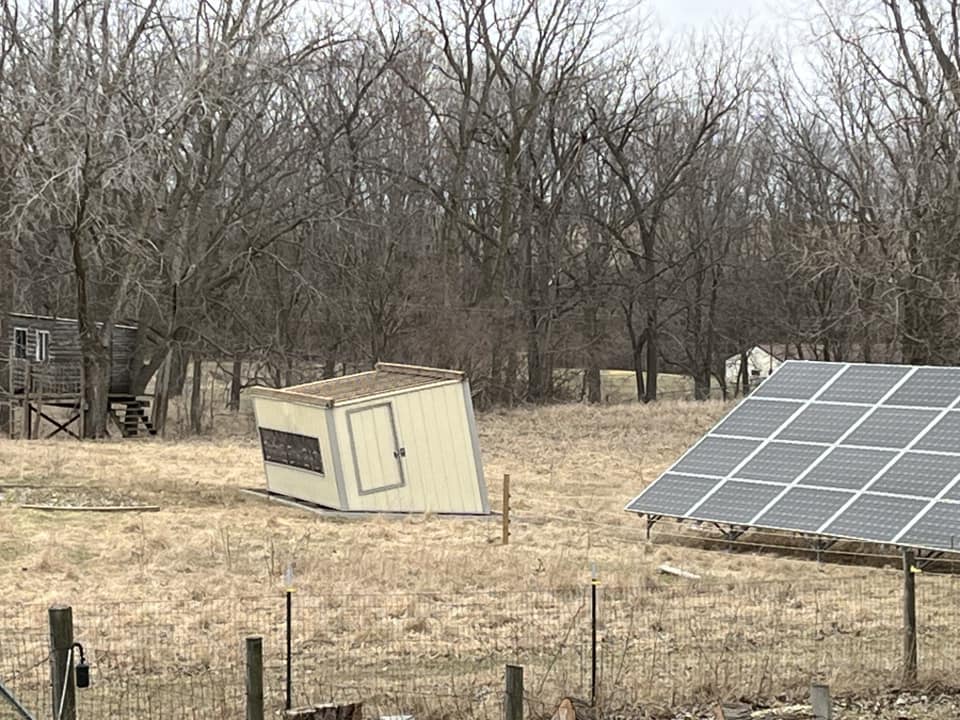
Not only did we have an active start to the day with winds and fire weather conditions in place, but the system also brought a line of showers and severe thunderstorms through the area that evening. While lightning activity remained on the low-end, convection that developed was able to mix down the strong winds aloft, causing damaging winds to occur at the surface. This resulted in widespread 60-80 mph winds, with some locations that saw over 80 mph. With such strong winds, numerous power outages were noted throughout the area. These winds also resulted in damage to trees, structures, and power poles/lines. In Johnson County Iowa, lightning struck in a field of timber, resulting in a fire that the strong winds spread for about 25 acres. We also confirmed one EF-0 tornado that occurred just northeast of Wilton, IA. The tornado occurred between 8:49-8:51 PM Friday evening, with estimated peak winds of 85 mph and a path length of 1.9 miles.
 |
.png) |
| Severe Thunderstorm Recap Slide | Wilton, Iowa EF0 Tornado (Full Public Information Statement) |
Other NWS Event Summaries: Chicago IL, Lincoln IL, Des Moines IA
Photos & Video
 |
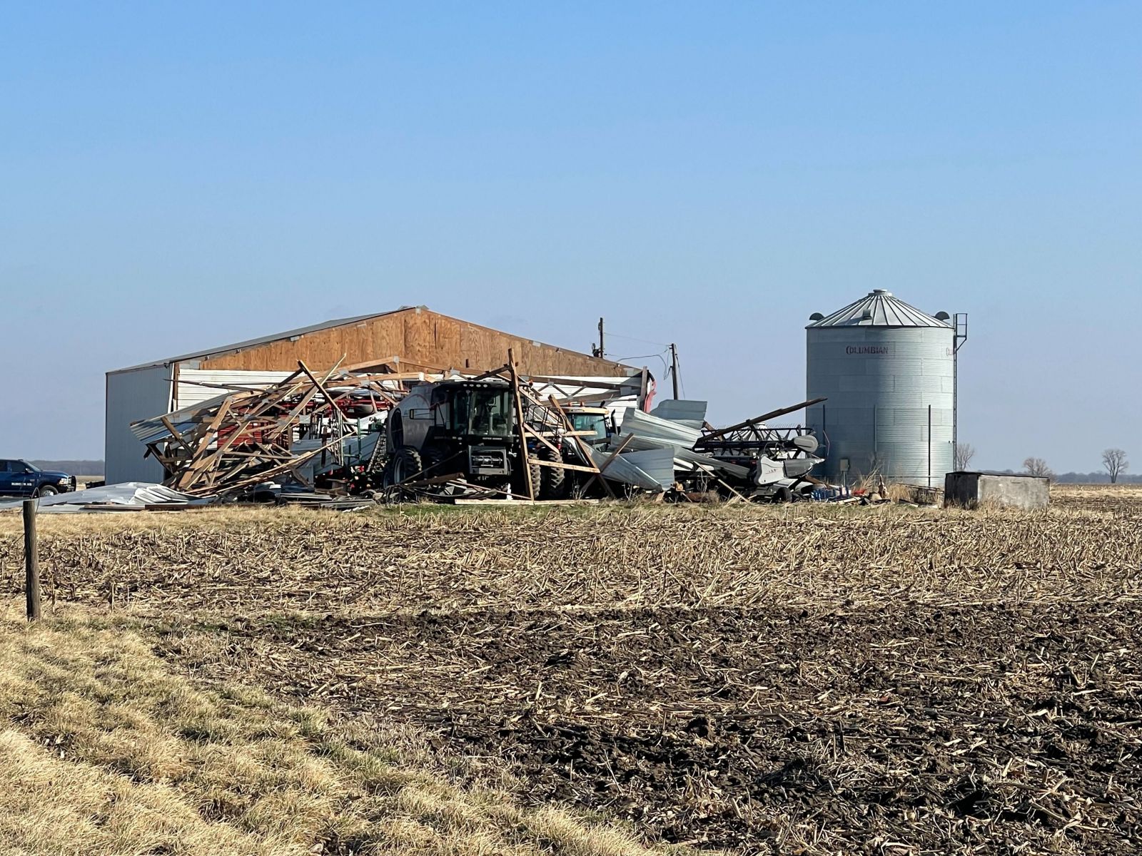 |
| Thunderstorm winds flipped a portable heavy chicken coop on the north side of Orion, IL - Courtesy of Jennifer Horwath Burnham | Thunderstorm winds severely damaged a machine shed near West Point, IL - Courtesy of Brent Clair |
 |
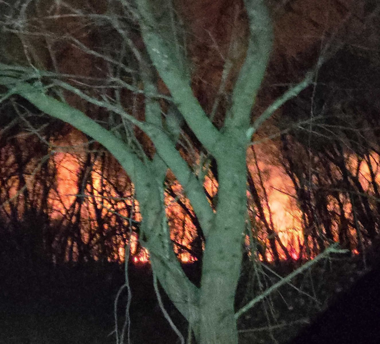 |
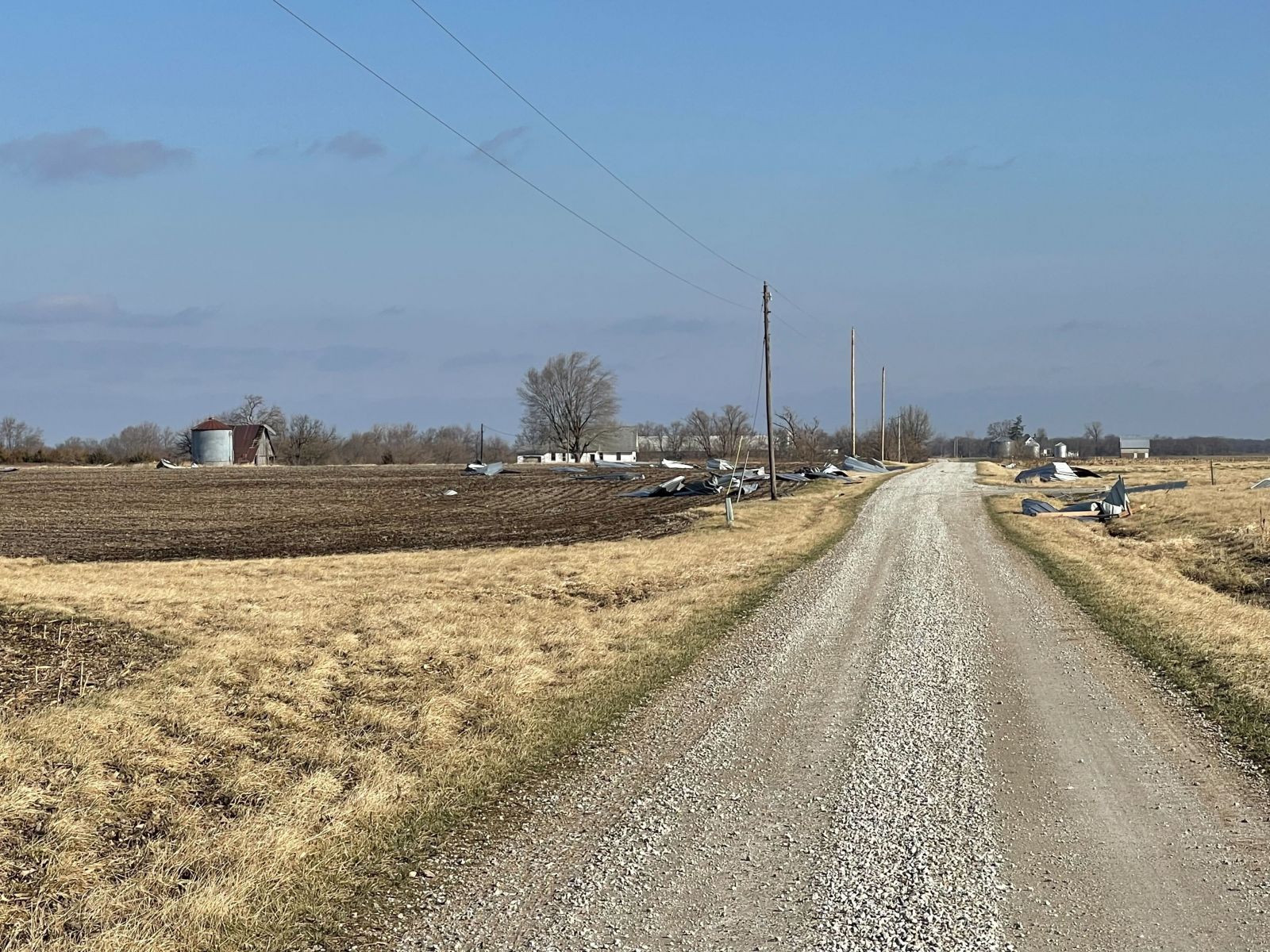
| Sheet metal from machine shed blown across gravel road - Courtesy of Brent Clair | Lightning sparked this 25 acre fire near Green Castle Airport in Johnson county - Courtesy of Johnson County IA EMA |
Storm Reports
|
Storm Report Map of County Warning Area and Adjacent Areas Note numbers of reports on key are nationwide totals from March 14, 2025 |
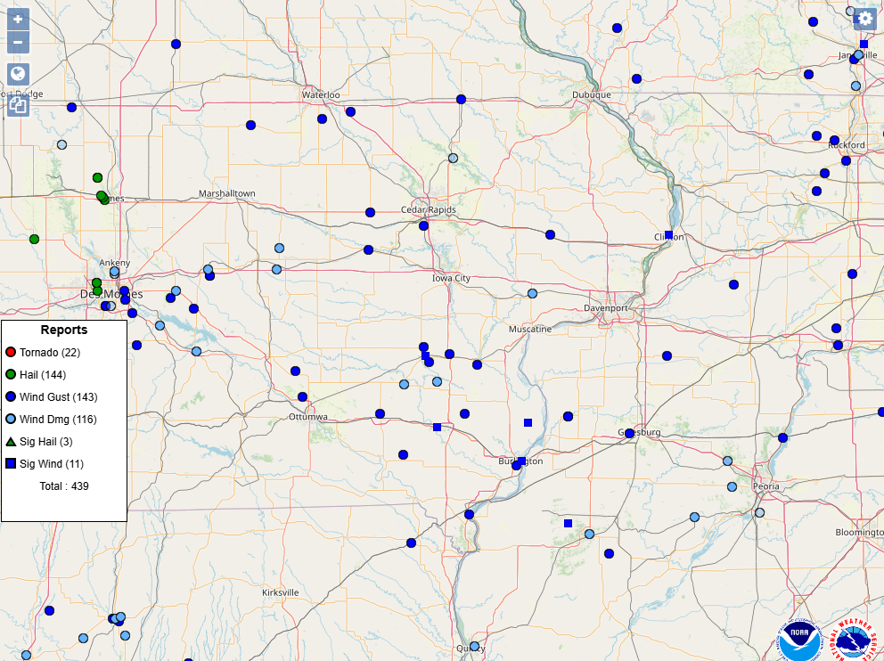 |
| Interactive Storm Report Map (SPC) |
| Nationwide Storm Report Map Image (SPC) |
Preliminary Local Storm Report...Summary
National Weather Service Quad Cities IA IL
508 PM CDT Mon Mar 17 2025

..TIME...   ...EVENT...      ...CITY LOCATION...     ...LAT.LON...
..DATE...   ....MAG....      ..COUNTY LOCATION..ST.. ...SOURCE....
            ..REMARKS..

0710 PM     Tstm Wnd Gst     1 W Medill              40.43N 91.78W
03/14/2025  E60 MPH          Clark              MO   Law Enforcement

            Relay of a 55 to 60 MPH thunderstorm wind
            gust.

0715 PM     Tstm Wnd Gst     1 SE Fairfield Municipa 41.03N 91.97W
03/14/2025  M60 MPH          Jefferson          IA   AWOS

            AWOS station KFFL Fairfield Arpt.

0734 PM     Tstm Wnd Gst     1 S Stockport           40.84N 91.83W
03/14/2025  M61 MPH          Van Buren          IA   Public

            EM reported a 61 mph wind gust just south of
            Stockport.

0735 PM     Tstm Wnd Gst     4 WSW Newhall           41.96N 92.03W
03/14/2025  M60 MPH          Benton             IA   Mesonet

            Mesonet station RVHI4 Us-30 At Us-218.

0737 PM     Tstm Wnd Gst     2 W Nauvoo              40.56N 91.42W
03/14/2025  M63 MPH          Lee                IA   Public


0737 PM     Tstm Wnd Dmg     1 S Salem               40.83N 91.62W
03/14/2025                   Henry              IA   CO-OP Observer

            Time estimated from radar. Shingles off roof
            with outdoor furniture blown over.

0745 PM     Tstm Wnd Dmg     1 NNW Carthage          40.42N 91.14W
03/14/2025                   Hancock            IL   Trained Spotter

            Large pine tree down, lost power in town for
            approx 3 hrs. Time estimated from radar.

0745 PM     Tstm Wnd Gst     3 N Washington          41.34N 91.70W
03/14/2025  M74 MPH          Washington         IA   Trained Spotter

            Spotter reported a measured 74 mph wind gust
            north of Washington on G36.

0748 PM     Tstm Wnd Gst     2 N Oakland Mills       40.97N 91.62W
03/14/2025  M77 MPH          Henry              IA   Trained Spotter

            Wind equipment measurement.

0750 PM     Tstm Wnd Gst     2 E Marengo             41.79N 92.04W
03/14/2025  M65 MPH          Iowa               IA   Public


0753 PM     Tstm Wnd Dmg     Brighton                41.17N 91.82W
03/14/2025                   Washington         IA   Trained Spotter

            Spotter reporting power poles down in
            Brighton Iowa.

0753 PM     Tstm Wnd Dmg     1 NNW Noble             41.18N 91.62W
03/14/2025                   Washington         IA   Emergency Mngr

            Turkey house lost roof and blown onto the
            road and pulling on power lines/poles.
            Multiple poles down in the area of the
            turkey farm and along a line towards
            Brighton. Two power poles on fire. Time
            estimated.

0755 PM     Tstm Wnd Gst     1 S Washington Airport  41.27N 91.67W
03/14/2025  M67 MPH          Washington         IA   AWOS

            AWOS station KAWG Washington Arpt.

0755 PM     Tstm Wnd Dmg     3 N Washington          41.34N 91.70W
03/14/2025                   Washington         IA   Public

            Delayed report of a destroyed machine shed
            and cattle shed about a quarter of a mile
            apart. Both buildings were open to the
            south. The time of the event was estimated
            using radar and near by observation at the
            Washington AWOS (KAWG).

0800 PM     Tstm Wnd Gst     Washington              41.30N 91.69W
03/14/2025  M78 MPH          Washington         IA   Emergency Mngr

            Measured at the Washington County EOC.

0801 PM     Tstm Wnd Gst     1 ENE Burlington        40.81N 91.10W
03/14/2025  M75 MPH          Des Moines         IA   Trained Spotter

            Measured on the riverfront and Main street.

0805 PM     Tstm Wnd Gst     2 NNE Ainsworth         41.31N 91.54W
03/14/2025  M62 MPH          Washington         IA   Trained Spotter


0806 PM     Tstm Wnd Gst     Burlington Regional Air 40.79N 91.13W
03/14/2025  M62 MPH          Des Moines         IA   Public

            ASOS equipment.

0810 PM     Tstm Wnd Dmg     West Point              40.26N 91.18W
03/14/2025                   Hancock            IL   Emergency Mngr

            Delayed report of photos of a destroyed
            machine shed with nearby broken power poles.
            Metal roofing blown across road to the
            northeast. Time of the event was estimated
            using radar.

0812 PM     Tstm Wnd Gst     cedar Rapids Municipal  41.90N 91.70W
03/14/2025  M79 MPH          Linn               IA   Other Federal

            Corrects previous tstm wnd gst report from
            cedar Rapids Municipal Airport. Report from
            the control tower.

0815 PM     Tstm Wnd Gst     4 WSW Mount Union       41.03N 91.45W
03/14/2025  E70 MPH          Henry              IA   Trained Spotter


0821 PM     Tstm Wnd Gst     1 W Kingston            40.99N 91.06W
03/14/2025  M77 MPH          Des Moines         IA   Public

            Branches down.

0831 PM     Tstm Wnd Gst     4 SE Blandinsville      40.52N 90.81W
03/14/2025  M81 MPH          McDonough          IL   Trained Spotter


0840 PM     Tstm Wnd Gst     2 E Bald Bluff          41.02N 90.81W
03/14/2025  E60 MPH          Henderson          IL   Trained Spotter

            Corrects time of occurrence for previous
            tstm wnd gst report from 2 E Bald Bluff.
            Estimated storm outflow gust.

0849 PM     Tornado          2 ENE Wilton            41.60N 91.00W
03/14/2025                   Cedar              IA   NWS Storm Survey

            A fast moving EF-0 tornado begun on the
            Muscatine/Cedar counties line. Causing roof
            damage, tree damage and eventually damage to
            farm outbuildings. The tornado had wind
            speeds of 85 MPH and at its widest was 50
            yards.

0852 PM     Tstm Wnd Dmg     3 WSW Sunbury           41.64N 90.99W
03/14/2025                   Cedar              IA   NWS Storm Survey

            Storm survey found sporadic damage
            associated with straight line winds through
            Sunbury. Winds were estimated to be 80-90
            MPH.

0853 PM     Tstm Wnd Gst     1 W Manchester          42.48N 91.47W
03/14/2025  E65 MPH          Delaware           IA   Trained Spotter


0855 PM     Tstm Wnd Gst     4 SW Adair              40.38N 90.56W
03/14/2025  E65 MPH          McDonough          IL   Public

            Public report of 60 to 70 MPH wind gusts.
            Some small branches reported down.

0904 PM     Tstm Wnd Dmg     Gerlaw                  40.99N 90.60W
03/14/2025                   Warren             IL   Broadcast Media

            Delayed report and time estimated from
            radar. Steeple blown off a church.

0905 PM     Tstm Wnd Dmg     Macomb                  40.47N 90.68W
03/14/2025                   McDonough          IL   Public

            Sheriff department reported multiple
            powerlines down throughout the county.

0905 PM     Tstm Wnd Dmg     Central City            42.21N 91.52W
03/14/2025                   Linn               IA   Fire Dept/Rescue

            A 12 foot tree uprooted.

0905 PM     Tstm Wnd Gst     Lowden                  41.86N 90.92W
03/14/2025  M60 MPH          Cedar              IA   CO-OP Observer


0920 PM     Tstm Wnd Dmg     Wilton                  41.59N 91.03W
03/14/2025                   Muscatine          IA   Amateur Radio

            Windows broken out of a home along with a
            patio table blown off the porch.

0937 PM     Tstm Wnd Dmg     Charlotte               41.96N 90.47W
03/14/2025                   Clinton            IA   Trained Spotter

            Time estimated by radar. Report that part of
            a barn roof was ripped off by the
            thunderstorm winds.

0941 PM     Tstm Wnd Gst     Cambridge               41.30N 90.20W
03/14/2025  M70 MPH          Henry              IL   Trained Spotter


0947 PM     Tstm Wnd Gst     3 ENE Clinton           41.86N 90.19W
03/14/2025  M75 MPH          Clinton            IA   Trained Spotter


0951 PM     Tstm Wnd Dmg     1 NNW Center Grove      42.50N 90.72W
03/14/2025                   Dubuque            IA   Fire Dept/Rescue

            Delayed report and time estimated from
            radar. Large business sign down just south
            of the Pennsylvania Ave and JFK Road
            intersection.

1005 PM     Tstm Wnd Dmg     Geneseo                 41.45N 90.15W
03/14/2025                   Henry              IL   Law Enforcement

            Two power poles down.

1028 PM     Tstm Wnd Gst     Tampico                 41.63N 89.79W
03/14/2025  M60 MPH          Whiteside          IL   Public

            Measured from personal weather station. Time
            estimated.

1035 PM     Tstm Wnd Dmg     1 S Hennepin            41.25N 89.35W
03/14/2025                   Putnam             IL   Law Enforcement

            Numerous trees down blocking roads south of
            Hennepin.

1039 PM     Tstm Wnd Dmg     1 E Hennepin            41.25N 89.34W
03/14/2025                   Putnam             IL   Law Enforcement

            Several power poles sheared off between
            Hennepin and Mark. 1400 customers without
            power.
Outlooks and Environment
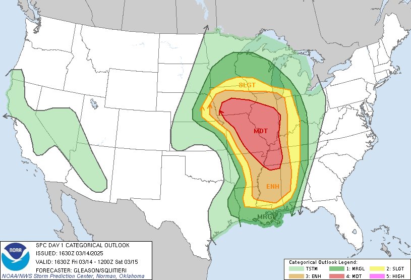
Storm Prediction Center Outlooks
 |
 |
 |
 |
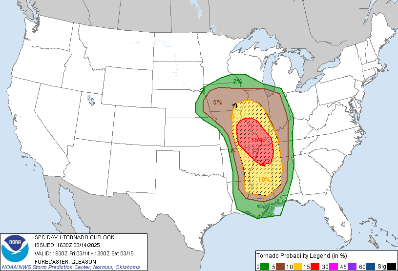
| SPC Day 1 1630z Outlook |
Tornado Risk Probabilities **Sig Severe Possible** |
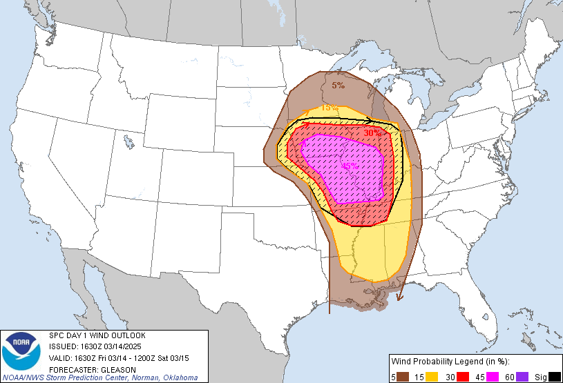
Severe Wind Risk Probabilities **Sig Severe Likely** |
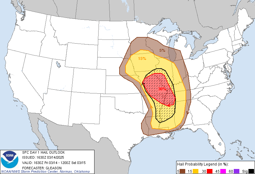
Severe Hail Risk Probabilities **Sig Severe Possible** |
Watches and Mesoscale Discussions
 |
 |
 |
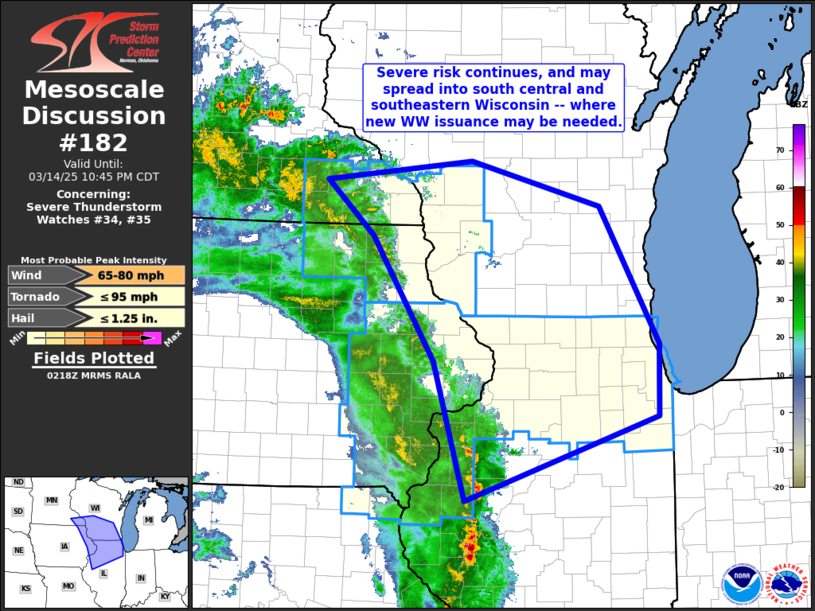 |
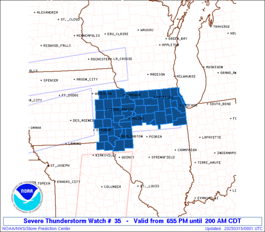
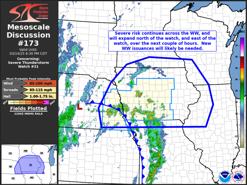
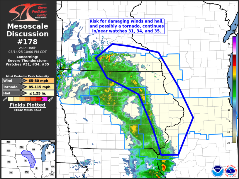
| Severe Thunderstorm Watch #35 | Mesoscale Discussion #173 | Mesoscale Discussion #178 | Mesoscale Discussion #182 |
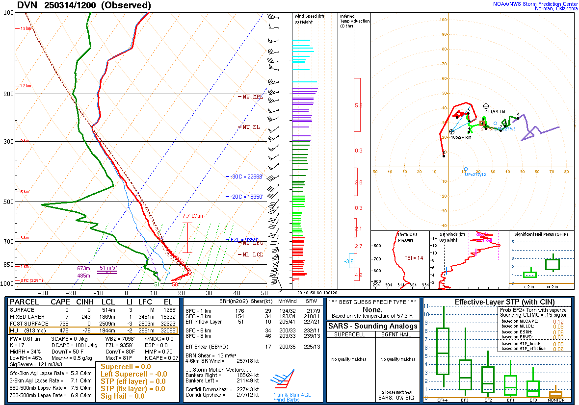
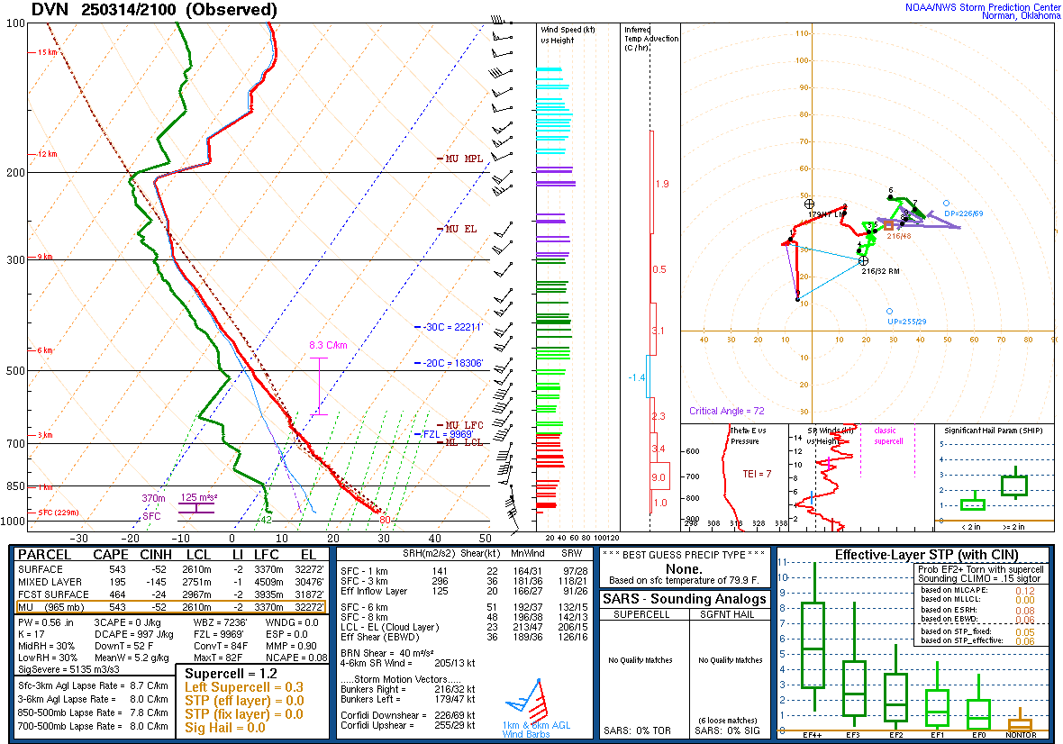
Local Soundings at DVN
 |
 |
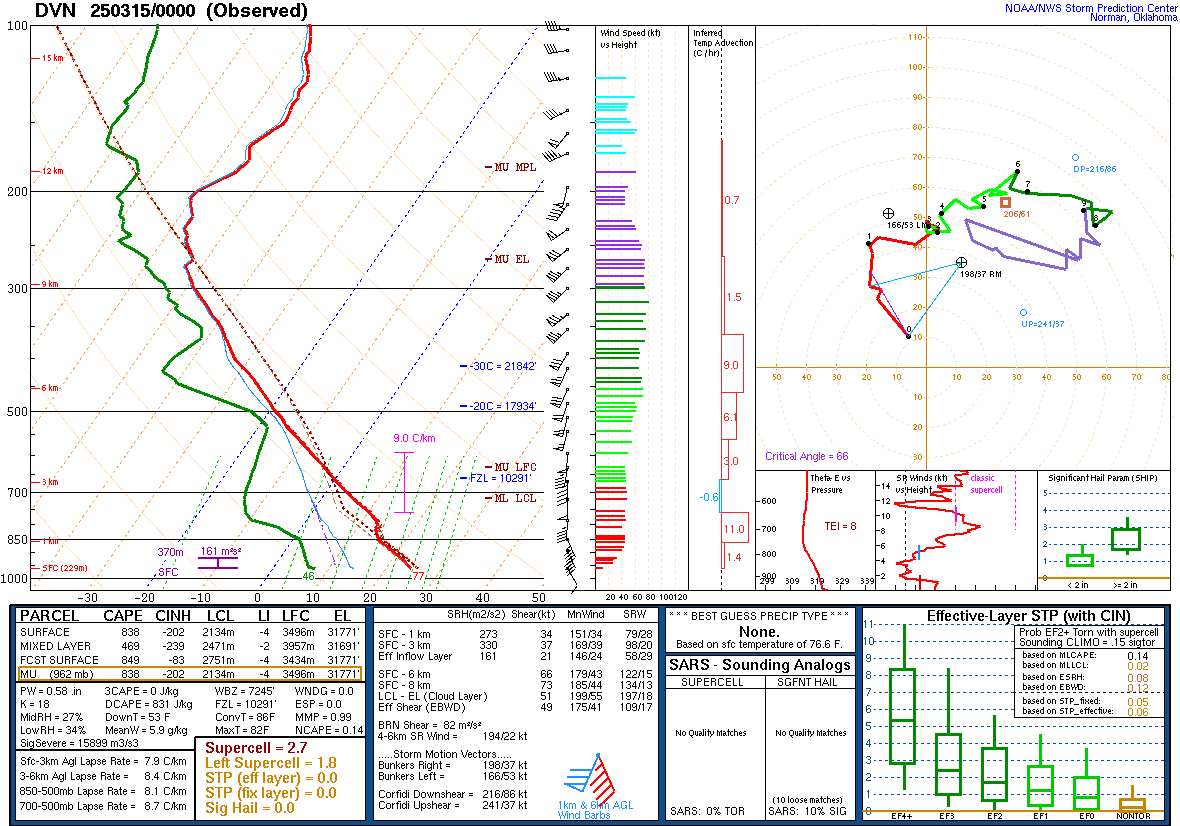 |
| 03/14/2025 - 7:00AM | 03/14/2025 - 4:00PM | 03/14/2025 7:00PM |
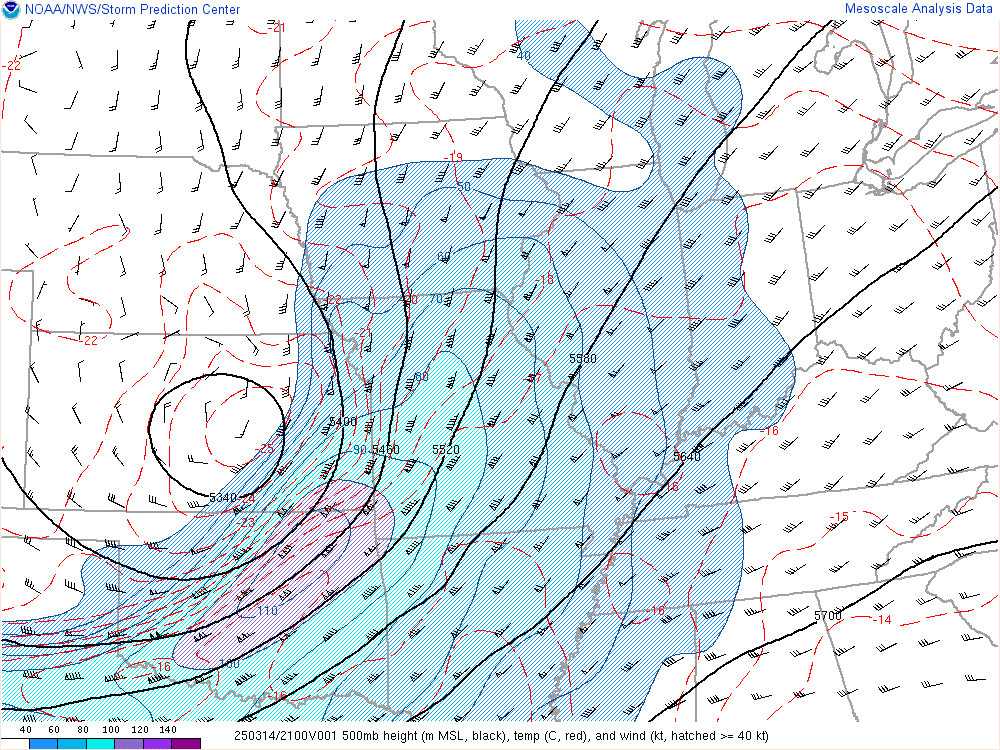
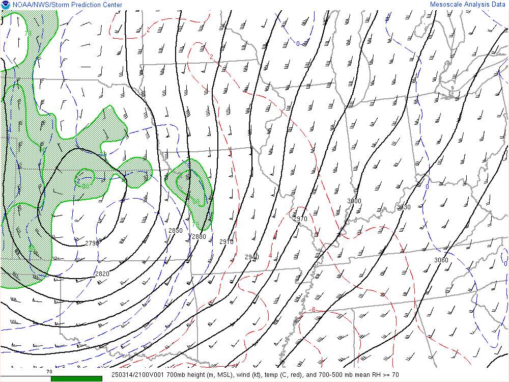
Synoptic Environment
 |
 |
 |
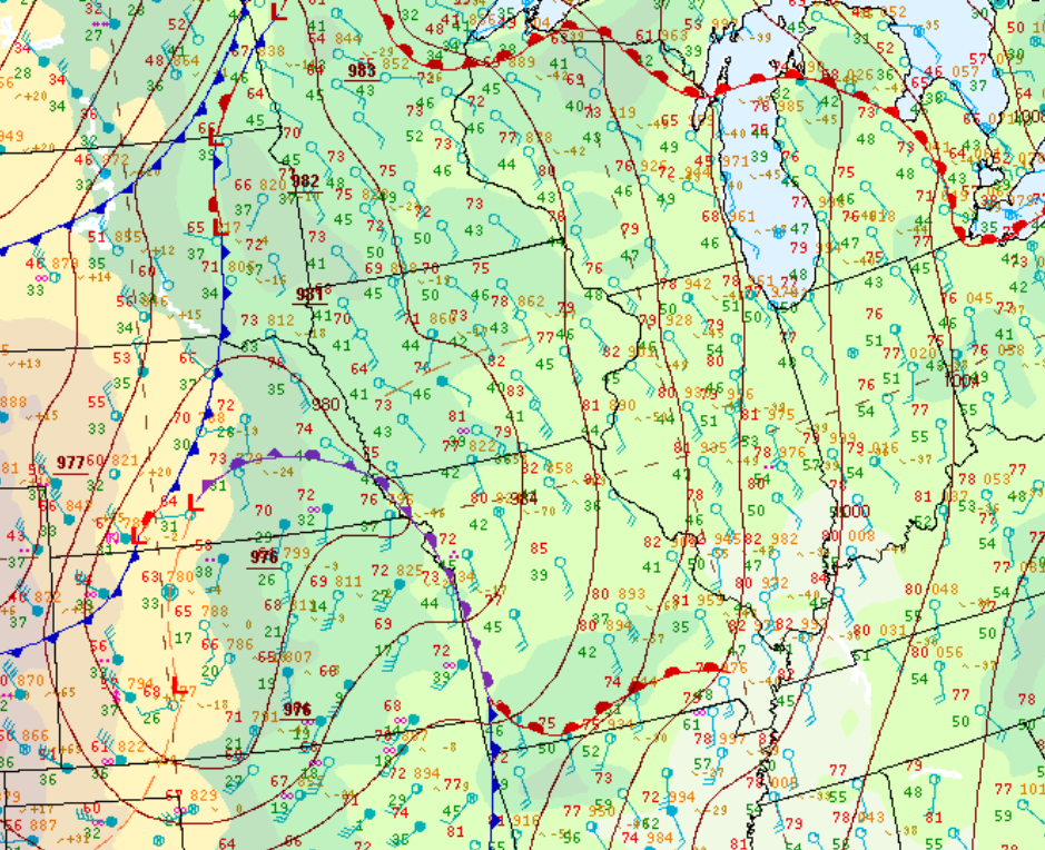 |
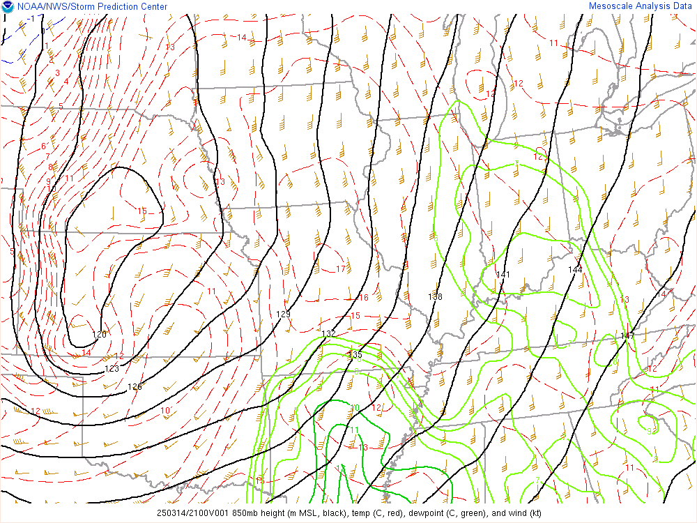
| 500 mb Chart at 4pm | 700 mb Chart at 4pm | 850 mb Chart at 4pm | Surface Chart at 4pm (WPC) |
Mesoscale Environment
 |
 |
 |
 |
|
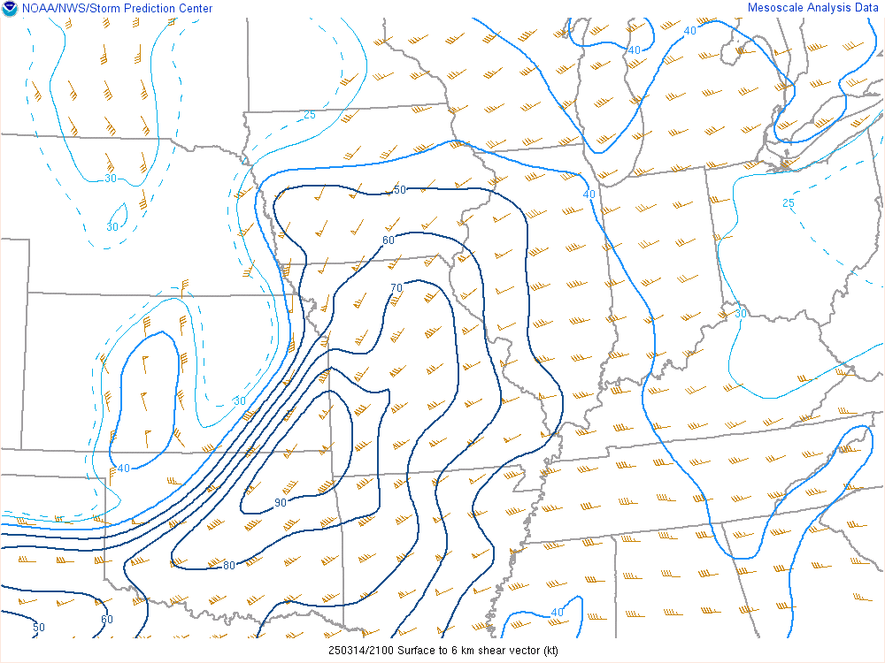
0-6 km Wind Shear Favorable for Organized Convection |
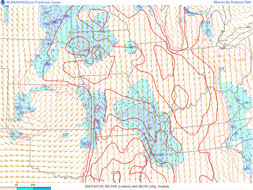
Instability Favorable for Organized Convection |
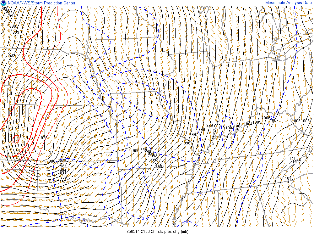
Pressure Change |
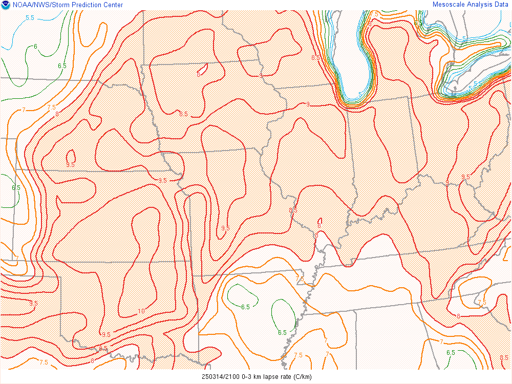
Low Level Lapse Rates |
 |
Media use of NWS Web News Stories is encouraged! |
|
Hazardous Weather
Watches, Warnings, & Advisories
Briefing
Hazards Page
View Local Storm Reports
Submit Report
Road Reports
Text Products
Forecasts
Fire Weather
Briefing
Hourly Forecast Graphs
Forecast Discussion
User-Defined Area
Activity Planner
Local Forecasts
Space Weather
Text Products
River Graphs
Airport Forecasts
Snow and Ice Probabilities
Winter Storm Severity Index (WSSI)
Current Conditions
Observations
Radar
Satellite
Rivers and Lakes
River Graphs
Road Reports
Drought Monitor
Text Products
Sunrise/Sunset Tables
Seasons (Equinoxes/Solstices)
Past Weather
Climate Maps
Climate Normals/Averages
Climate Records
Climate/Almanac Data
Recent Observation History
Climate Graphs
Climate Summaries
Observation Site History
Past Events
Text Products
Sunrise/Sunset Tables
US Dept of Commerce
National Oceanic and Atmospheric Administration
National Weather Service
Quad Cities, IA/IL
9040 N Harrison Street
Davenport Municipal Airport
Davenport, IA 52806-7326
563-386-3976
Comments? Questions? Please Contact Us.
Thank you for visiting a National Oceanic and Atmospheric Administration (NOAA) website. The link you have selected will take you to a non-U.S. Government website for additional information.
NOAA is not responsible for the content of any linked website not operated by NOAA. This link is provided solely for your information and convenience, and does not imply any endorsement by NOAA or the U.S. Department of Commerce of the linked website or any information, products, or services contained therein.
You will be redirected to: