Quad Cities, IA/IL
Weather Forecast Office
A cluster of thunderstorms weakened while moving into northeast Iowa toward the noon hour near and northwest of Cedar Rapids, IA. An isolated single cell continued to track east however, and with the mid afternoon heating intensified over Jones County. The storm eventually became a high precipitation supercell as it moved into Jackson County producing a swath of damaging hail up to baseball size and winds of 70 to 80 mph.
The city of Maquoketa, IA was hardest hit as most residents reported some property damage. Nearly 1,000 new and used vehicles from several automotive dealerships suffered hail damage. One owner of a car dealership was quoted as saying that the cars on his lot looked like they had chicken pox. The pea to golf ball sized hail was so frequent, lasting nearly 20 minutes, that melting remnants left a nearly 2 inch thick sheet of ice in the bed of one pickup truck. Damage to the city of Maquoketa alone was estimated at nearly 20 million dollars.
Technical Notes:
 |
|
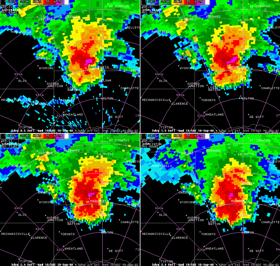
Base reflectivity from 1950z with 0.5 / 1.5 / 2.4 / 3.4 degree elevation slices. BWER present south through southeast of Maquoketa. 1 inch to 2.75 inch hail and winds up to 80 mph were reported in Maquoketa, IA between 1940z and 1951z. |
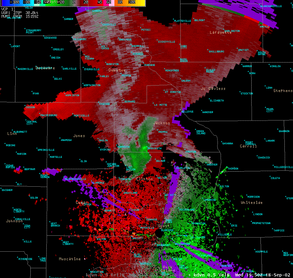 |
| Storm relative velocity from 1950z with low level rotation still convergent and a RFD wrapping around the updraft. |
Hazardous Weather
Watches, Warnings, & Advisories
Briefing
Hazards Page
View Local Storm Reports
Submit Report
Road Reports
Text Products
Forecasts
Fire Weather
Briefing
Hourly Forecast Graphs
Forecast Discussion
User-Defined Area
Activity Planner
Local Forecasts
Space Weather
Text Products
River Graphs
Airport Forecasts
Snow and Ice Probabilities
Winter Storm Severity Index (WSSI)
Current Conditions
Observations
Radar
Satellite
Rivers and Lakes
River Graphs
Road Reports
Drought Monitor
Text Products
Sunrise/Sunset Tables
Seasons (Equinoxes/Solstices)
Past Weather
Climate Maps
Climate Normals/Averages
Climate Records
Climate/Almanac Data
Recent Observation History
Climate Graphs
Climate Summaries
Observation Site History
Past Events
Text Products
Sunrise/Sunset Tables
US Dept of Commerce
National Oceanic and Atmospheric Administration
National Weather Service
Quad Cities, IA/IL
9040 N Harrison Street
Davenport Municipal Airport
Davenport, IA 52806-7326
563-386-3976
Comments? Questions? Please Contact Us.

