Supercell thunderstorms developed in the evening hours and formed an organized cluster around Waterloo, Iowa. As the storms moved southeast through Eastern Iowa they interacted with boundaries and produced 6 tornadoes with widespread wind damage in the Cedar Rapids, Iowa metropolitan area.
 |
Storm damage southeast of Waterloo, IA in the city of Vinton, IA |
|
|
|
 |
Barn damage in Vinton, IA |
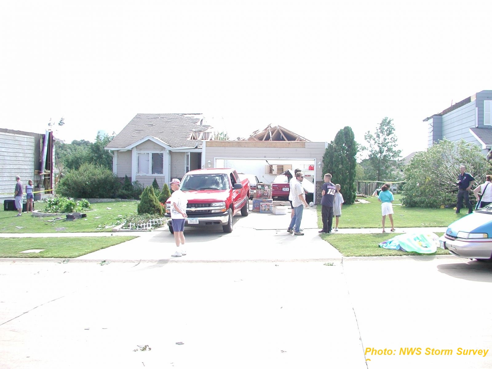
One tornado touched down near the intersection of Zelda Drive and East Avenue Northwest in Cedar Rapids, IA. The tornado moved southeast for 0.25 miles across Peace Avenue and then lifted on Floral Avenue. The tornado reached peak intensity on Peace Avenue where F2 winds unroofed 3 homes, and 26 other homes were heavily damaged. This was the first tornado inside the Cedar Rapids city limits since 1965.
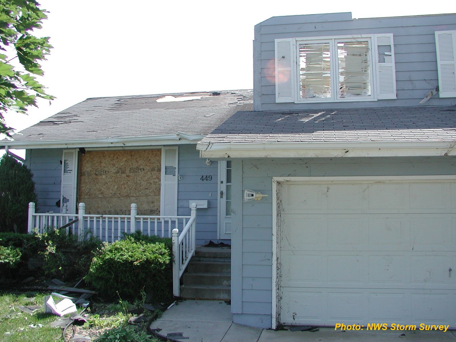
The following tree and building damage pictures were taken at 24th Avenue Drive, Cedar Rapids, IA.
 |
|
 |
|
 |
|
 |
|
 |
|
| Damage in Cedar Rapids, IA |
KCRG TV and KGAN TV in Cedar Rapids measured 63 knots (73 mph) and 53 knots (61 mph) respectively at their studios during the storm. At the height of the storm in Cedar Rapids, Alliant Energy reported that about half of its 70,000 customers in the Cedar Rapids area were without power. Sporatic wind damage then occurred from Cedar Rapids to the Mississippi River. Heavy rain accompanying the storms produced mainly nuisance street flooding in many cities, but did result in 2 mudslides, one in Moline, Illinois and another across Illinois 84 just northwest of Mississippi Palisades State Park in Carroll County Illinois. The second mudslide resulted in a traffic accident with no injuries.
In Muscatine County Iowa, the storms evolved into a bow echo and then raced to the east southeast and produced widespread wind damage with winds estimated at 80 knots or stronger (92 mph) that lasted 10 to 15 minutes across the Illinois Counties of Rock Island, Mercer, and Southern Henry. An unsubstantiated wind gust of 90 knots (104 mph) occurred at Lock and Dam 16 on the Mississippi River just east of Muscatine, Iowa. Mercer and Southern Henry counties in Illinois had extensive damage from the bow echo with Galva, Illinois, in southern Henry County being hardest hit. An estimated 10,000 to 15,000 people were without power in the affected 3 counties. High winds of at least 80 knots (92 mph) lasted for nearly 15 minutes in Galva, IL toppling a grain elevator onto the Burlington Northern Santa Fe (BNSF) railroad mainline. The combination of the toppled grain elevator and a propane leak caused by the fallen elevator halted rail traffic for 11 hours, delaying 7 or 8 BNSF trains. Blackhawk College East Campus in Southeast Henry County cancelled classes for several days due to considerable damage with many trees and power lines down. In Henry County Illinois alone, an estimated 25,000 acres of corn was flattened.

