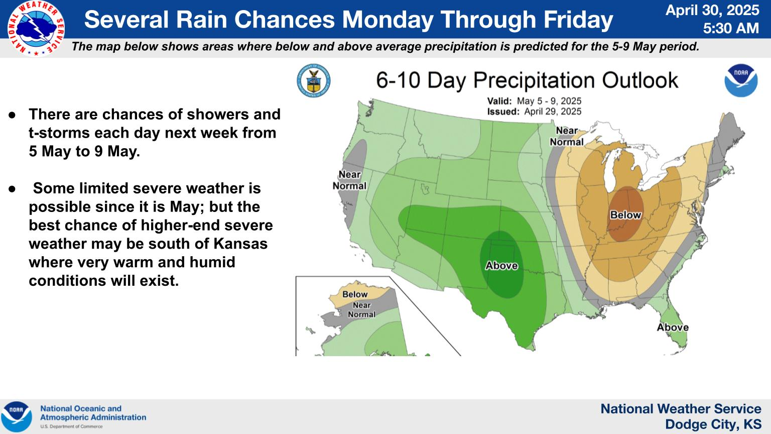
Travel conditions will be challenging across the northern Plains, Great Lakes and east coast through Thanksgiving holiday weekend. Heavy snow, blizzard conditions, for the upper Midwest and Great Lakes region through Thanksgiving to be followed by another strong storm for the Plains, Great Lakes and Northeast this weekend. Strong winds are expected with these systems adding to travel difficulties Read More >