Scattered strong to severe storms capable of sporadic large hail and severe winds are expected this afternoon and evening across portions of western Texas. Widespread showers and thunderstorms may produce isolated flash flooding across the Ozarks today and the Southeast into next week. Read More >
Overview
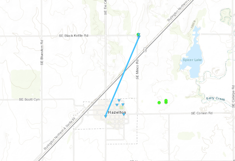
A tornado developed in the city of Hazelton Saturday evening, then tracked northeast while producing EF-0 damage. While in Hazelton Sunday, the damage survey team noted several small trees were snapped, along with damage to a metal roofed shed. Northeast of town, there was damage to another metal shed, an uprooted tree and a empty trailer turned over.Tornadoes:
|
Tornado - Hazelton
|
||||||||||||||||
The Enhanced Fujita (EF) Scale classifies tornadoes into the following categories:
| EF0 Weak 65-85 mph |
EF1 Moderate 86-110 mph |
EF2 Significant 111-135 mph |
EF3 Severe 136-165 mph |
EF4 Extreme 166-200 mph |
EF5 Catastrophic 200+ mph |
 |
|||||
 |
Media use of NWS Web News Stories is encouraged! Please acknowledge the NWS as the source of any news information accessed from this site. |
|