Cold temperatures will continue across much of the eastern U.S. into today. Heavy lake effect snow continues into today east of Lakes Erie and Ontario. Two Pacific cold fronts will cross the Pacific Northwest early this week followed by another atmospheric river. Heavy rain and gusty winds are expected through midweek, with the potential for renewed urban and river flooding. Read More >
Overview
A line of severe thunderstorms moved rapidly east through southwest into central Kansas during the late evening hours of 26 May 2019 into the early overnight hours of 27 May 2019. Several short-lived tornadoes resulted from this line of storms with all tornadoes resulting in either EF1 or EF0 damage.
Tornadoes:
|
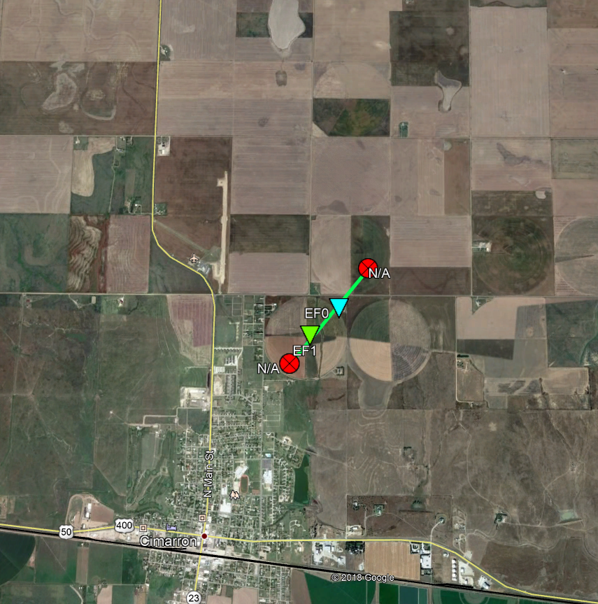
Tornado - Cimarron
|
||||||||||||||||
|
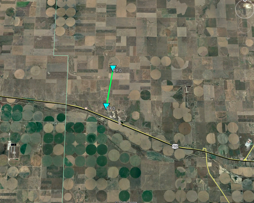
Tornado - Howell
|
||||||||||||||||
|
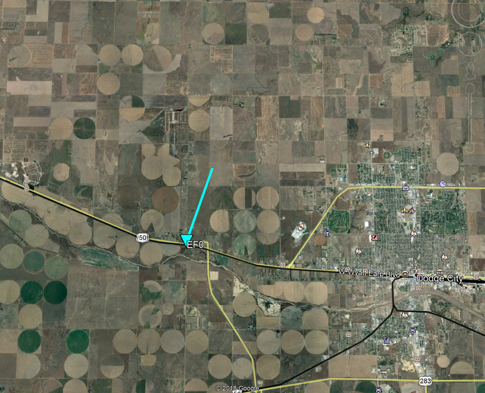
Tornado - West of Dodge City
|
||||||||||||||||
|
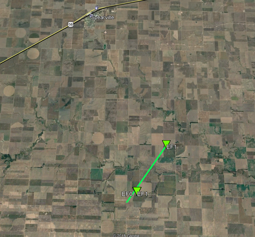
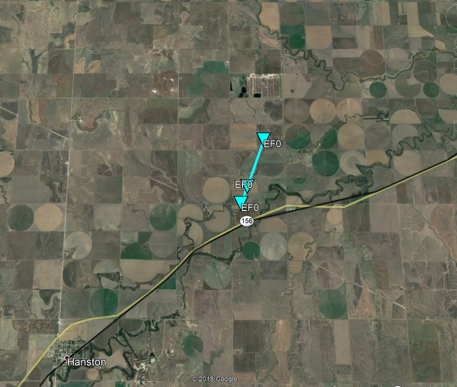
Tornado - South of Spearville
|
||||||||||||||||
|
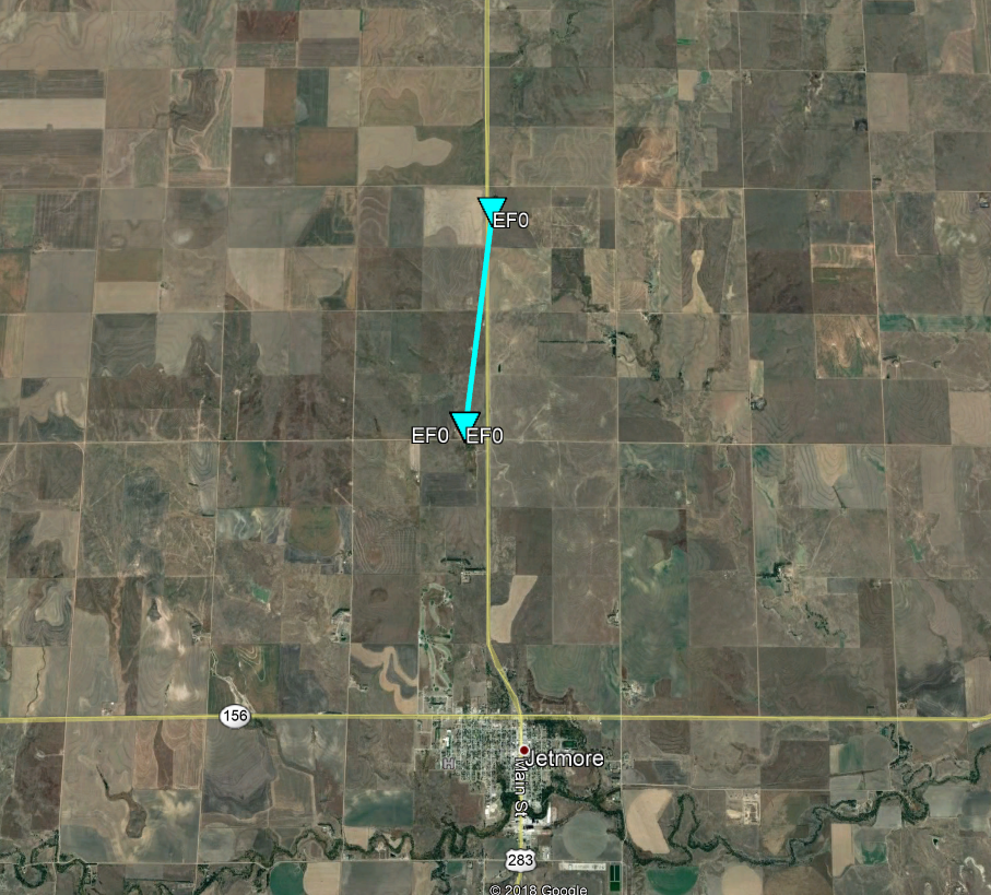
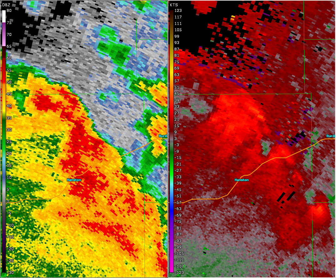
Tornado - Jetmore
|
||||||||||||||||
|
Tornado - West-Northwest of Gray
|
||||||||||||||||
|
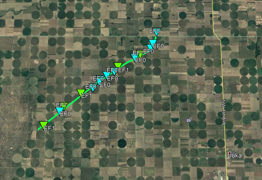
Tornado - Byers
|
||||||||||||||||
The Enhanced Fujita (EF) Scale classifies tornadoes into the following categories:
| EF0 Weak 65-85 mph |
EF1 Moderate 86-110 mph |
EF2 Significant 111-135 mph |
EF3 Severe 136-165 mph |
EF4 Extreme 166-200 mph |
EF5 Catastrophic 200+ mph |
 |
|||||
Radar
Tornado - Cimarron
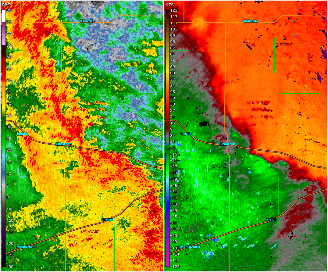 |
| KDDC WSR-88D data for Cimarron tornado. |
Tornado - Howell
 |
| KDDC WSR-88D data for Howell tornado. |
Tornado - West of Dodge City
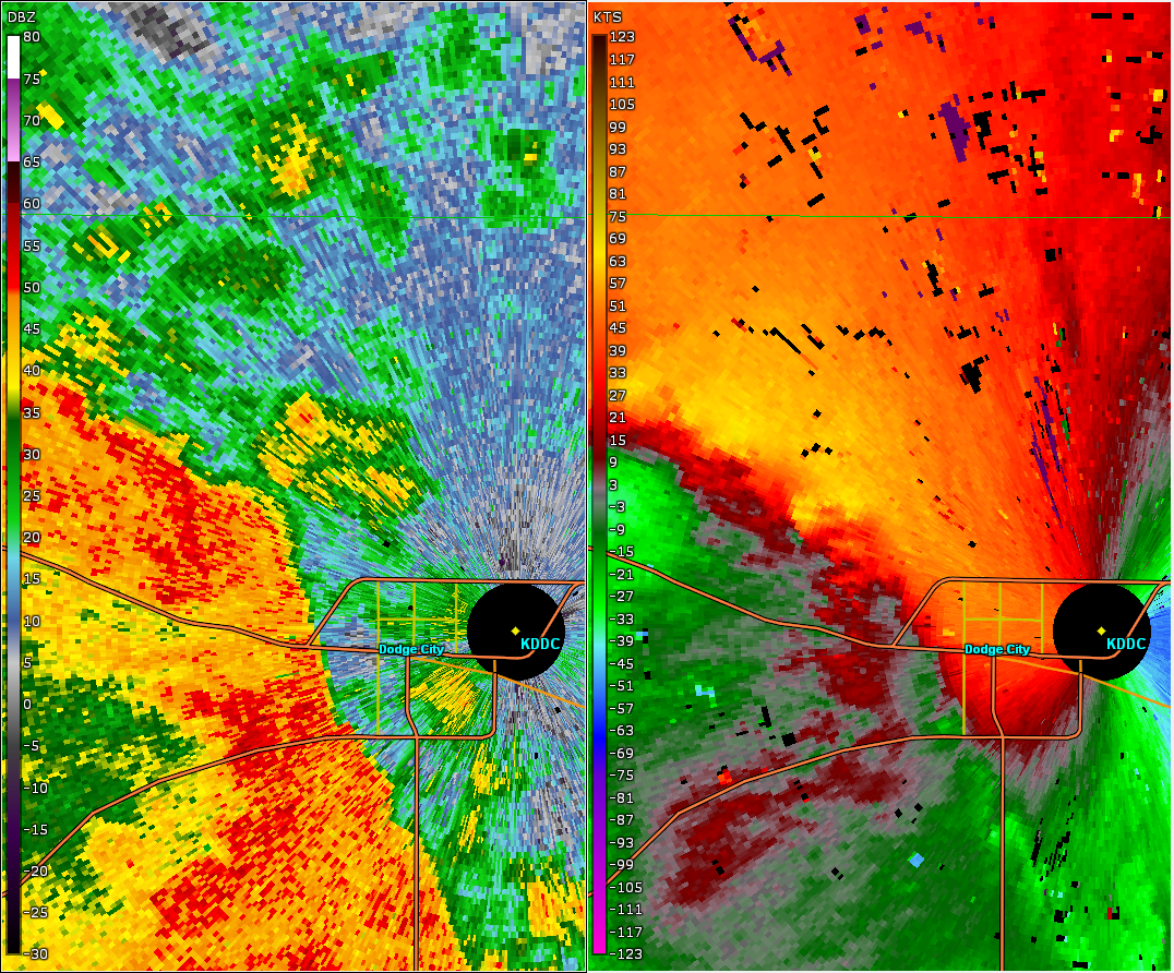 |
| KDDC WSR-88D data for west of Dodge City tornado. |
Tornado - South of Spearville
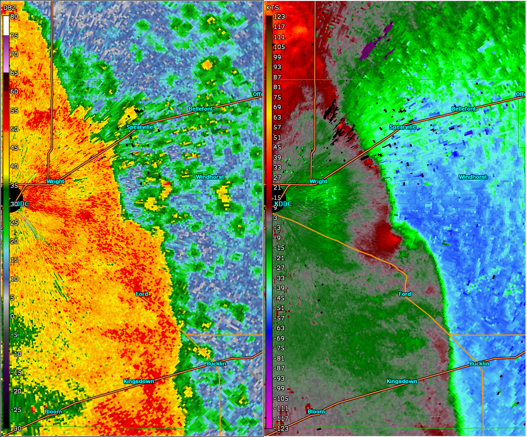 |
| KDDC WSR-88D data for south of Spearvill tornado. |
Tornado - Jetmore
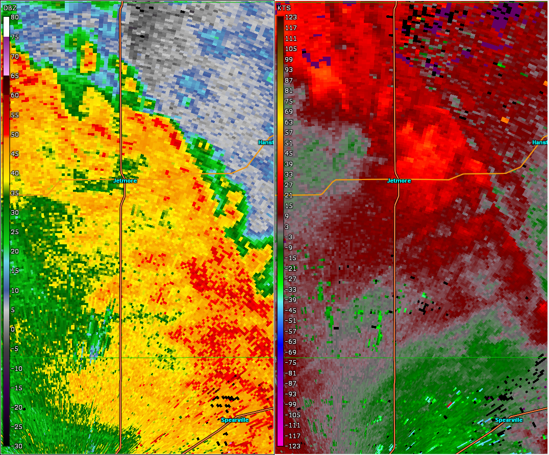 |
| KDDC WSR-88D data for Jetmore tornado. |
Tornado - West-Northwest of Gray
 |
| KDDC WSR-88D data for Gray tornado. |
Tornado - Byers
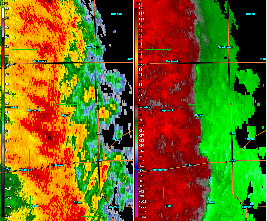 |
| KDDC WSR-88D data for Pratt-Stafford county tornado. |
 |
Media use of NWS Web News Stories is encouraged! Please acknowledge the NWS as the source of any news information accessed from this site. |
|