
A weather system in the Pacific Northwest will produce rain throughout the day, before a potent atmospheric river produces a prolonged round of heavy rainfall, widespread urban and river flooding, and high elevation snow to the region Monday through Wednesday. Showers and thunderstorms may produce isolated damaging winds, a brief tornado, and locally heavy rainfall across parts of Florida today. Read More >
Overview
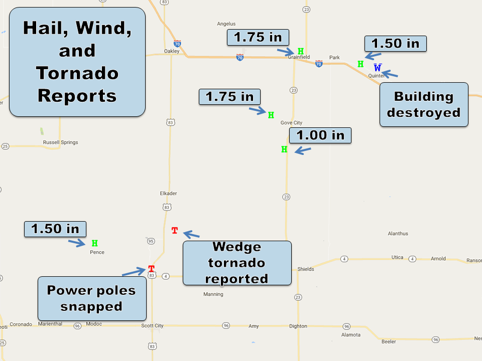
A supercell moved across portions of Scott County during the early evening hours. This supercell produced 3 tornadoes.Tornadoes:
|
Tornado - Near Modoc
Track Map 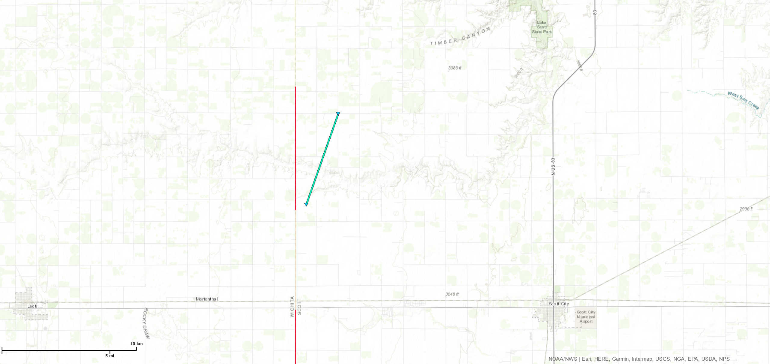 
|
||||||||||||||||
|
Tornado - NW Scott City
Track Map 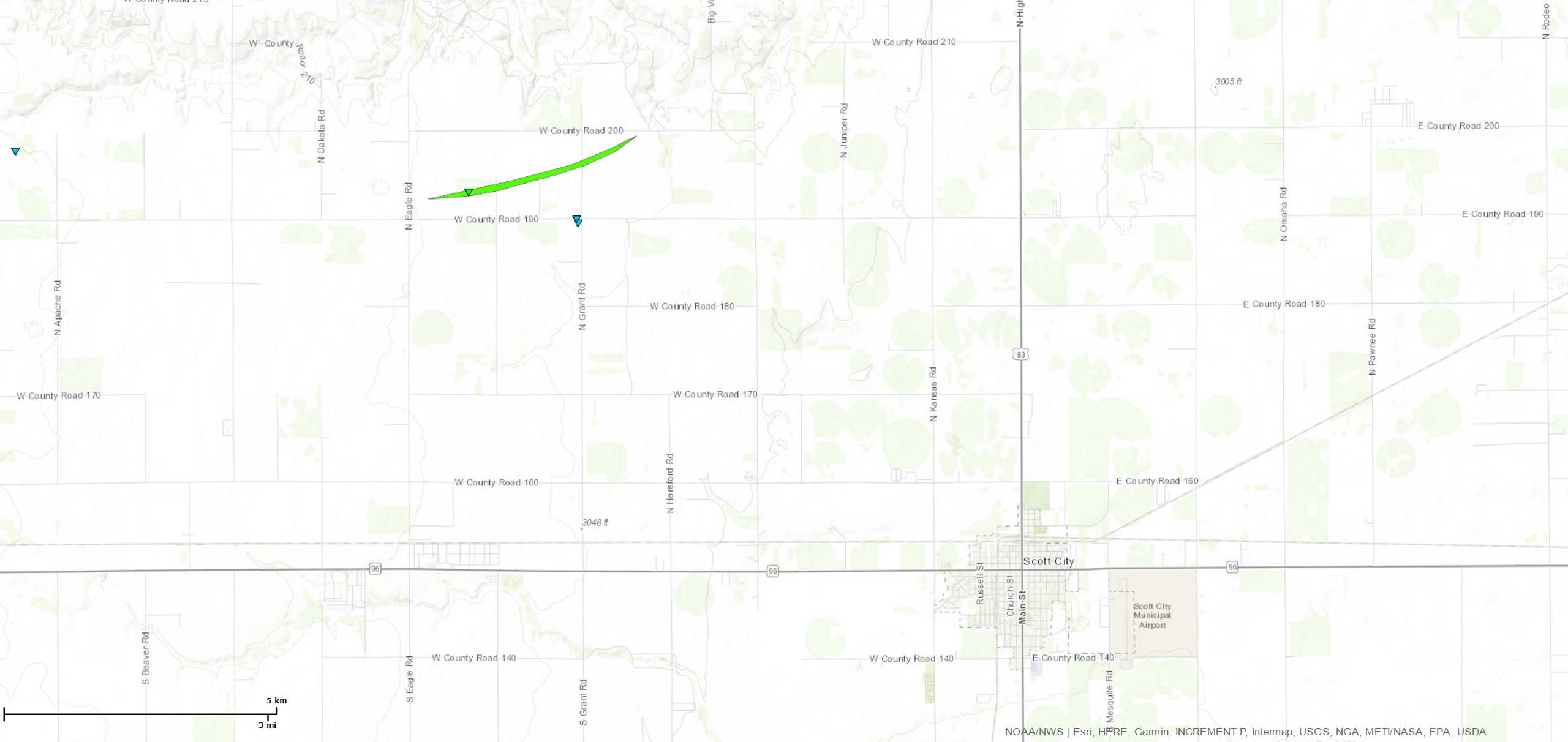
|
||||||||||||||||
|
Tornado - North Scott
Track Map 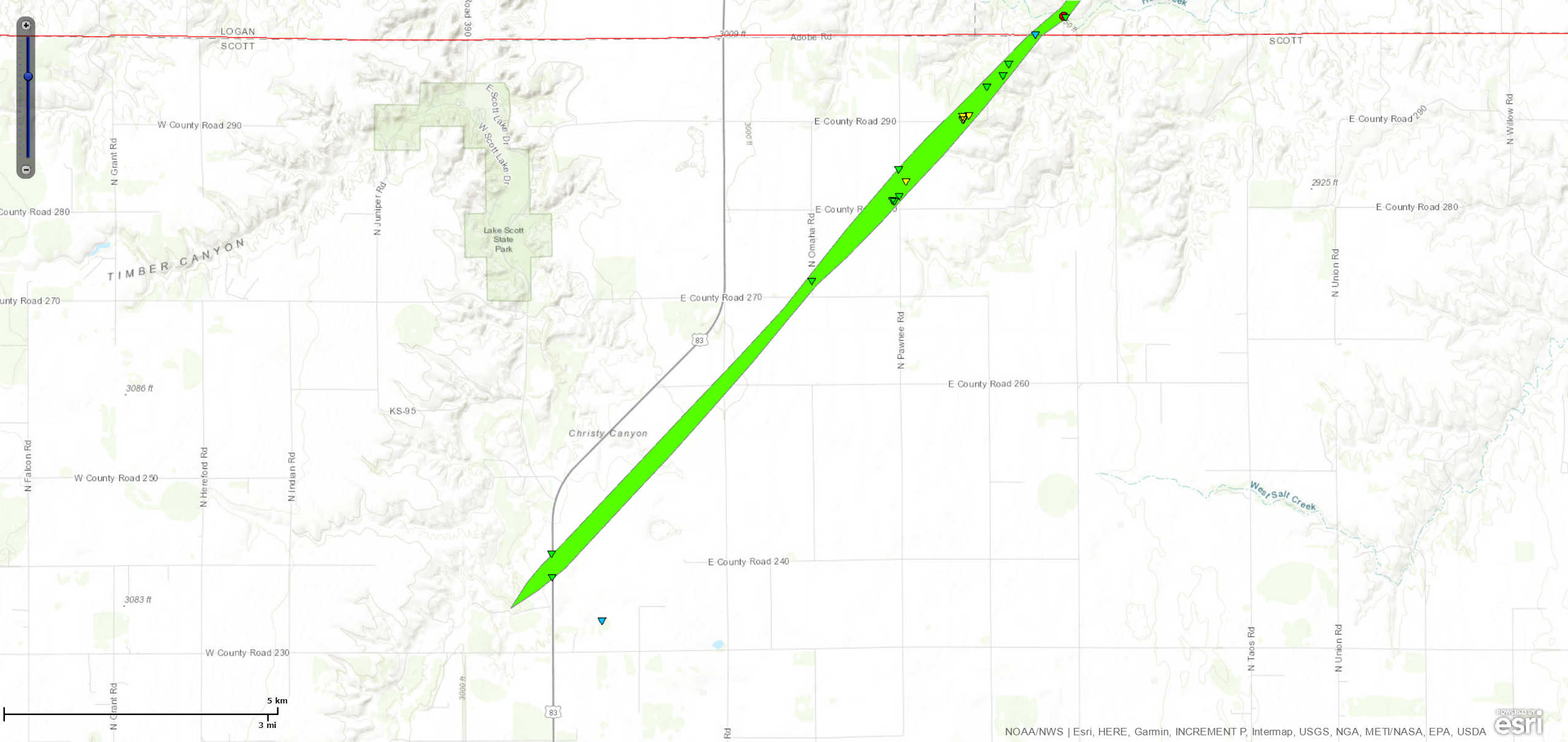
|
||||||||||||||||
The Enhanced Fujita (EF) Scale classifies tornadoes into the following categories:
| EF0 Weak 65-85 mph |
EF1 Moderate 86-110 mph |
EF2 Significant 111-135 mph |
EF3 Severe 136-165 mph |
EF4 Extreme 166-200 mph |
EF5 Catastrophic 200+ mph |
 |
|||||
Storm Reports
 |
Media use of NWS Web News Stories is encouraged! Please acknowledge the NWS as the source of any news information accessed from this site. |
|

