SKYWARN Spotter Training is back! Here’s the list of all the Spotter Trainings we will be presenting this year! These are free to attend, for all ages, and typically last about 2 hours. Keep your eyes to the skies and learn how to identify storm features, report severe weather, and get a refresher on severe weather safety!
Please see this website for more information and exact locations for training.
weather.gov/cys/skywarn

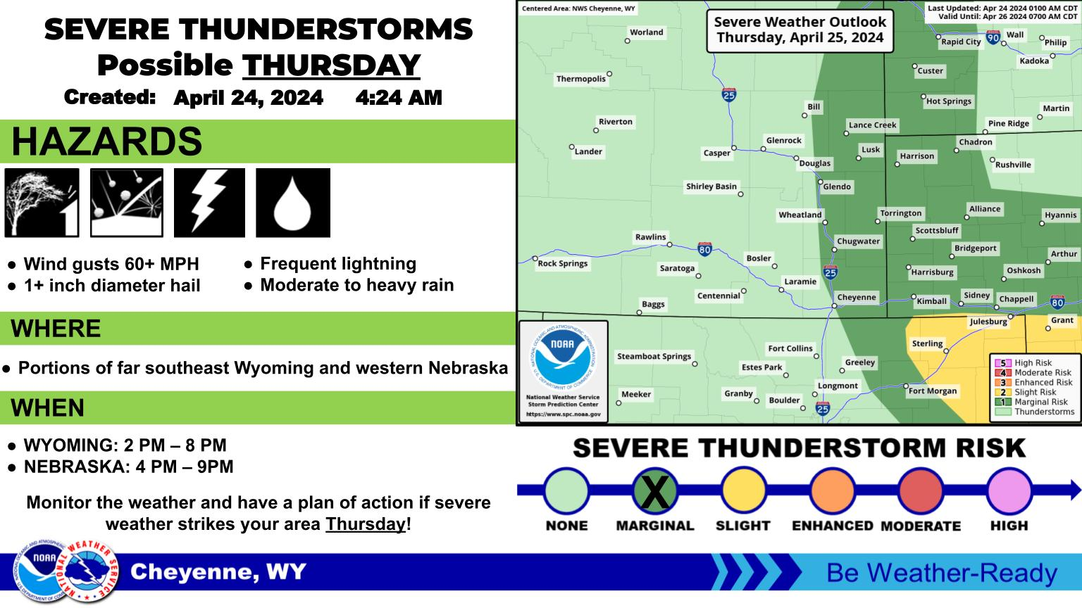


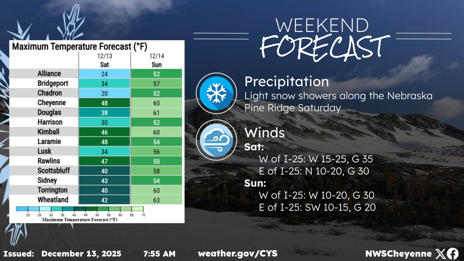
 Weather Story
 Weather Map
 Local Radar