Cheyenne is located in the southeastern corner of Wyoming at an elevation of 6,120 feet. The surrounding country is mostly rolling prairie. The elevation climbs west to the Laramie Mountain Range about 8,700 feet, approximately 30 miles west of Cheyenne. The current population has been on the rise since the early 20th century, currently over 62,000.
The National Weather Service Forecast Office in Cheyenne provides forecasts for southeast Wyoming and the western Nebraska Panhandle. Some of the products that are issued include: severe thunderstorm and tornado warnings, flash flood watches and warnings, high wind watches and warnings, winter weather watches and warnings, aviation, and fire weather forecasts.
|
NWS Cheyenne County Warning and Forecast Area |
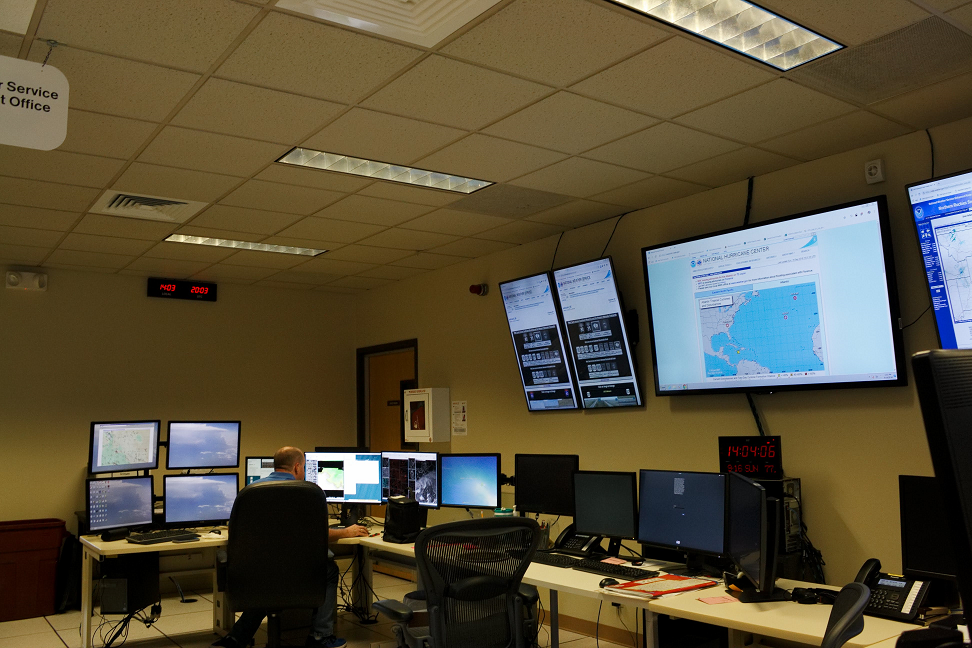
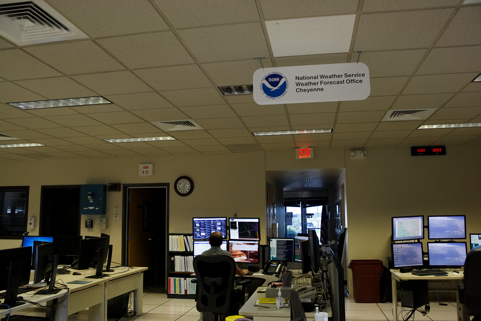
All of the forecasts provided are prepared by meteorologists. The office is staffed 24 hours, 7 days a week, 365 days a year. The forecasters are constantly monitoring the latest weather, radar and satellite data, local media outlets, and surrounding National Weather Service Forecast Offices to ensure the accuracy and consistency of the weather forecast.
|
NOTE: We will strive to always include detailed information regarding zones to better serve the public and our partners in locating places of interest to them as different weather events affect our area. |
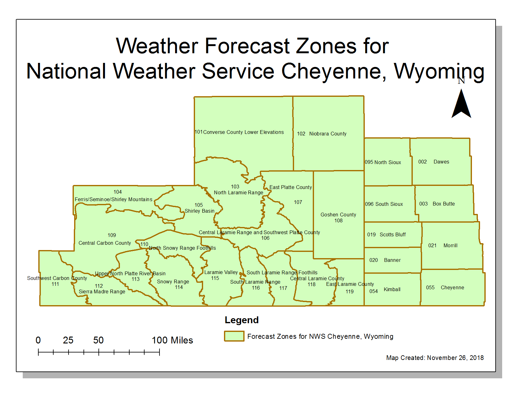
 These weather forecast zones break up portions of our County Warning Area (CWA) to best represent different orographic and spatial features including our mountains and valleys. These weather forecast zones break up portions of our County Warning Area (CWA) to best represent different orographic and spatial features including our mountains and valleys. |
| On the Wyoming Side of Forecast Zones: WYZ101 (Converse County Lower Elevations), WYZ102 (Niobrara County), WYZ103 (North Laramie Range), WYZ104 (Ferris/Seminoe/Shirley Mountains), WYZ105 (Shirley Basin), WYZ106 (Central Laramie Range and Southwest Platte County), WYZ107 (East Platte County), WYZ108 (Goshen County), WYZ109 (Central Carbon County), WYZ110 (North Snowy Range Foothills), WYZ111 (Southwest Carbon County), WYZ112 (Sierra Madre Range), WYZ113 (Upper North Platte River Basin), WYZ114 (Snowy Range), WYZ115 (Laramie Valley), WYZ116 (South Laramie Range), WYZ117 (South Laramie Range Foothills), WYZ118 (Central Laramie County), and WYZ119 (East Laramie County). | On the Nebraska Side of Forecast Zones: NEZ002 (Dawes), NEZ003 (Box Butte), NEZ019 (Scotts Bluff), NEZ020 (Banner), NEZ021 (Morrill), NEZ054 (Kimball), NEZ055 (Cheyenne), NEZ095 (North Sioux), and NEZ096 (South Sioux). |
|
NOTE: We will strive to always include detailed information regarding zones to better serve the public and our partners in locating places of interest to them as different weather events affect our area. |
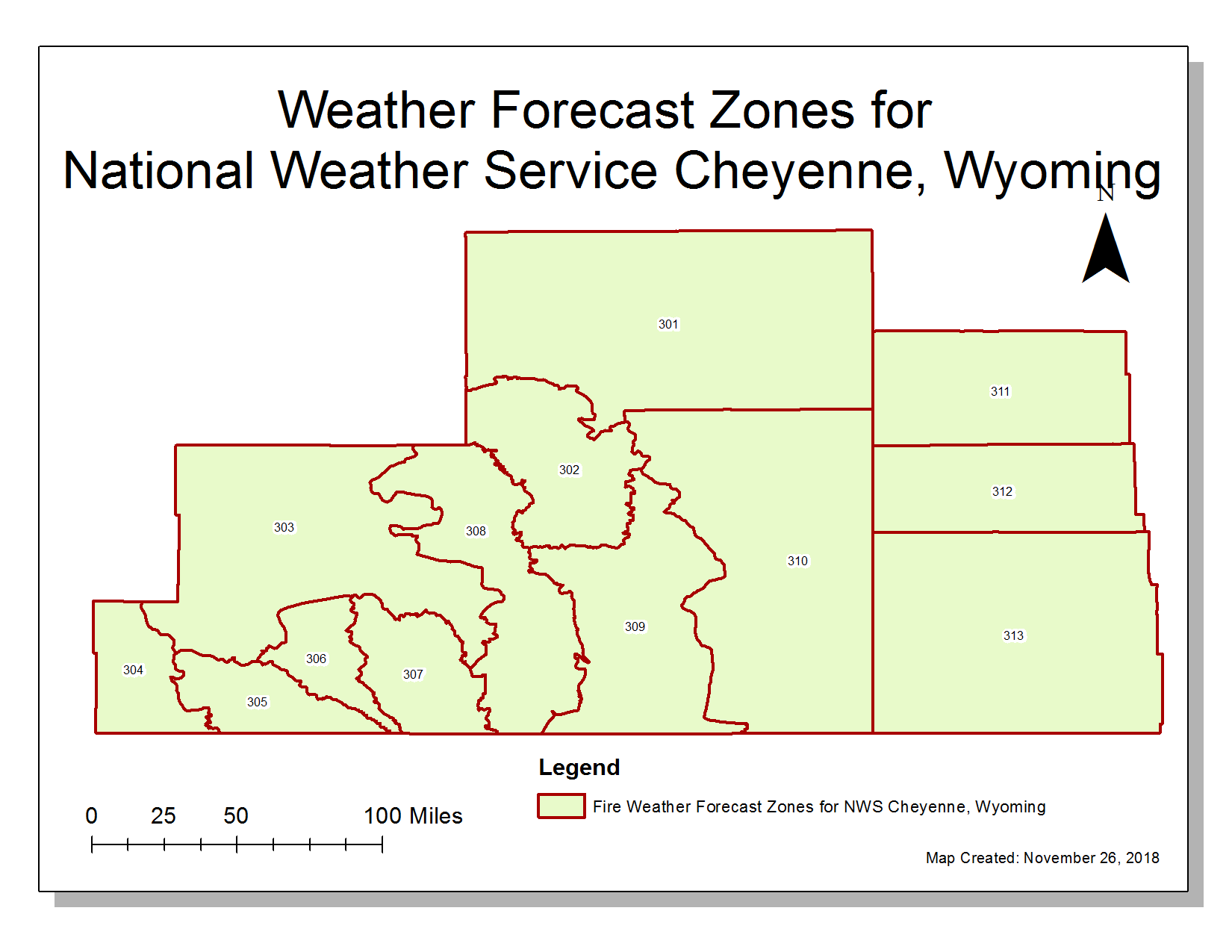 These fire weather forecast zones break up portions of our County Warning Area (CWA) to best represent different orographic and spatial features including our mountains and valleys. These fire weather forecast zones break up portions of our County Warning Area (CWA) to best represent different orographic and spatial features including our mountains and valleys. |
| On the Wyoming Side of Fire Weather Forecast Zones: WYZ301 (Niobrara/Lower Elevations of Converse/Thunder Basin National Grassland), WYZ302 (North Laramie Range/Medicine Bow National Forest), WYZ303 (Central and Northern Carbon/Ferris-Seminoe-Shirley Mountains), WYZ304 (Southwest Carbon County), WYZ305 (Sierra Madre/Medicine Bow National Forest), WYZ306 (Upper North Platte River Basin), WYZ307 (Snowy Range/Medicine Bow National Forest), WYZ308 (Laramie Valley/Shirley Basin), WYZ309 (South Laramie Range/Medicine Bow National Forest), WYZ310 (Platte/Goshen/Central and Eastern Laramie). | On the Nebraska Side of Fire Weather Forecast Zones: NEZ311 (Pine Ridge/Nebraska National Forest/Oglala National Grasslands), NEZ312 (Box Butte/South Sioux), NEZ313 (Scotts Bluff National Monument/Wildcat Hills). |
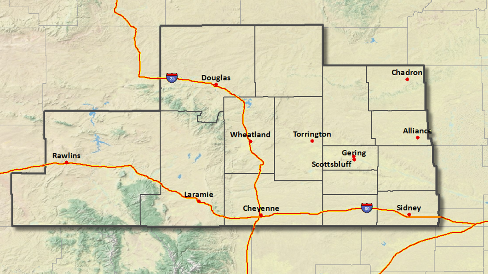
We issue 7 day forecasts for southeast Wyoming and the western Nebraska Panhandle. Meteorologists utilize the Advanced Weather Integrated Processing System (AWIPS) and Graphical Forecast Editor (GFE) to analyze computer model forecasts, radar data, satellites, and much more. In addition, forecasters issue watches, warnings, and advisories. Fire weather and aviation forecasts are also disseminated. Aviation forecasts are produced for the Cheyenne, Laramie, Rawlins, Chadron, Scottsbluff, Sidney, and Alliance terminals. Fire weather forecasts are especially important to support firefighter efforts.
|
|
|
Meteorologists issue watches, warnings, and advisories during weather events that require additional precautions.
|
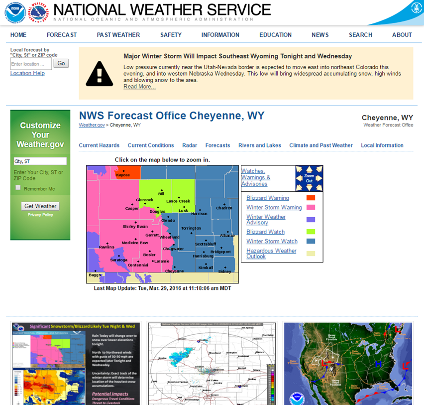
NWS Cheyenne web page showing color coded watches and warnings |
Watches are issued when conditions are favorable for events that will begin within current day or in the next day or so. Watches can be issued for many different types of weather events such as: severe thunderstorm, tornado, floods, high winds, fire weather, and winter weather. Watches are designed to ensure that there is plenty of time to prepare and take the necessary precautions before warnings are issued.
Warnings are issued when events are imminent or currently observed. Warnings are urgent and protective actions should be taken immediately. Advisories are issued for non-life threatening weather events.
Most of the watches and warning are issued by the forecast office. For severe thunderstorms and tornadoes, watches are prepared in collaboration with the Storm Prediction Center (SPC) in Norman, OK. After either a severe thunderstorm or tornado watch is issued by SPC, NWS Cheyenne utilize Doppler radars, satellite, spotter reports, and surface observations to issue warnings.


 Weather Story
 Weather Map
 Local Radar