Overview
Severe weather impacted southeastern Wyoming and the western Nebraska Panhandle during May 18-21, 2014 with very large hail, damaging winds, and tornadoes. The Storm Prediction Center included southeastern Wyoming and the western Nebraska Panhandle in SLIGHT risks for severe thunderstorms both days. After the passage of a cold front, moisture was abundant with southeasterly low level flow supporting of development of supercell thunderstorms. On May 20, thunderstorms produced hail over an inch in diameter in Goshen and Converse counties in Wyoming. On May 21, a supercell thunderstorm produced a tornado north of Wheatland, Wyoming in Platte County and hail over an inch in diameter.
Track Map:
.jpg) |
.jpg) |
|
||||||||||
|
Tornado north of Wheatland, WY as it touched down Credit: Unknown |
Tornado weakening and dissipating. Credit: Unknown |
Enhanced Fujita (EF) Scale classifies tornadoes into the following categories:
| EF0 Weak 65-85 mph |
EF1 Moderate 86-110 mph |
EF2 Significant 111-135 mph |
EF3 Severe 136-165 mph |
EF4 Extreme 166-200 mph |
EF5 Catastrophic 200+ mph |
 |
|||||
Photos & Video:
 |
 |
.jpg) |
 |
|
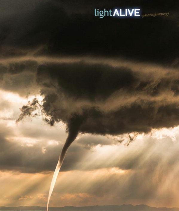
Picture of the tornado near Wheatland, WY on May 21 Credit: Light Alive Photography via Landon Brown |
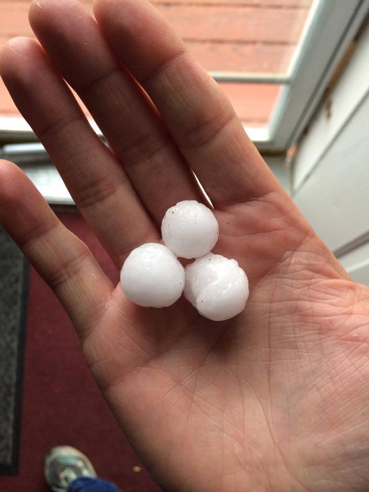
Quarter sized hail near Glenrock, WY on May 21 Credit: Russ Dalgarn |
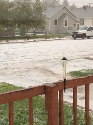
Hail covering the ground at Torrington, WY on May 20 Credit: Chris Jenkins |
Hail covering the ground at Torrington, WY on May 20 Credit: Melody Hood |
Storm Reports
 |
 |
| Time | Location | Report | Comments |
|---|---|---|---|
|
May 20 3:14 pm |
7 miles SW of Douglas, WY | 1 inch Hail | |
| 4:25 pm | Torrington, WY | 1 inch Hail | |
|
May 21 Around 3 pm |
14 miles N of Wheatland, WY | Tornado | Near mile marker 90 on Interstate 25. Tornado touched down and lifted four times. |
| Guernsey, WY | 1 inch Hail |
 |
Media use of NWS Web News Stories is encouraged! Please acknowledge the NWS as the source of any news information accessed from this site. |
|


 Weather Story
 Weather Map
 Local Radar