Overview
|
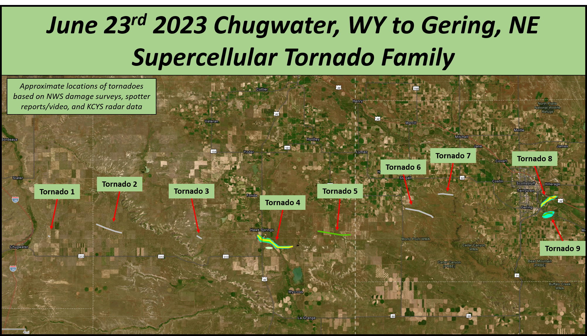
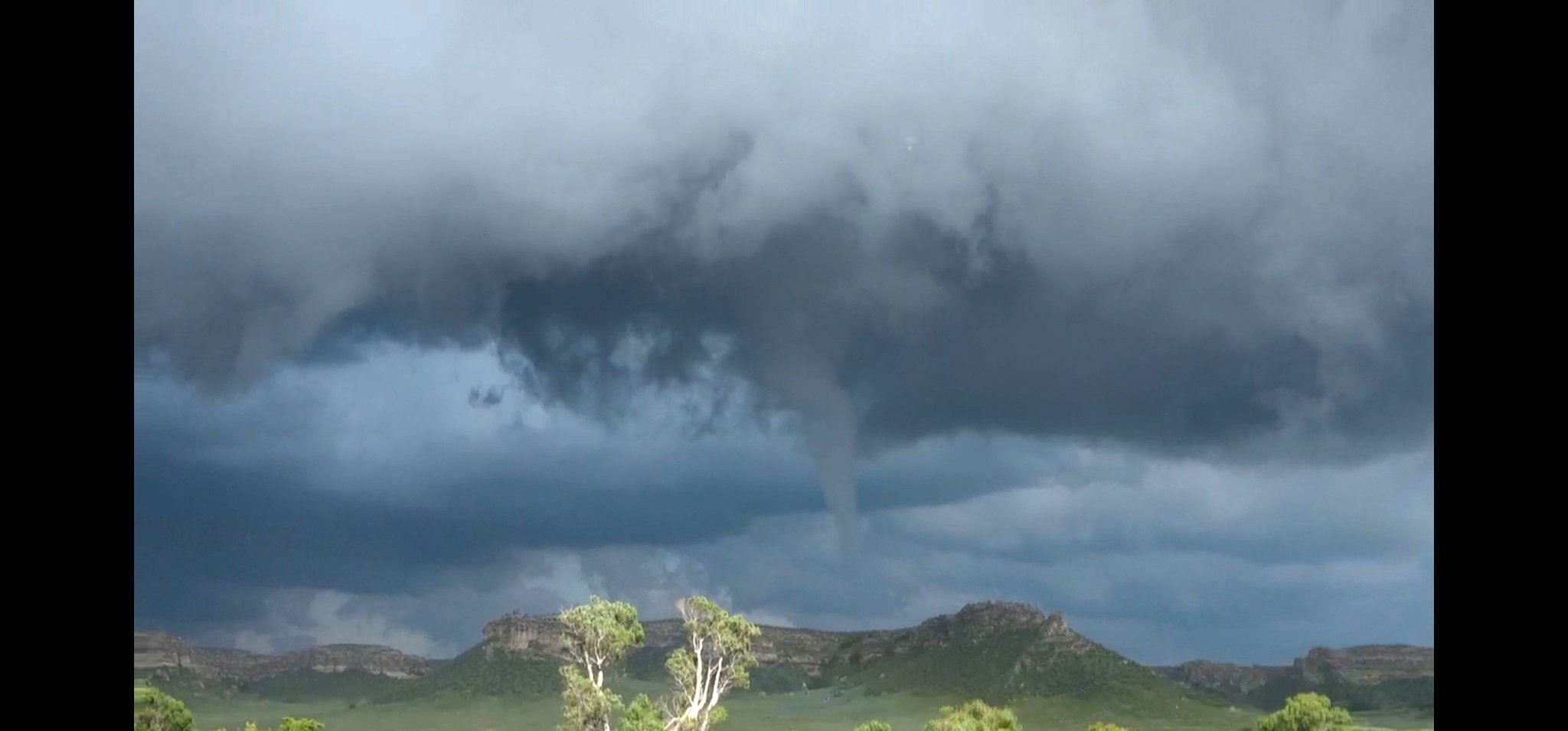
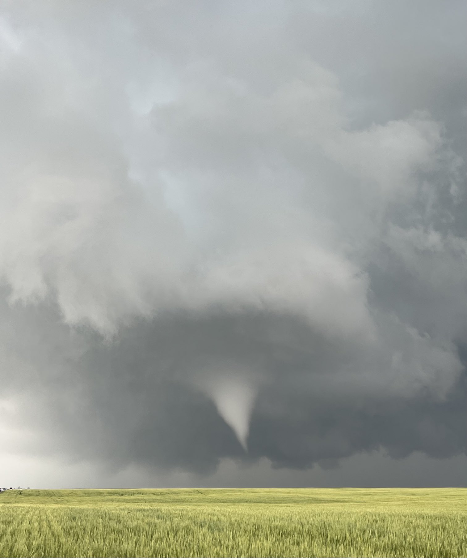
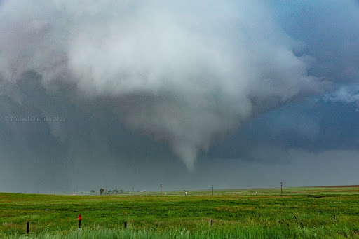
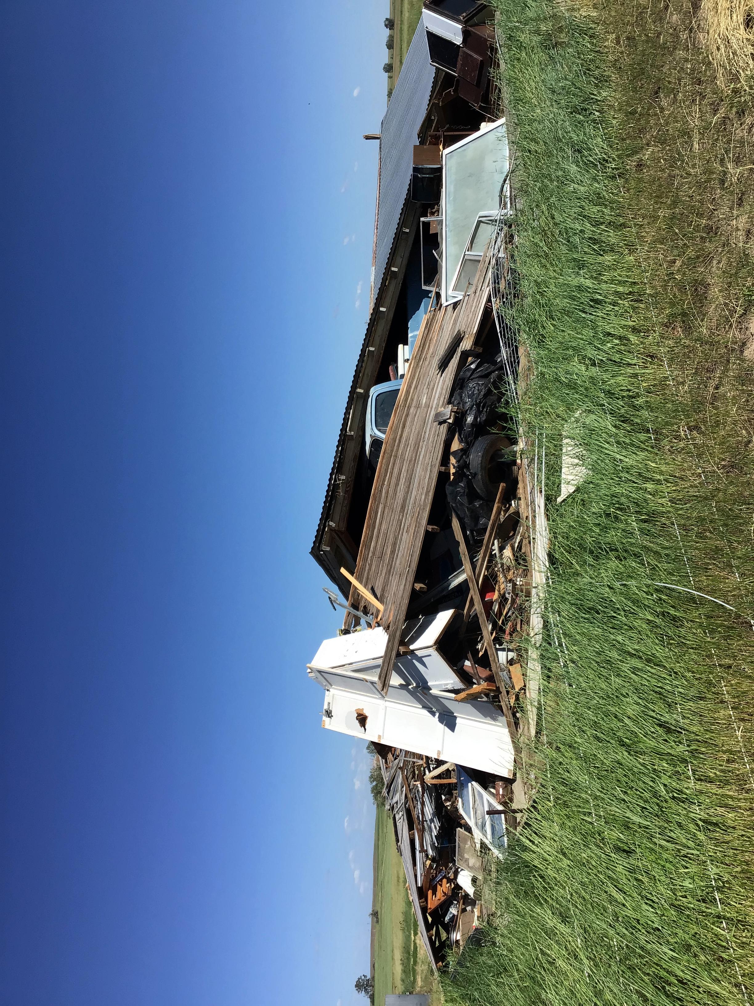
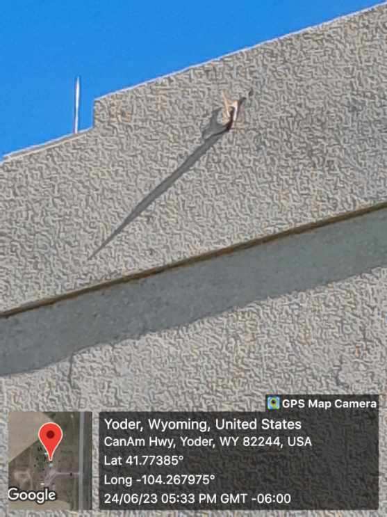
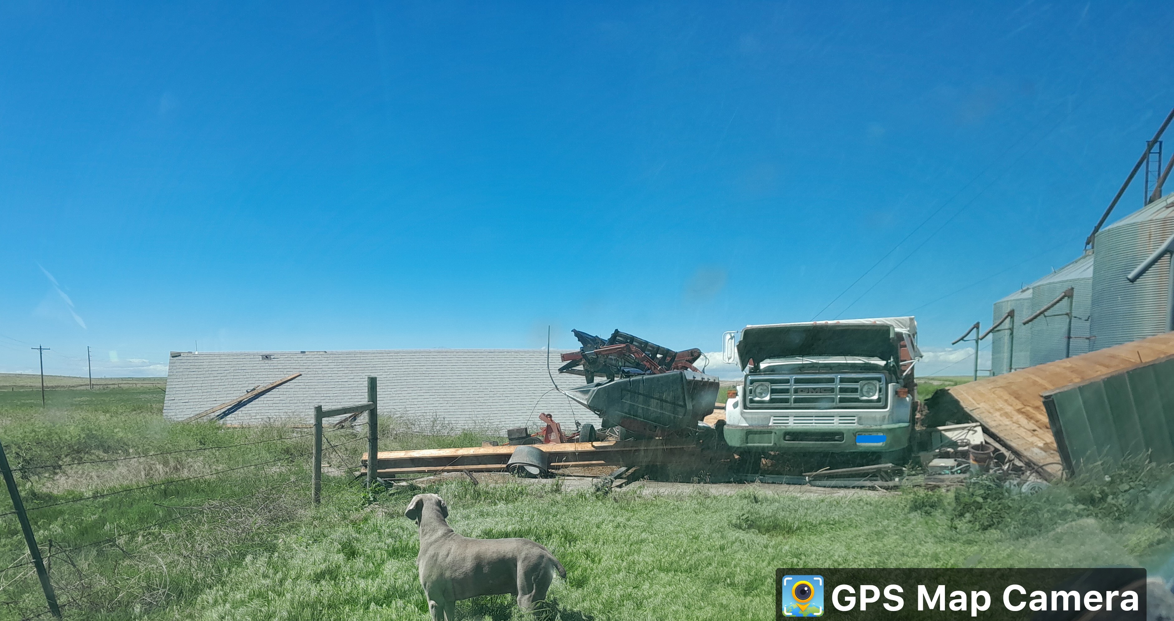
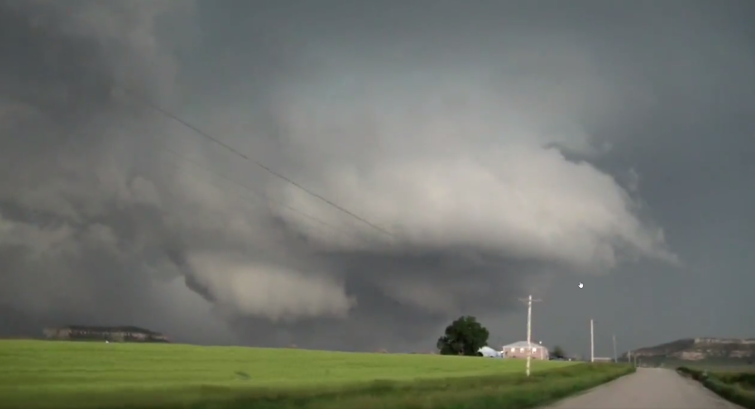
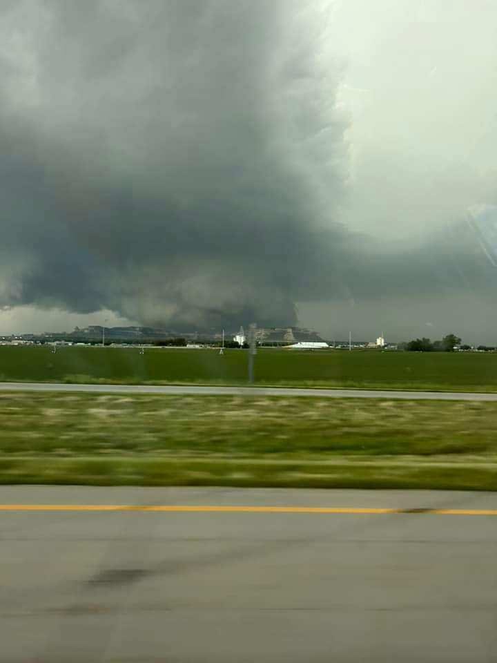
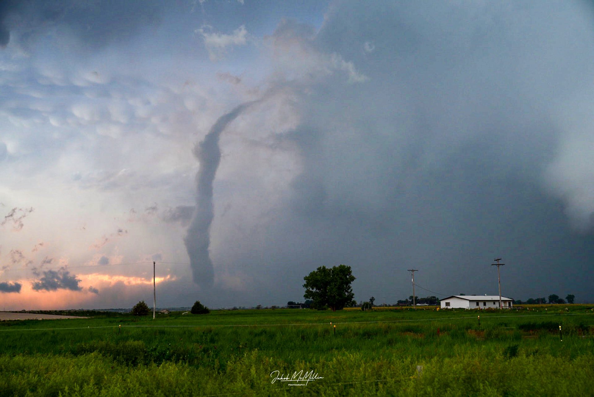
On June 23rd 2023, a powerful supercell thunderstorm developed near Chugwater, Wyoming and tracked east through Platte, Goshen, and Scotts Bluff counties. 9 tornadoes occurred from this cyclic supercell. Many of the tornadoes remained over open country with no damage reported, however two tornados produced EF-2 damage, one near Hawk Springs and another just east of Gering. This event had a high degree of predictability, with forecast models and short-term guidance honing in on the threat for supercells and possible tornadoes in this location a few days out. Thus, numerous photos and videos from spotters and the public were received from this event. Due to the remote nature of some of the tornadoes, exact paths were a best-estimate from spotter photos and radar data. Thanks is extended to all who shared photos, video, and reports from this event. For the official NWS Public Information Statement on this event in text format, please see this link. |
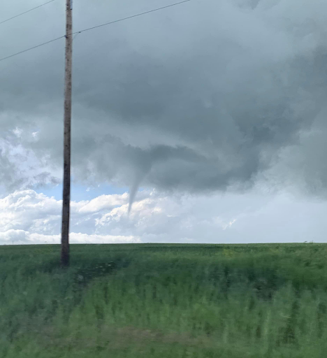
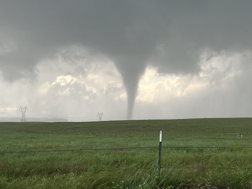
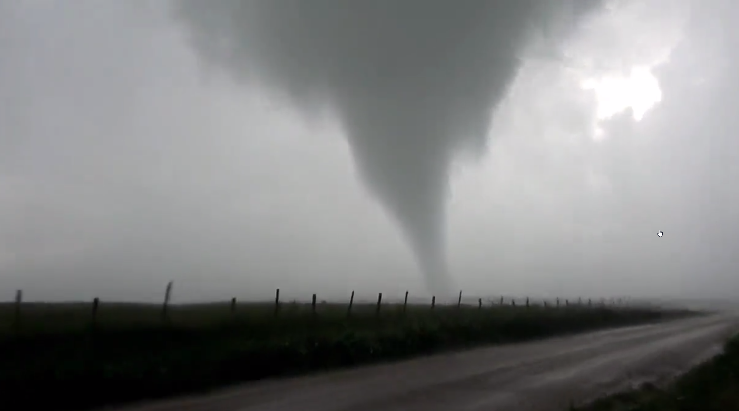
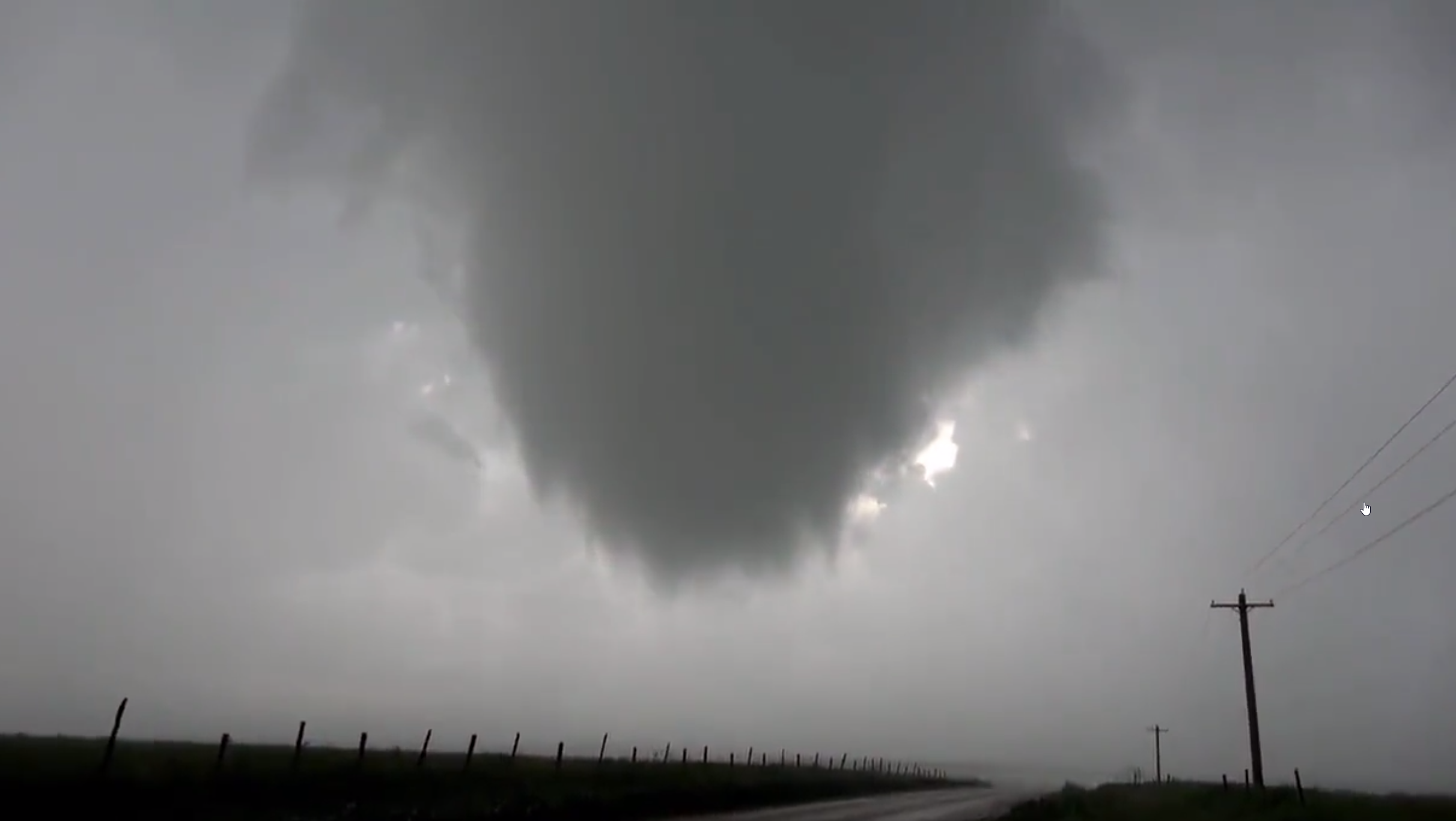
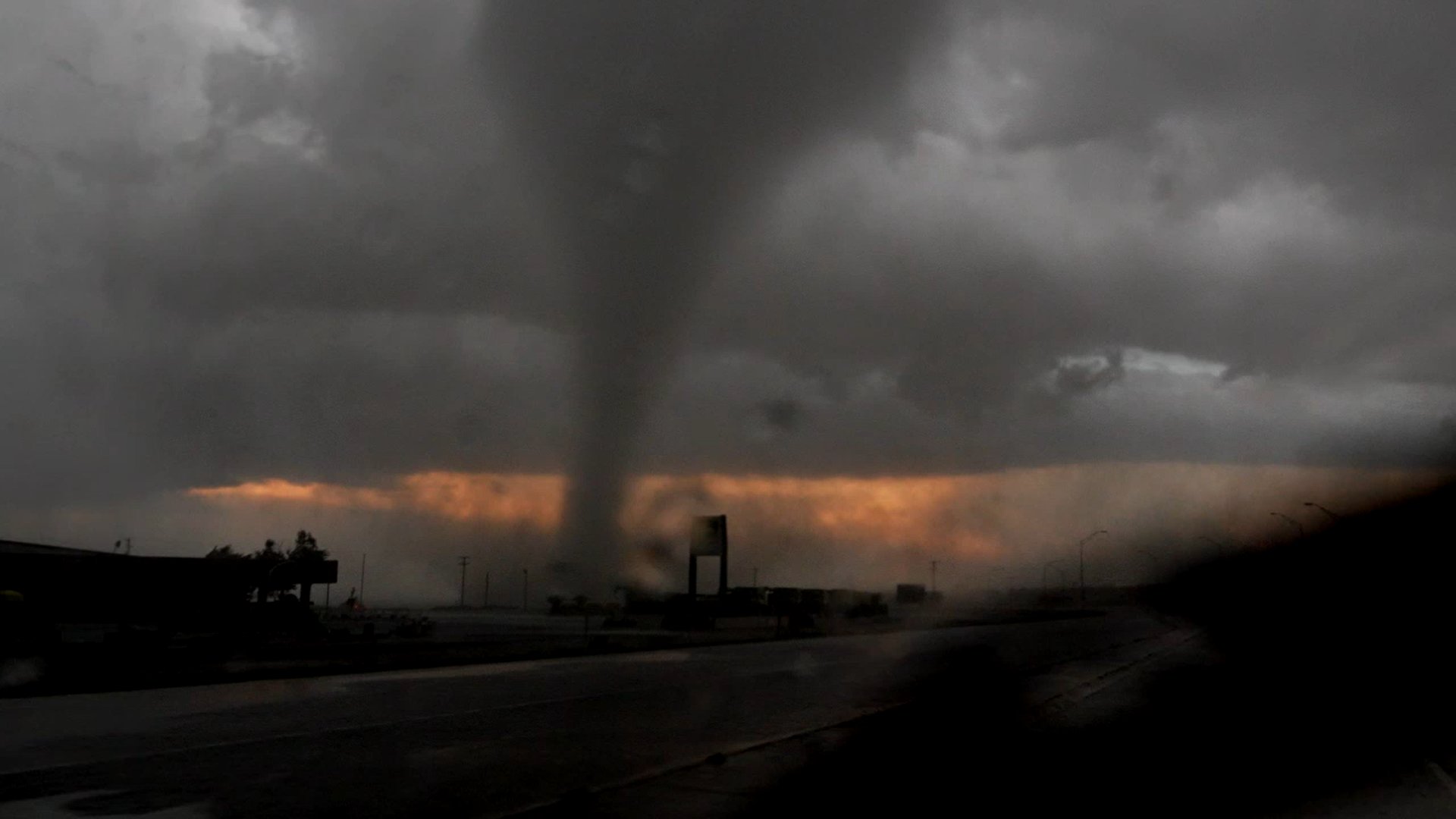
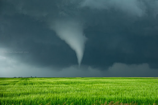 The second tornado from the Chugwater-Scottsbluff supercell, in open country near the Platte/Goshen County line. |
|
Overview map showing all 9 tornadoes in the "Tornado Family" from the cyclic supercell.
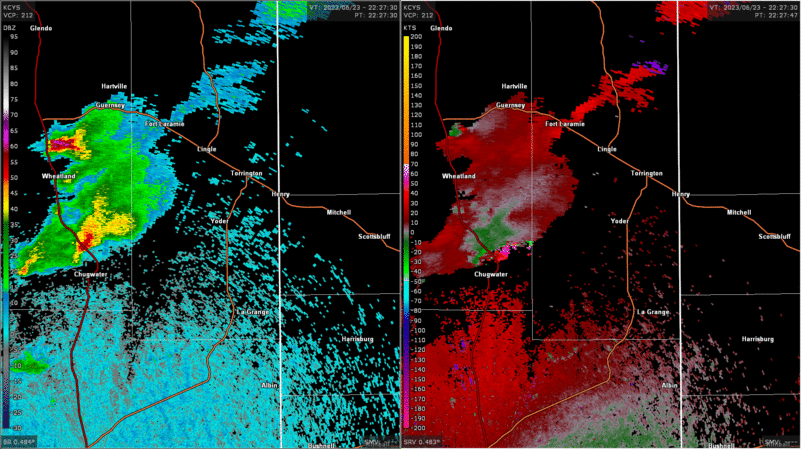
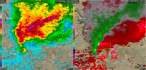
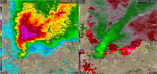
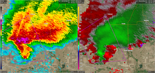
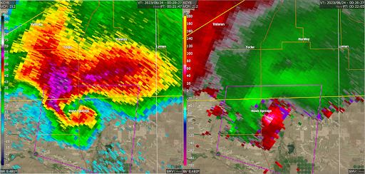
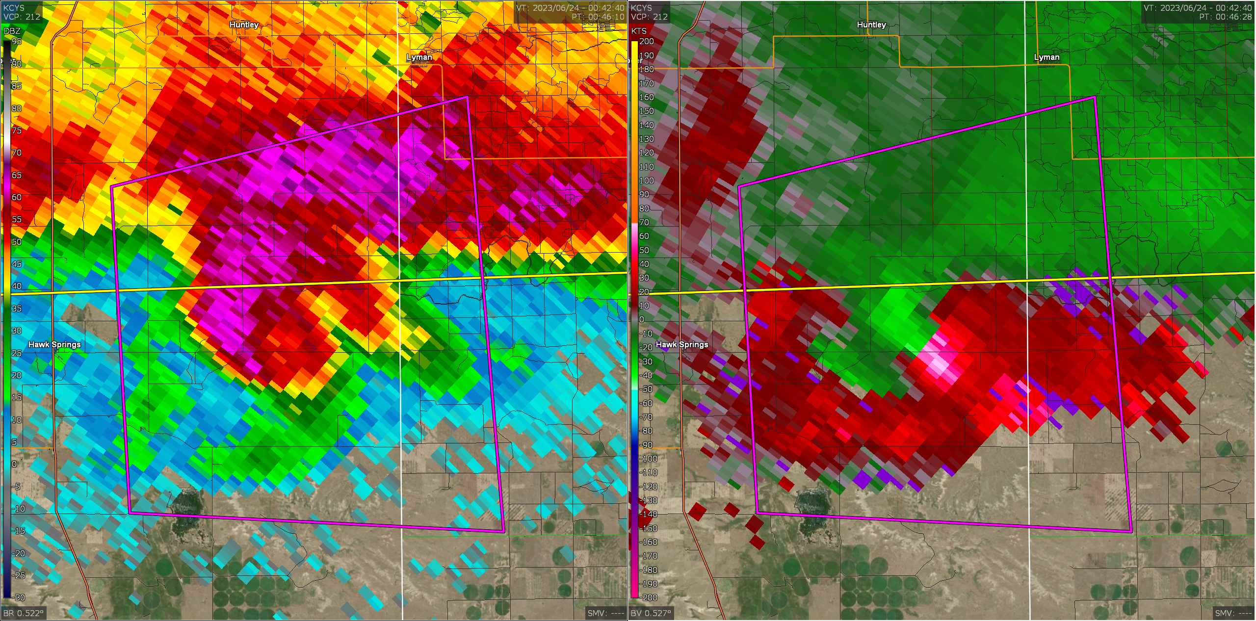
Radar Reflectivity and Velocity loop showing the evolution of the supercell |
Tornadoes
|
Tornado - Just east of Chugwater
Track Map 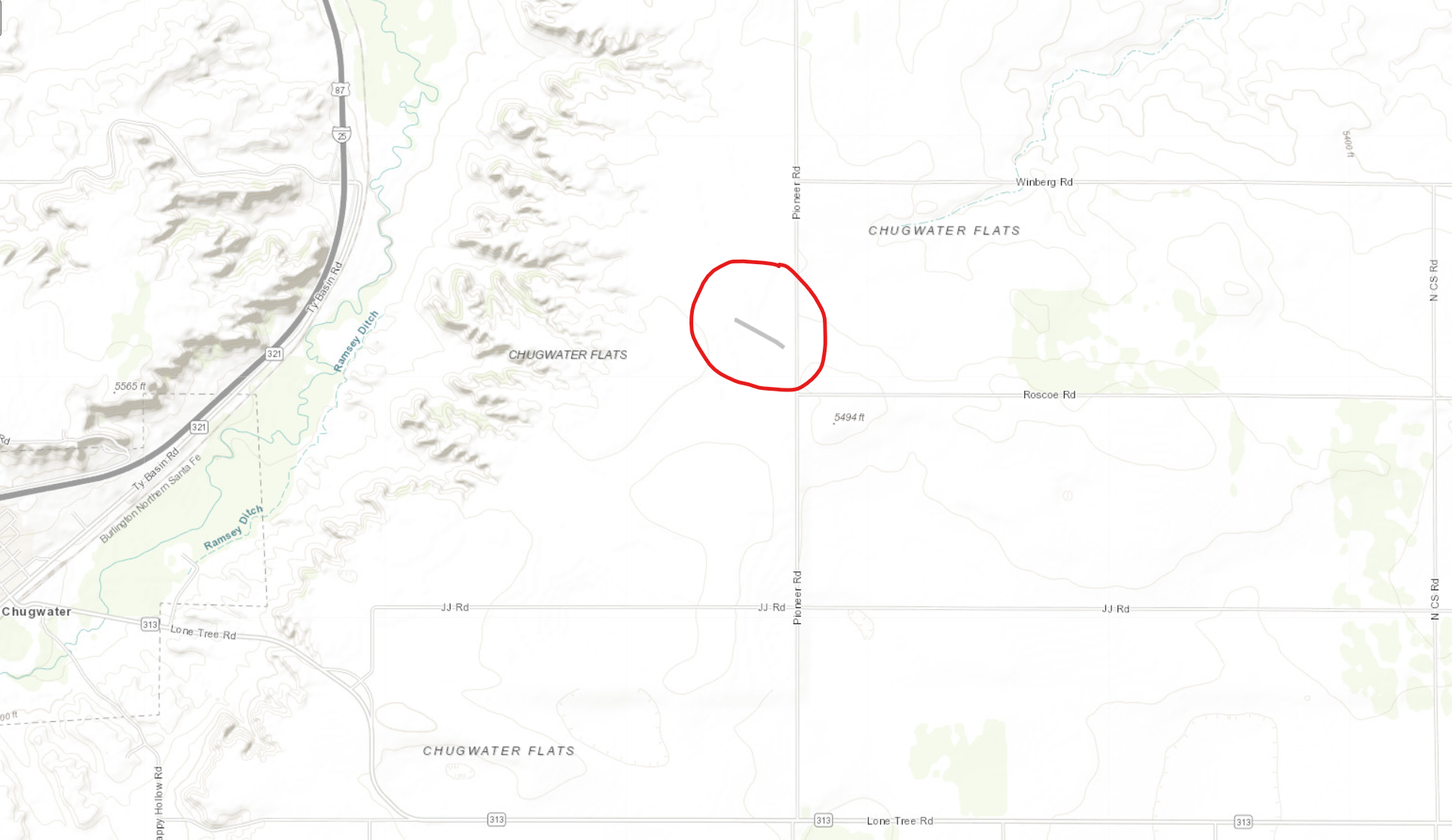
|
||||||||||||||||
|
||||||||||||||||
|
Tornado - 9 miles east of Chugwater
Track Map 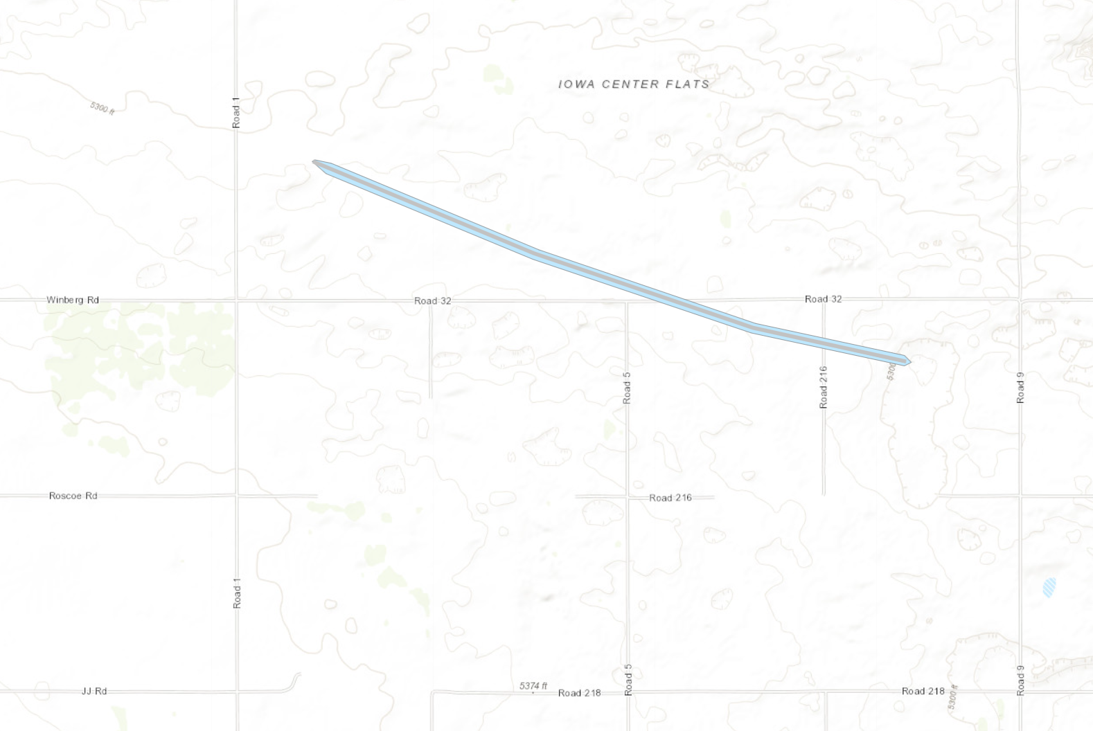
|
||||||||||||||||
|
||||||||||||||||
|
Tornado - 7 miles west of Hawk Springs
Track Map 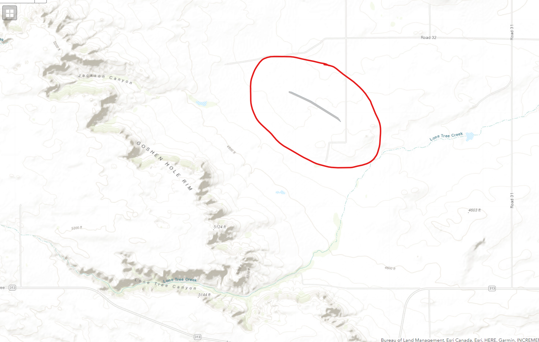
|
||||||||||||||||
|
||||||||||||||||
|
Tornado - Just south of Hawk Springs
Track Map 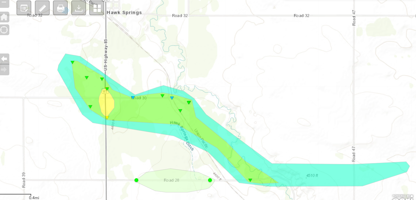
|
||||||||||||||||
|
||||||||||||||||
|
Tornado - 6 miles east of Hawk Springs
Track Map 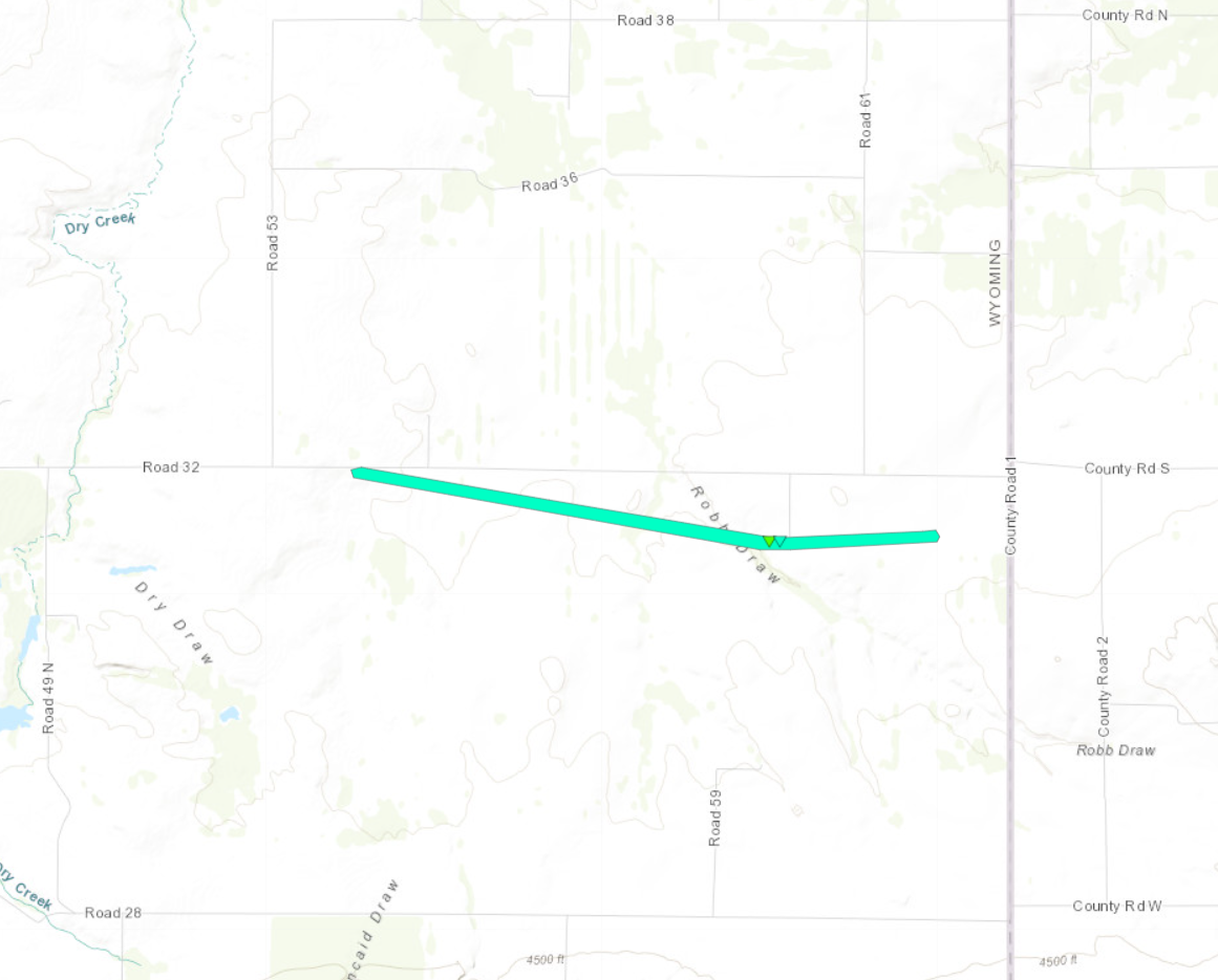
|
||||||||||||||||
|
||||||||||||||||
|
Tornado - Approximately 12 miles west of Gering
Track Map 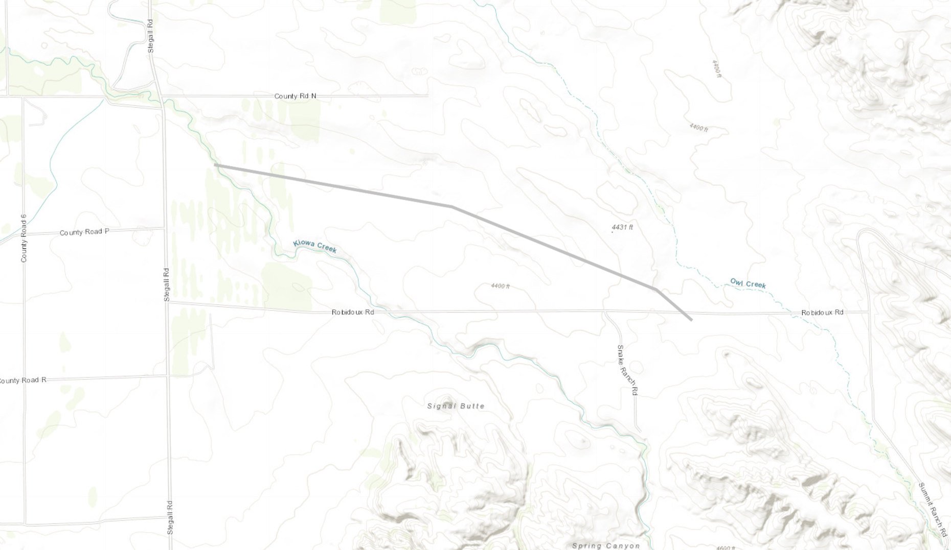
|
||||||||||||||||
|
||||||||||||||||
|
Tornado - Approximately 9 miles west of Gering
Track Map 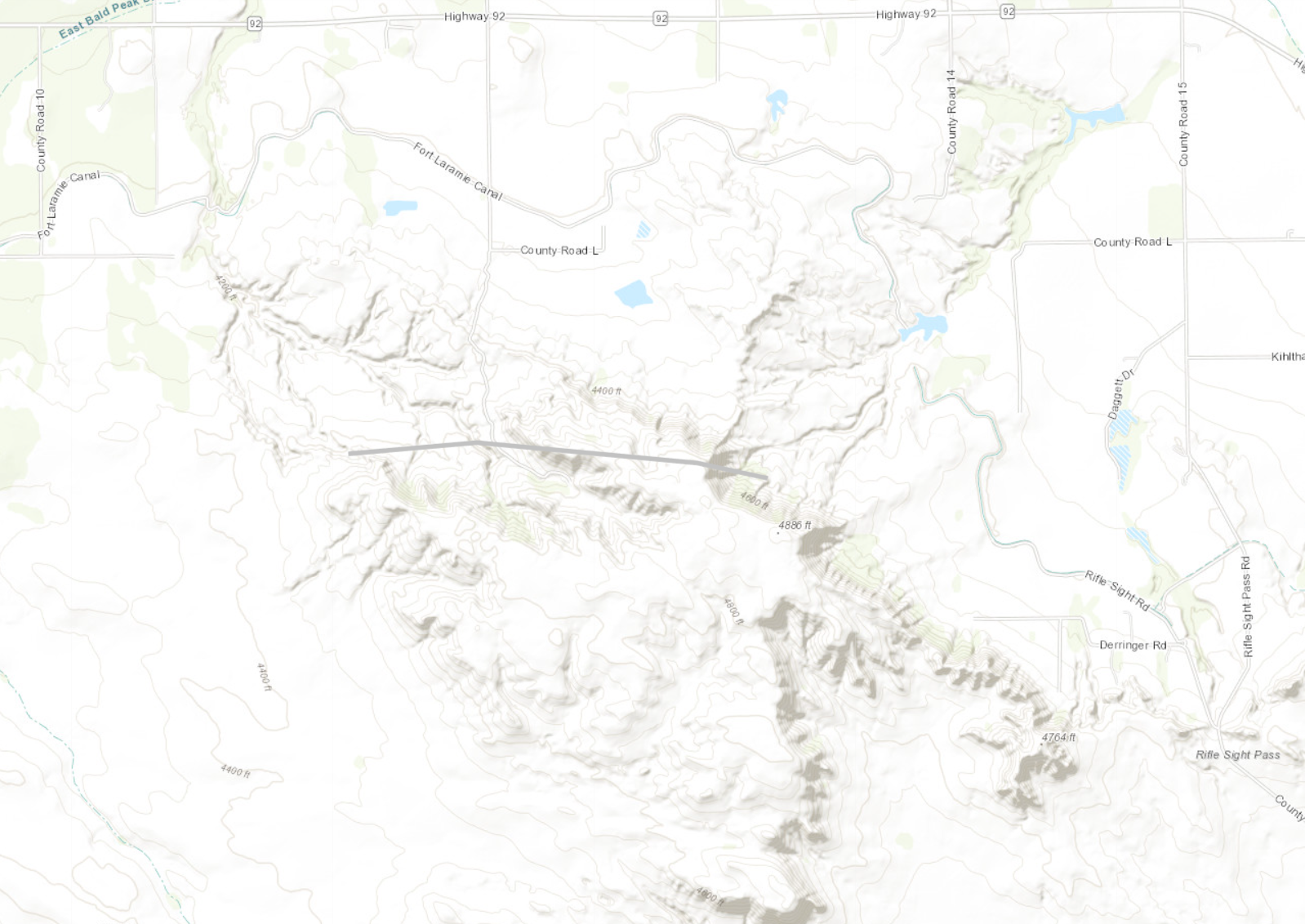
|
||||||||||||||||
|
||||||||||||||||
|
Tornado - 1.5 miles east-northeast of Gering
Track Map 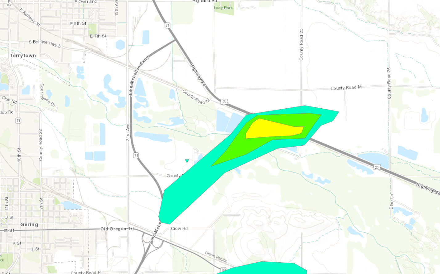
|
||||||||||||||||
|
||||||||||||||||
|
Tornado - 2 miles southeast of Gering
Track Map 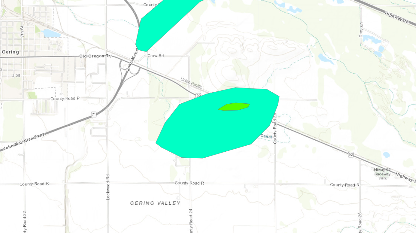
|
||||||||||||||||
|
||||||||||||||||
The Enhanced Fujita (EF) Scale classifies tornadoes into the following categories:
| EF0 Weak 65-85 mph |
EF1 Moderate 86-110 mph |
EF2 Significant 111-135 mph |
EF3 Severe 136-165 mph |
EF4 Extreme 166-200 mph |
EF5 Catastrophic 200+ mph |
 |
|||||
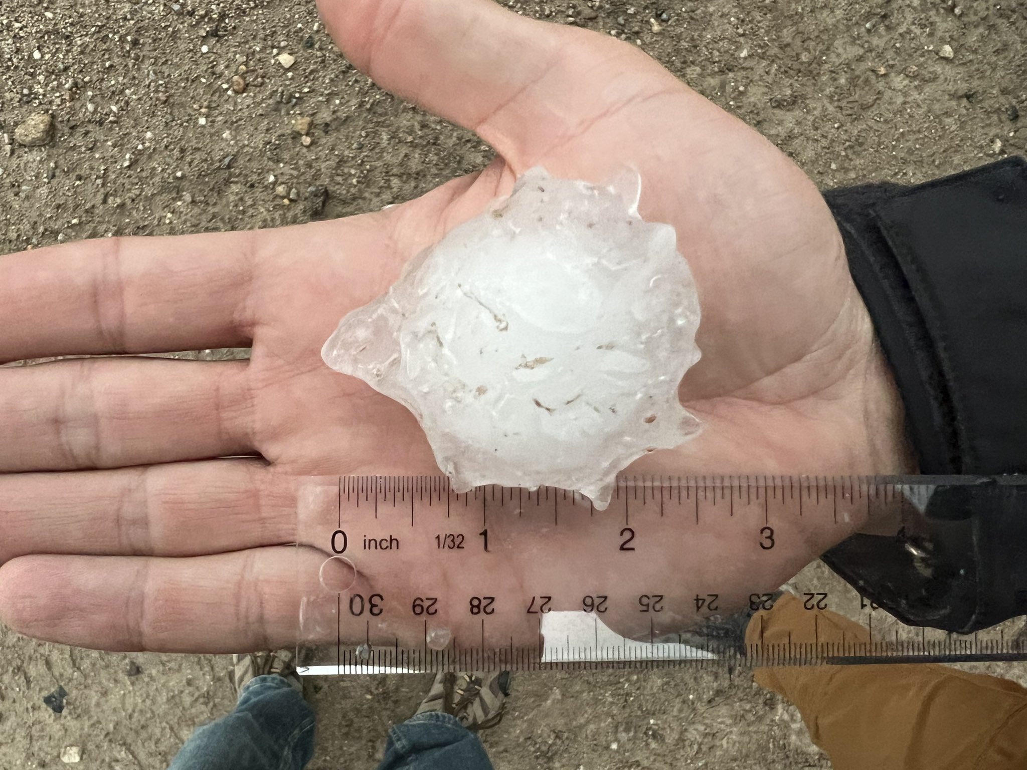
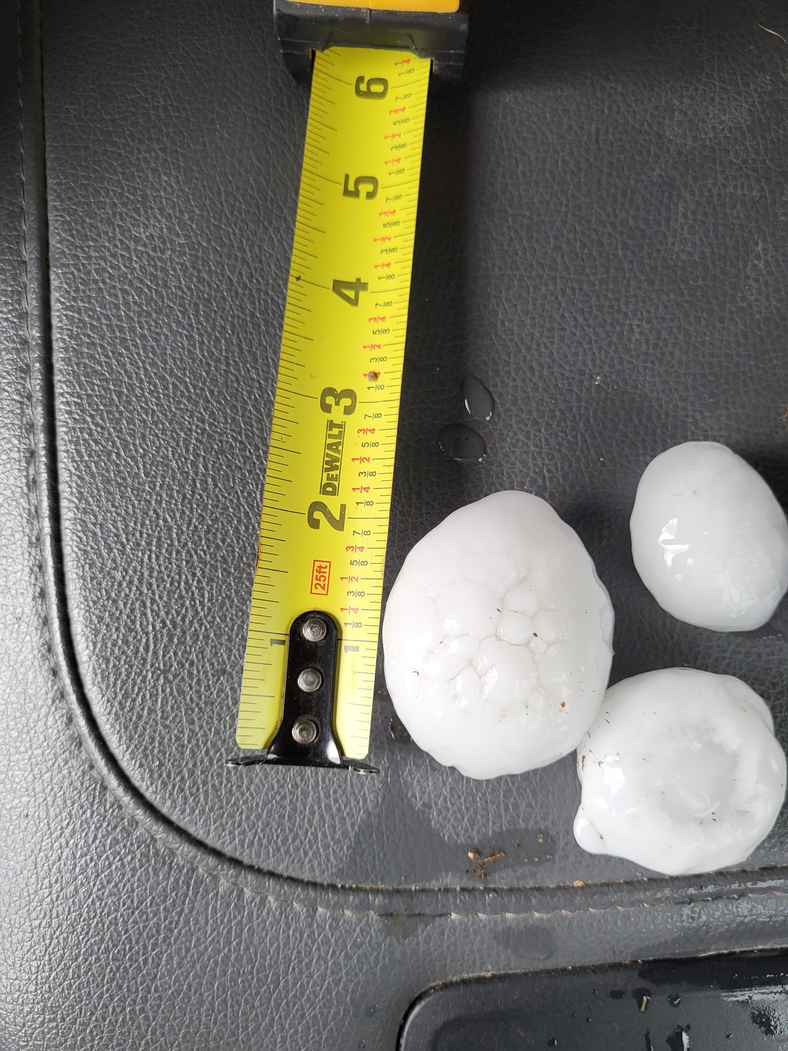
Hail
In addition to the tornadoes, this storm produce a long, wide swath of hail from southeast Wyoming through western Nebraska. Below are a few pictures.
 |
 |
 |
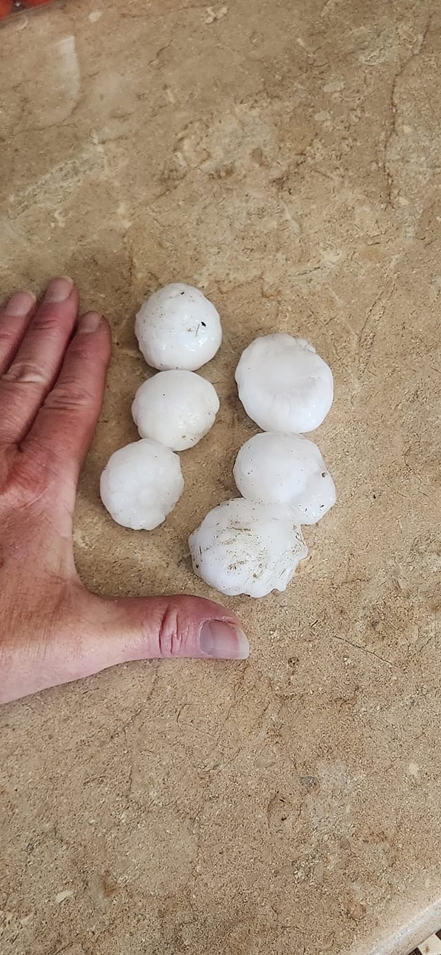 |
| Large hail south of Minatare | Large hail in Slater | Large hail in Lodgepole | Another photo of large hail in Slater from storm spotter |
Radar
 |
|||
| Composite radar image of the storm every hour from 20:00 UTC (2PM MDT) to 02:00 UTC (8PM MDT) on June 23, 2023 |
Storm Reports
Official NWS Public Information Statement on this event: https://nwschat.weather.gov/p.php?pid=202307020003-KCYS-NOUS45-PNSCYS
 |
Media use of NWS Web News Stories is encouraged! Please acknowledge the NWS as the source of any news information accessed from this site. |
|


.png)
.png)
.png)
.png)
 Weather Story
 Weather Map
 Local Radar