Overview
|
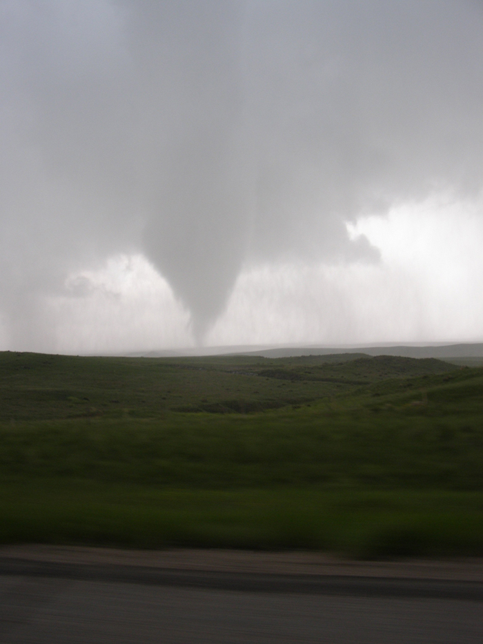
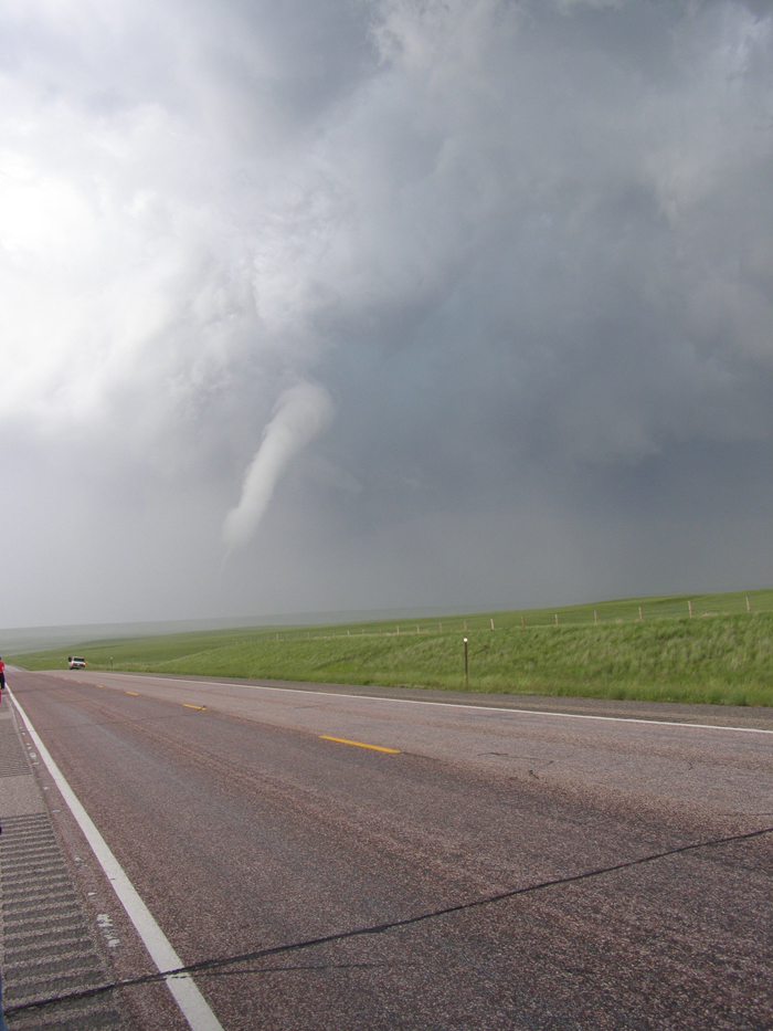
The most photogenic tornado in Wyoming history occurred on June 5, 2009 in southern Goshen County. The EF2 tornado was observed by many parties including the NOAA VORTEX2 research team and The Weather Channel. The first tornado report was received at 4:07 pm, 11 miles west of La Grange, Wyoming. The tornado continued its eastward trek for approximately 30 miles. The National Weather Service storm damage assessment team documented uprooted trees, broken power lines, and broken windows at farm homes. The tornado remained in open country and no injuries were reported. |
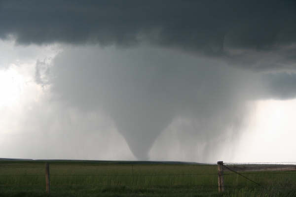
Mature rain wrapped tornado. Credit: Dan Fitts |
 |
 |
|
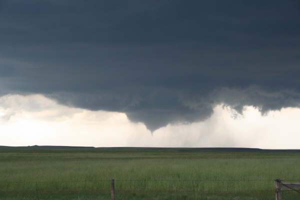
Funnel cloud about to touch down in Goshen County Credit: Dan Fitts |
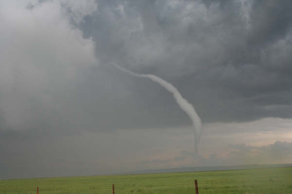
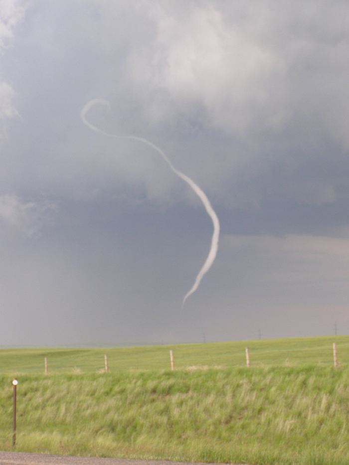
Tornado beginning to dissipate near the Wyoming-Nebraska state line Credit: Dan Fitts |
Tornadoes:
|
Tornado - La Grange, WY
Track Map
 |
The Enhanced Fujita (EF) Scale classifies tornadoes into the following categories:
| EF0 Weak 65-85 mph |
EF1 Moderate 86-110 mph |
EF2 Significant 111-135 mph |
EF3 Severe 136-165 mph |
EF4 Extreme 166-200 mph |
EF5 Catastrophic 200+ mph |
 |
|||||
Photos & Video:
Storm Damage
 |
 |
 |
 |
|
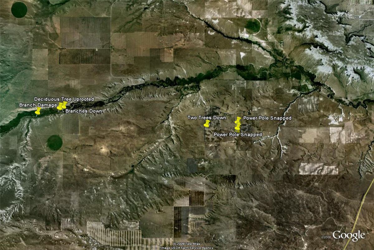
Damage map showing pins where to highlight areas of tornado damage in Goshen County. Credit: NWS Cheyenne Damage Survey |
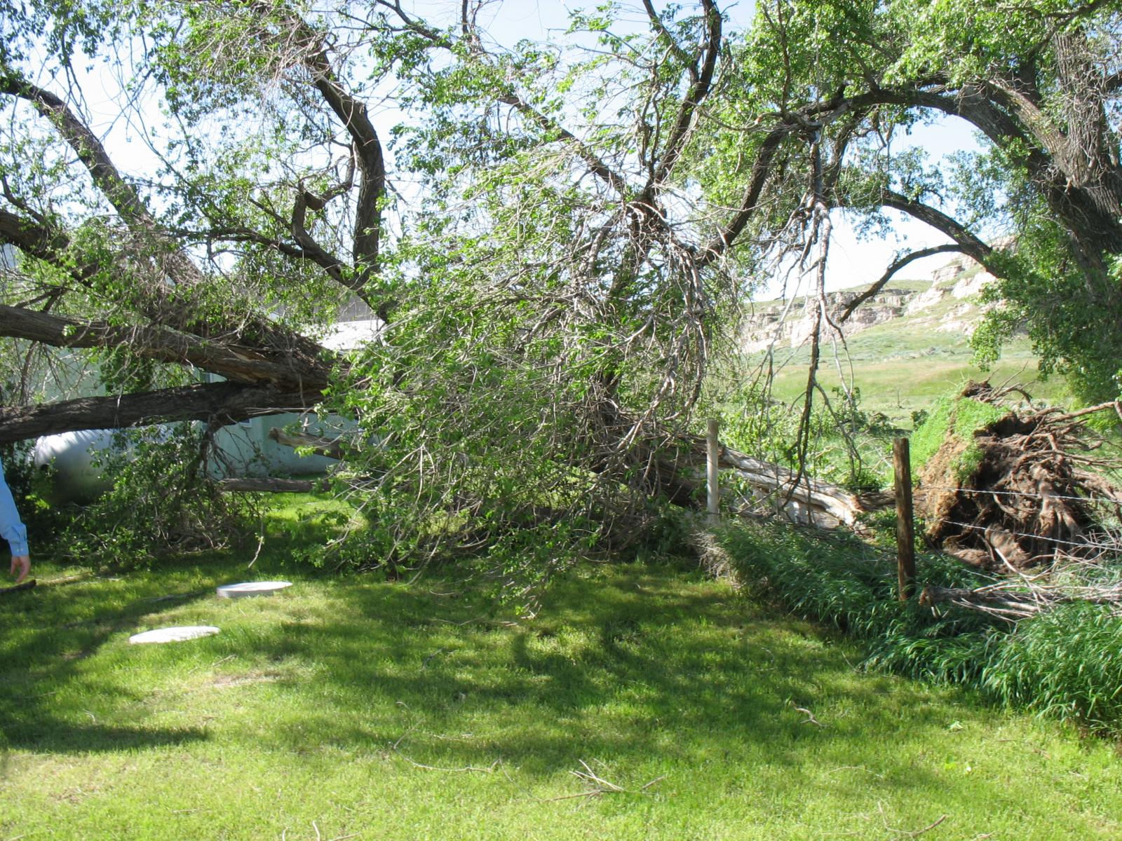
Uprooted tree damage along road 25, approximately 12 miles west of La Grange, WY. Credit: NWS Cheyenne Damage Survey |
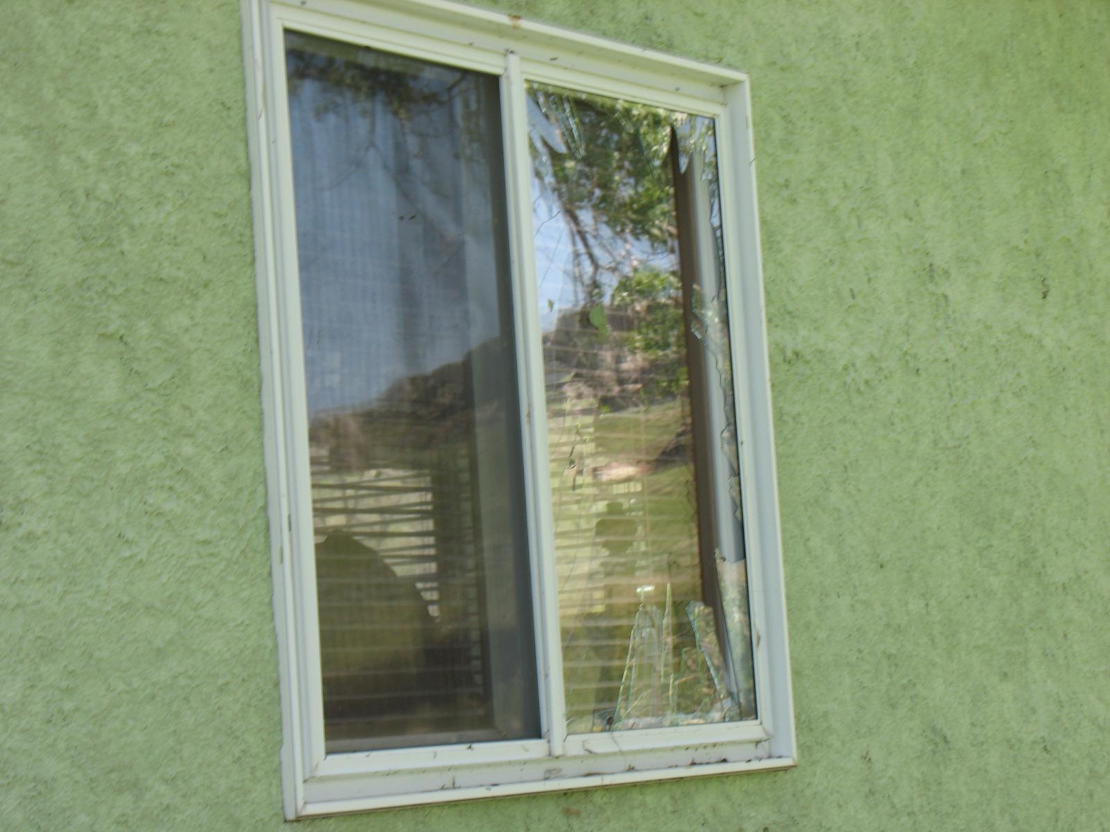
Broken window from tornado debris, approximately 10 miles west of La Grange, WY. Credit: NWS Cheyenne Damage Survey |
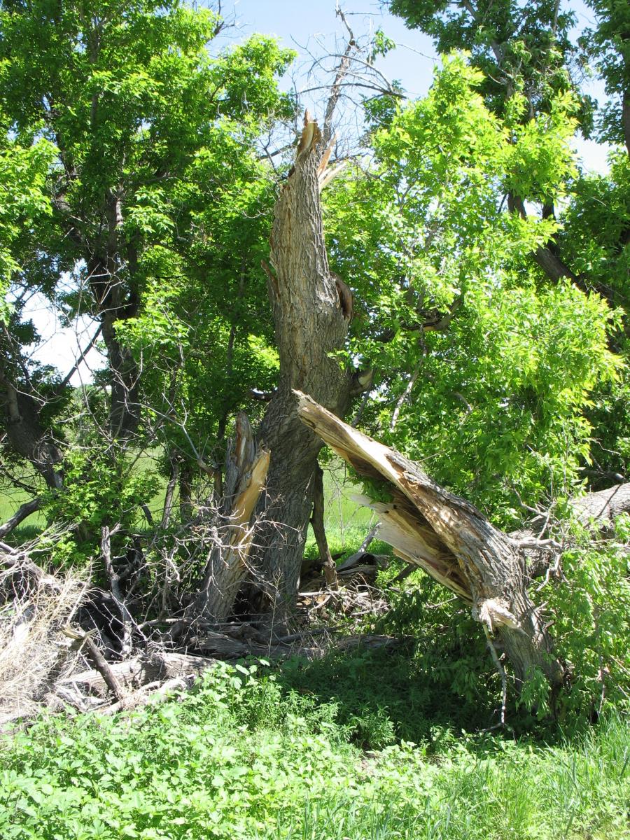
Uprooted broken tree, approximately 10 miles west of La Grange, WY. Credit: NWS Cheyenne Damage Survey |
Vortex2 NOAA's National Severe Storms Laboratory
 |
 |
 |
 |
|
VORTEX2 west of La Grange, WY. Credit: NOAA VORTEX2 |
VORTEX2 near La Grange, WY. Credit: NOAA VORTEX2 |
VORTEX2 east of La Grange, WY as the tornado dissipates. Credit: NOAA VORTEX2 |
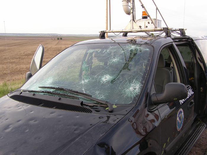
Large hail from the storm left the National Severe Storms vehicle damaged. Credit: NOAA VORTEX2 |
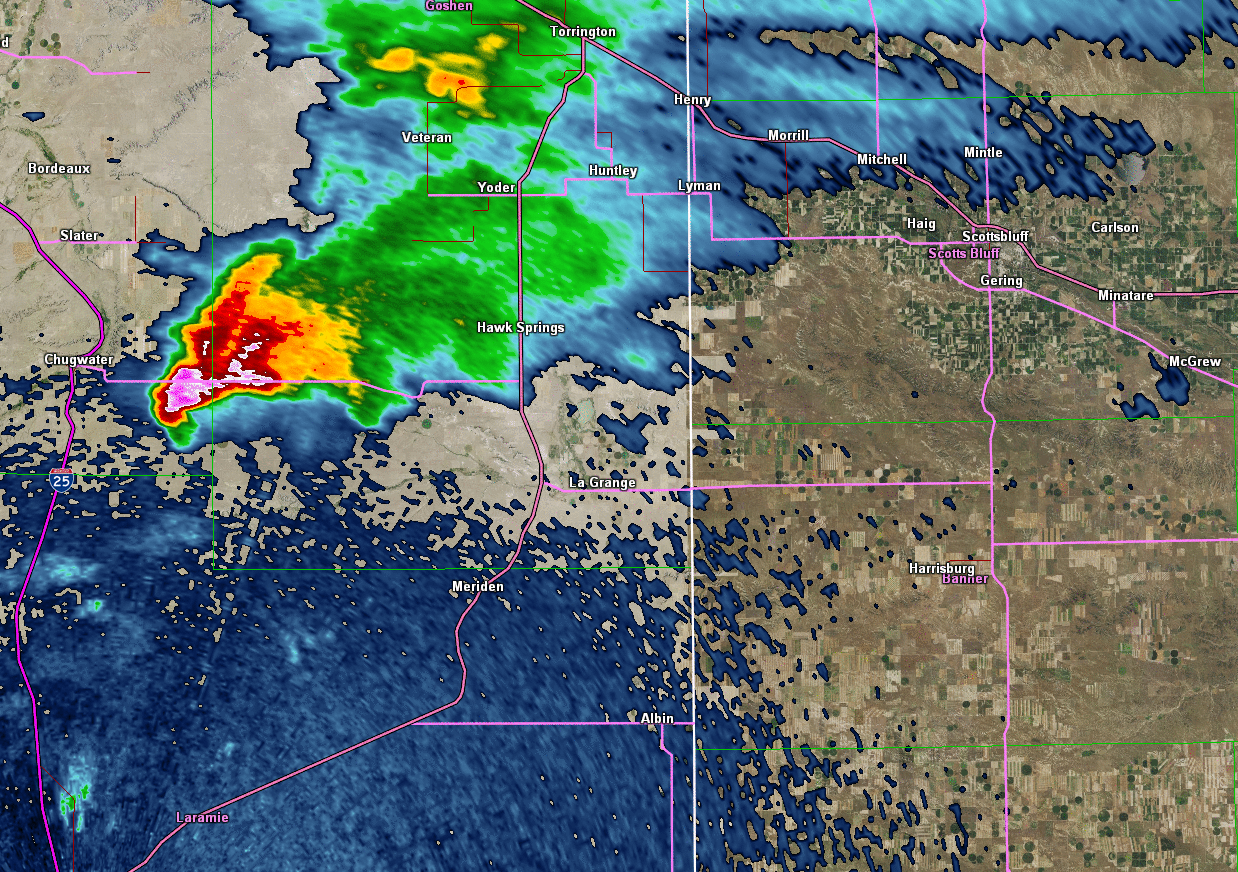
Radar:
 |
 |
|
Reflectivity image loop from 3:25 PM to 5:42 PM as the supercell thunderstorm and associated tornado moved to the southeast. |
Storm relative velocity image loop from 3:25 PM to 5:42 PM. The green-red couplet depicts the tornadic rotation. |
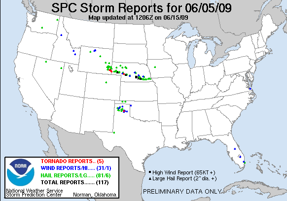
Storm Reports
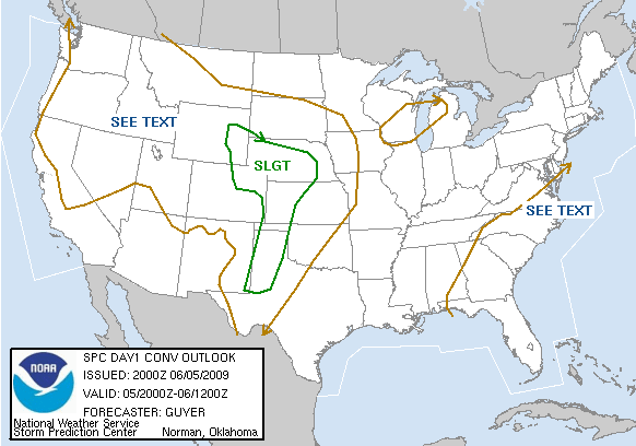
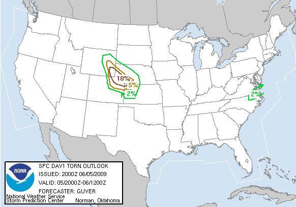
Storm Prediction Center Outlooks
 |
 |
 |
| SPC Day 1 Categorical Outlook | SPC Day 1 Tornado Outlook | SPC Day 1 Hail Outlook |
Storm Reports
 |
|
||||||||||
| June 5, 2010 Storm Reports |
 |
Media use of NWS Web News Stories is encouraged! Please acknowledge the NWS as the source of any news information accessed from this site. |
|


 Weather Story
 Weather Map
 Local Radar