|
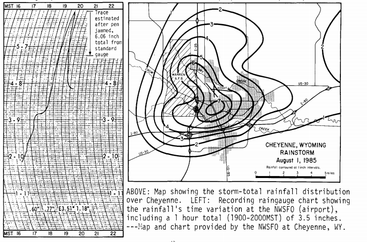
On the evening of August 1st, 1985, a devastating hailstorm struck the city of the Cheyenne, Wyoming leading to flash flooding across the city. Crow Creek, Dry Creek and the downtown sector were inundated with fast rising water from the storm. The National Weather Service Forecast Office in Cheyenne measured 6.06 inches of rainfall as the official measurement though upwards to 7.87 inches in some places in the city, all in about a 3-hour span! In addition, a one-hour rainfall total of 3.50 inches was recorded setting a new 1-hour record along with the 6.06 inches becoming the new 24-hour record for the state of Wyoming. In all, 12 fatalities, 70 injuries, and total damages exceeding $61 million were reported. Most of the deaths were associated with people being swept away in their cars as they tried to cross flooded streets along Dry Creek.
For more information, please see the Meteorological Analysis of the Cheyenne, Wyoming, Flash Flood and Hailstorm of 1 August 1985 |
Credit: United States Geological Survey (USGS) |
Photos:
 |
 |
 |
| Rainfall map and rain gauge chart from Cheyenne, WY NWS Office | Cars stacked by floodwaters in downtown Cheyenne, Wyoming Credit: USGS |
Hail accumulation following flooding in Cheyenne, Wyoming Credit: USGS |
Radar:
 |
 |
 |
 |
| National Center for Atmospheric Research (NCAR) CP-2 radar reflectivity at 2335 GMT, 1 August 1985. | NCAR CP-2 radar reflectivity at 0020 GMT, 2 August 1985. | NCAR CP-2 radar reflectivity at 0030 GMT, 2 August 1985. | NCAR CP-2 radar reflectivity at 0105 GMT, 2 August 1985. |
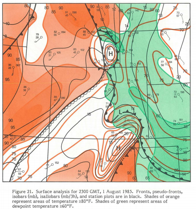
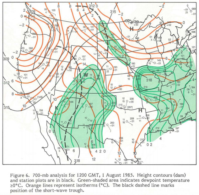
Surface and Upper Air Maps
 |
 |
 |
 |
 |
 |
 |
 |
 |
 |
 |
 |
Media use of NWS Web News Stories is encouraged! Please acknowledge the NWS as the source of any news information accessed from this site. |
|


 Weather Story
 Weather Map
 Local Radar