|
A large supercell thunderstorm developed near the Interstate 80 Summit during the early afternoon hours on 05/27/18. Initial reports of large hail were received at around 1415 MDT. This severe thunderstorm lifted northeast into western portions of Laramie county spawning its first tornado at around 1443 MDT north of Buford, WY. This tornado producing severe thunderstorm continuing lifting northeast recycling numerous times. Although much of the life-cycle of the tornado was spent over open country causing no damage, significant damage occurred in the vicinity of Federal, WY, 17 miles northwest of Cheyenne. The tornado continued over open country and crossed Interstate 25 near the Whitaker exit producing damage to a vehicle. With no damage indicator as it crossed Interstate 25, this portion of this cyclical tornado was rated EF-Unknown. Although the tornado likely continued periodically east of Interstate 25 before lifting, there were no additional reports of structures impacted or other damage. |
Storm as it crossed Interstate 25 near the Whitaker Exit.
|
|
|
 |
 |
|
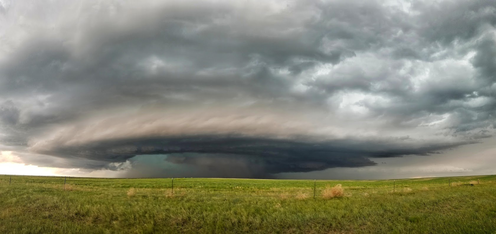
Supercell Thunderstorm West of Cheyenne Credit: Jacob Deflitch |
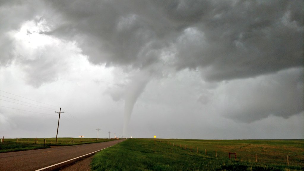
Tornado near Federal Credit: Dan Fitts |
Tornado near Federal Credit: Jeremy Bower |
Tornadoes:
|
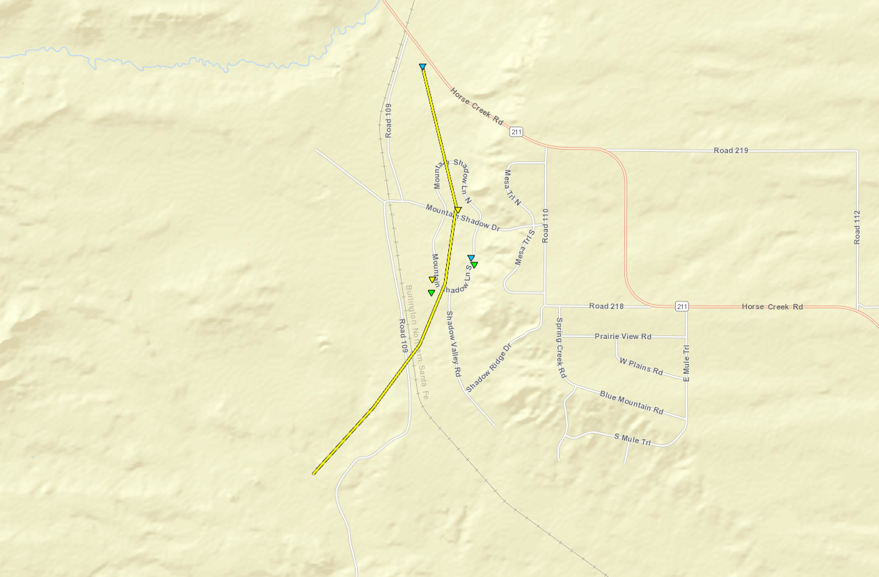
Tornado - Federal, WY
Track Map
|
||||||||||||||||
|
Tornado-19 North/Northwest Cheyenne
Track Map
|
||||||||||||||||
The Enhanced Fujita (EF) Scale classifies tornadoes into the following categories:
| EF0 Weak 65-85 mph |
EF1 Moderate 86-110 mph |
EF2 Significant 111-135 mph |
EF3 Severe 136-165 mph |
EF4 Extreme 166-200 mph |
EF5 Catastrophic 200+ mph |
 |
|||||
Photos & Video:
Click Image to Enlarge
 |
 |
|
Near Vedauwoo |
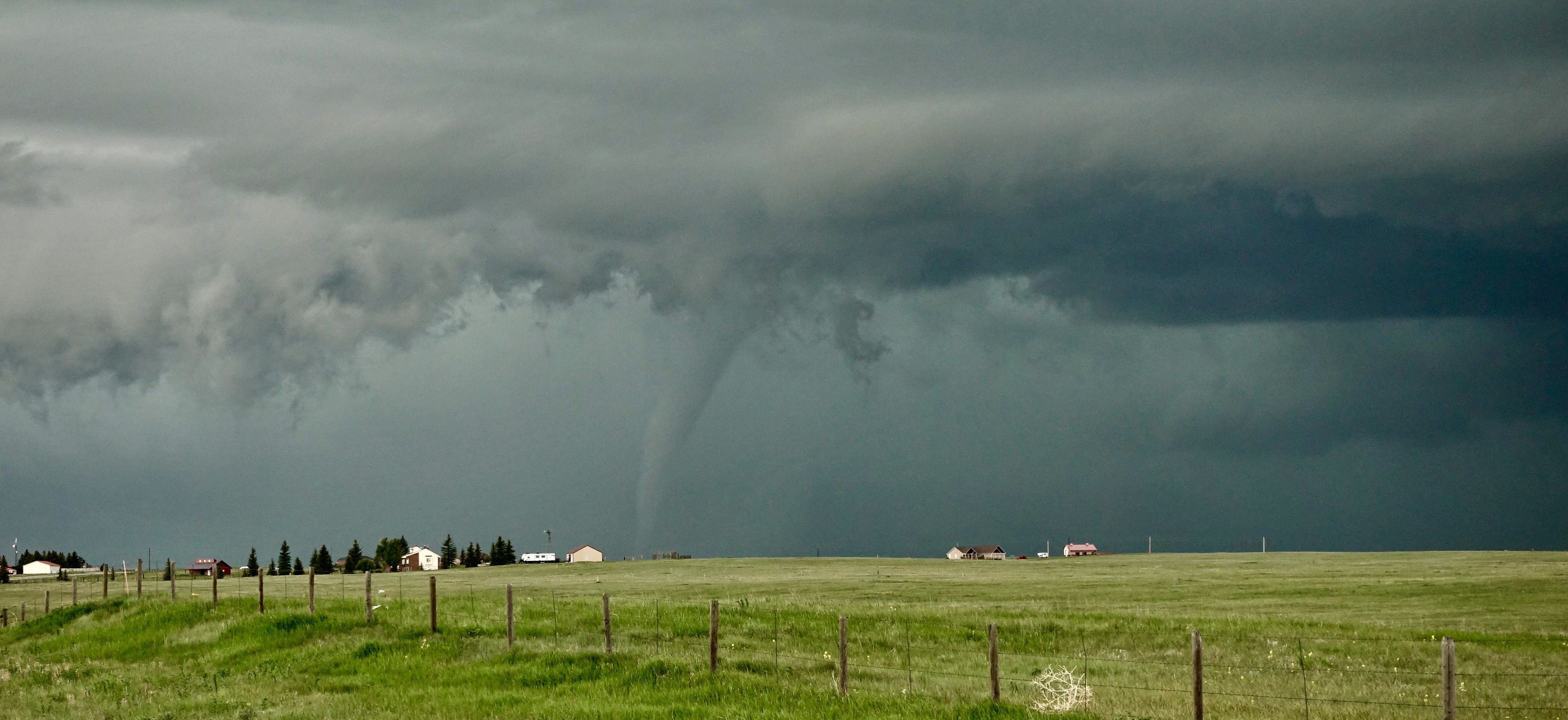
Northwest of Cheyenne Credit: Jason Stroup |
Storm Reports
 |
 |
 |
 |
|
Home Destroyed |
Home Damaged Federal, WY |
Homes Destroyed Federal, WY |
Circular Debris Damage Federal, WY |
|
Aerial views courtesy of Laramie County Emergency Management Agency |
|||
 |
Media use of NWS Web News Stories is encouraged! Please acknowledge the NWS as the source of any news information accessed from this site. |
|


 Weather Story
 Weather Map
 Local Radar