
A slow moving front extending from the Great Lakes region into the Plains will bring snow, wintry mix, and ice accumulation north of the front from the Upper Midwest into New England, and severe weather and heavy rain south of the front. Scattered severe thunderstorms with damaging gusts, severe hail, and heavy rain are expected across parts of the Great Lakes/Midwest through tonight. Read More >
State College, PA
Weather Forecast Office
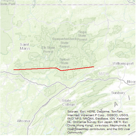
A tornado moved one mile south of Penfield to seven miles north of Lock Haven. Ten houses were destroyed or damaged. About 88,000 trees were destroyed in Pennsylvania State Forest land. In Clinton County, this tornado also took down a large metal fire tower and at least one cabin. Golf ball size hail fell near Avis. This tornado carved a 75 mile long path of damage; at times this path was 1.5 miles wide.
Source: NCDC Storm Data: May 1985; Volume 27, Number 5

The scar from this tornado can still be seen in satellite imagery. In this Bing map, you can see the scar extending from south of Hollywood, PA to northeast of Jersey Shore, PA.

US Dept of Commerce
National Oceanic and Atmospheric Administration
National Weather Service
State College, PA
328 Innovation Blvd, Suite 330
State College, PA 16803
(814)954-6440
Comments? Questions? Please Contact Us.


 Send Us a Report