State College, PA
Weather Forecast Office
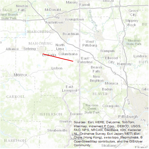
A tornado touched down just south of Salem and had a hit-skip path east-southeast to southeast of New Waterford where the funnel went back into the clouds. This same storm complex produced a tornado at Beaver Falls, Pennsylvania. Many homes and farm buildings were destroyed, with damage estimates $5 to $6 million.
Source: NCDC Storm Data: May 1985; Volume 27, Number 5

US Dept of Commerce
National Oceanic and Atmospheric Administration
National Weather Service
State College, PA
328 Innovation Blvd, Suite 330
State College, PA 16803
(814)954-6440
Comments? Questions? Please Contact Us.


 Radar
Radar Current Weather
 Rivers & Lakes
 Satellite
 Forecast Maps
 Hour by Hour Forecast
 Tropical Weather
 Graphical Hazards
 Weather Hazards Briefing
 Fire Weather
 Text Forecasts and Statements
 Forecaster's Discussion
 Send Us a Report
 KCCX Local Radar (Hi-Res)
 Drought
 Winter
 Follow us on X
 Follow us on Facebook
 CTP RSS Feed