Here is a summary of the significant storm which impacted Central PA
on Christmas Eve and Christmas Day 2020
(as of 10AM 25 Dec 2020)
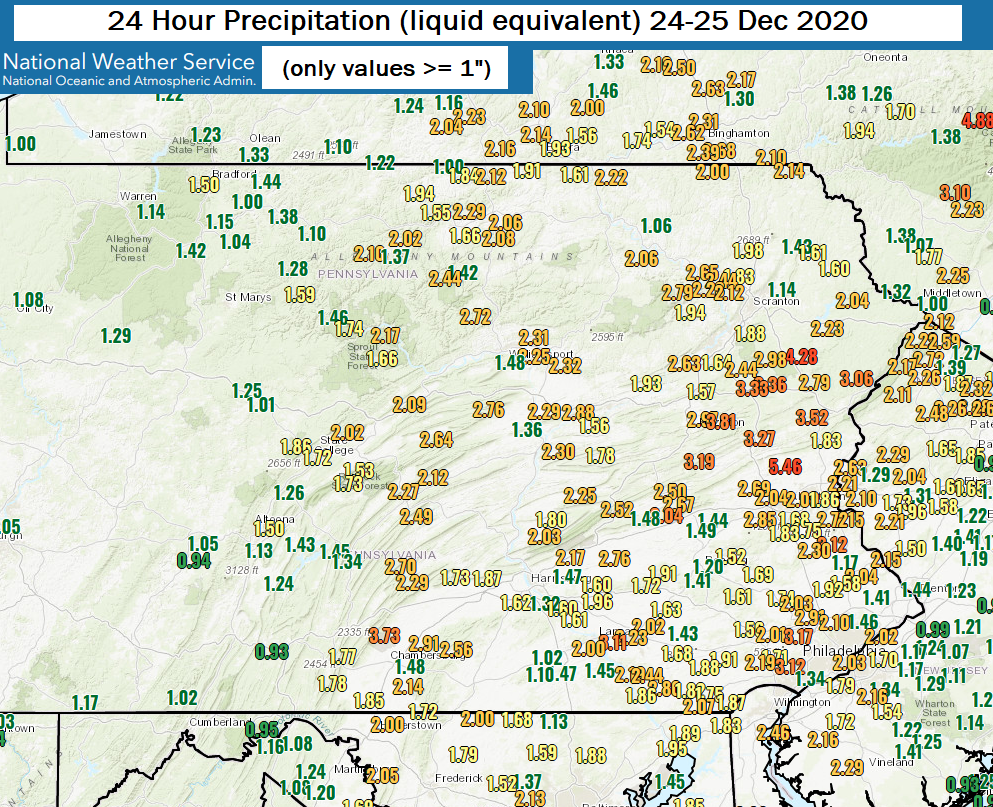
A significant storm brought 1" to 4" of rain to most of Pennsylvania on Christmas Eve and Christmas Day 2020 (Thursday and Friday, 24-25 December). The rain was followed immediately by a sharp drop in temperatures and several inches of snow over western PA.
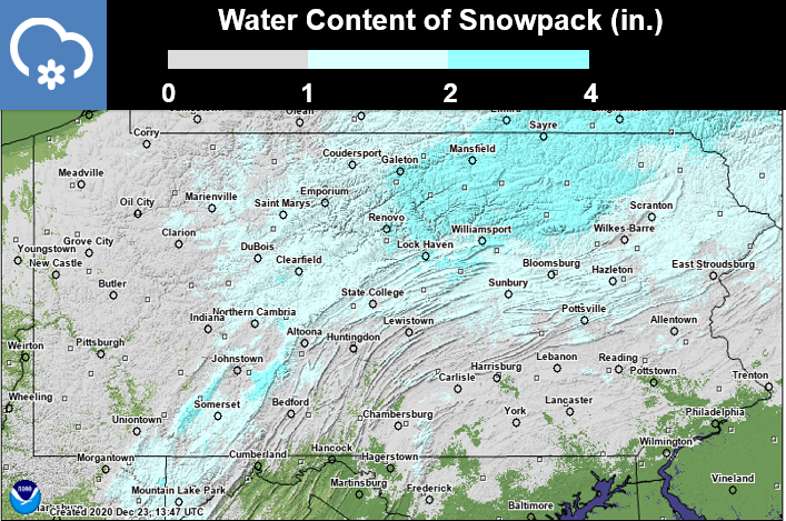
The rain fell onto a deep snow pack over much of the state. The snow had fallen from a storm one week before, dropping up to 2 feet of snow over parts of northeastern PA. The snow held as much as 2 inches of water in it before it started to melt in the middle of the week.
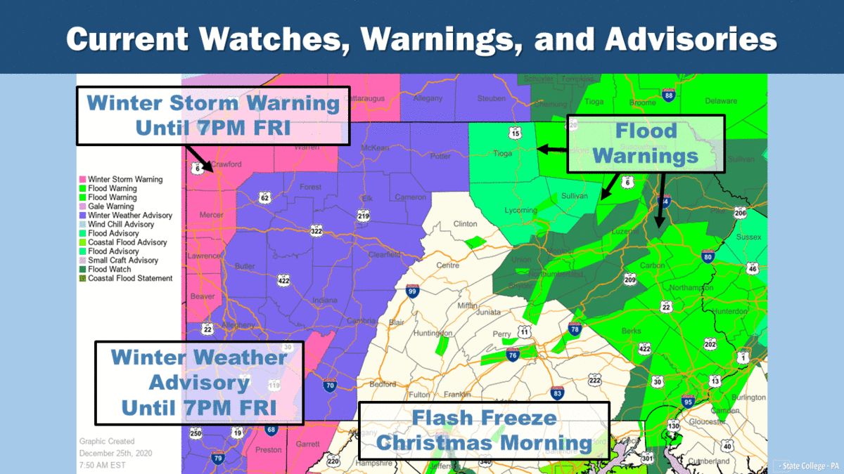
The combination of the heavy rain and melting snow brought flooding to most of Central and Eastern PA, especially the Susquehanna and Delaware River basins. You will find below some of the specifics of the storm, including river gauge traces (hydrographs) for many points/cities.
Rainfall from the storm...
Water held in the snow pack before the rain fell...
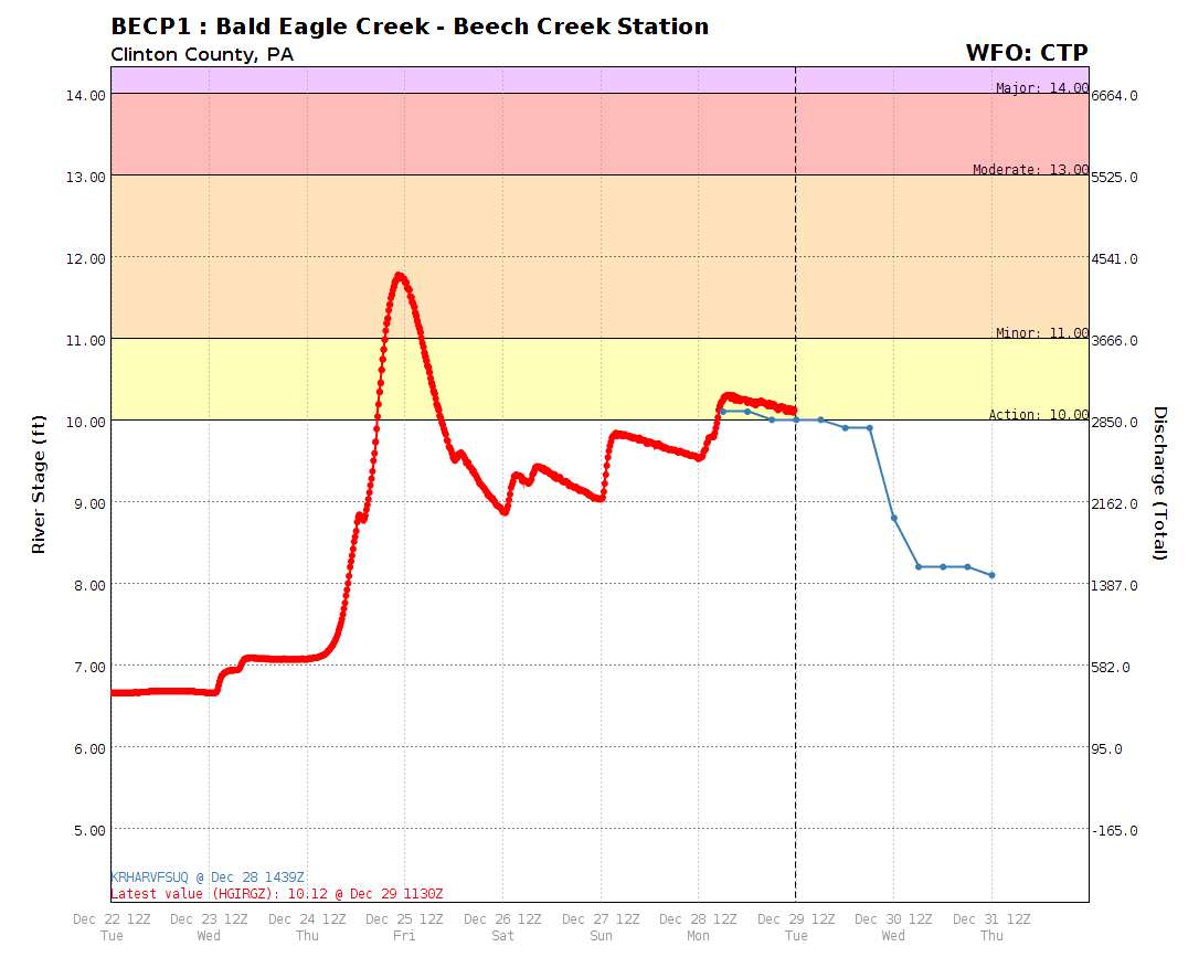
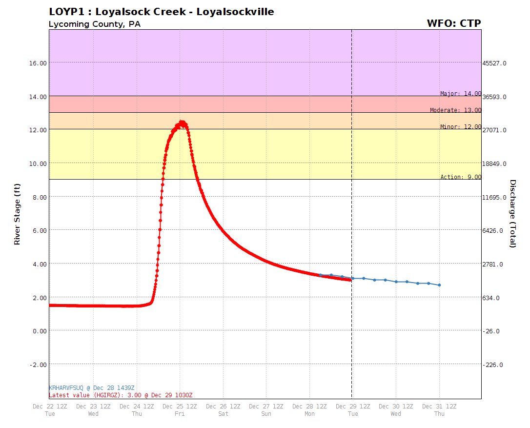
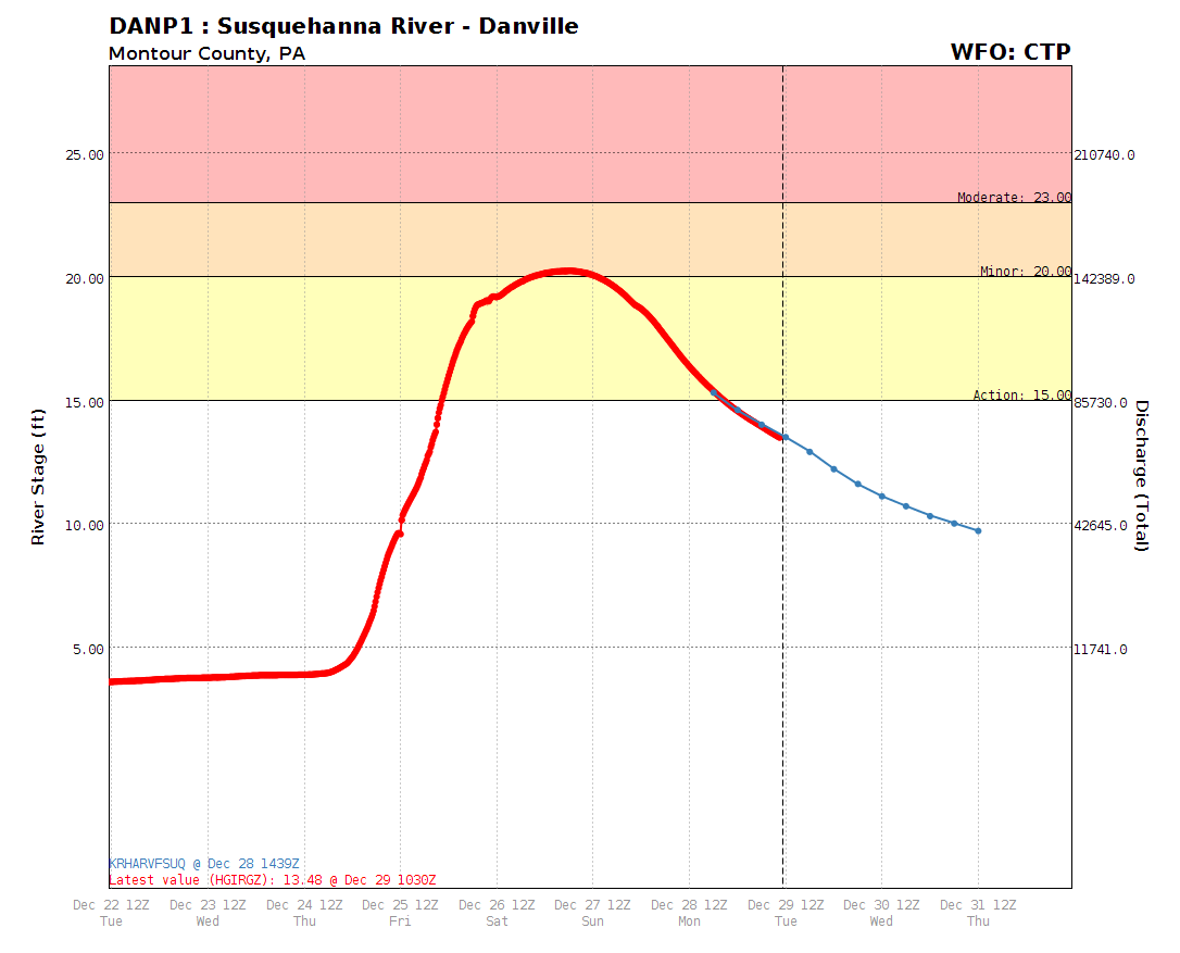
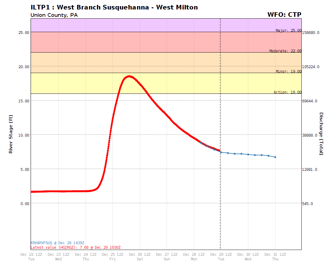
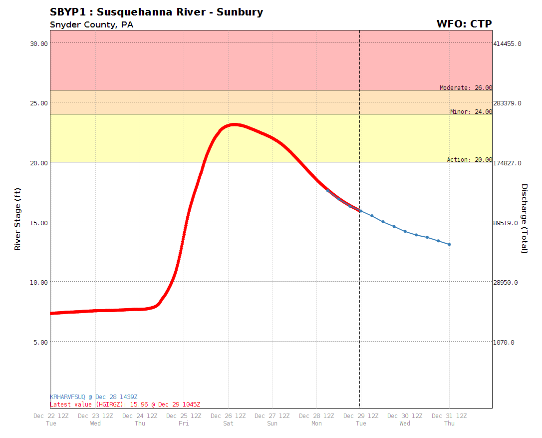
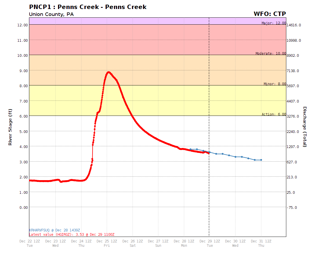
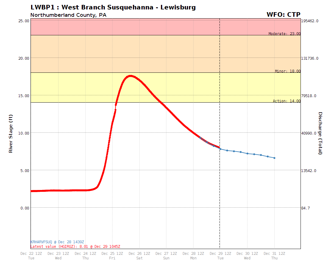
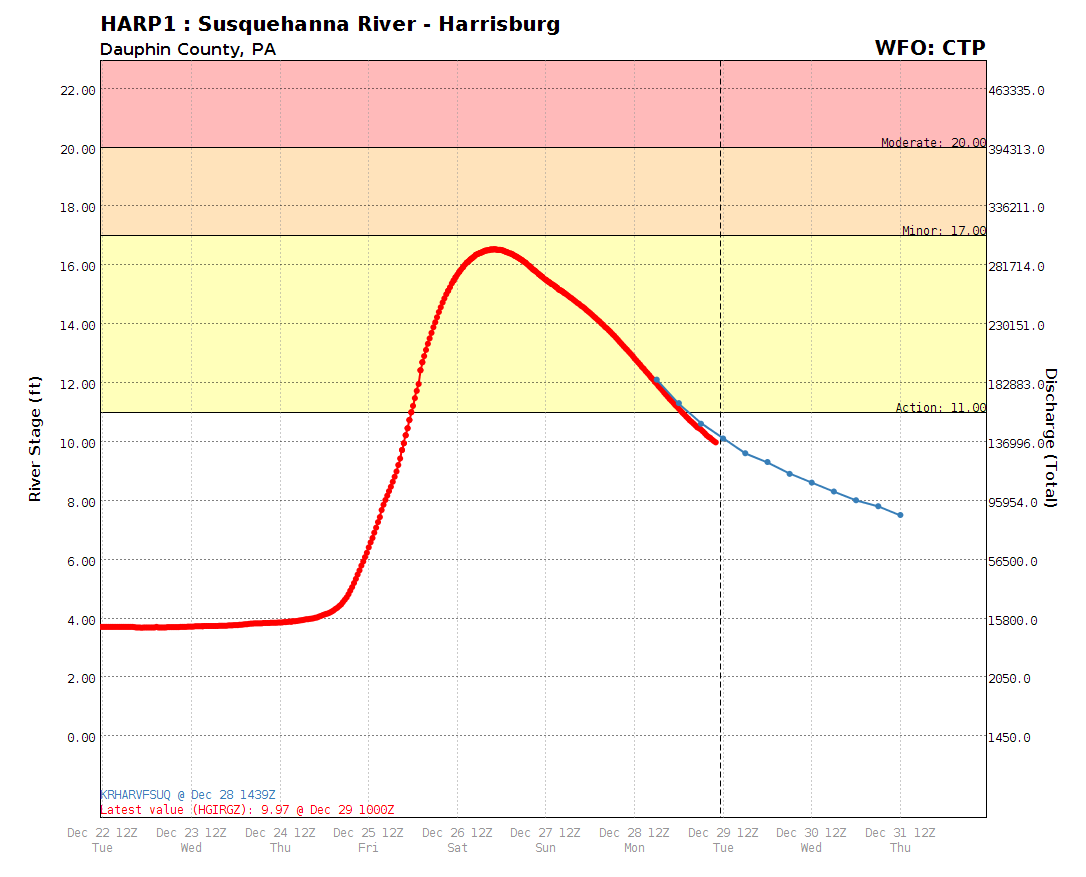
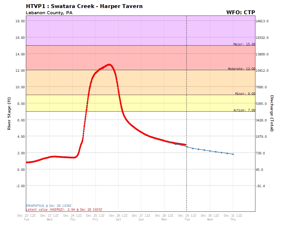
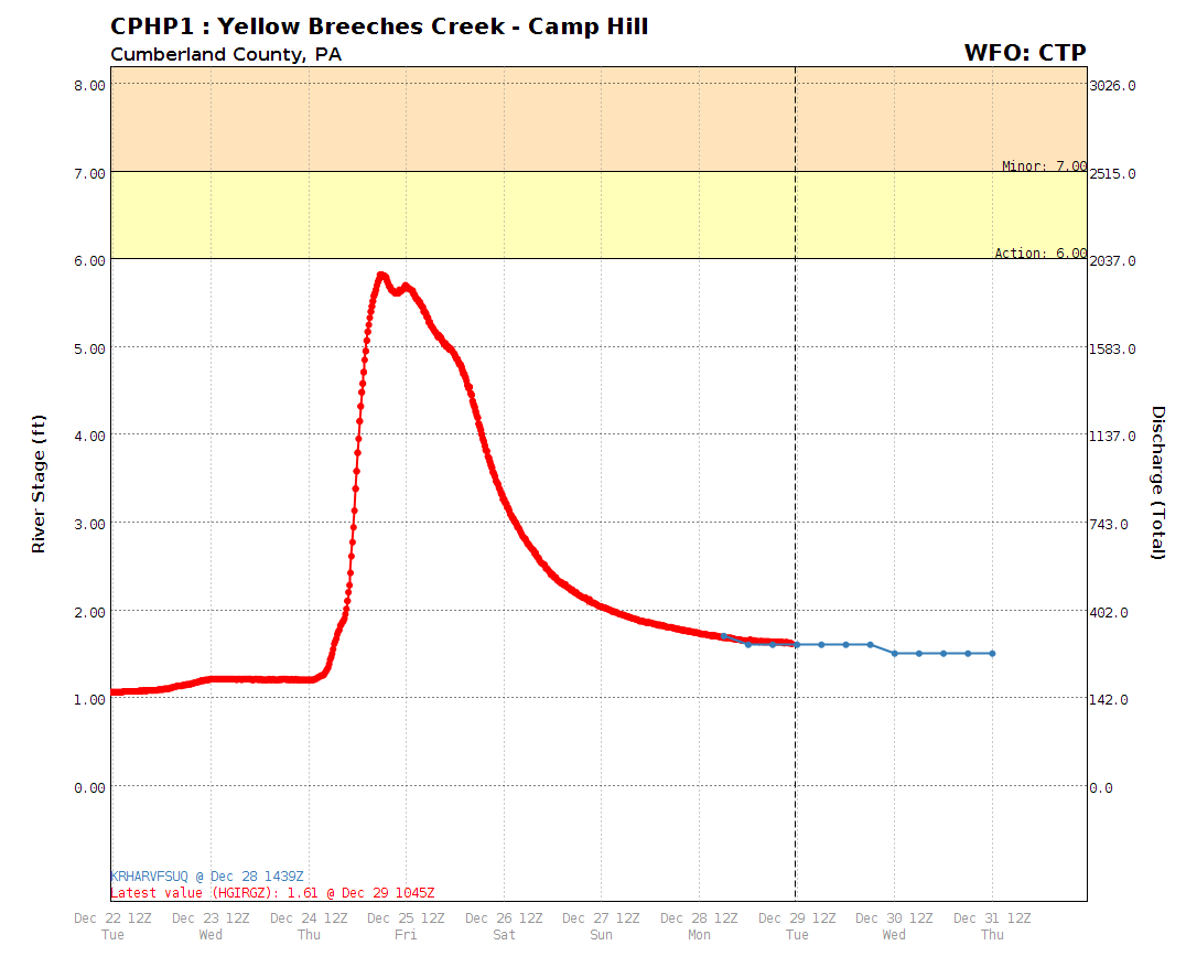
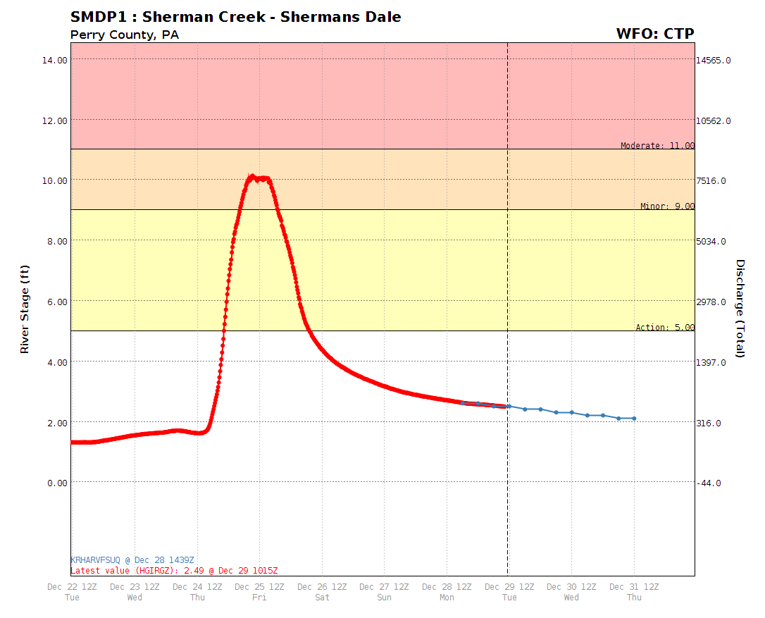
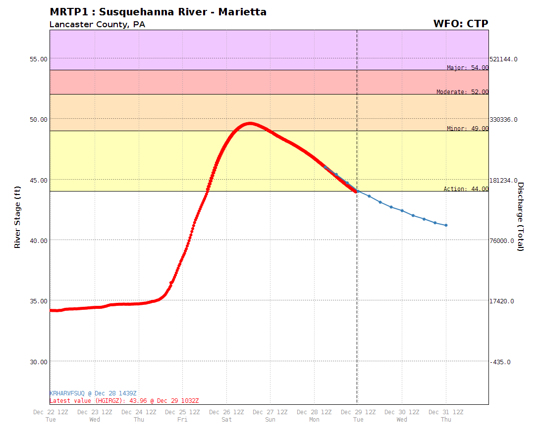
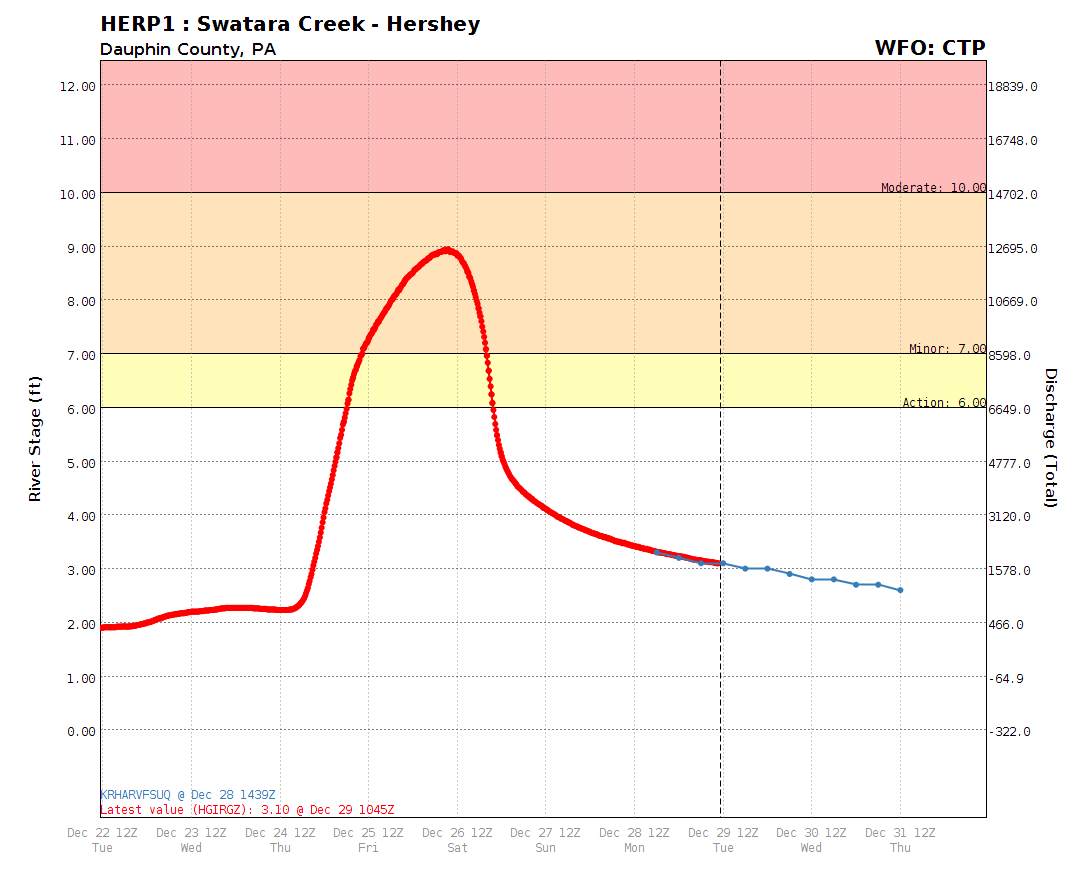
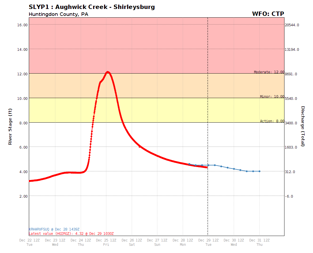
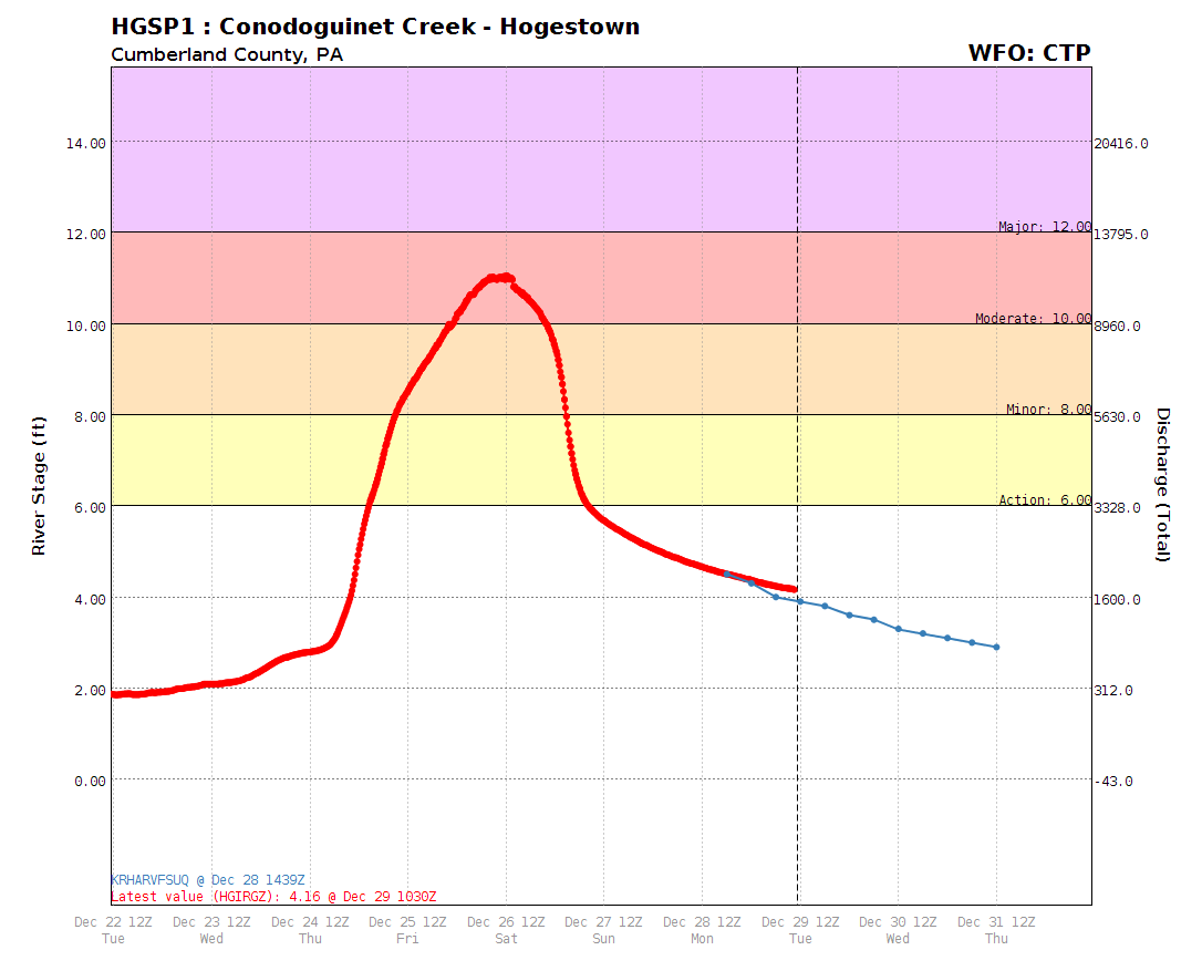
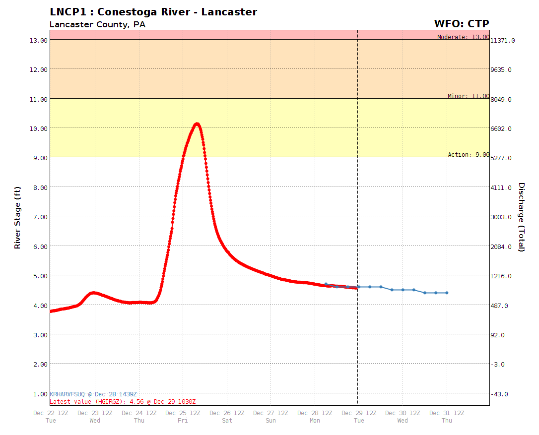
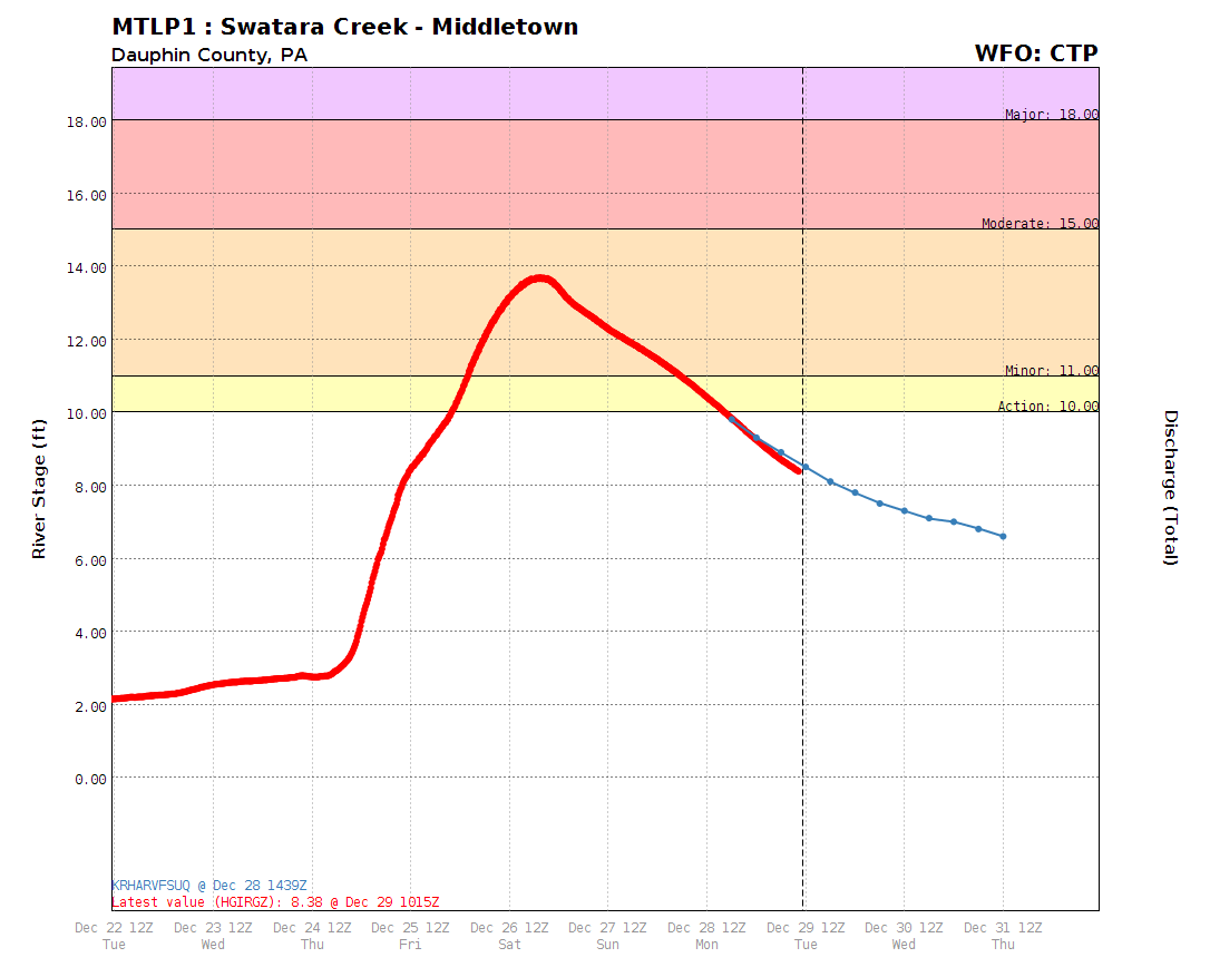
River Gauge Traces (Hydrographs) = ROLL OVER TO ZOOM IN
|
Beech Creek Station
|
Loyalsockville
|
Danville
|
Bloomsburg

|
|||
|
Spruce Creek

|
Milton
|
Sunbury
|
Penns Creek
|
|||
|
Williamsburg

|
Lewisburg
|
Harrisburg
|
Harper Tavern
|
|||
|
Camp Hill
|
Shermansdale
|
Marietta
|
Hershey
|
|||
|
Shirleysburg
|
Hogestown
|
Lancaster
|
Middletown
|
Timeline of events...
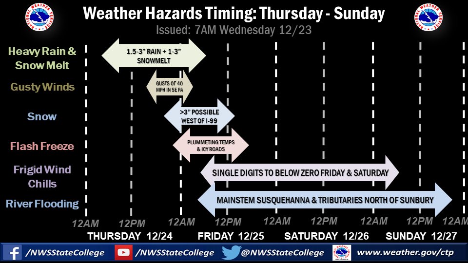
Earlier Forecast Information
|
A storm system will bring multiple hazards to central PA beginning on Christmas Eve Day (12/24) of 2020 and continue into Christmas Day. See the graphic below (composed of 3 slides). Highlights:
|


 Send Us a Report