
Isolated severe thunderstorms with strong wind gusts and hail will be possible Tuesday from parts of central Plains northeastward into the Midwest. Additional storms capable of damaging winds will be possible across the eastern Florida peninsula. Elevated to critical fire weather including gusty winds and low relative humidity is forecast again Tuesday over much of the northern Great Plains. Read More >
Overview
|
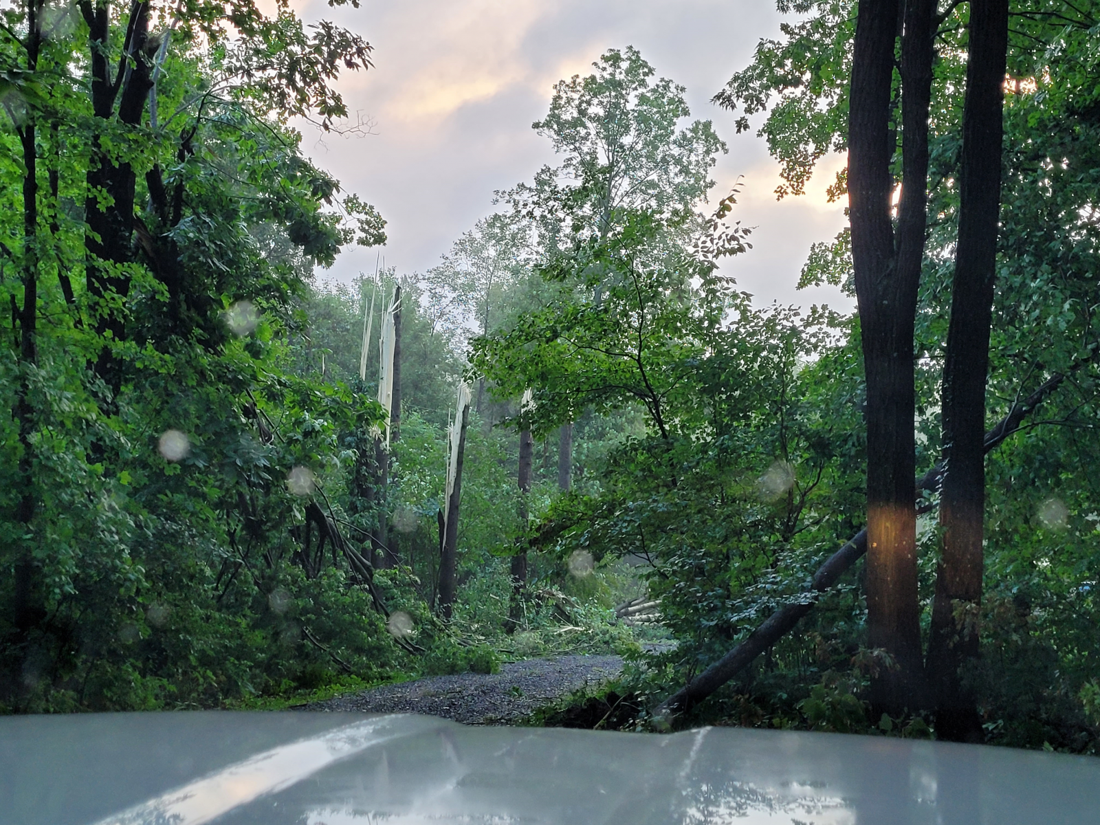
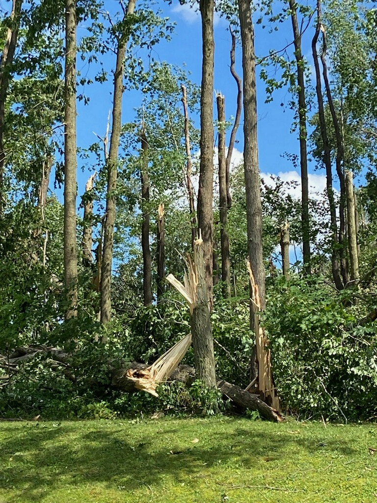
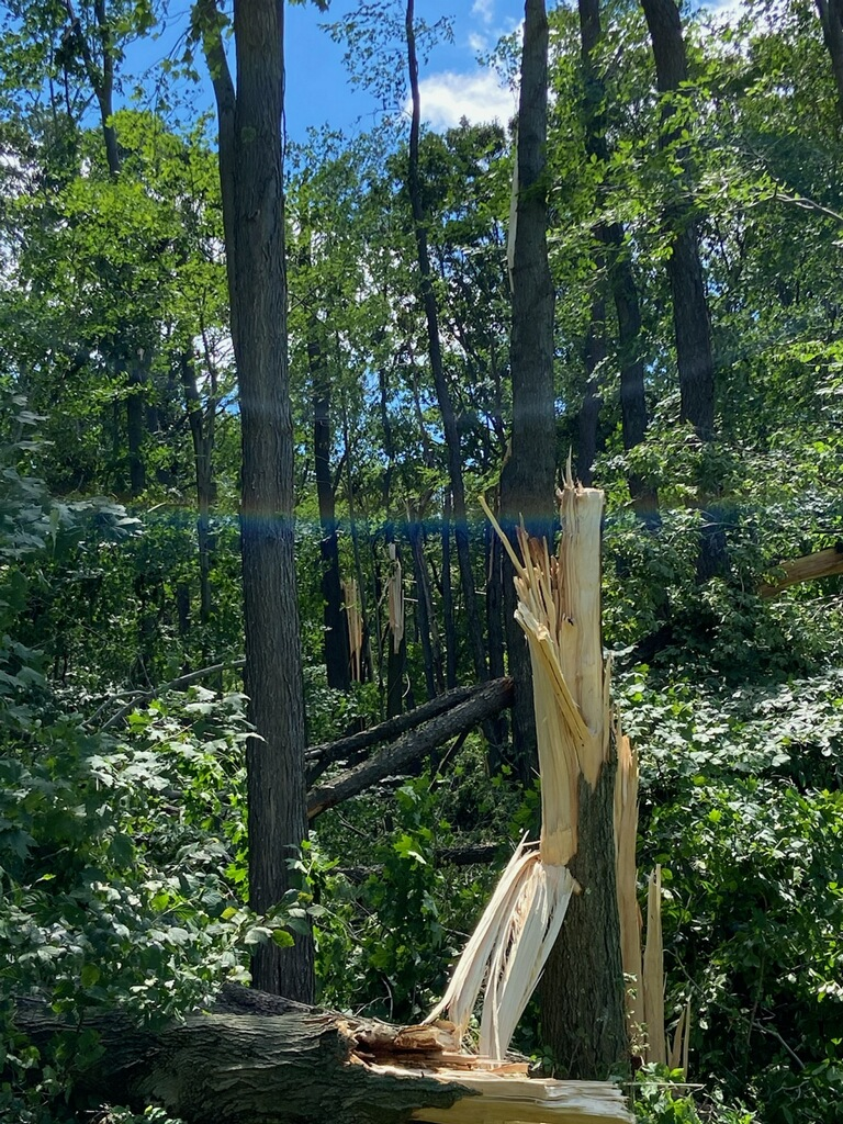
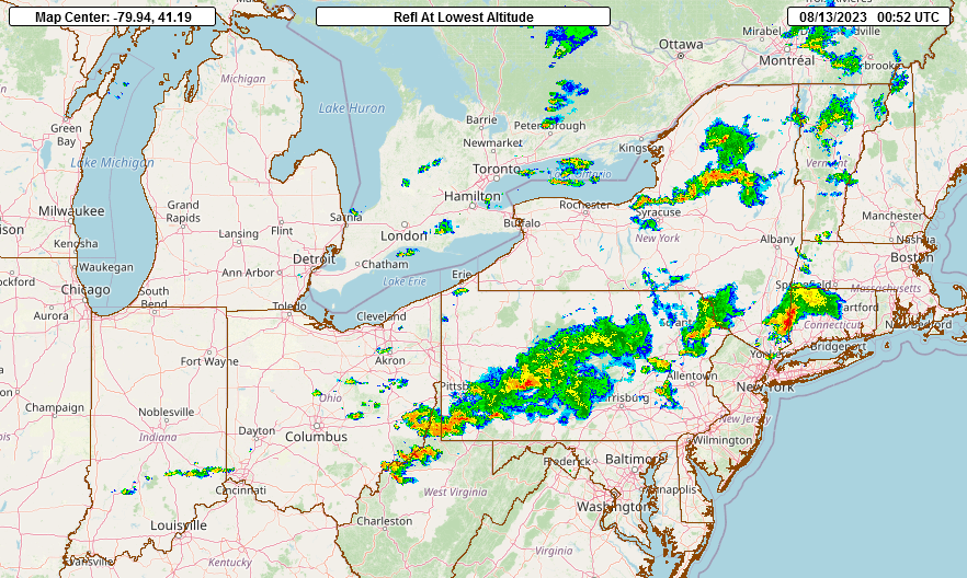
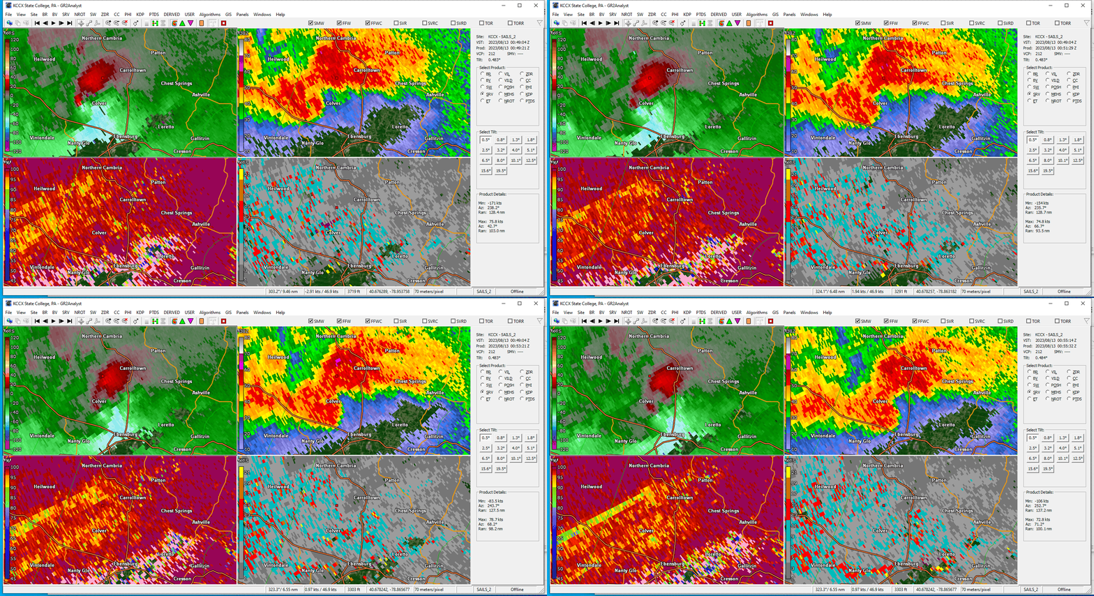
Relatively strong shear and modest instability contributed a severe weather episode across West-Central Pennsylvania during the evening of August 12, 2023. A squall line developed over the western part of the state during the afternoon, then pushed across the Laurel Highlands during the evening hours. An EF0 tornado formed within the squall line in the vicinity of Belsano in Cambria County. |
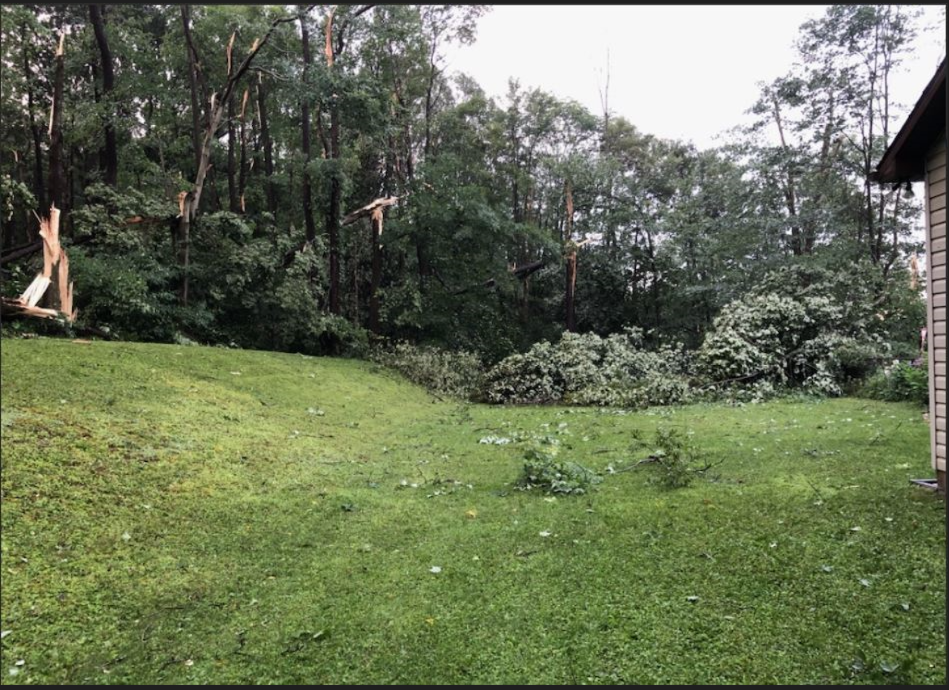 Damage from the tornado near Colver, PA |
Tornadoes:
|
Tornadoes
Track Map 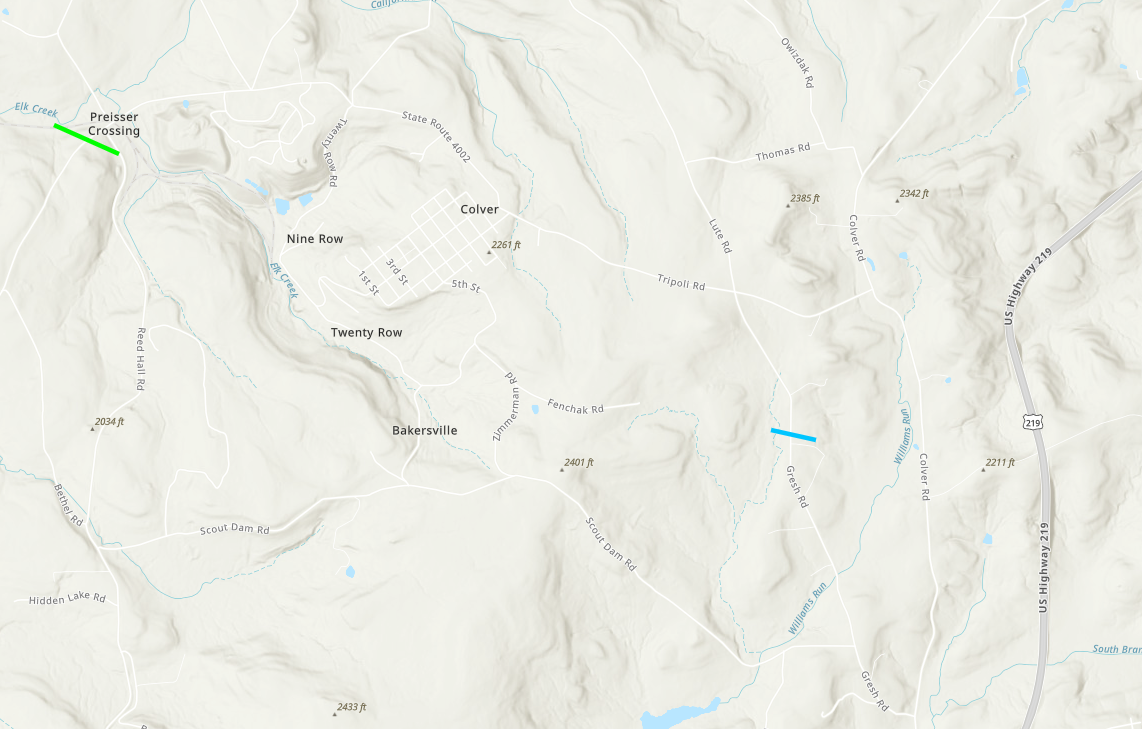 
Downloadable KMZ File |
||||||||||||||||
The Enhanced Fujita (EF) Scale classifies tornadoes into the following categories:
| EF0 Weak 65-85 mph |
EF1 Moderate 86-110 mph |
EF2 Significant 111-135 mph |
EF3 Severe 136-165 mph |
EF4 Extreme 166-200 mph |
EF5 Catastrophic 200+ mph |
 |
|||||
Environment:
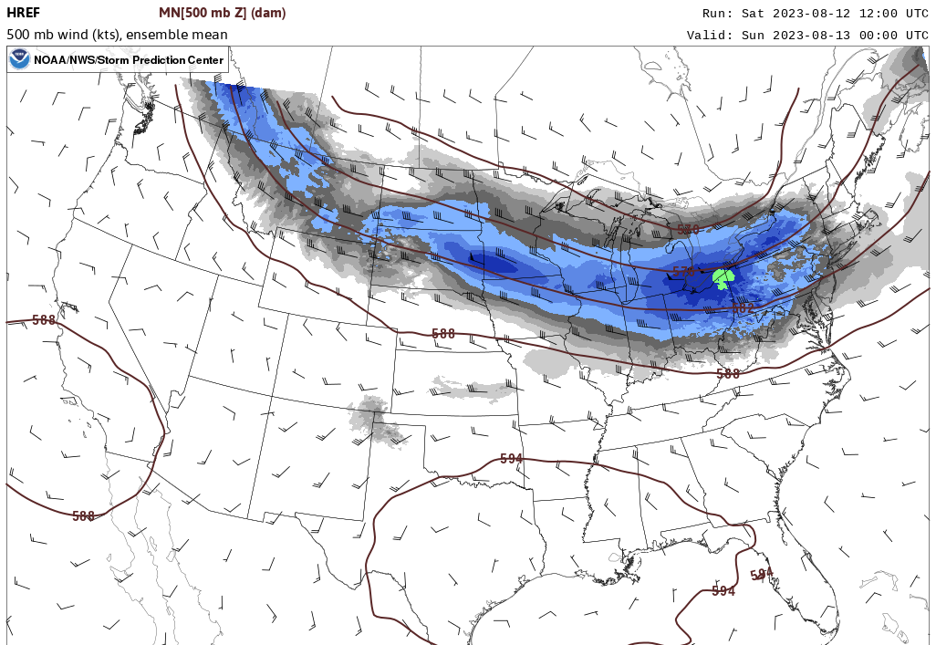
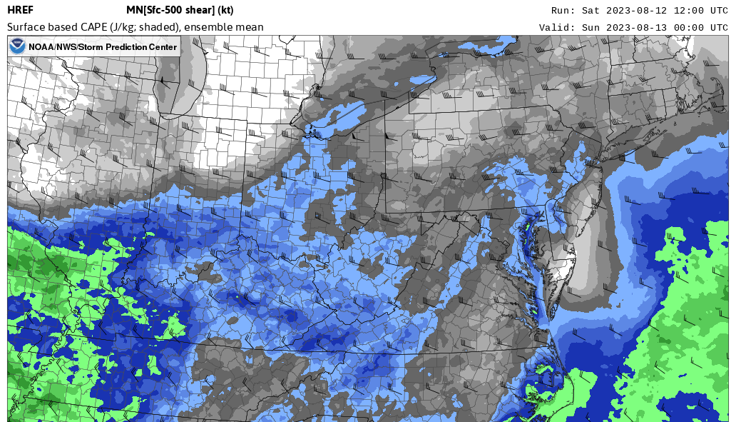
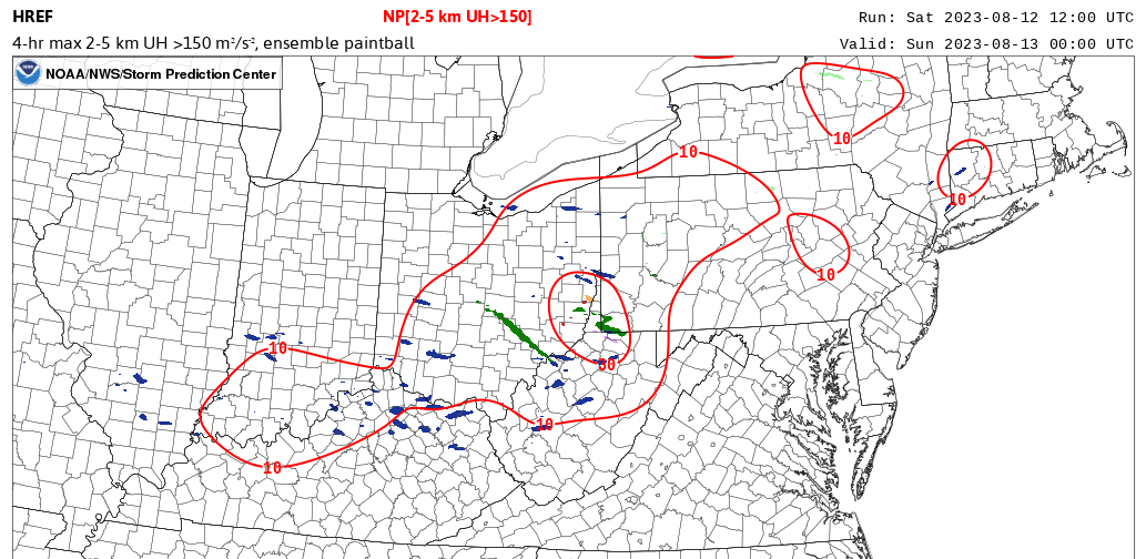
Relatively strong mid level flow/deep layer shear and modest instability was present across Western PA on the evening of August 12, 2023.
Wind
Insert summary here.
 |
 |
 |
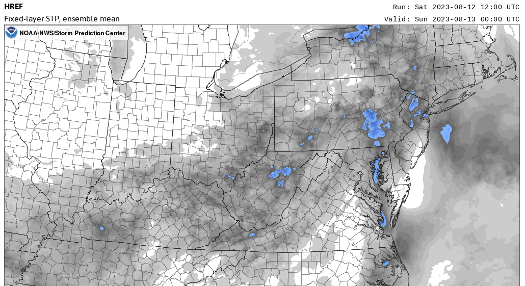 |
| A belt of near 50kt winds at 500mb moving into Western PA | CAPEs near 500J/kg across the Laurel Highlands | Several HREF members indicated 2-5km Updraft Helicity values >150, which is supportive of supercells. | HREF STP values near 1 across the Laurel Highlands |
Hail
Insert summary here.
| Caption | Caption | Caption | Caption |
Photos & Video
Header
 |
 |
 |
|
| Caption (source) |
Radar
Header
 |
 |
||
| Regional Radar 852 PM 08/13/2023 | Loop of SRM, REF, CC and SW at time of tornado |
Storm Reports
Insert storm reports here. Copy in PNS or paste map.
 |
Media use of NWS Web News Stories is encouraged! Please acknowledge the NWS as the source of any news information accessed from this site. |
 |