
In the Northern Plains into the Upper Great Lakes and Mid-Atlantic, heavy to excessive rain may bring flash and urban flooding Tuesday. Severe thunderstorms producing damaging winds are most likely over parts of the Dakotas into Minnesota Tuesday afternoon into the overnight, with other isolated storms producing hail or wind over the northern High Plains. Extreme heat returns to the southwest U.S. Read More >
Overview
|
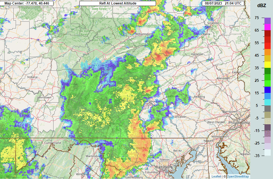
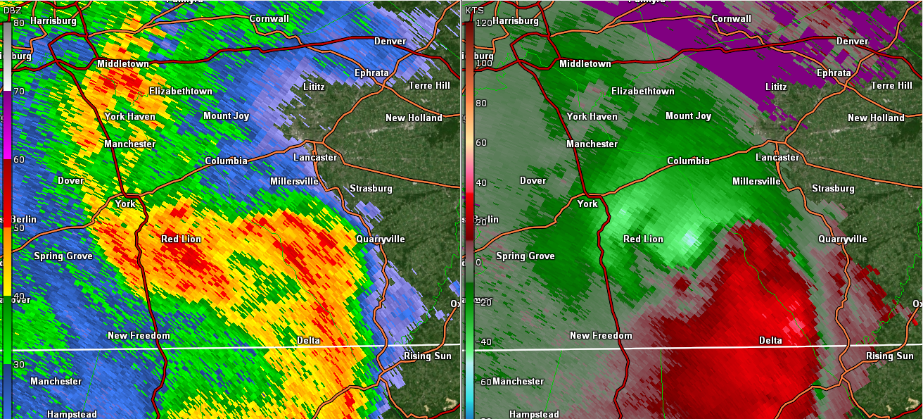
High instability and wind shear contributed to a significant severe weather episode across south-central Pennsylvania during the afternoon and evening of August 7, 2023. Of note, a significant bow echo produced widespread wind damage and a trio of weak (EF0-EF1) tornadoes across southern York and Lancaster Counties. |
 Tornado damage off of Truce Rd, Lancaster County, PA |
Upper Air/Surface
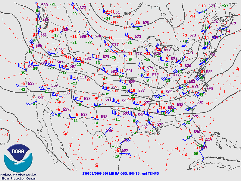
A seasonably deep upper level trough worked into PA on August 7th 2023.
 |
 |
 |
|
500mb pattern 00Z 08/08/23
|
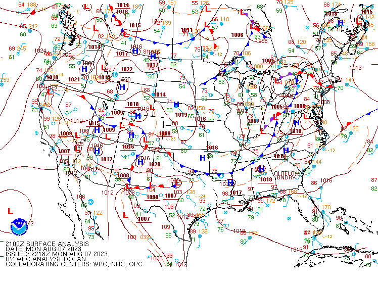
Surface pattern 21Z 08/07/23
|
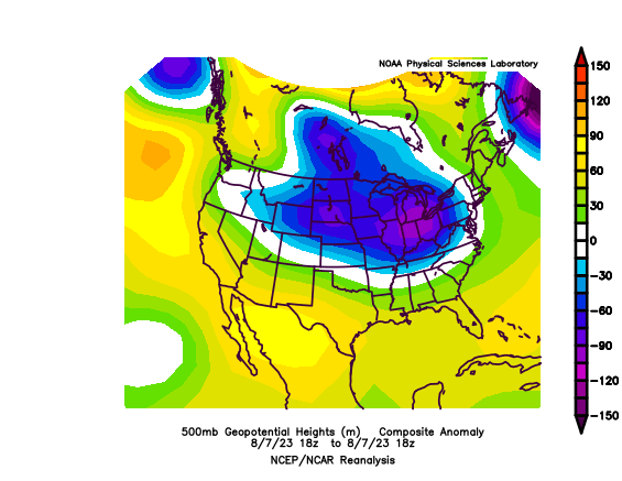
500mb Anomalies
|
Photos
Header
 |
 |
| Schoolhouse Rd, Whiterock, Lancaster Co |
Lancaster Co damage
|
Radar
 |
 |
|
Radar Loop
|
REF/SRM at time of tornado 4SSW Smithville, Lancaster Co
|
Storm Reports
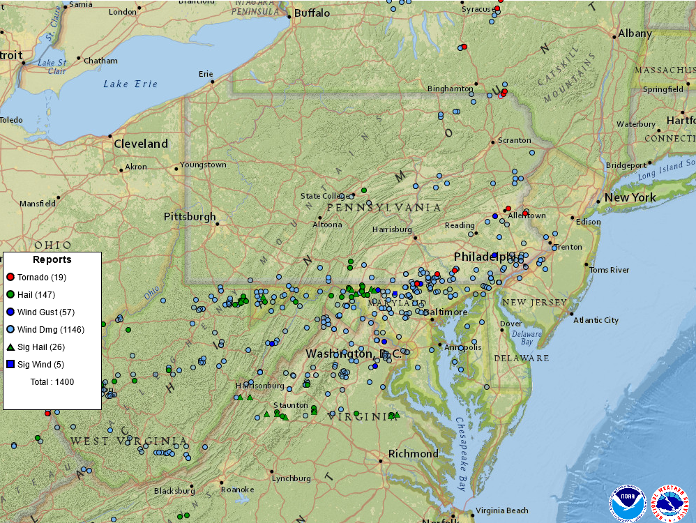
Storm report map for August 7 2023
 |
Media use of NWS Web News Stories is encouraged! Please acknowledge the NWS as the source of any news information accessed from this site. |
|


 Send Us a Report