|
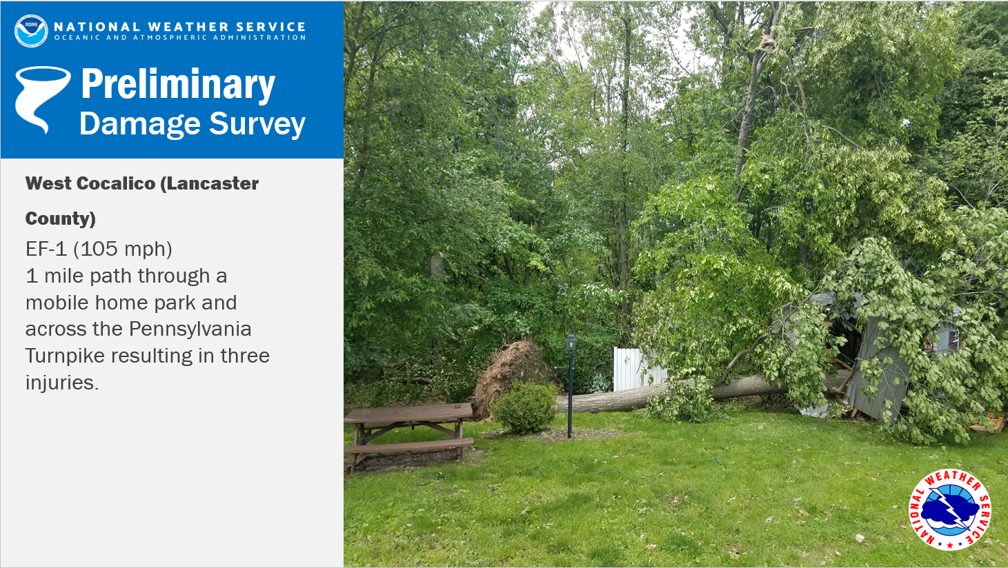
A tornado touched down in northern Lancaster County causing destruction across the turnpike in the evening hours of May 19, 2019. |
 |
|
Below you can find more information from each damage survey conducted in central PA: |
|
West Cocalico EF-1 Tornado (Lancaster County)
Public Information Statement National Weather Service State College PA 423 PM EDT Tue May 21 2019 ...EF-1 TORNADO CONFIRMED IN LANCASTER COUNTY... Location...West Cocalico Township in Lancaster County Pennsylvania Date...May 19 2019 Estimated Time...803 PM EDT Maximum EF-Scale Rating...EF-1 Estimated Maximum Wind Speed...105 mph Maximum Path Width...125 yards Path Length...1 mile * Fatalities...0 * Injuries...3 * The information in this statement is preliminary and subject to change pending final review of the event(s) and publication in NWS Storm Data. ...Summary... The National Weather Service in State College PA has confirmed an EF-1 tornado near West Cocalico Township in Lancaster County Pennsylvania on May 19 2019. At 803 PM EDT, a severe thunderstorm produced a tornado in West Cocalico Township in northern Lancaster County. The tornado first formed near the Oak Ridge mobile home park, just to the north and west of Oak Ridge Court. Dozens of trees were uprooted or snapped in this area, with minor structural damage also noted to some of the mobile homes, just south of the region of significant tree damage. Maximum winds were estimated to be near 100 mph at this time. The tornado then tracked northeastward across Wollups Hill Road, with additional tree uproots and snaps in this area. The tornado then subsequently tracked eastward, very close to the Pennsylvania Turnpike (Interstate 76), between Wollups Hill Road and Kline Road. Additional tree snaps and uproots occurred on either side of the highway (both north and south of the Interstate). The Pennsylvania Turnpike had to be closed for a time, due to fallen trees and debris across the highway. The tornado then continued on an east-northeastward heading, causing additional tree damage, as well as some structural damage, in the vicinity of both Kline Road and Bridal Path Way. Damage was noted to a mobile home close to Kline Road and just to the south of the Pennsylvania Turnpike. A storage shed, housing lawn equipment, was also destroyed in this vicinity. Also, three homes sustained roof damage along Kline Road, just north of the Turnpike. Maximum winds were estimated to be near 105 mph at this point. Three minor injuries were sustained in this area due to flying debris. The tornado appeared to dissipate, just to the east of Kline Road and north of the Pennsylvania Turnpike, at around 805 PM EDT. This information can also be found on our website at weather.gov/StateCollege. For reference: the Enhanced Fujita Scale classifies tornadoes into the following categories: EF0...Wind speeds 65 to 85 mph EF1...Wind speeds 86 to 110 mph EF2...Wind speeds 111 to 135 mph EF3...Wind speeds 136 to 165 mph EF4...Wind speeds 166 to 200 mph EF5...Wind speeds greater than 200 mph $$ Jurewicz/Travis |