
Dangerous, record-breaking heat will intensify across most of the central and eastern U.S this week. Heat indices will likely exceed 100 degrees. Heat is likely to continue across the eastern U.S. through the Independence Day holiday weekend. Critical fire weather conditions will continue Tuesday across portions of the Four Corners and Great Basin, as dry conditions and gusty winds persist. Read More >
Overview
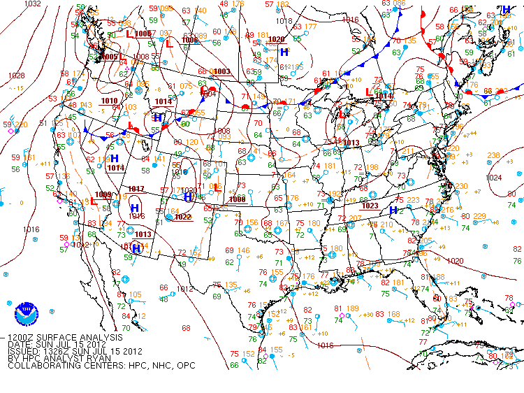
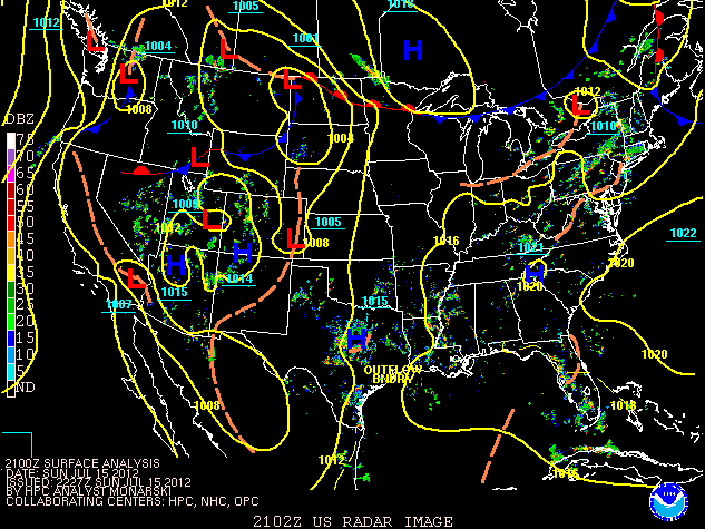
On July 15, 2012, a short-wave moving through a ridge brought a surge of moisture and anomalously high precipitable water to Pennsylvania. This influx of moisture caused a surge of CAPE values over the region and led to the formation of two bow echoes, one developing over central PA and moving eastward, the other forming in southern PA and primarily impacting Harrisburg. With the exception of two tornadoes in Bradford County, PA and St Mary’s County, MD, the event was dominated by low-end wind damage and reports of fallen trees.
 |
 |
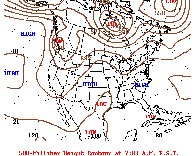 |
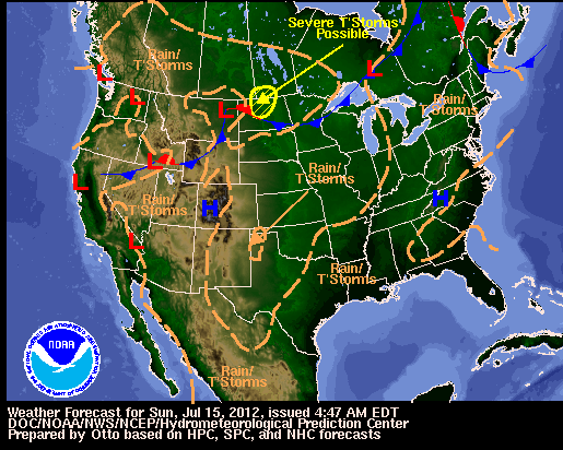
| Surface Map 7/15/20 | WPC National Forecast Chart | 500-mb Analysis 7/15/20 |
 |
 |
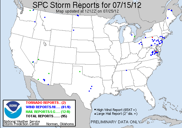 |
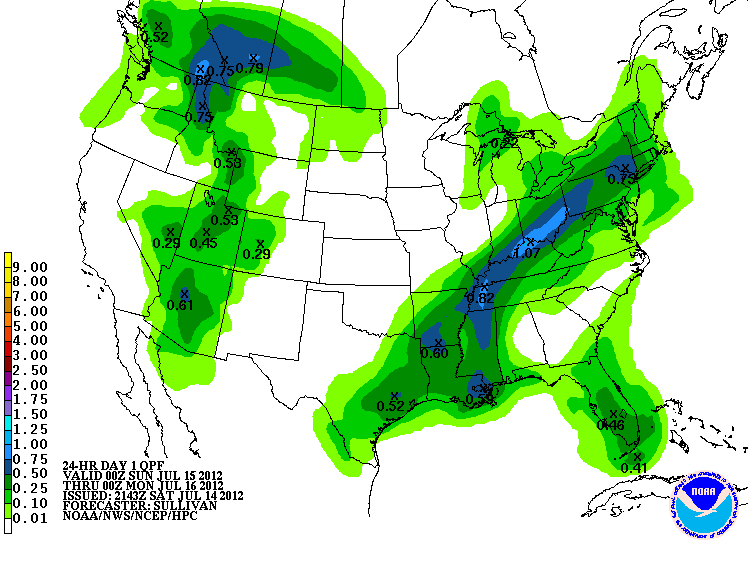
| 24-H QPF 7/15/20 0Z - 7/16/20 0Z | WPC Analysis/Radar Composite 18Z | SPC Storm Reports for 07/15/12 |
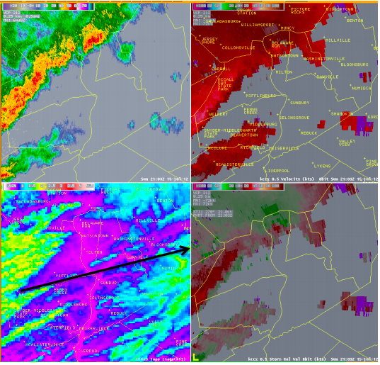
KCCX radar at 2103 UTC 7/15/12. Upper left shows 0.5 degree reflectivity, upper right shows 0.50 degree velocity, lower right shows storm relative velocity and lower left shows the terrain. Arrow shows origin of bow and its approximate path.
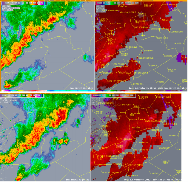
KCCX radar 7/15/12. 0.5 degree reflectivity and base velocity data upper image is 2112 UTC and lower image is 2130 UTC.
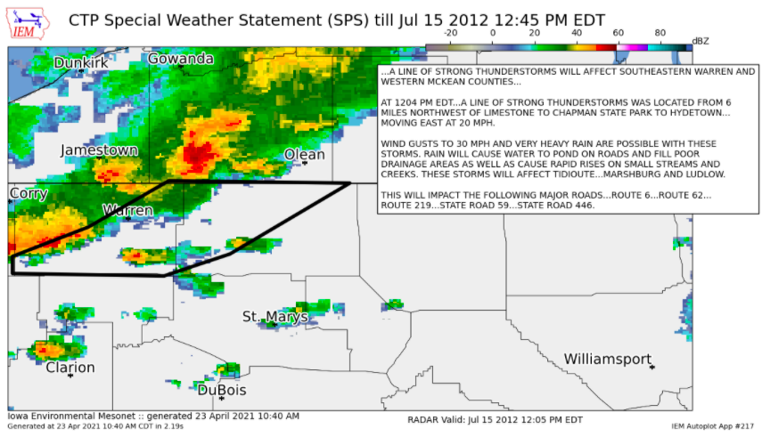
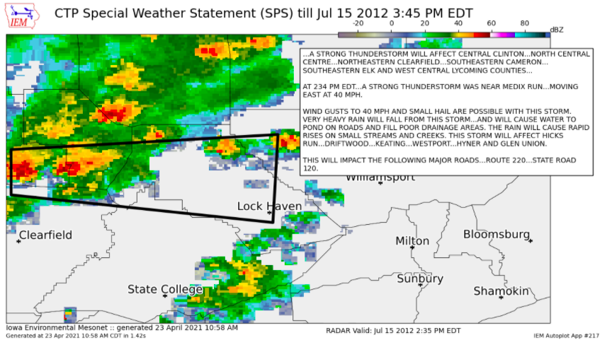
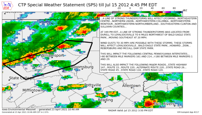
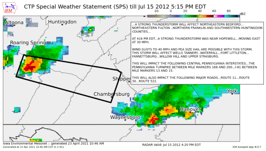
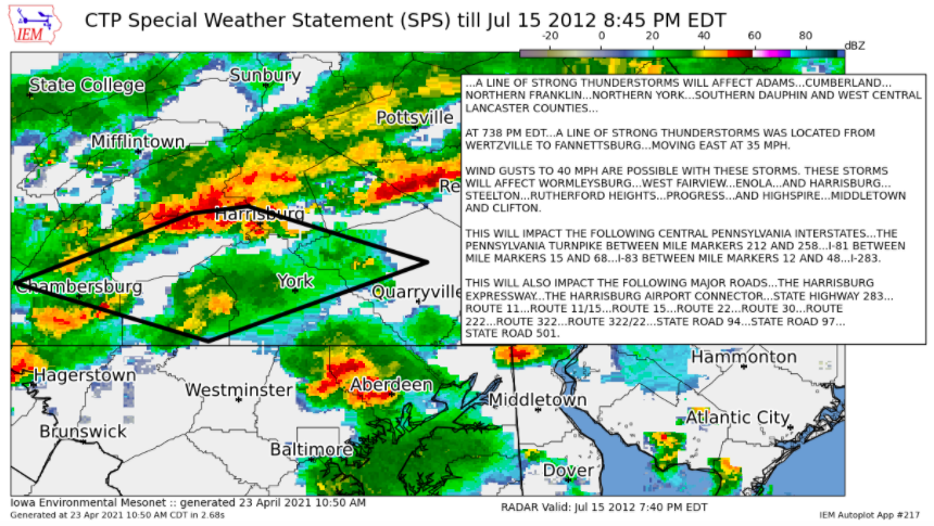
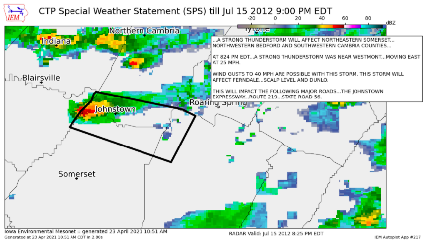
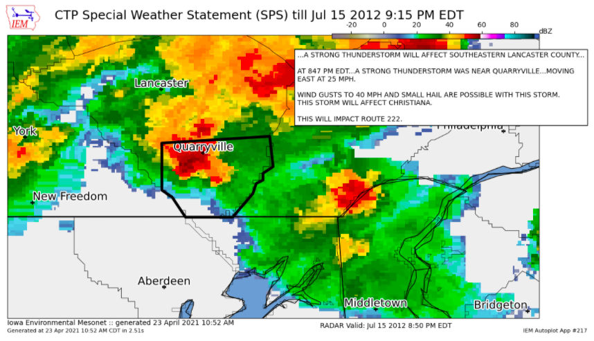
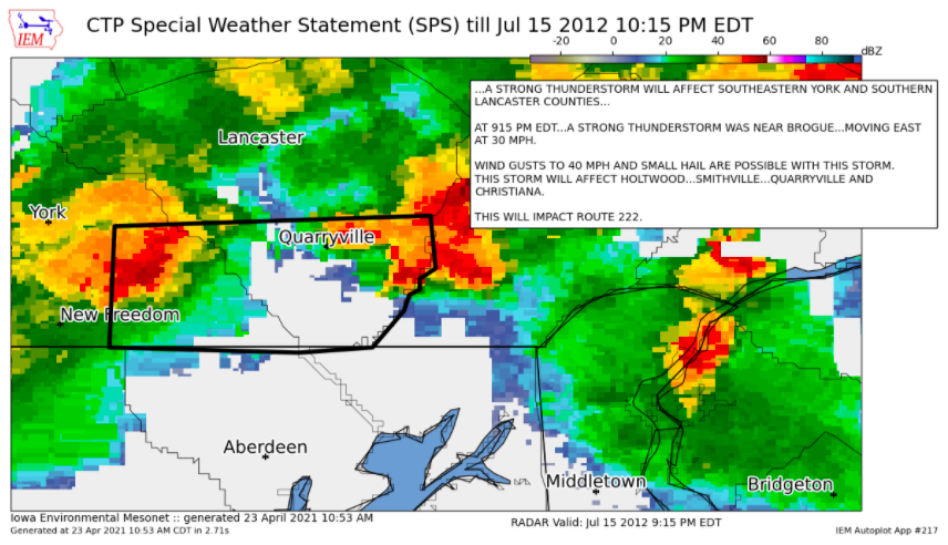
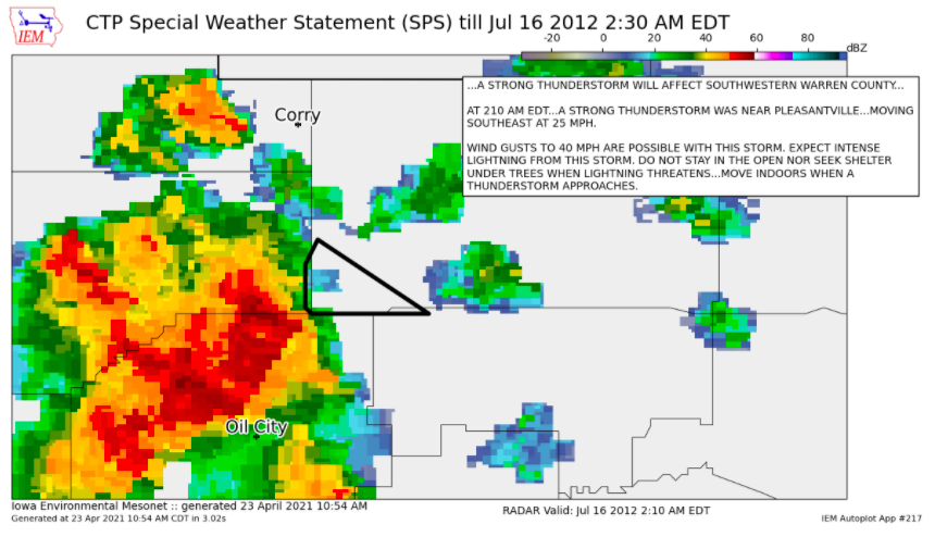
Special Weather Statements
 |
 |
 |
 |
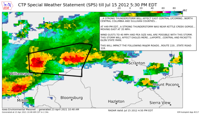
| Special Weather Statement #1 | Special Weather Statement #2 | Special Weather Statement #3 | Special Weather Statement #4 |
 |
 |
 |
 |
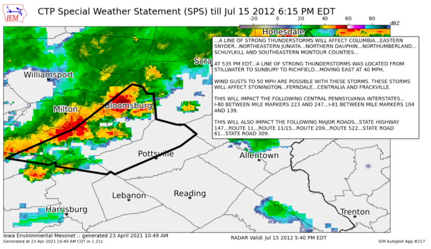
| Special Weather Statement #5 | Special Weather Statement #6 | Special Weather Statement #7 | Special Weather Statement #8 |
 |
 |
 |
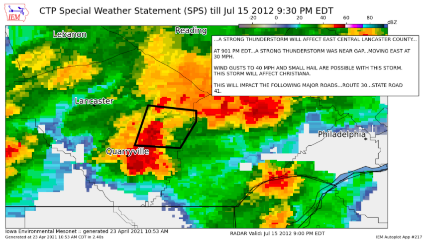 |
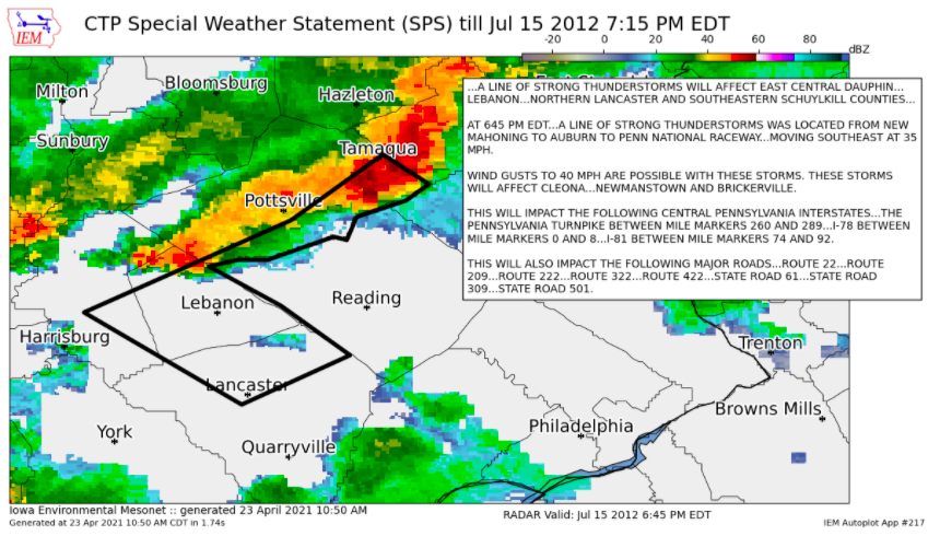
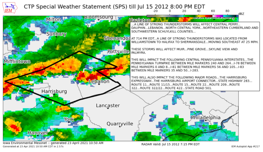
| Special Weather Statement #9 | Special Weather Statement #10 | Special Weather Statement #11 | Special Weather Statement #12 |
 |
 |
| Special Weather Statement #13 | Special Weather Statement #14 |
 |
Media use of NWS Web News Stories is encouraged! Please acknowledge the NWS as the source of any news information accessed from this site. |
|


 Send Us a Report