Overview
Two tornadoes occurred in Huntingdon County, PA on May 27th, 2011.
Tornadoes:
|
Tornado - Trough Week
Track Map .gif) 
|
||||||||||||||||
|
Tornado - Calvin
Track Map 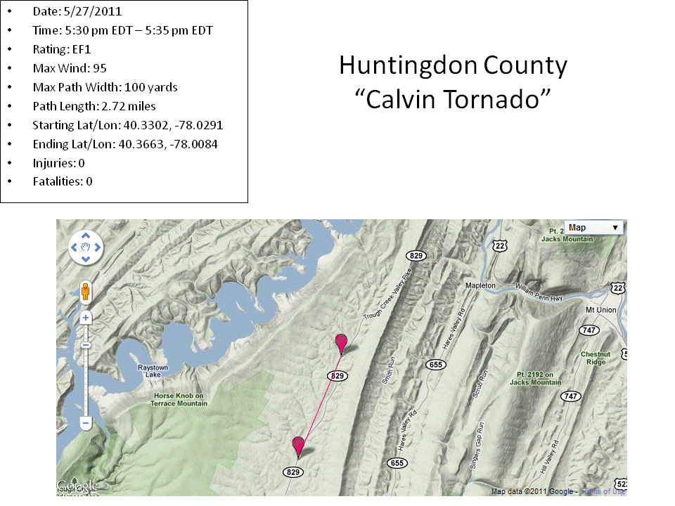
|
||||||||||||||||
The Enhanced Fujita (EF) Scale classifies tornadoes into the following categories:
| EF0 Weak 65-85 mph |
EF1 Moderate 86-110 mph |
EF2 Significant 111-135 mph |
EF3 Severe 136-165 mph |
EF4 Extreme 166-200 mph |
EF5 Catastrophic 200+ mph |
 |
|||||
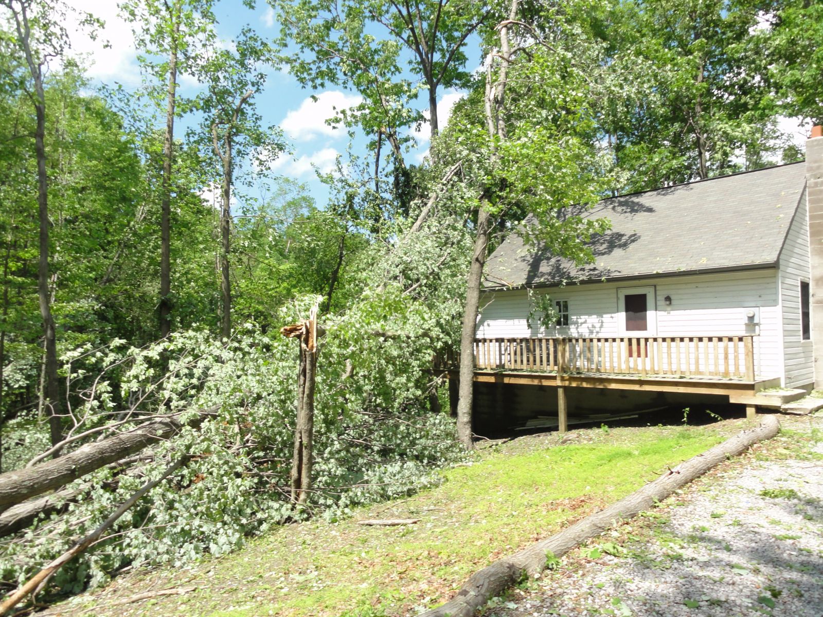
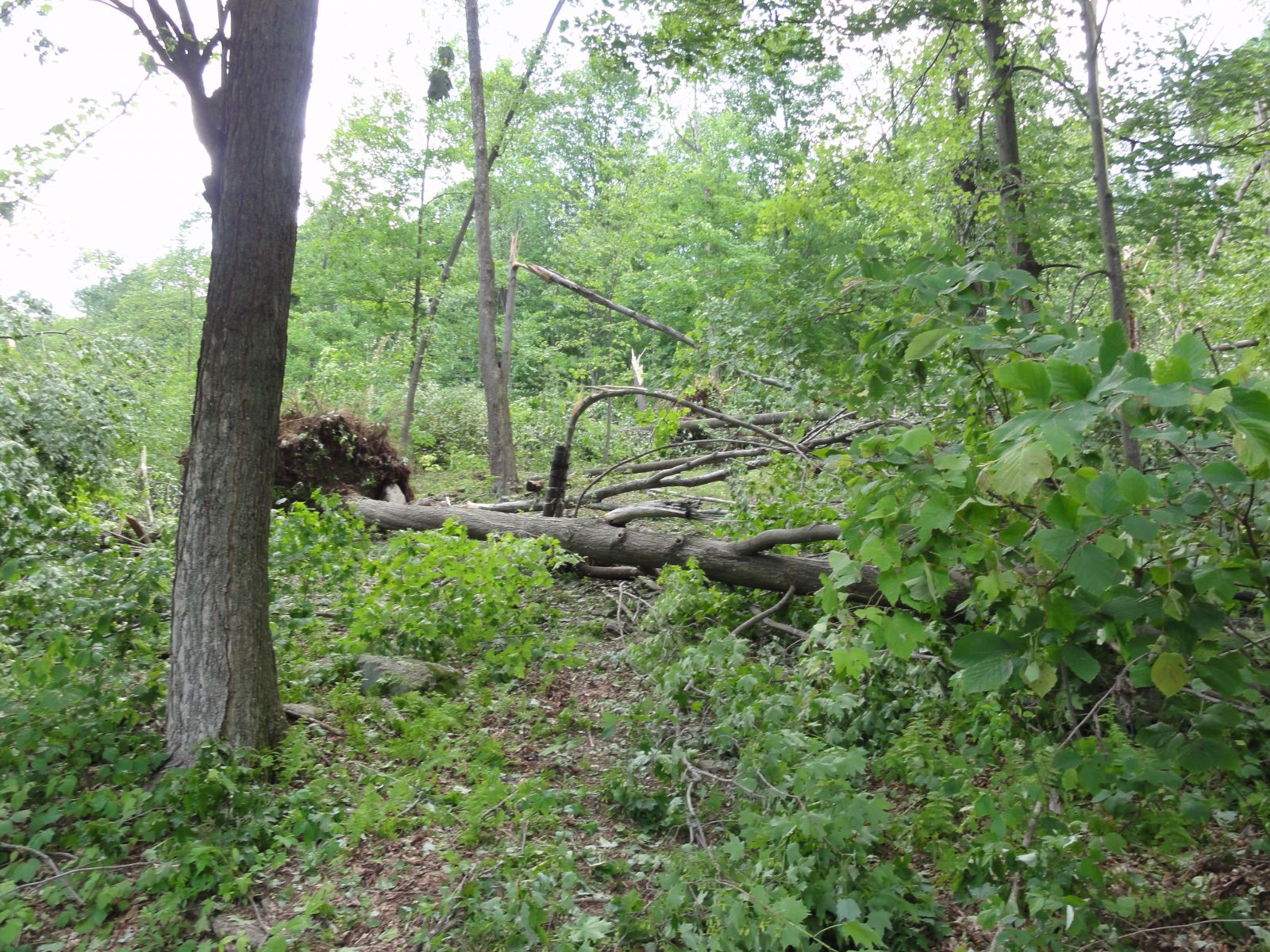
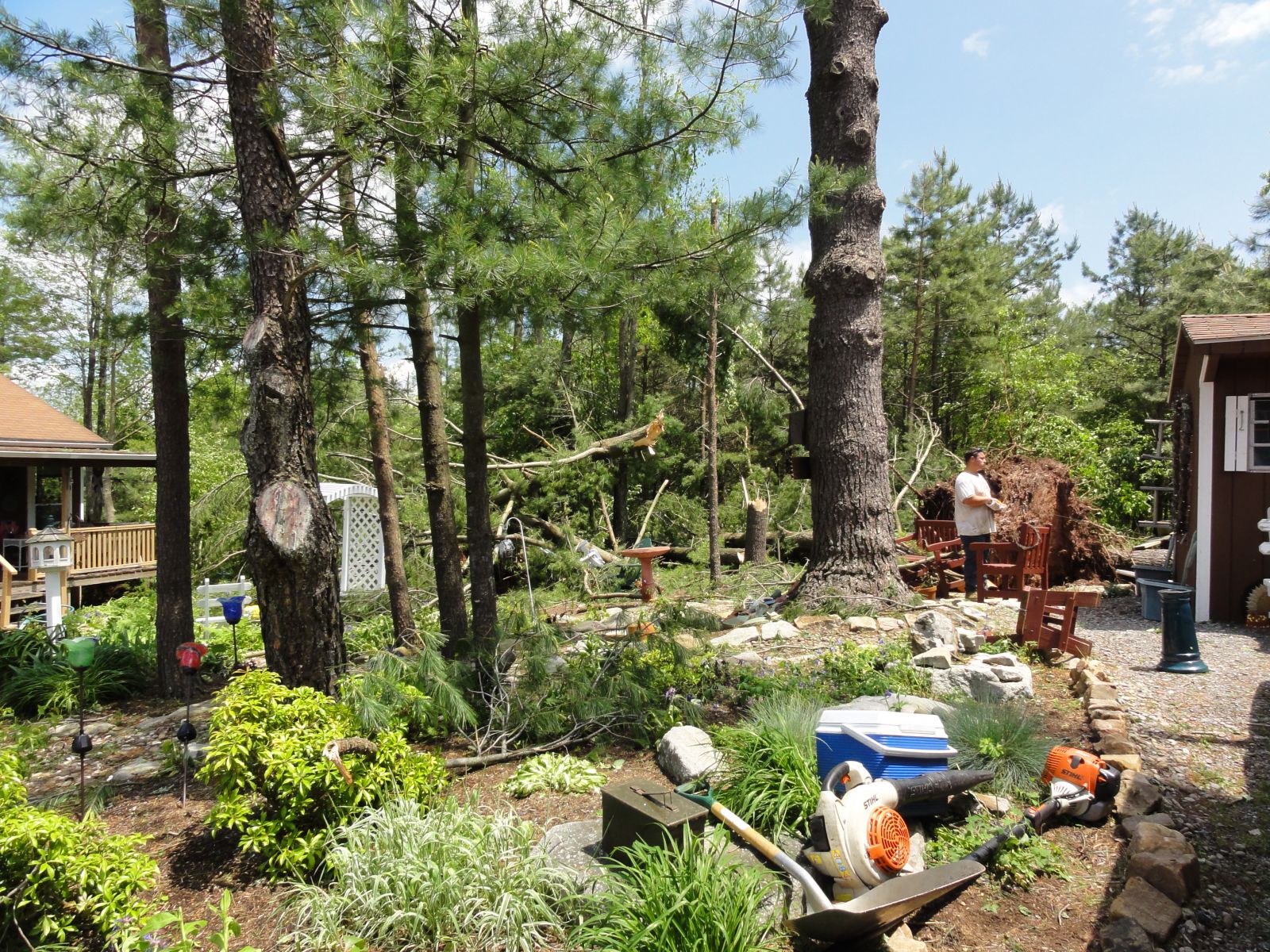
Photos & Video
Header
 |
 |
 |
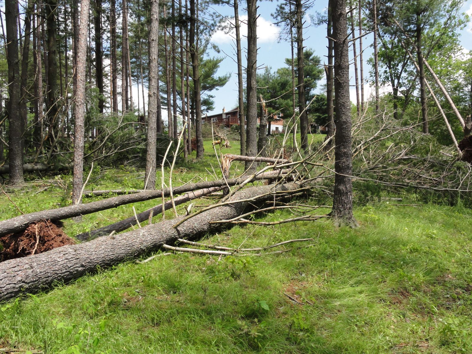 |
| Trough Creek Tornado Picture | Trough Creek Tornado Picture | Calvin Tornado Picture | Calvin Tornado Picture |
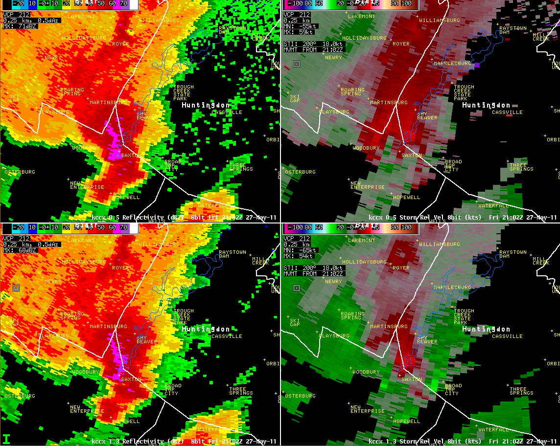
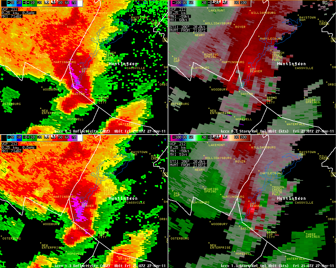
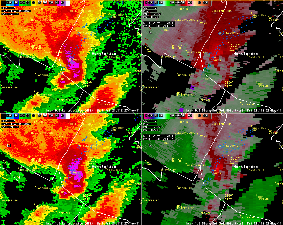
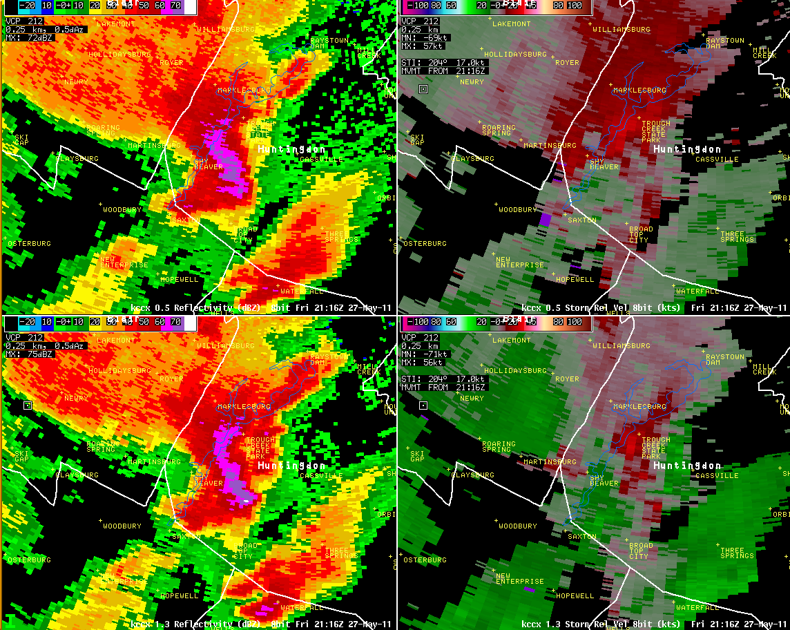
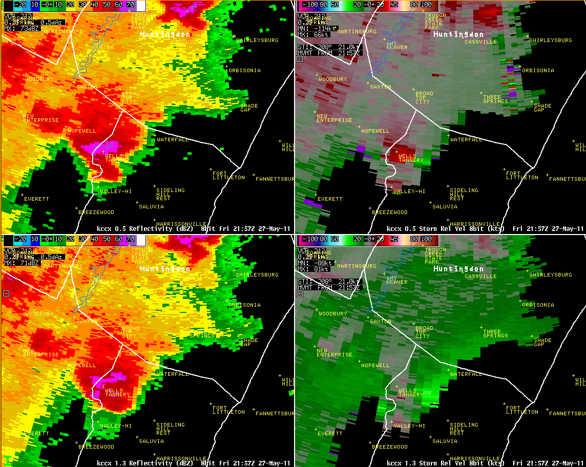
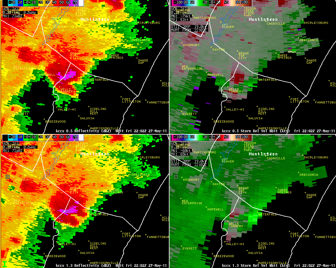
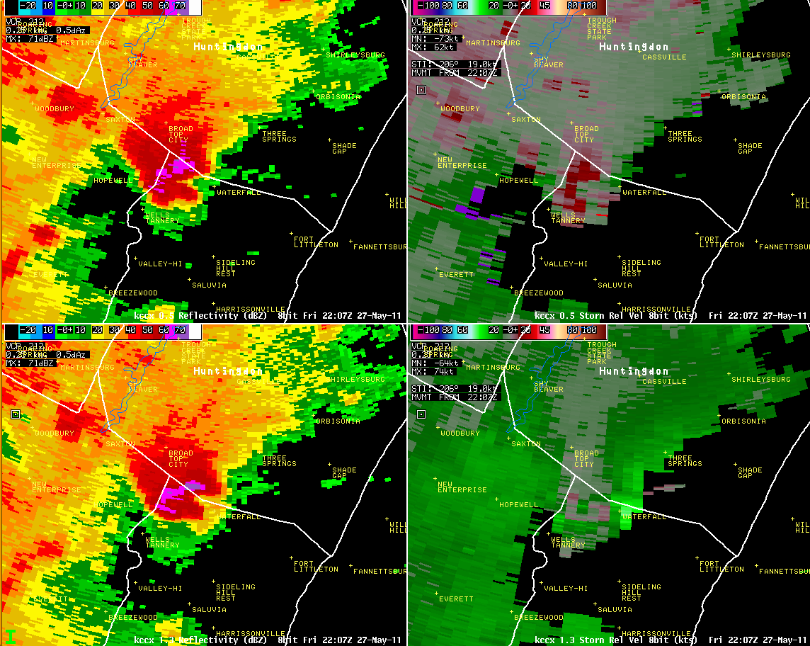
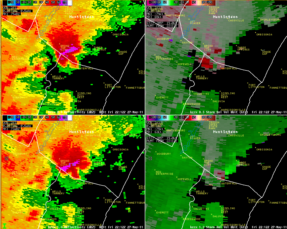
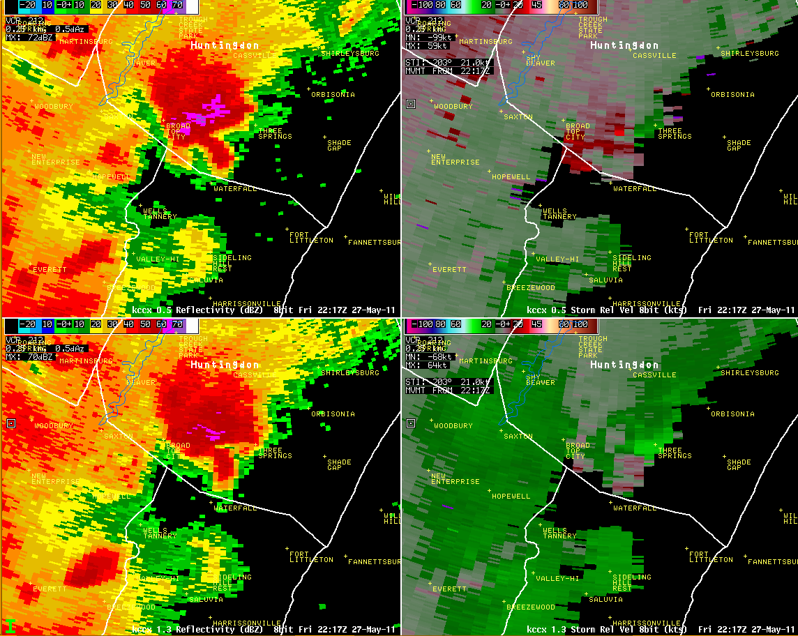
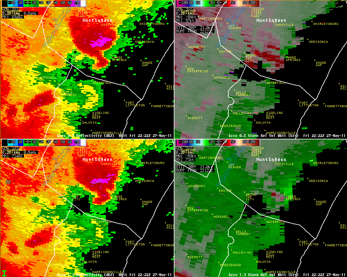
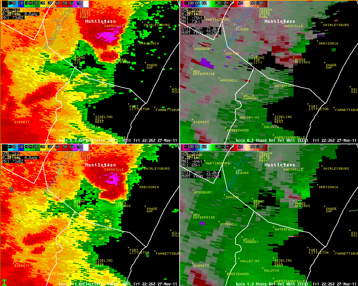
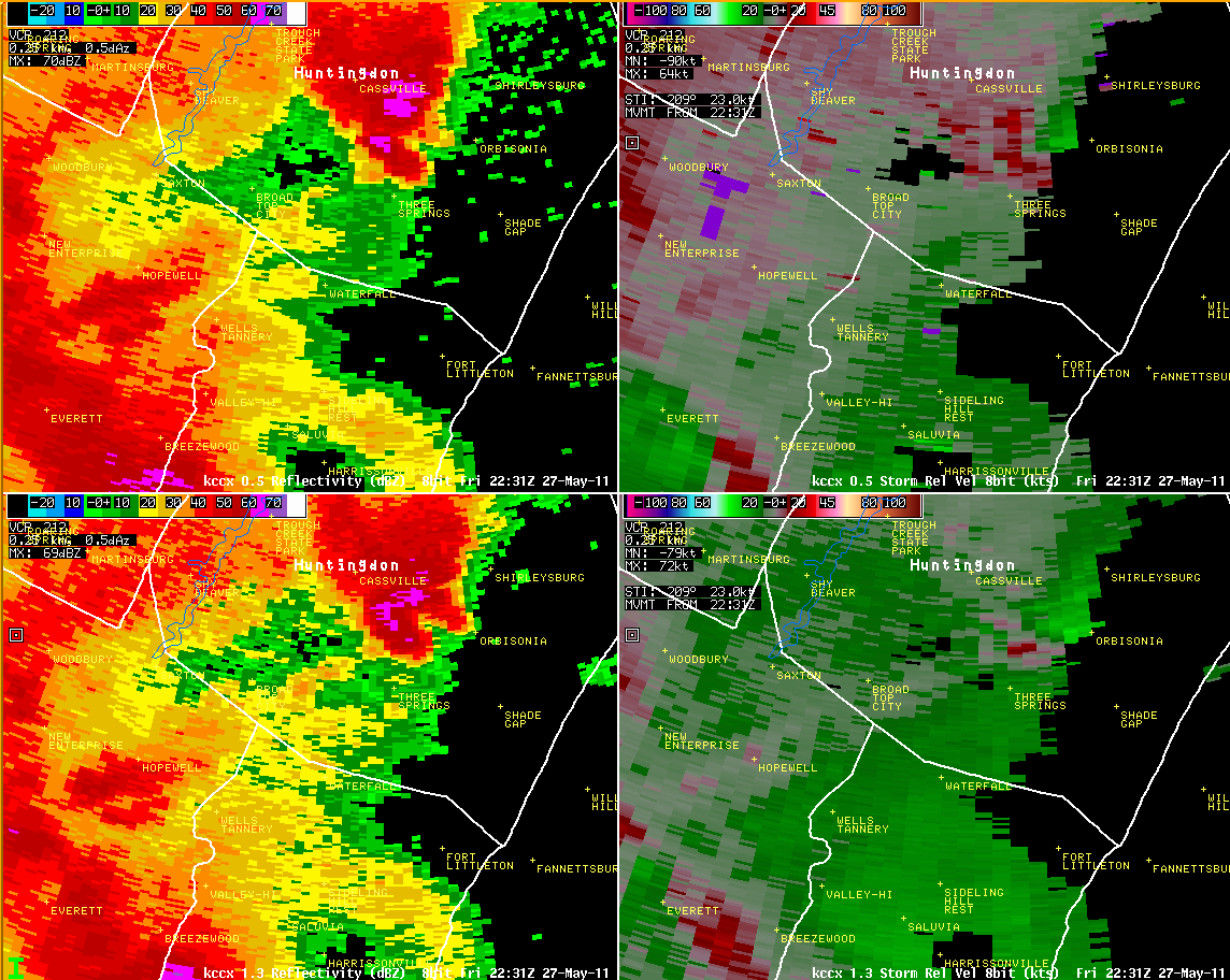
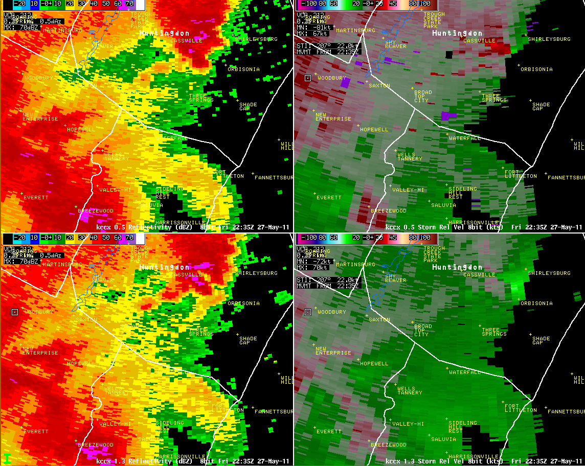
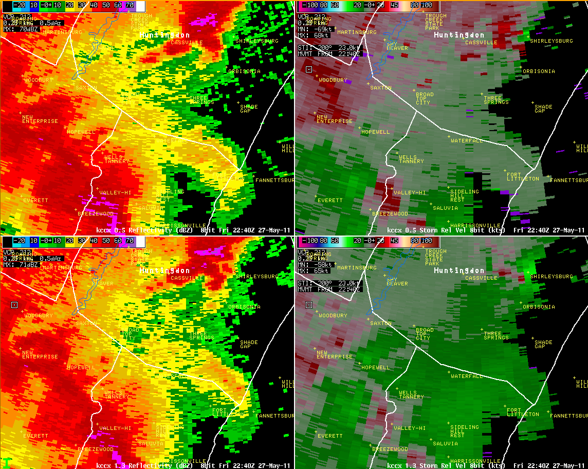
Radar
 |
 |
 |
 |
 |
 |
 |
 |
 |
 |
 |
 |
 |
 |
 |
 |
Media use of NWS Web News Stories is encouraged! Please acknowledge the NWS as the source of any news information accessed from this site. |
|


 Send Us a Report