
Scattered severe storms capable of large to very large hail, severe wind gusts, and a few tornadoes will be possible across the central Plains this evening. Heavy to excessive rainfall may bring a flooding threat from the Great Lakes to the Mid-South through tonight. Hot, dry and windy conditions will continue to bring a critical fire weather threat from the Southwest into the Great Basin. Read More >
Overview
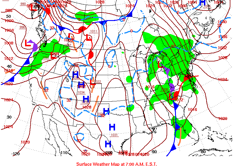
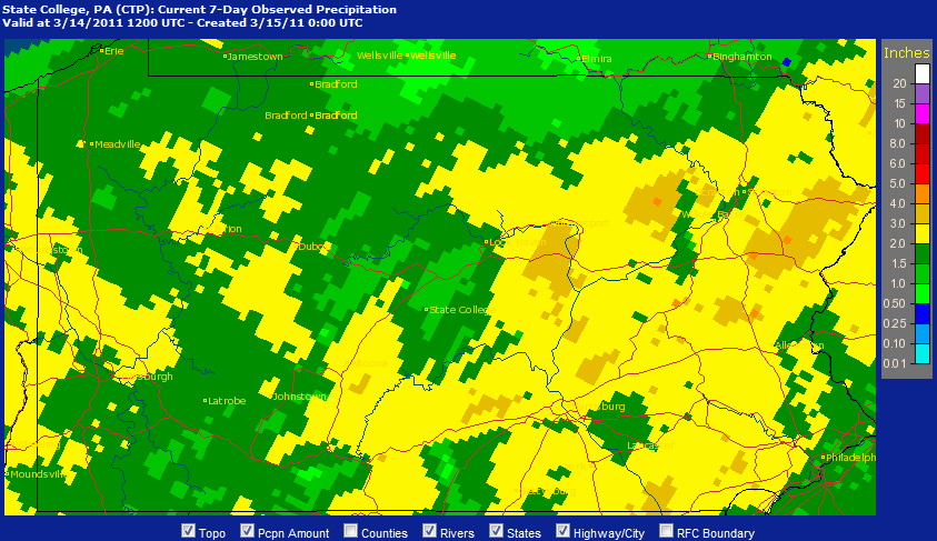
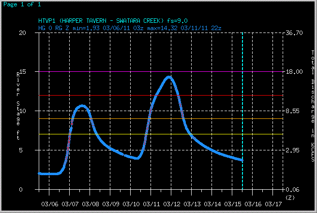
A widespread 2 to 3 inches of rainfall occured on March 10th through March 11th, 2011. The rain (and some snow) was due to a very slow-moving front that nearly stalled over the Upper Ohio Valley and Mid-Atlantic States. This brought flooding and high river levels.
 |
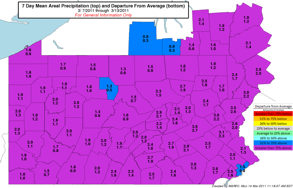 |
| Surface Map of March 10th, 2011 | Departure From Normal Precipitation from March 7th through 14th |
 |
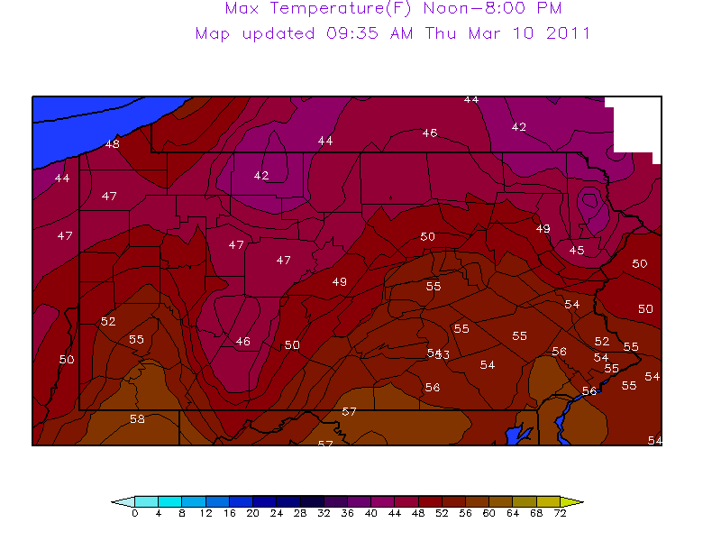 |
| Rainfall (liquid precipitation) from March 7th through 14th | Maximum Temperature Map for March 1th, 2011 - Note upper 40s and lower 50s across PA |
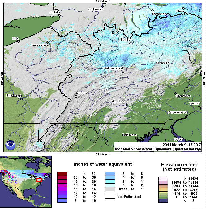
Snow Depth
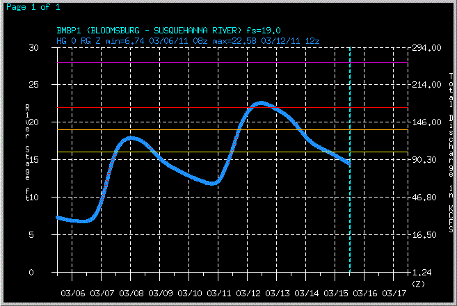
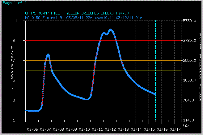
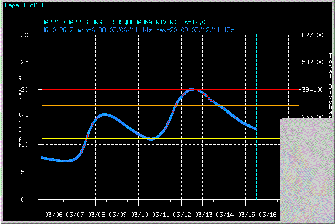
River Gauges
 |
 |
 |
 |
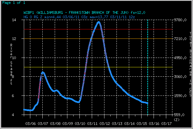 |
| Bloomsburg River Gauge March 6th-15th | Camp Hill River Gauge March 6th-15th | Harrisburg River Gauge March 6th-15th | Harper Tavern River Gauge March 6th-15th | Williamsburg River Gauge March 6th-15th |
 |
Media use of NWS Web News Stories is encouraged! Please acknowledge the NWS as the source of any news information accessed from this site. |
|


 Send Us a Report