
Widespread life-threatening flash and urban flooding will continue to pose a significant threat to life and property in south-central Texas. Catastrophic fiver flooding, with rapid rises on small streams, arroyos, and typically dry washes, is expected. Monsoonal showers persist across the Great Basin and Southwest with greatest flash flooding in southern Arizona. Read More >
Overview
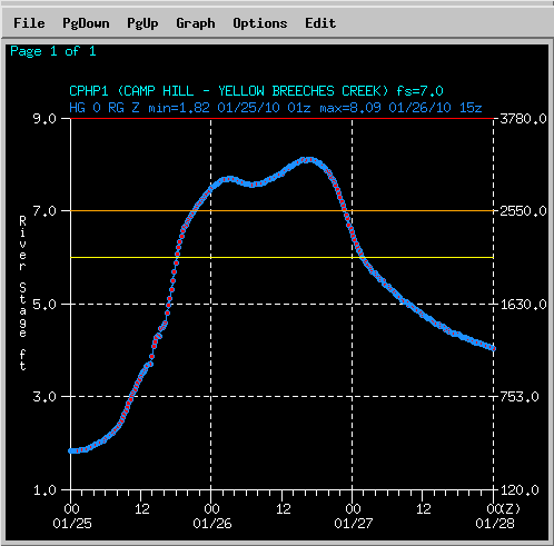
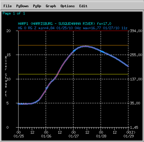
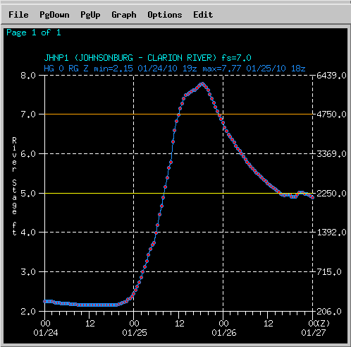
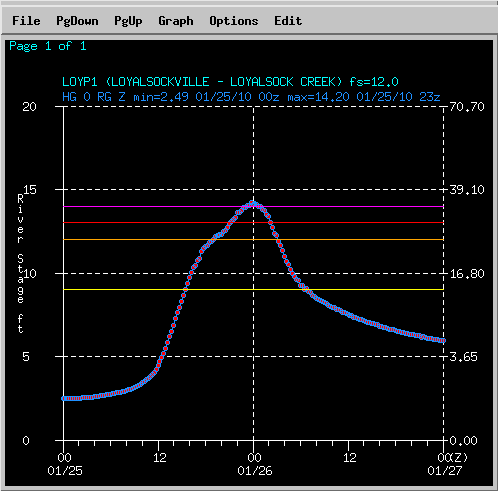
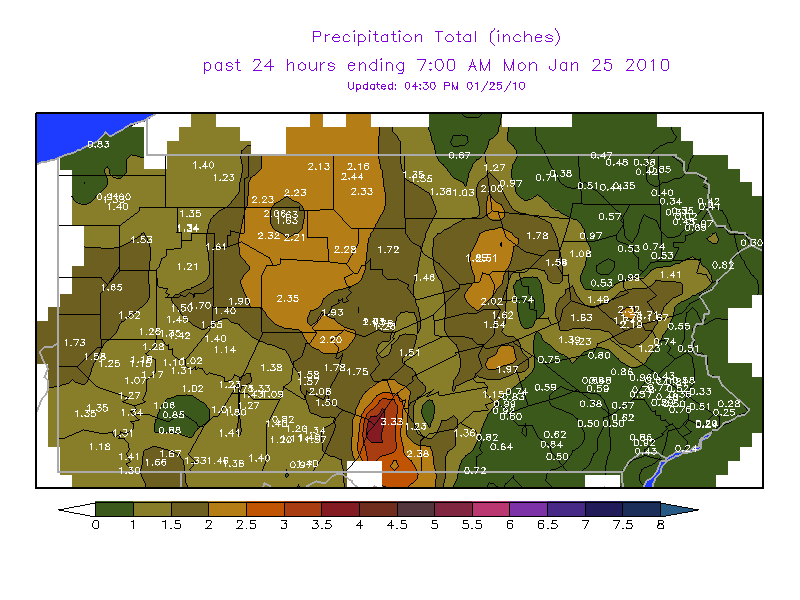
A widespread rainfall of 1.5 to 3.5 inches occurred over a 24 hour period between Sunday afternoon (24 Jan 2010) and Monday afternoon (25 Jan 2010). A powerful storm moved north through the Great Lakes, and brought very warm air up into Pennsylvania for the 4th weekend in January of 2010. High temperatures on the 24th and 25th were in the mid 40s to near 60 degrees. The rainfall was generally an inch to an inch and a half over the western mountains, to nearly 4 inches in the higher elevations to the east of State College. Places to the southeast of a York to Reading line received less than an inch from the entire storm. The extremely heavy rain caused small creeks and streams to flood very quickly, and even the larger rivers rose over flood stages or very close to flood levels.
Hydrographs
 |
 |
 |
 |
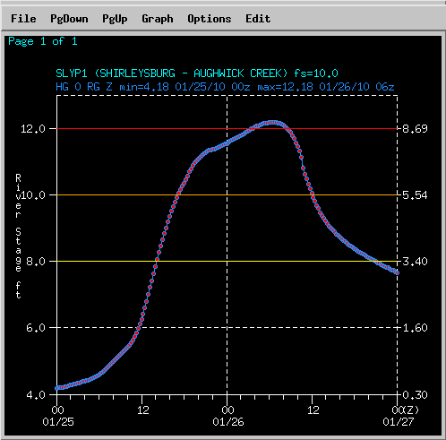 |
| Yellow Breeches Creek near Camp Hill | Susquehanna River at Harrisburg | Clarion River at Johnsonburg | Loyalsock Creek at Loyalsockville | Aughwick Creek at Shirleysburg |
Rainfall Reports
 |
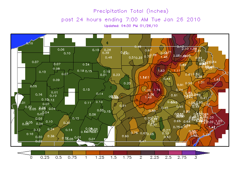 |
| 24 Hr Rainfall Reports from 7AM EST 24 Jan 2010 through 7 AM EST 25 Jan 2010 | 24 Hr Rainfall Reports from 7AM EST 25 Jan 2010 through 7 AM EST 26 Jan 2010 |
 |
Media use of NWS Web News Stories is encouraged! Please acknowledge the NWS as the source of any news information accessed from this site. |
|


 Send Us a Report