
Record setting heat is expected over the next several days from the Intermountain West through the northern Plains. Furthermore, fire weather concerns increase with dry and breezy conditions. Meanwhile, heavy rainfall and severe thunderstorm threats for the Ohio/Tennessee Valleys, central Appalachians and Southeast today. The threat shifts to central Gulf Coast and across central Texas this week. Read More >
Overview
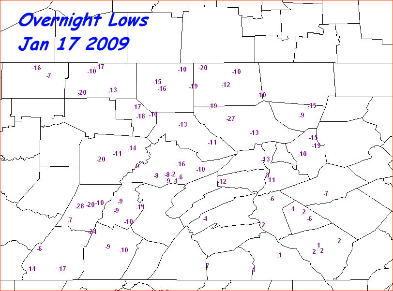
Frigid Morning Temperatures Saturday 17 Jan 2009 The coldest morning in at least a decade occurred across the region Saturday (the 17th) morning. A record low of 13 below zero F was set at Williamsport, PA, breaking the record set in 1982 of 12 below. See the map below for other reported low/minimum temperatures that morning. Low temperatures varied greatly from urban areas to rural spots, which is not unusual on clear, calm mornings any time of year. They also varied from areas close to bodies of relatively warmer water to open land, and also from hill tops to valleys. Again, this variation was not unusual, but the near-record cold was.Photos
 |
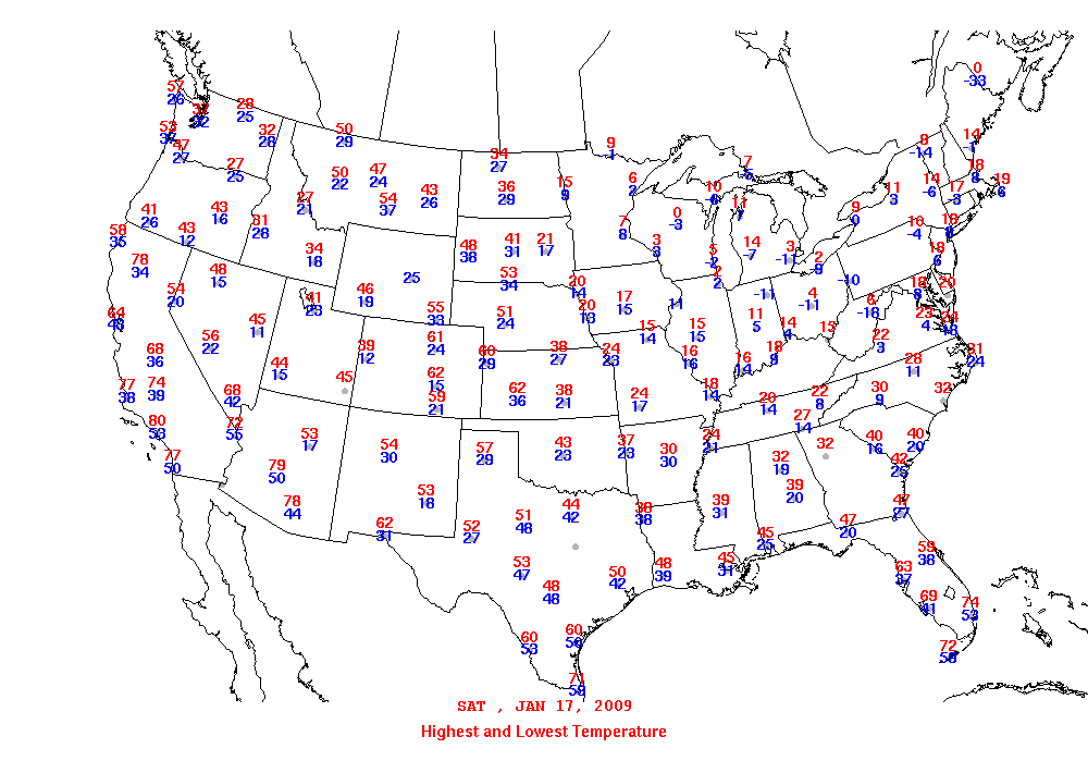 |
| Local Low Temperatures Saturday the 17th | National Temperature Map (lows in blue) |
 |
Media use of NWS Web News Stories is encouraged! Please acknowledge the NWS as the source of any news information accessed from this site. |
|



 Radar
Radar Current Weather
 Rivers & Lakes
 Satellite
 Forecast Maps
 Hour by Hour Forecast
 Tropical Weather
 Graphical Hazards
 Weather Hazards Briefing
 Fire Weather
 Text Forecasts and Statements
 Forecaster's Discussion
 Send Us a Report
 KCCX Local Radar (Hi-Res)
 Drought
 Winter
 Follow us on X
 Follow us on Facebook
 CTP RSS Feed