Overview
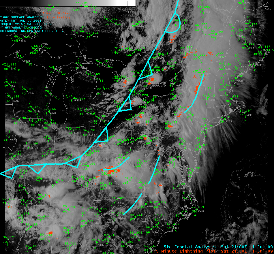
A cold front neared the state on Saturday, and severe weather broke out in the warm and humid airmass before the front. The abundant moisture, strong winds aloft, and heating of the late day July sunshine combined to produce severe thunderstorms, and at least one tornado.
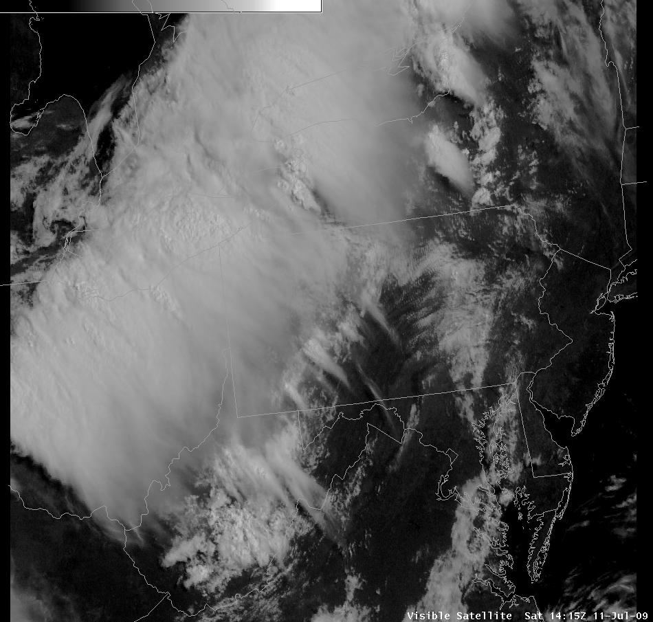
The heat was suppressed at first during the morning and late afternoon, as a large shield of altostratus and cirrus clouds moved over the region. These clouds were the remnants of thunderstorms that occurred over OH and MI early Saturday morning.
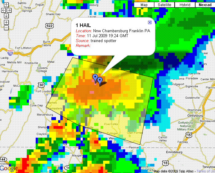
The first severe weather of the day was large hail (up to 1 inch in diameter) that occurred in a supercell over central Franklin County, in and near Chambersburg, PA. This storm formed in the early afternoon, in the vicinity of a weak pre-frontal trough - just before the high clouds got thick enough to inhibit heating over that area. Then, there was lull in storm formation over the state, until clearing came in behind the first showers of the day.
Multiple thunderstorms - some long-track supercells and some storms that evolved into long-lived bow echoes - then formed over the west-central mountains and moved quickly to the east. Many reports of damage and large hail were received.
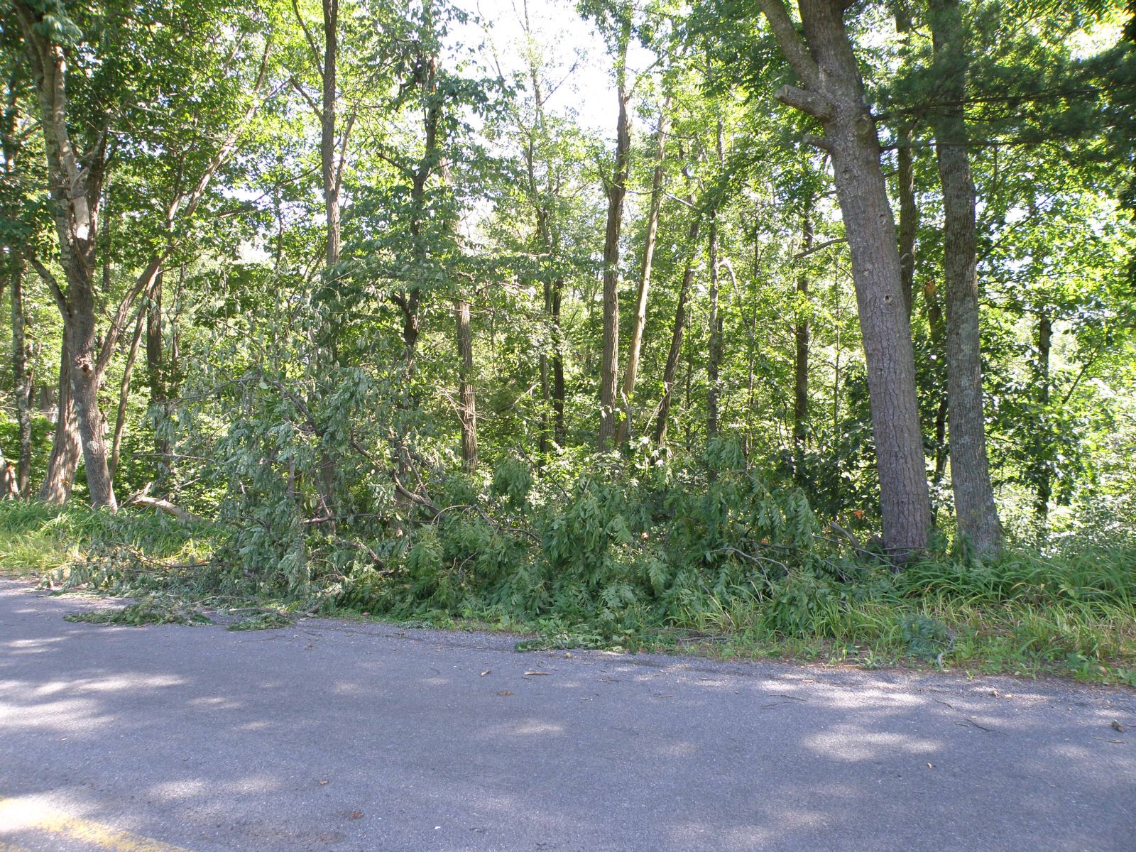
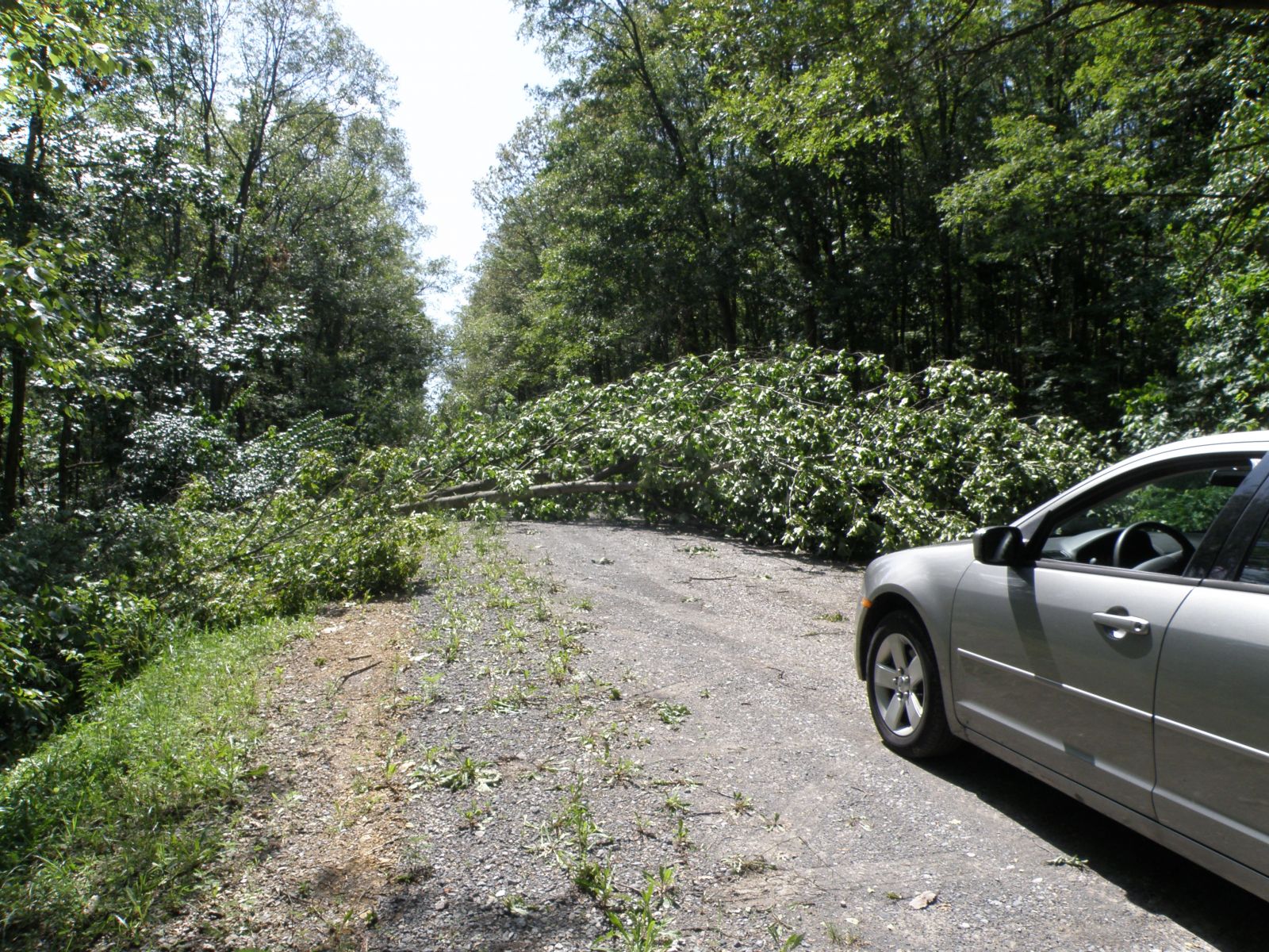
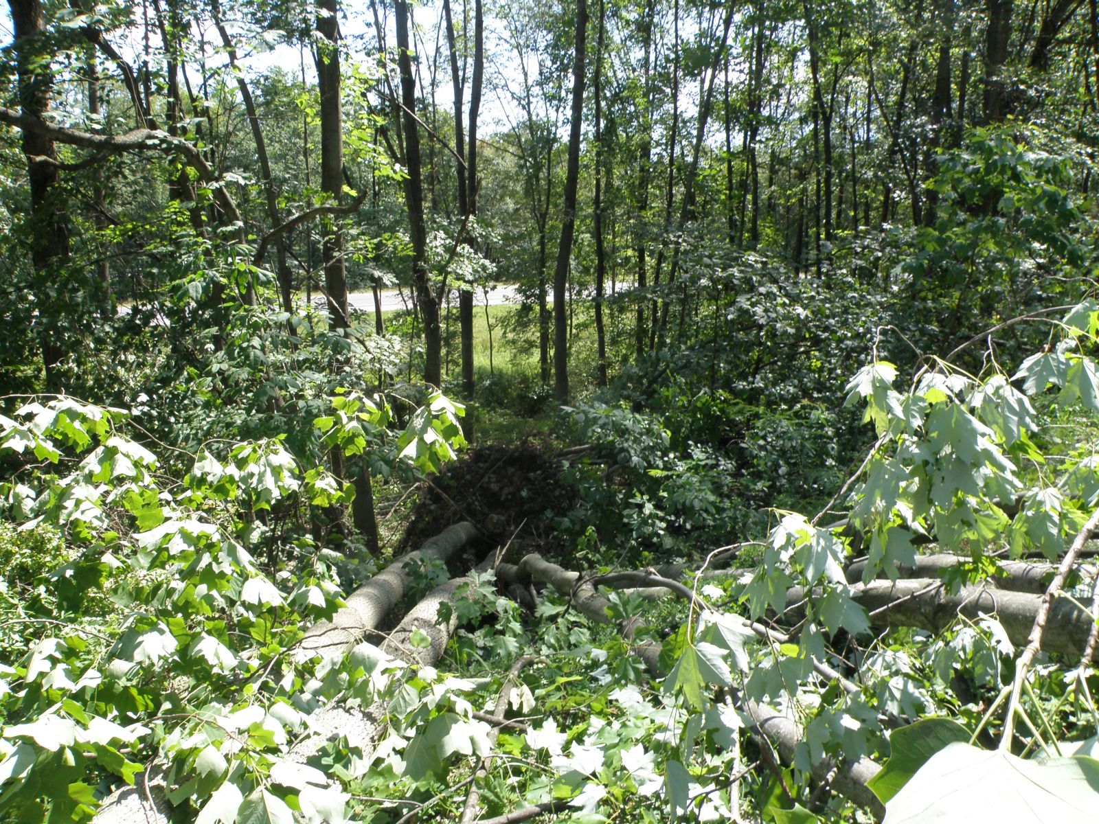
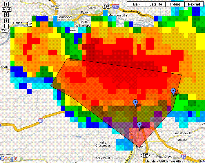
One long-track, right turning, supercell formed to the north of Jersey Shore in the early evening hours. It moved to the south and east, through Williamsport, and into northeastern Union County, just west of Milton, and continued to the southeast. This storm produced at least one tornado - crossing over I-80 from north to south near White Deer Furnace in northeastern Union County (west of Milton) where it was witnessed by a State Trooper. The storm made many other areas of wind damage, and some large hail.
 |
 |
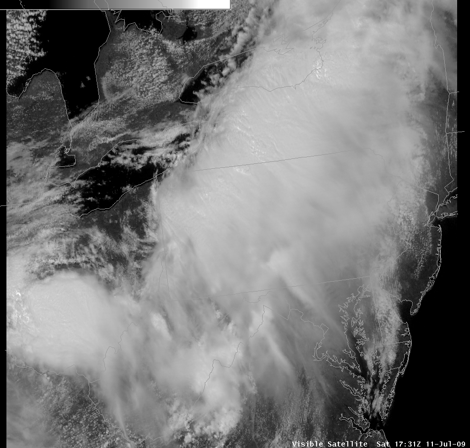 |
| Fronts, boundaries, and visible satellite | Visible satellite Saturday morning | Visible satellite Saturday afternoon |
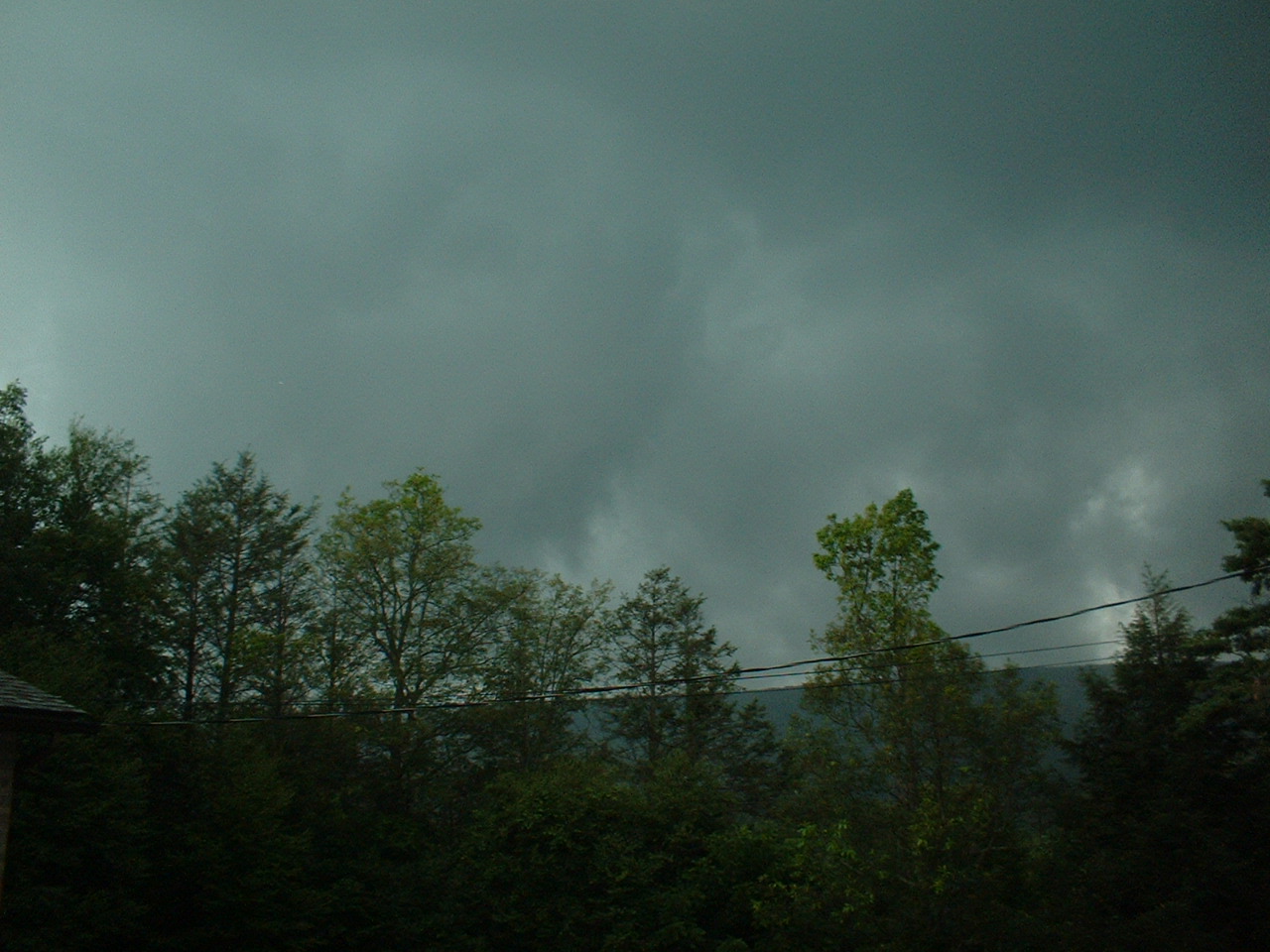
Photos & Video
 |
 |
 |
 |
|
Tornado - White Deer Furnace
|
||||||||||||||||
Storm Reports
NWUS51 KCTP 130055
LSRCTP

PRELIMINARY LOCAL STORM REPORT...SUMMARY
NATIONAL WEATHER SERVICE STATE COLLEGE PA
854 PM EDT SUN JUL 12 2009

..TIME...   ...EVENT...      ...CITY LOCATION...     ...LAT.LON...
..DATE...   ....MAG....      ..COUNTY LOCATION..ST.. ...SOURCE....
            ..REMARKS..

0314 PM     HAIL             NNW CHAMBERSBURG        39.93N 77.66W
07/11/2009  E0.88 INCH       FRANKLIN           PA   TRAINED SPOTTER

0324 PM     HAIL             NNW CHAMBERSBURG        39.93N 77.66W
07/11/2009  E1.00 INCH       FRANKLIN           PA   TRAINED SPOTTER

0325 PM     HAIL             3 E ST. THOMAS          39.94N 77.68W
07/11/2009  E1.00 INCH       FRANKLIN           PA   FIRE DEPT/RESCUE

0510 PM     TSTM WND DMG     2 SW WILLIAMSPORT       41.22N 77.05W
07/11/2009                   LYCOMING           PA   TRAINED SPOTTER

            TREES AND WIRES DOWN IN SUSQUEHANNA STATE PARK.

0545 PM     TORNADO          WATSONTOWN              41.08N 76.86W
07/11/2009                   NORTHUMBERLAND     PA   PUBLIC

            TORNADO OBSERVED ON THE GROUND.

0550 PM     TORNADO          2 N MILTON              41.04N 76.85W
07/11/2009                   NORTHUMBERLAND     PA   LAW ENFORCEMENT

            TORNADO OBSERVED BY STATE TROOPER ON I-80.

0551 PM     HAIL             TURBOTVILLE             41.10N 76.77W
07/11/2009  E0.75 INCH       NORTHUMBERLAND     PA   LAW ENFORCEMENT

0609 PM     TSTM WND DMG     NORTHERN CAMBRIA        40.67N 78.78W
07/11/2009                   CAMBRIA            PA   LAW ENFORCEMENT

            SEVERAL REPORTS OF TREES AND WIRES DOWN IN NORTHERN
            CAMBRIA AND SUSQUEHANNA TWP.

0620 PM     TSTM WND DMG     COALPORT                40.75N 78.53W
07/11/2009                   CLEARFIELD         PA   PUBLIC

            TREES AND WIRES REPORTED DOWN IN COALPORT.

0632 PM     TSTM WND DMG     BLOOMSBURG              41.00N 76.46W
07/11/2009                   COLUMBIA           PA   LAW ENFORCEMENT

            TREES AND WIRES REPORTED DOWN IN BLOOMSBURG.

0632 PM     TSTM WND DMG     3 W BLOOMSBURG          41.00N 76.51W
07/11/2009                   COLUMBIA           PA   TRAINED SPOTTER

            TREES REPORTED DOWN 3W OF BLOOMSBURG. ESTIMATED 60 MPH
            WIND GUST.

0648 PM     TSTM WND DMG     PHILIPSBURG             40.89N 78.21W
07/11/2009                   CENTRE             PA   LAW ENFORCEMENT

            UTILITY LINES DOWN AROUND IN PHILIPSBURG.

0727 PM     TSTM WND DMG     NEW BLOOMFIELD          40.42N 77.19W
07/11/2009                   PERRY              PA   LAW ENFORCEMENT

            TREES REPORTED DOWN NEAR NEW BLOOMFIELD.

0745 PM     TSTM WND DMG     3 N LOCK HAVEN          41.18N 77.45W
07/11/2009                   CLINTON            PA   LAW ENFORCEMENT

            TREES REPORTED DOWN ALONG RT 664 HALF A MILE SOUTH OF
            SWISSDALE.

0745 PM     TSTM WND DMG     2 E MAHANOY CITY        40.81N 76.10W
07/11/2009                   SCHUYLKILL         PA   TRAINED SPOTTER

            NUMEROUS TREES DOWN OFF OF ROUTE 54 WEST OF BARNESVILLE.

0759 PM     HAIL             MONTOURSVILLE           41.25N 76.92W
07/11/2009  E1.25 INCH       LYCOMING           PA   PUBLIC

0800 PM     TSTM WND DMG     LEWISTOWN               40.60N 77.57W
07/11/2009                   MIFFLIN            PA   LAW ENFORCEMENT

            TREES REPORTED DOWN NEAR THE WALNUT ST EXIT OF RT 322.

0848 PM     TSTM WND DMG     1 N SELINSGROVE         40.82N 76.87W
07/11/2009                   SNYDER             PA   LAW ENFORCEMENT

            TREES REPORTED DOWN NORTH OF SELINSGROVE.

0925 PM     TSTM WND DMG     4 N HARRISBURG          40.33N 76.88W
07/11/2009                   DAUPHIN            PA   PUBLIC

            TREES DOWN AND LAWN FURNITURE TOSSED ABOUT.

0931 PM     HAIL             LINGLESTOWN             40.34N 76.79W
07/11/2009  E0.88 INCH       DAUPHIN            PA   PUBLIC

1200 AM     FLASH FLOOD      1 E BLOOMSBURG          41.00N 76.44W
07/12/2009                   COLUMBIA           PA   TRAINED SPOTTER

            TWO RAIN GAUGE REPORTS OF 3.55 AND 4.00 INCHES OF RAIN
            MEASURED JUST EAST OF THE BLOOMSBURG FAIRGROUNDS.
            ROADWAYS COVERED BY WATER AND ROCKS.


&&

$$
Radar
 |
 |
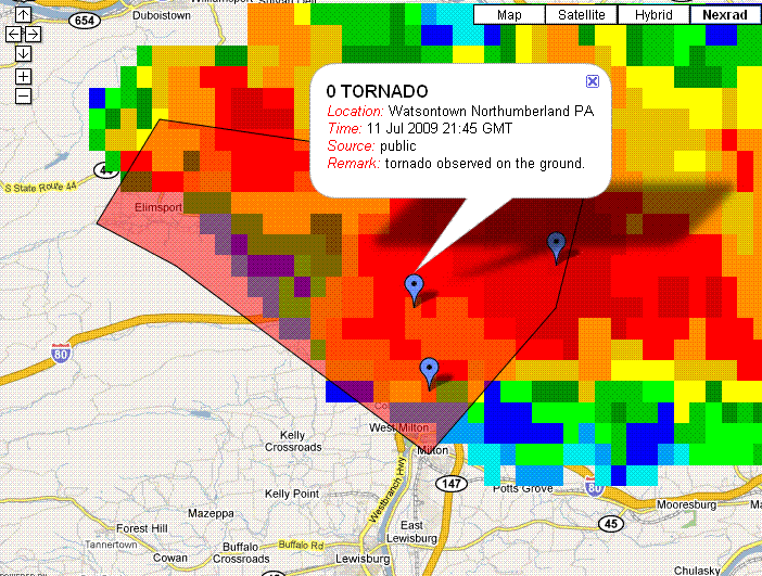 |
| Supercell Storm over Chambersburg, PA at 1920 UTC, producing 1 inch hail | Composite Reflectivity at 528 PM EDT, with initial Tornado Warning area (in light red) and spots where severe weather was reported during the warning valid time. | Same as to the left, at 2145 UTC with public report of Tornado overlaid. |
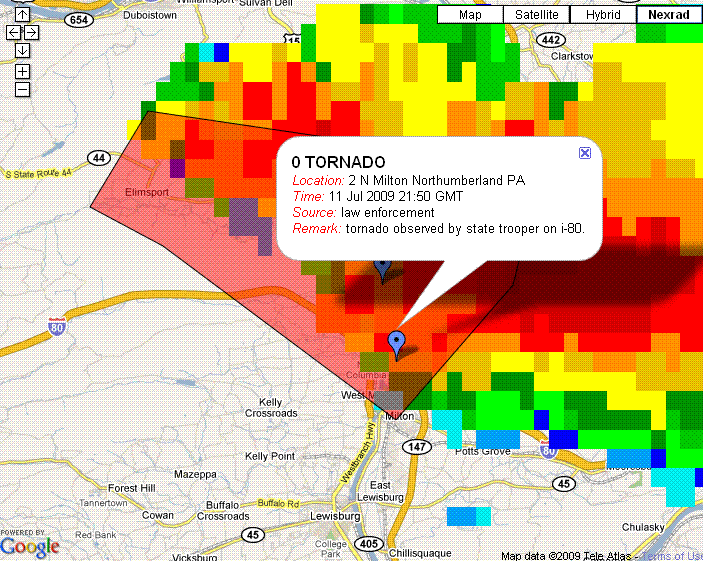 |
| Same as above, at 2150 UTC with Pennsylvania State Trooper report of tornado crossing I-80 overlaid. |
 |
Media use of NWS Web News Stories is encouraged! Please acknowledge the NWS as the source of any news information accessed from this site. |
 |