Overview
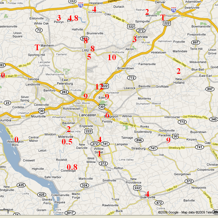
A band of very heavy snow set up right over Lancaster and Lititz, PA during the evening of Tuesday, Feb 3rd, 2009, and lasted into the early morning hours of Wednesday, the 4th. Snowfall rates were estimated to be up to 3 inches per hour at times.
Hardly any snow fell to the Southwest and Northeast of the band of snow. The band was generally stationary for 5-6 hours in 10-15 mile-wide a line from Lititz to Lancaster and Strasburg. Locations in Northeast Lancaster County (Reamstown for example) hardly had a dusting. To the southwest, Millersville University had just a half of an inch.
Hints at the potential convective nature of the snow were given by the NWS CTP local WRF model run during the daytime on the 3rd. The location of the (potential) heavy snow was near to Lancaster County, but not perfectly located. It was within a few grid points for a 12km model, though.
Larger/Broader-scale models will not catch such a small-scale event, and underestimated the potential for snowfall in that tiny area.
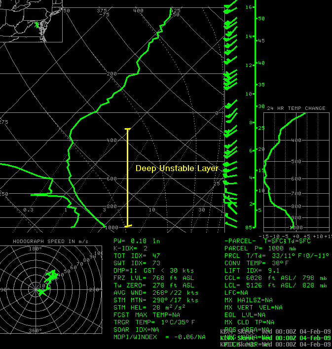
A look at the LWX (Sterling, VA) balloon/upper-air sounding from 00Z on the 4th (7 PM EST on the 3rd) portrays a very steep lapse rate in the lowest 15kft of the atmosphere. The atmosphere appeared to be unstable all the way up to the tropospheric inversion at about 25kft. The unstable atmosphere most likely led to convective enhancement inside the snow band which began to show up early in the day over Northern and Central PA. An upper-level low pressure area moving eastward from the Great Lakes provided additional lift. The focusing mechanism for the band - that is why it developed and stayed where it was - is much more difficult to explain.
For many in Lancaster and Lititz, this will probably be the heaviest snow they receive this winter.
 |
 |
 |
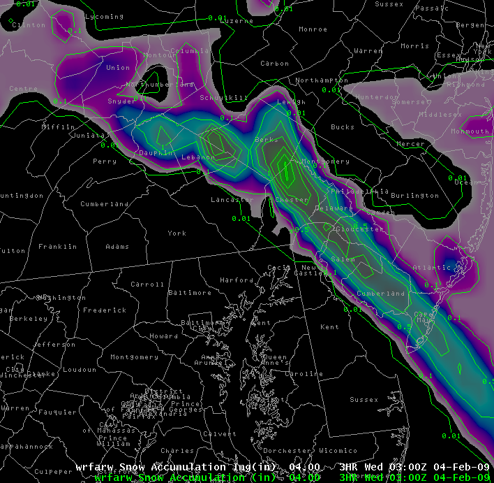 |
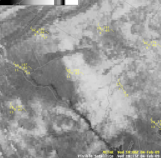
| Central Lancaster County Snow Map from 3-4Feb2009 | Central Lancaster County Snow Stripe on Visible Satellite Picture 4 Feb 09. | LWX Sounding from 00Z 4Feb2009 (7 PM EST 3Feb2009) | WRF-ARW 00Z 3hr Snow Accumulation Graphic for 00-03Z 4Feb2009 |
 |
Media use of NWS Web News Stories is encouraged! Please acknowledge the NWS as the source of any news information accessed from this site. |
|


 Send Us a Report