Overview
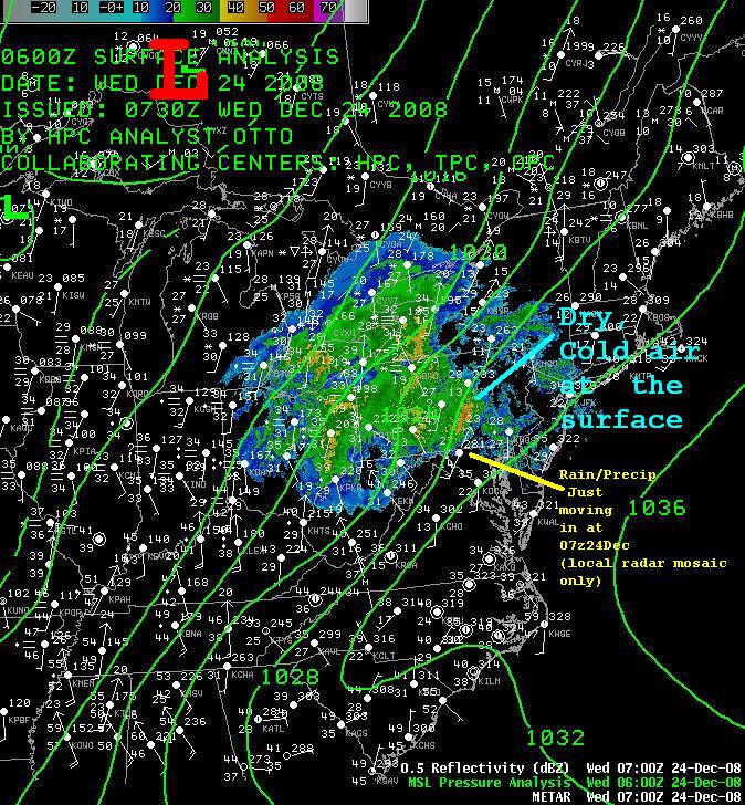
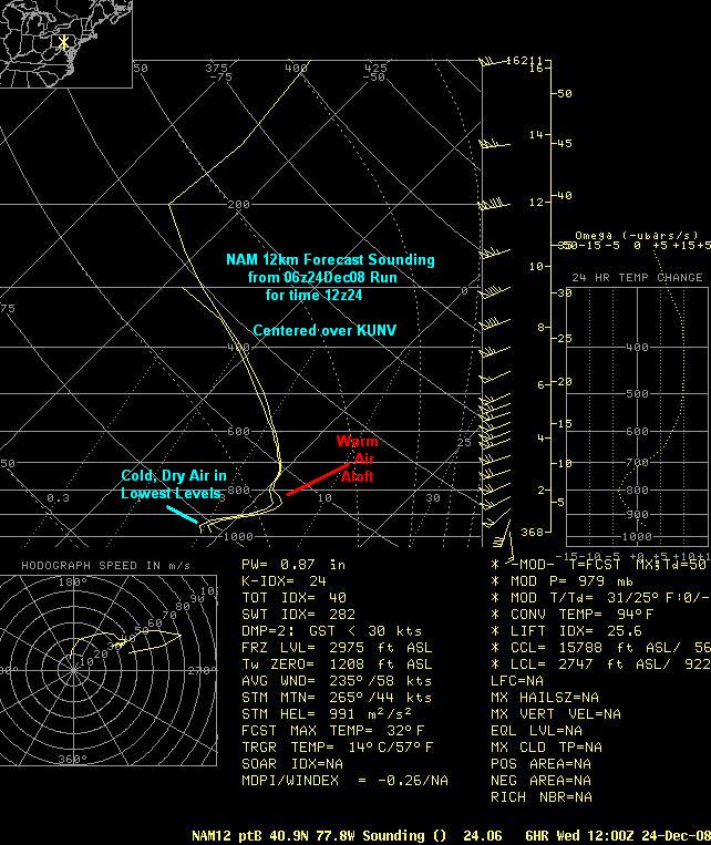
A storm whose center of low pressure passed far to the northwest of PA produced lots of ice over the Central and Eastern two-thrids of the region between Midnight and 2 or 3 PM on Christmas Eve (Day), the 24th of December, 2008. The precipitation moved in around or just after Midnight as a mix of sleet and freezing rain, which then turned to almost all freezing rain by sunrise. Temperatures aloft warmed while the lowest layers of the atmosphere stayed sub- freezing in the Northern and Central Mountains and Lower Susquehanna Valley. The Western Mountains turned to plain rain in the early morning hours, but much of Central PA stayed at or below freezing for the fore-noon hours on Christmas Eve.
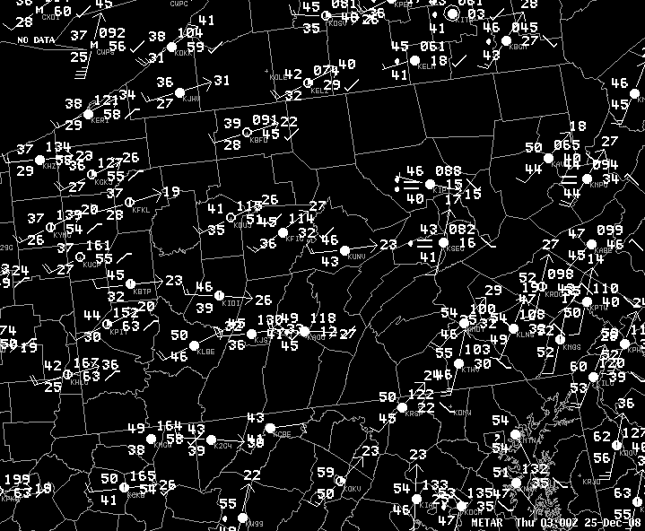
The ice built up on almost everything, as temperatures hovered very close to freezing. Eventually, the temperatures warmed into the 40s and 50s over much of the state, but not until after sunset! A cold front then swept through from west to east in the evening, and produced wind gusts of 40 to 50 mph across the west.
 |
 |
 |
| Surface Map with Pressure Isobars and local radar mosaic around 07z 24Dec2008 | Surface Map at 03z25Dec2008 as the cold front passes (note warm temps and gusty winds) | NAM12km 06z25Dec2008 Run at time 12z (7 AM EST) Dec25th showing cold air trapped beneath warm advective inversion/warm nose. |
 |
Media use of NWS Web News Stories is encouraged! Please acknowledge the NWS as the source of any news information accessed from this site. |
 |