State College, PA
Weather Forecast Office
Overview
A prolonged snowfall event occurred over Central PA from Wednesday night (Nov 19th) into Saturday (Nov 22nd).
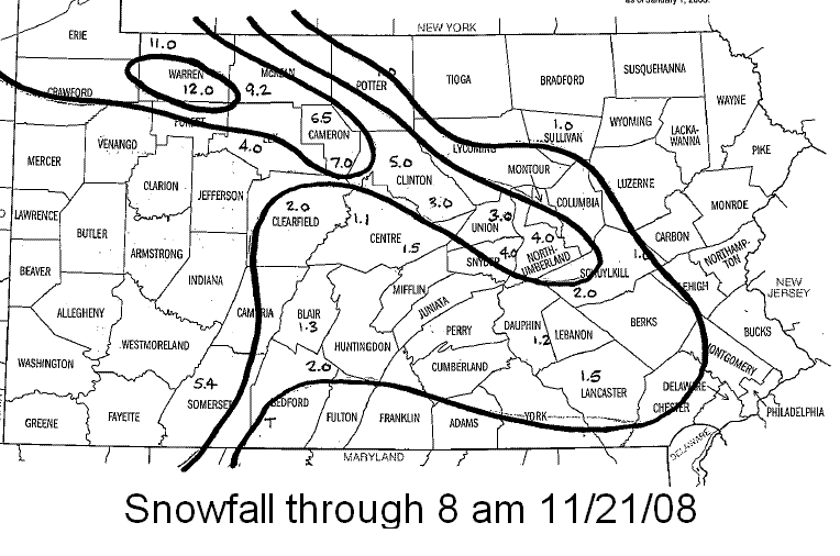
The event started with a weak Alberta Clipper moving through on fast west-northwest flow Wednesday night. This Clipper produced very minor snow accumulations, mainly across the northern part of PA.
The event then turned immediately into a lake effect event with several enhancements from occasional intrusions of even colder air. A record low (minimum) temperature was tied at Williamsport, PA on the morning of the 22nd - 15 degrees which was last set in 1969.
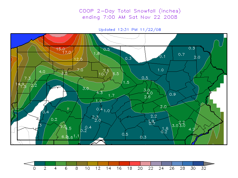
The cold air flowing over the great lakes made heavy snow over the Northwest Mountains (aka the Snow Belt), and the upslope areas of the Laurel Mountains.
But, the most unusual features were a series of long-lived snow bands that produced snow well into the Central Mountains, and even into the Southeastern Piedmont east of Harrisburg.
See the images below for more information.
 |
 |
 |
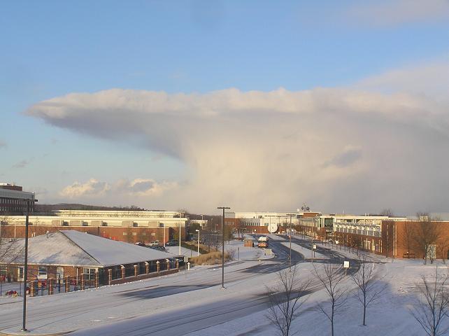
| 48 hour Snow Totals from 7 am Nov 20 thru 7am Nov 22 | Total snow through 8am Nov 21 | Snow Squall on the Afternoon of Nov 21st, view to the East from NWS CTP. Photo by Rob Radzanowski, Forecaster |
 |
Media use of NWS Web News Stories is encouraged! Please acknowledge the NWS as the source of any news information accessed from this site. |
 |
US Dept of Commerce
National Oceanic and Atmospheric Administration
National Weather Service
State College, PA
328 Innovation Blvd, Suite 330
State College, PA 16803
(814)954-6440
Comments? Questions? Please Contact Us.


 Send Us a Report