Overview
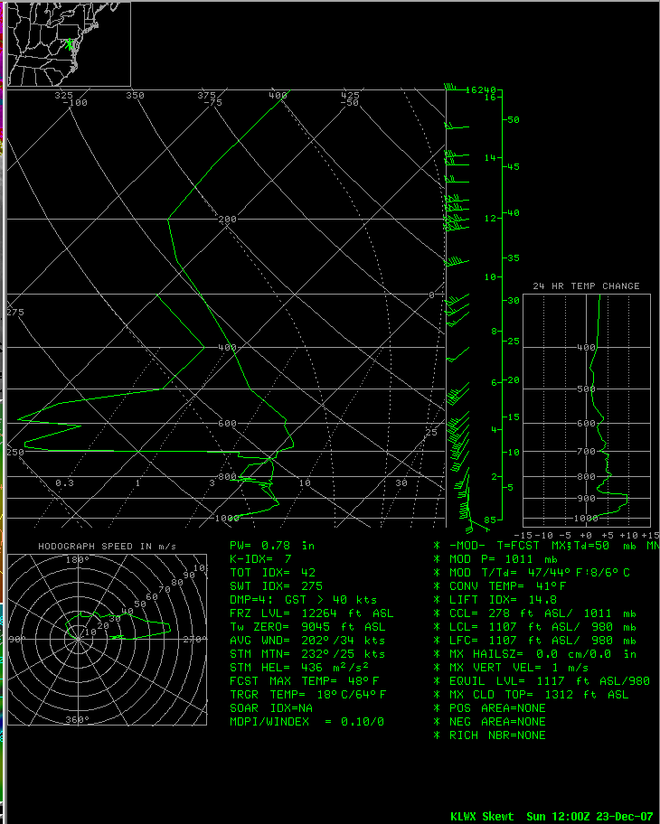
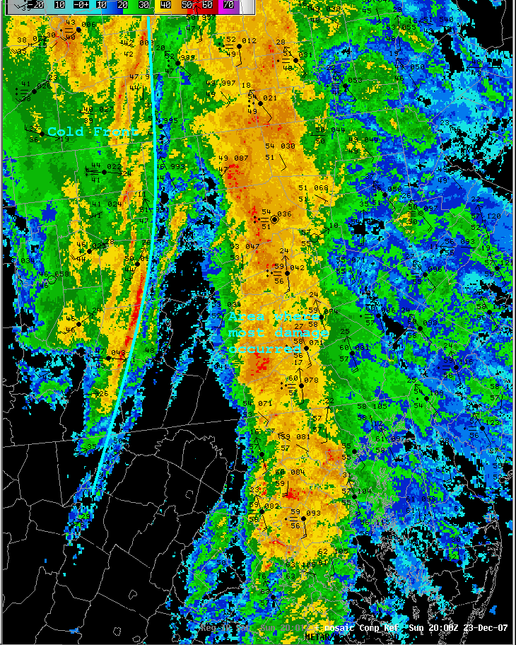
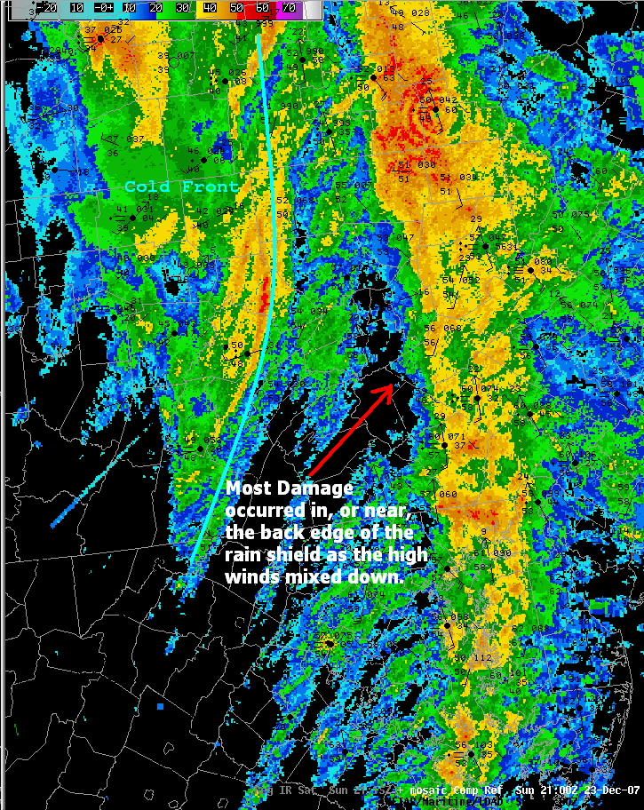
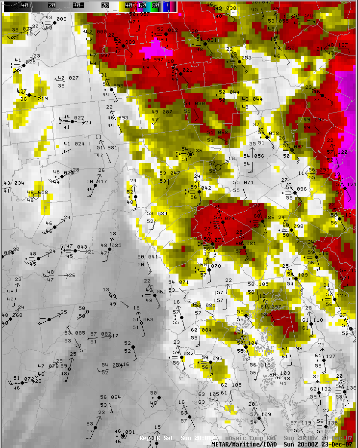
Strong winds crossed the region on Dec 23rd, as a cold front raced through from the west. This storm system had unusually strong winds associated with it, which helped to drive unseasonably warm and moist air into the region. Many places around Harrisburg had highs on Sunday (the 23rd) in the 50s and some were even over 60°F. Harrisburg International Airport (KMDT) reached 62°F, which was only three degrees below the record high of 65°F set in 1990. Sporadic reports of wind damage occurred as the strong winds just above the surface mixed down at the back edge of the main rain shield, which was out ahead of the cold front. See the soundings below - including a special 18z balloon release - from KLWX (Washington DC). The winds were up to 70 knots just a few thousand feet above the ground. Very little lightning and thunder happened with the rain as it moved through, as the clouds were very warm, and bore little ice. There was about an inch of rain in many locations, which pushed some waterways high. Williamsport Airport (KIPT) set a record for the most rain for any Dec 23rd on record (1.35 inches). A few of the smaller creeks and streams came out of their banks, especially where the ice and snow that was on the ground melted to combine with the rain, and caused local drainages to fill quickly. Most of the smaller streams went back in their banks very quickly.Skew T's
 |
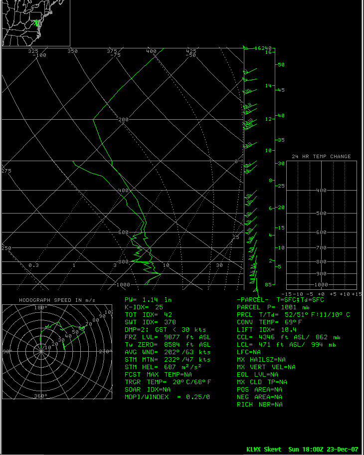 |
| LWX Sounding from 12z on the 23rd, note the strong winds very close to the surface, and extremely steep inversion. | Special LWX balloon sounding from 18z |
Radar
 |
 |
 |
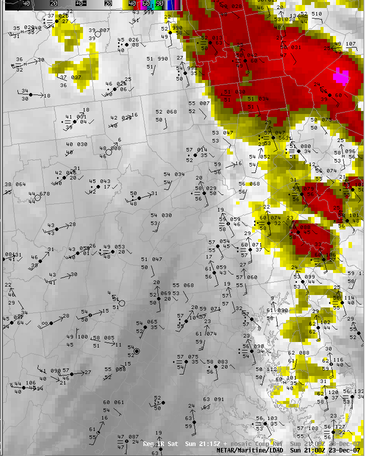 |
| 20z Radar and Surface Obs | 21z Radar and Surface Obs | IR Satellite and obs from 20z (3 PM EST) | IR and obs from 21z (4 PM EST) |
 |
Media use of NWS Web News Stories is encouraged! Please acknowledge the NWS as the source of any news information accessed from this site. |
 |