
Dangerous, record-breaking heat will intensify across most of the central and eastern U.S this week. Heat indices will likely exceed 100 degrees. Heat is likely to continue across the eastern U.S. through the Independence Day holiday weekend. Critical fire weather conditions will continue today and likely Tuesday across portions of the Four Corners and northern High Plains. Read More >
Overview
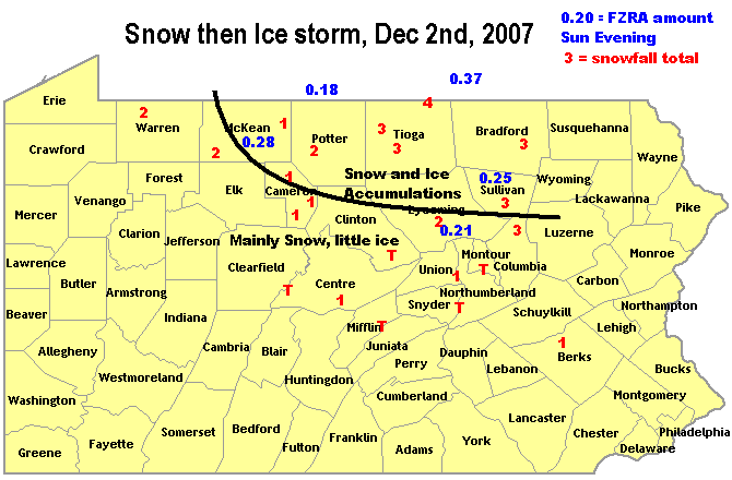
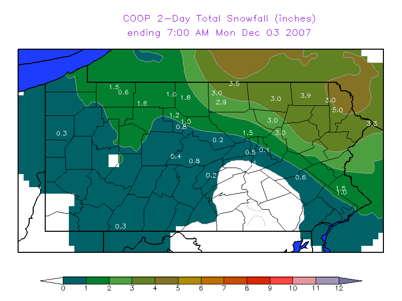
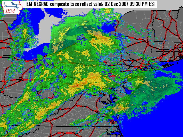
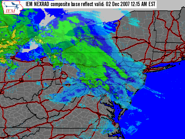
Late Saturday night, and early Sunday morning, early on the 2nd of December, a light snowfall coated the Northern and Central mountains of Pennsylvania with generally 1-3 inches of snow. The snow mixed with sleet briefly Sunday morning before it tapered off to almost nothing for most of the daylight hours on Sunday. Then, late in the day on Sunday, a second part of the same storm system brought a significant amount of rain up over the region. Much of the area was still below freezing, so freezing rain ensued - rain freezing on contact with the ground and objects. Around a quarter of an inch of ice accumulated Sunday evening over the Northern mountains as the rain came down onto cold power lines and trees. A few power outages were reported, but, the temperatures quickly warmed to above freezing - and turned the freezing rain over to plain rain Sunday night. This plain rain helped to melt away any ice accumulations through the night. So, by 7 am Monday morning, not much ice was left on the surfaces and trees. |
Media use of NWS Web News Stories is encouraged! Please acknowledge the NWS as the source of any news information accessed from this site. |
|


 Send Us a Report