
A Moderate Risk of severe thunderstorms (level 4 of 5) is in the outlook across portions of the Midwest today. Damaging winds, a few tornadoes and frequent lightning with heavy rainfall are in the forecast. Meanwhile, dangerous heat across the southern Plains into the Great Lakes, mid-Atlantic and Northeast will expand into Friday. Risk for wildfires for the central Rockies and Sacramento Valley. Read More >
Overview
It was another afternoon and evening of (mainly pulse) severe thunderstorms across Central Pennsylvania. The worst of the weather consolidated over the Harrisburg Metro area around 8 pm, and produced flooding.
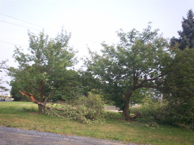
There was also sporadic severe weather earlier in the day. A number of funnel cloud reports came in during the day, but most of the severe storms produced large hail and straight-line winds.
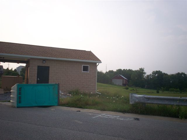
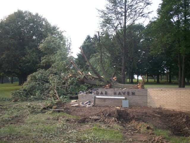
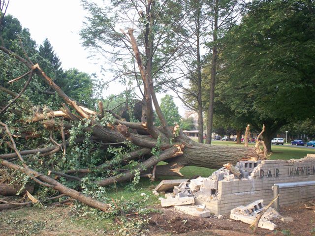
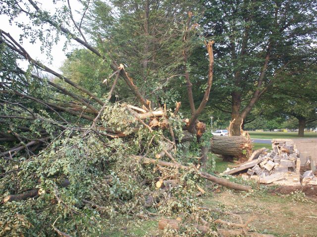
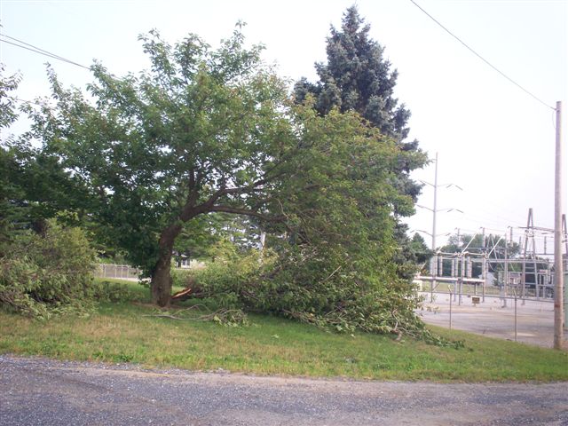
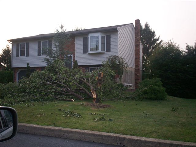
One credible report of a funnel cloud, and damage nearby, came from the Chambersburg area (at Letterkenny Army Depot) during the early afternoon. The Emergency Management Agency in Franklin County sent a team to look at this scene Monday morning, and determined the damage was most likely due to thunderstorm wind gusts, and not a tornado:
 |
 |
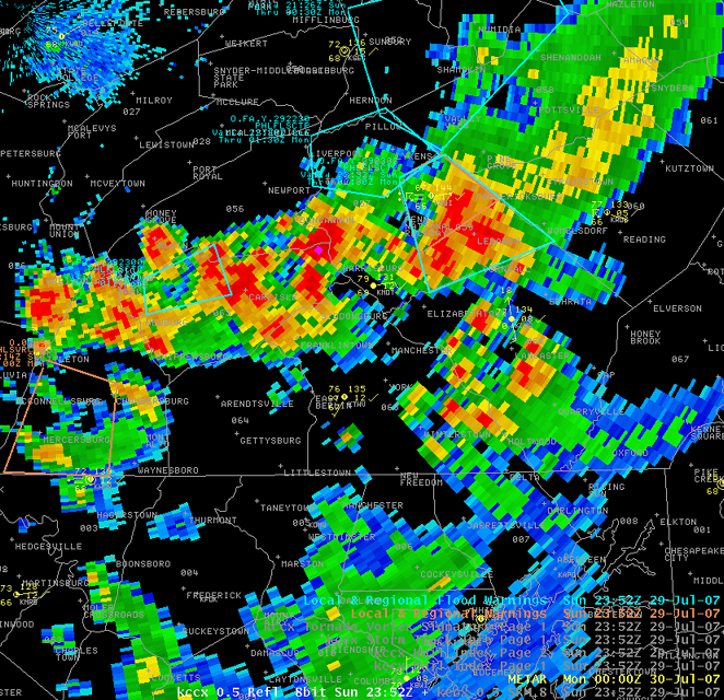 |
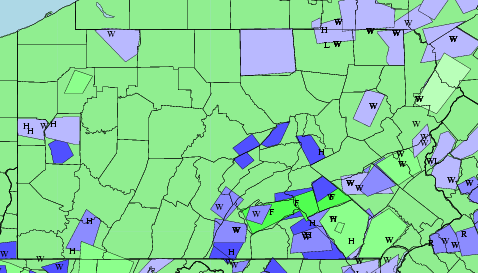
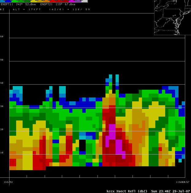
| Warnings and damage reports from 7/27/2007 thru 7/29/2007 | Reflectivity Cross Section of storm north of Harrisburg, near Marysville. This storm eventually collapsed and created a bow echo that traveled through York and western Lancaster Counties. | Cells merging over Harrisburg |
Photos & Video
Header
 |
 |
 |
 |
 |
 |
 |
 |
 |
 |
 |
 |
Downburst Report & Storm Reports
PUBLIC INFORMATION STATEMENT
NATIONAL WEATHER SERVICE STATE COLLEGE PA
1205 PM EDT MON JUL 30 2007

...PUBLIC INFORMATION STATEMENT...

...DOWNBURST WIND DAMAGED CONFIRMED IN FRANKLIN COUNTY,
PENNSYLVANIA ON SUNDAY JULY 29...

THE FOLLOWING INFORMATION IS AN ASSESSMENT OF THE DAMAGE THAT
OCCURRED AT THE LETTERKENNY ARMY DEPOT IN FRANKLIN COUNTY ON JULY 29
2007.

* EVENT DATE: JULY 29 2007

* ESTIMATED START TIME: 1205 PM EDT

* ESTIMATED END TIME: 1215 PM EDT

* EVENT TYPE: DOWNBURST WIND

* EVENT LOCATION: LETTERKENNY ARMY DEPOT FRANKLIN COUNTY PA

* PEAK WIND: 50 TO 60 MPH

* NO INJURIES REPORTED

* DISCUSSION/DAMAGE: A SLOW MOVING THUNDERSTORM WITH HEAVY RAIN
  PRODUCED A DAMAGING DOWNBURST WIND GUST EARLY SUNDAY AFTERNOON
  OVER THE EASTERN SECTION OF THE LETTERKENNEY ARMY DEPOT. THE
  DAMAGE WAS CONFINED TO AN AREA JUST WEST OF THE INTERSECTIONS OF
  ROUTES 997 AND 433 NEAR CULBERTSON STATION OR ABOUT 5 MILES
  NORTH OF CHAMBERSBURG. TWO BUILDINGS SUSTAINED PARTIAL ROOF
  DAMAGE WHICH MAY HAVE BEEN THE RESULT OF THE HEAVY RAIN AND
  PERHAPS THE WIND. AWAY FROM THE BUILDINGS A NUMBER OF TREE
  BRANCHES WERE DOWN...SOME PORTABLE SHEDS TIPPED OVER...AND TENTS
  DAMAGED OVER A HALF-MILE AREA.

* THE STORM PRODUCED AN APPARENT FUNNEL CLOUD OR ROTATING CLOUD
  DEBRIS WHICH LASTED SEVERAL MINUTES. ACCORDING TO EYEWITNESSES
  THE FUNNEL CLOUD DID NOT TOUCH THE GROUND.

$$
PRELIMINARY LOCAL STORM REPORT...SUMMARY
NATIONAL WEATHER SERVICE STATE COLLEGE PA
1231 PM EDT MON JUL 30 2007

..TIME...   ...EVENT...      ...CITY LOCATION...     ...LAT.LON...
..DATE...   ....MAG....      ..COUNTY LOCATION..ST.. ...SOURCE....
            ..REMARKS..

0247 AM     TSTM WND DMG     ORBISONIA               40.24N 77.89W
07/29/2007                   HUNTINGDON         PA   EMERGENCY MNGR

            LARGE TREE LIMBS DOWN

1210 PM     TSTM WND DMG     6 N CHAMBERSBURG        40.02N 77.66W
07/29/2007                   FRANKLIN           PA   EMERGENCY MNGR

            PARTIAL ROOF DAMAGE SUSTAINED ON THE EASTERN SECTION OF
            THE LETTERKENNY ARMY DEPOT.

1210 PM     FUNNEL CLOUD     6 N CHAMBERSBURG        40.02N 77.66W
07/29/2007                   FRANKLIN           PA   PUBLIC

            4 PUBLIC REPORTED FUNNEL CLOUDS IN VICINITY OF
            LETTERKENNY ARMY DEPOT. REPORTS RELAYED VIA FRANKLIN
            COUNTY 911 CENTER.

1220 PM     FUNNEL CLOUD     6 N CHAMBERSBURG        40.02N 77.66W
07/29/2007                   FRANKLIN           PA   TRAINED SPOTTER

0520 PM     HAIL             SHAMOKIN                40.79N 76.55W
07/29/2007  E0.88 INCH       NORTHUMBERLAND     PA   PUBLIC

0700 PM     HAIL             GREENCASTLE             39.79N 77.73W
07/29/2007  E1.00 INCH       FRANKLIN           PA   PUBLIC

0800 PM     TSTM WND DMG     LEBANON                 40.34N 76.42W
07/29/2007                   LEBANON            PA   LAW ENFORCEMENT

            TREES DOWN AND HIGHWAY SIGN DAMAGED.

0800 PM     FLASH FLOOD      CARLISLE                40.20N 77.20W
07/29/2007                   CUMBERLAND         PA   LAW ENFORCEMENT

            FLASH FLOODING...ROAD CLOSURES...AND FLOODED
            INTERSECTIONS REPORTED ACROSS CUMBERLAND COUNTY.


0829 PM     TSTM WND DMG     LINGLESTOWN             40.34N 76.79W
07/29/2007                   DAUPHIN            PA   LAW ENFORCEMENT

            TREES DOWN IN LINGLESTOWN. WIRES DOWN BETWEEN LINGLESTOWN
            AND HARRISBURG.

0830 PM     FLASH FLOOD      LEBANON                 40.34N 76.42W
07/29/2007                   LEBANON            PA   LAW ENFORCEMENT

            BRIEF FLOODING OF INTERSECTIONS.

0830 PM     FLASH FLOOD      HARRISBURG              40.28N 76.88W
07/29/2007                   DAUPHIN            PA   LAW ENFORCEMENT

            FLOODING OF URBAN INTERSECTIONS REPORTED.

0850 PM     HAIL             BAINBRIDGE              40.09N 76.67W
07/29/2007  E0.75 INCH       LANCASTER          PA   PUBLIC

            PENNY-SIZED HAIL ACCOMPANIED BY WINDS ESTIMATED TO 55 MPH.

0910 PM     TSTM WND DMG     2 W YORK                39.96N 76.77W
07/29/2007                   YORK               PA   PUBLIC

            TREES DOWN AND STREET FLOODING REPORTED IN WEST MANCHESTER TWP.
 |
Media use of NWS Web News Stories is encouraged! Please acknowledge the NWS as the source of any news information accessed from this site. |
|


 Send Us a Report