Overview
|
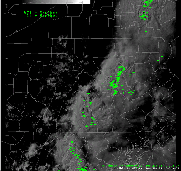
A cluster of thunderstorms fired up in the afternoon heating over New York, New Jersey and Northeastern PA. These storms then moved into Central PA - from the northeast. This storm movement was very unusual - as our predominant/usual flow pattern over Central PA makes most storms move in from the west or south or even sometimes northwest. But, northeast to southwest thunderstorm motions are rare in Central PA. |
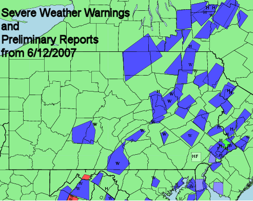 Graphical plot of severe warnings and preliminary reports. |
 |
 |
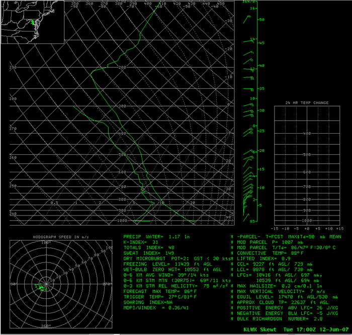 |
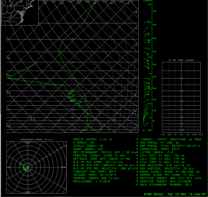
| Visible Satellite Image and Lightning Plot 7:15 pm June 12 | KLWX Skew T diagram 8:00 am June 12 | KLWX Skew T diagram 1:00 pm June 12 |
Radar
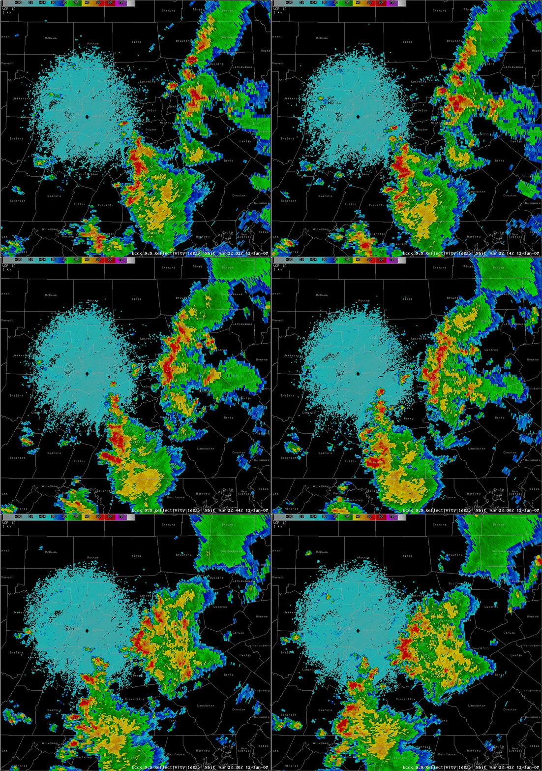 |
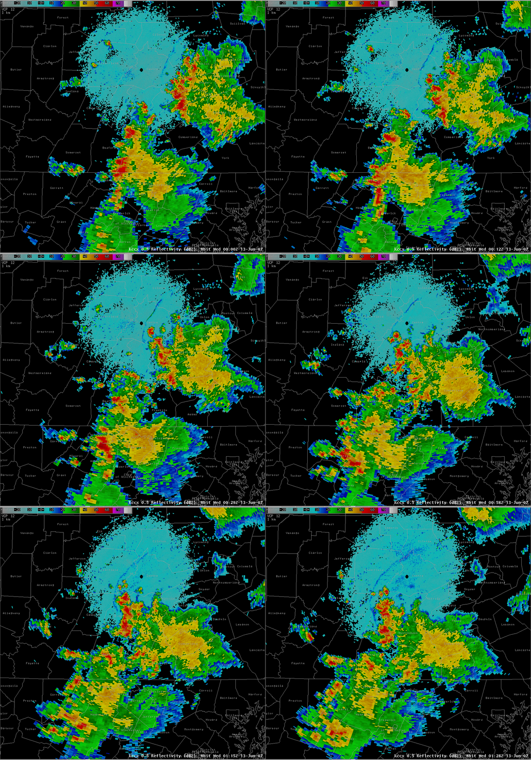 |
| KCCX 0.5 degree base reflectivity loop 6:02 to 7:43 pm June 12 | KCCX 0.5 degree base reflectivity loop 8:00 to 9:28 pm June 12 |
Storm Reports
PRELIMINARY LOCAL STORM REPORT...SUMMARY
NATIONAL WEATHER SERVICE STATE COLLEGE PA
1151 AM EDT WED JUN 13 2007

..TIME...   ...EVENT...      ...CITY LOCATION...     ...LAT.LON...
..DATE...   ....MAG....      ..COUNTY LOCATION..ST.. ...SOURCE....
            ..REMARKS..

0415 PM     TSTM WND DMG     HARPER TAVERN           40.41N 76.57W
06/12/2007                   LEBANON            PA   EMERGENCY MNGR

            TREES DOWN.

0508 PM     TSTM WND DMG     4 S HERNDON             40.65N 76.85W
06/12/2007                   NORTHUMBERLAND     PA   LAW ENFORCEMENT

            TREES DOWN ON WIRES

0545 PM     TSTM WND DMG     SSE NEWPORT             40.48N 77.13W
06/12/2007                   PERRY              PA   LAW ENFORCEMENT

            NUMEROUS TREES DOWN

0605 PM     TSTM WND DMG     BENTON                  41.19N 76.39W
06/12/2007                   COLUMBIA           PA   LAW ENFORCEMENT

            TREES DOWN.

0615 PM     TSTM WND DMG     2 SSW ORANGEVILLE       41.05N 76.43W
06/12/2007                   COLUMBIA           PA   LAW ENFORCEMENT

            TREES DOWN.

0637 PM     HAIL             HUGHESVILLE             41.24N 76.73W
06/12/2007  M1.00 INCH       LYCOMING           PA   TRAINED SPOTTER

            NICKEL TO QUARTER SIZED HAIL FELL FOR 2 MINUTES

0715 PM     TSTM WND DMG     4 NNW GREENCASTLE       39.84N 77.76W
06/12/2007                   FRANKLIN           PA   LAW ENFORCEMENT

            TREES DOWN

0925 PM     TSTM WND DMG     BELLWOOD                40.60N 78.33W
06/12/2007                   BLAIR              PA   TRAINED SPOTTER

            WIND GUST TO 61 MPH MEASURED ON A ROOFTOP ANEMOMETER.
            NUMEROUS LIMBS DOWN.

0932 PM     TSTM WND DMG     BELLWOOD                40.60N 78.33W
06/12/2007                   BLAIR              PA   LAW ENFORCEMENT

            TREES AND WIRES DOWN.

0955 PM     TSTM WND DMG     PORTAGE                 40.39N 78.68W
06/12/2007                   CAMBRIA            PA   EMERGENCY MNGR

            TREES AND WIRES DOWN MAINLY NEAR PORTAGE...BUT ALSO
            ACROSS MUCH OF THE REST OF THE COUNTY.
 |
Media use of NWS Web News Stories is encouraged! Please acknowledge the NWS as the source of any news information accessed from this site. |
 |