Overview
Scattered showers and thunderstorms formed in the very warm and humid air over the mountains of Central PA during the midday of Sunday the 29th, and another line of storms formed over Central OH. The storms over OH died through the afternoon as the moved into an unfavorable environment over Western PA, but the cells over Central PA moved into the Eastern half of the state, and began to produce copious hail.
Additional storms that fired up over Central VA moved to the left of the mean flow -- moving almost due north, and into Southeastern PA, late in the day. These storms proved to be the most dangerous, as they made very large hail, with many reports of Nickel-sized (0.88 inch) to Quarter-sized (1.00 inch) hail.
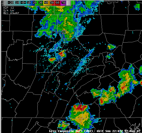 Caption |
Radar
 |
 |
 |
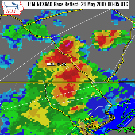 |
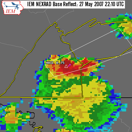
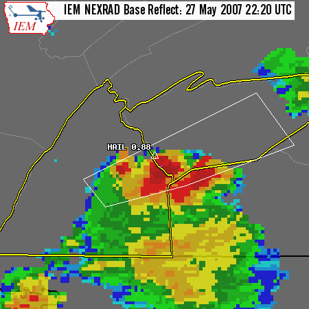
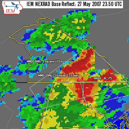
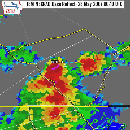
| Reflectivity plan view of Hail Storm over central Franklin County | Reflectivity plan view of Hail Storm over Southwestern Cumberland County | Reflectivity plan view of Hail Storm over Southern York County | Reflectivity plan view of Hail Storm over York County |
 |
 |
 |
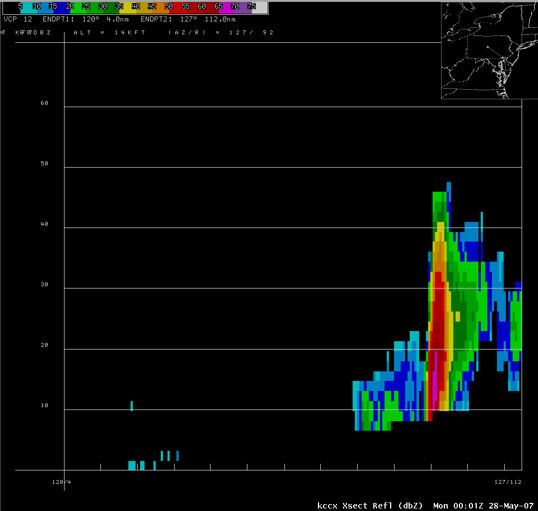 |
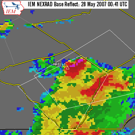
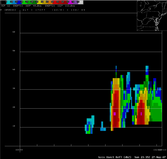
| Reflectivity plan view of Hail Storm over Lancaster County | Reflectivity plan view of Hail Storm over Lancaster County | Reflectivity Cross Section through hail storm near York County, PA | Reflectivity Cross Section through hail storm over Lancaster County, PA |
 |
| Reflectivity Cross Section through hail storm over Lancaster County, PA |
Storm Reports
NWUS51 KCTP 281348
LSRCTP
PRELIMINARY LOCAL STORM REPORT...SUMMARY
NATIONAL WEATHER SERVICE STATE COLLEGE PA
948 AM EDT MON MAY 28 2007
..TIME... ...EVENT... ...CITY LOCATION... ...LAT.LON...
..DATE... ....MAG.... ..COUNTY LOCATION..ST.. ...SOURCE....
..REMARKS..
0300 PM HAIL MILTON 41.01N 76.85W
05/27/2007 E0.75 INCH NORTHUMBERLAND PA TRAINED SPOTTER
0610 PM HAIL SCOTLAND 39.96N 77.59W
05/27/2007 U0.75 INCH FRANKLIN PA TRAINED SPOTTER
0620 PM HAIL SHIPPENSBURG 40.05N 77.52W
05/27/2007 U0.88 INCH CUMBERLAND PA PUBLIC
0630 PM HAIL SHIPPENSBURG 40.05N 77.52W
05/27/2007 U0.88 INCH CUMBERLAND PA PUBLIC
0745 PM TSTM WND DMG 3 N WILLIAMSPORT 41.28N 77.02W
05/27/2007 LYCOMING PA LAW ENFORCEMENT
TREE DOWN ON WIRES IN HEPBURN TOWNSHIP
0750 PM TSTM WND DMG LOGANVILLE 39.86N 76.71W
05/27/2007 YORK PA LAW ENFORCEMENT
MULTIPLE TREES DOWN
0750 PM TSTM WND DMG STEWARTSTOWN 39.75N 76.59W
05/27/2007 YORK PA LAW ENFORCEMENT
MULTIPLE TREES DOWN
0750 PM HAIL DELTA 39.73N 76.33W
05/27/2007 U0.75 INCH YORK PA PUBLIC
0805 PM HAIL 3 SE BROGUE 39.83N 76.41W
05/27/2007 U0.75 INCH YORK PA PUBLIC
0810 PM HAIL LANCASTER 40.04N 76.30W
05/27/2007 U1.00 INCH LANCASTER PA PUBLIC
0812 PM HAIL LANCASTER 40.04N 76.30W
05/27/2007 U0.88 INCH LANCASTER PA PUBLIC
0824 PM HAIL AKRON 40.16N 76.20W
05/27/2007 U1.00 INCH LANCASTER PA PUBLIC
0841 PM HAIL EPHRATA 40.18N 76.18W
05/27/2007 M1.00 INCH LANCASTER PA TRAINED SPOTTER
&&
$$
MMD
GAD
 |
Media use of NWS Web News Stories is encouraged! Please acknowledge the NWS as the source of any news information accessed from this site. |
 |