
A very active spring pattern with tropical concerns across the Pacific. Heavy rainfall will continue to impact Hawaii this weekend. Meanwhile we continue to monitor a developing typhoon that may affect Guam into early next week. For the Lower 48, heavy snow for mountains of California this weekend, increase threat for severe thunderstorms next week for the Plains and record warmth spreads east. Read More >
Overview
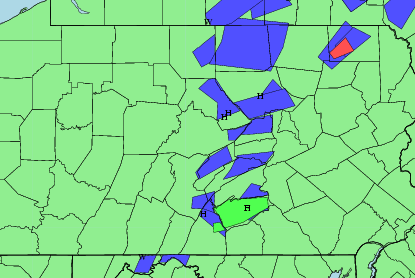
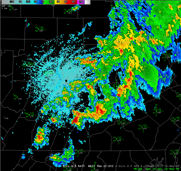
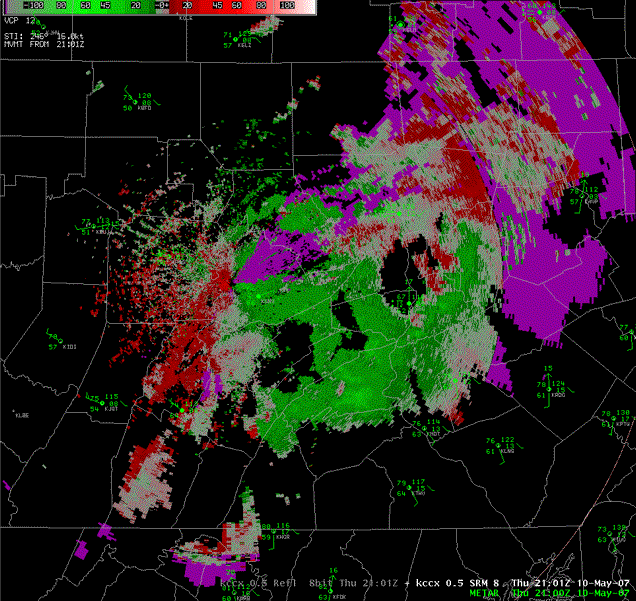
Showers and thunderstorms formed in a moist airmass over Central PA during the late morning and early afternoon on May 10th. These storms had little wind shear to make them move or to create wind damage through mixing, but the temperatures aloft were conducive to make hail.
 |
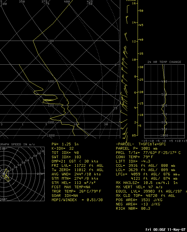 |
| Graphic of issued severe weather alerts. | 00z sounding from Sterling, VA |
Radar
Note in the Reflectivity Cross section below the amount of high returns in the mid level of the storm. The freezing level was around 12kft this day.
 |
 |
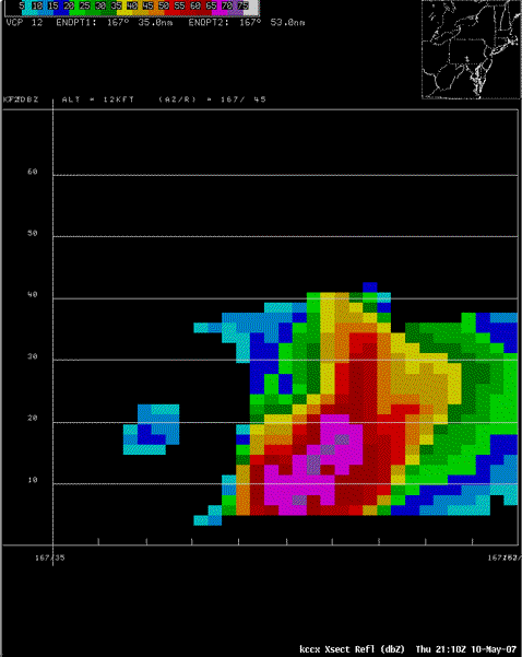 |
| Reflectivity plan view from 2101z | Storm Relative Motion from 2101z | Reflectivity Cross Section through hail storm Northwest of Shippensburg, PA |
Storm Reports
NWUS51 KCTP 110031
LSRCTP
PRELIMINARY LOCAL STORM REPORT...CORRECTED
NATIONAL WEATHER SERVICE STATE COLLEGE PA
831 PM EDT THU MAY 10 2007
..TIME... ...EVENT... ...CITY LOCATION... ...LAT.LON...
..DATE... ....MAG.... ..COUNTY LOCATION..ST.. ...SOURCE....
..REMARKS..
0200 PM HAIL MILL HALL 41.10N 77.49W
05/10/2007 E0.75 INCH CLINTON PA TRAINED SPOTTER
PENNY SIZE HAIL
0214 PM HAIL LOCK HAVEN 41.14N 77.45W
05/10/2007 E0.75 INCH CLINTON PA TRAINED SPOTTER
REPORTED AT LOCK HAVEN AIRPORT
0215 PM HAIL COGAN STATION 41.31N 77.03W
05/10/2007 E1.00 INCH LYCOMING PA TRAINED SPOTTER
0535 PM HAIL 2 N WILLOW HILL 40.14N 77.77W
05/10/2007 E1.00 INCH FRANKLIN PA PUBLIC
0610 PM HAIL N CARLISLE 40.20N 77.20W
05/10/2007 M0.88 INCH CUMBERLAND PA TRAINED SPOTTER
0715 PM FLASH FLOOD N CARLISLE 40.20N 77.20W
05/10/2007 CUMBERLAND PA TRAINED SPOTTER
INTERSECTIONS FLOODED AND CREEKS RISING.
0806 PM FLASH FLOOD CARLISLE 40.20N 77.20W
05/10/2007 CUMBERLAND PA EMERGENCY MNGR
WATER RESCUE REPORTED IN SILVER SPRING TOWNSHIP. 3.5
INCHES OF RAINFALL BETWEEN 5 AND 8PM IN CARLISLE.
&&
$$
 |
Media use of NWS Web News Stories is encouraged! Please acknowledge the NWS as the source of any news information accessed from this site. |
 |