Overview
This was a very interesting storm. The storm fired up in the heat and instability over Western Pennsylvania during the late afternoon of July 10th, 2006. It showed very strong cyclonic rotation as it passed to the south of Emlenton, PA (along I-80), knocking down trees in Brady's Bend, PA (Armstrong Co).
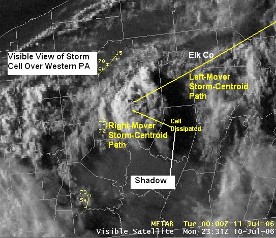
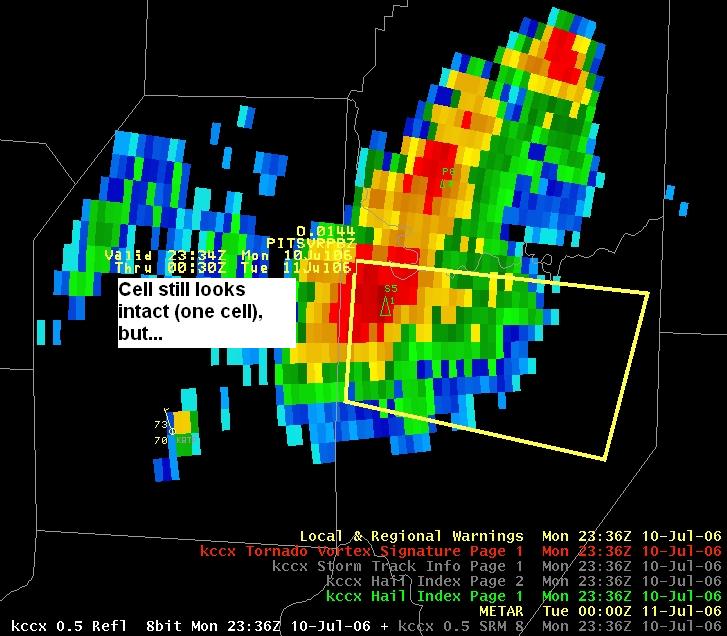
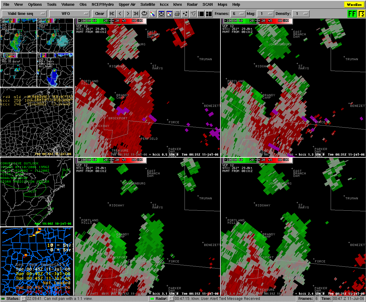
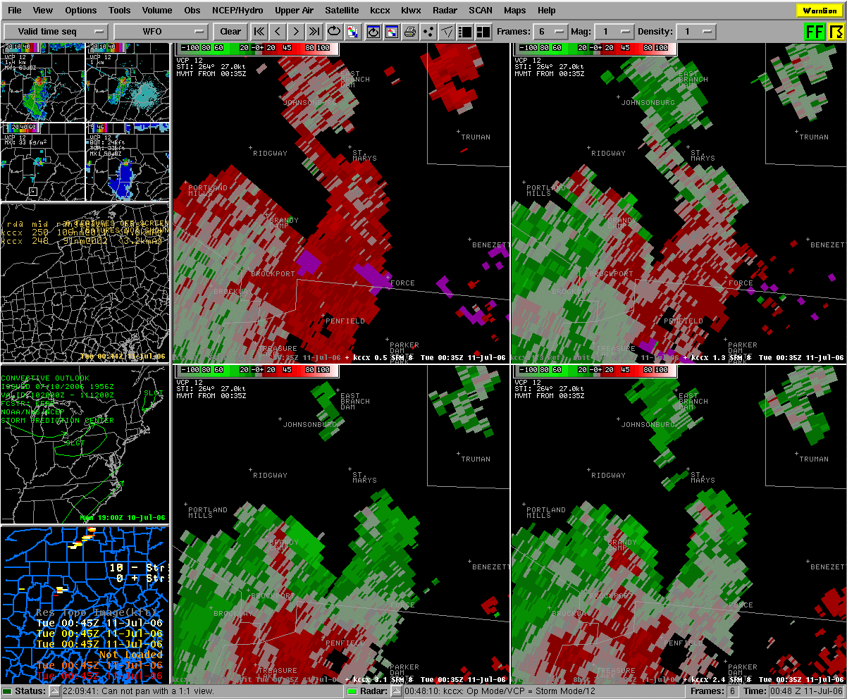
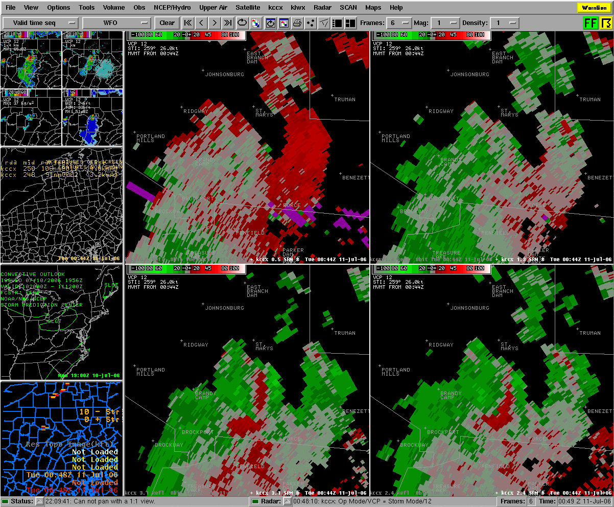
The storm then began to split as it moved eastward. The left-half of the split-cell moved northeastward into Elk County, PA, and the entire cell was rotating anti-cyclonically (clockwise) - which is unusual.
The Southern/Right-moving/cyclonically-rotating half of the cell moved into Indiana County and fell apart, as it moved into an area cooled-off by it's own shadow and anvil-rain.
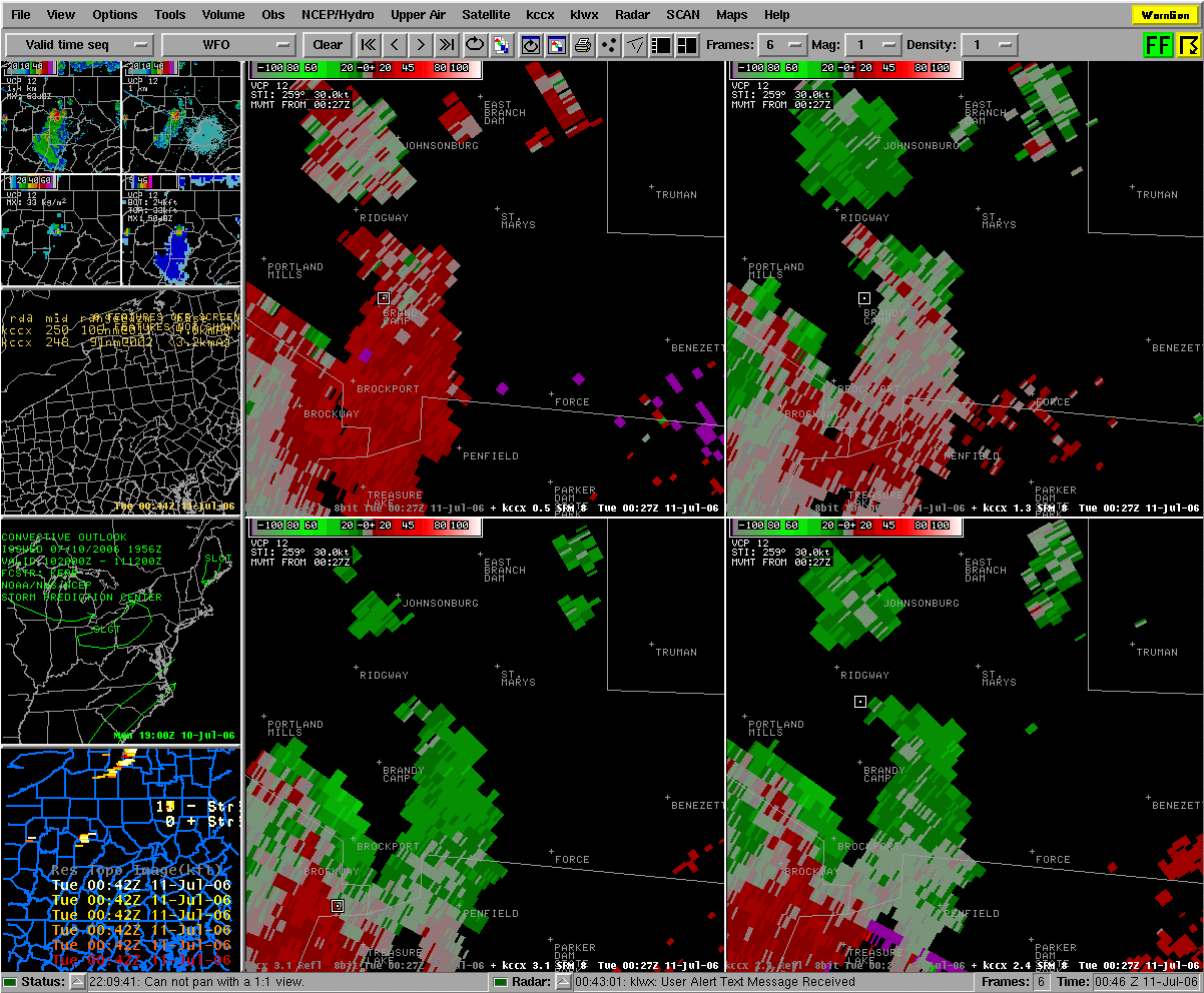
The Northern/Left-moving/anti-cyclonically rotating cell had rotation so strong and deep, that it prompted Severe Thunderstorm Warnings for Elk and Cameron Counties. Little if any damage was reported in those areas, as the cell crossed through the very sparsely-populated State Forest land over the north-central mountains.
However, as the storm cell continued to move to the east-northeast, the storm's rotation changed back to mainly cyclonic (counter-clockwise) rotation, and eventually made damage in Mansfield, PA (Tioga County), and downstream in Athens, PA (Bradford Co) and on toward Binghamton, NY.
 |
 |
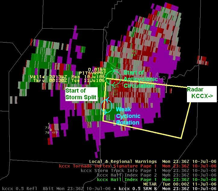 |
| Satellite Image of Storm as it began to split over Western PA | KCCX 0.5deg Reflectivity (Z) of Storm as it began to split over Western PA | KCCX 0.5deg Storm Relative Motion (SRM) of Storm as it began to split over Western PA |
Radar
 |
 |
 |
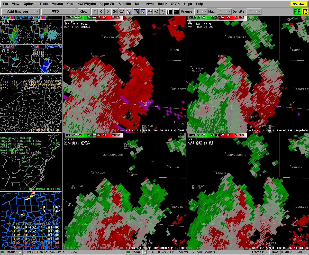 |
| Storm Relative Motion Four-Panel of Elk County Storm | Storm Relative Motion Four-Panel of Elk County Storm | Storm Relative Motion Four-Panel of Elk County Storm | Storm Relative Motion Four-Panel of Elk County Storm |
 |
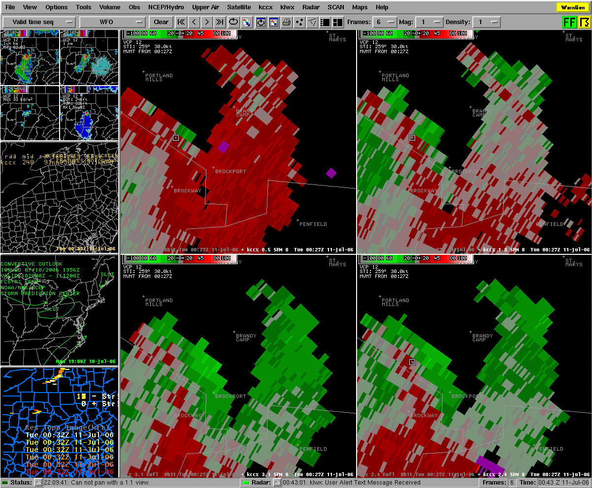 |
| Storm Relative Motion Four-Panel of Elk County Storm | Storm Relative Motion Four-Panel of Elk County Storm |
Storm Reports
- - DDHHMM
WRKMMD
PRELIMINARY LOCAL STORM REPORT
NATIONAL WEATHER SERVICE PITTSBURGH PA
824 PM EDT MON JUL 10 2006
..TIME... ...EVENT... ...CITY LOCATION... ...LAT.LON...
..DATE... ....MAG.... ..COUNTY LOCATION..ST.. ...SOURCE....
..REMARKS..
0740 PM TSTM WND DMG BRADYS BEND 41.00N 79.63W
07/10/2006 ARMSTRONG PA EMERGENCY MNGR
MULTIPLE TREES DOWN
&&
PRELIMINARY LOCAL STORM REPORT
NATIONAL WEATHER SERVICE STATE COLLEGE PA
1039 PM EDT MON JUL 10 2006
..TIME... ...EVENT... ...CITY LOCATION... ...LAT.LON...
..DATE... ....MAG.... ..COUNTY LOCATION..ST.. ...SOURCE....
..REMARKS..
1020 PM TSTM WND DMG MANSFIELD 41.81N 77.08W
07/10/2006 TIOGA PA LAW ENFORCEMENT
TREES DOWN
&&
PRELIMINARY LOCAL STORM REPORT
NATIONAL WEATHER SERVICE BINGHAMTON NY
1217 AM EDT TUE JUL 11 2006
..TIME... ...EVENT... ...CITY LOCATION... ...LAT.LON...
..DATE... ....MAG.... ..COUNTY LOCATION..ST.. ...SOURCE....
..REMARKS..
1055 PM TSTM WND DMG ATHENS 41.95N 76.52W
07/10/2006 BRADFORD PA LAW ENFORCEMENT
TREES DOWN
1115 PM TSTM WND DMG OWEGO 42.10N 76.26W
07/10/2006 TIOGA NY LAW ENFORCEMENT
TREES DOWN ON WIRE
&&
 |
Media use of NWS Web News Stories is encouraged! Please acknowledge the NWS as the source of any news information accessed from this site. |
 |