Overview
By: Dave Ondrejik (WCM), John La Corte (Senior Forecaster),Greg DeVoir (Senior Forecaster), Robert Radzanowski (Forecaster), Aaron Tyburski (Forecaster) Peter Jung (SSH), Ron Holmes (ITO), Les Thario (ESA), and Victor Cruz (HMT)
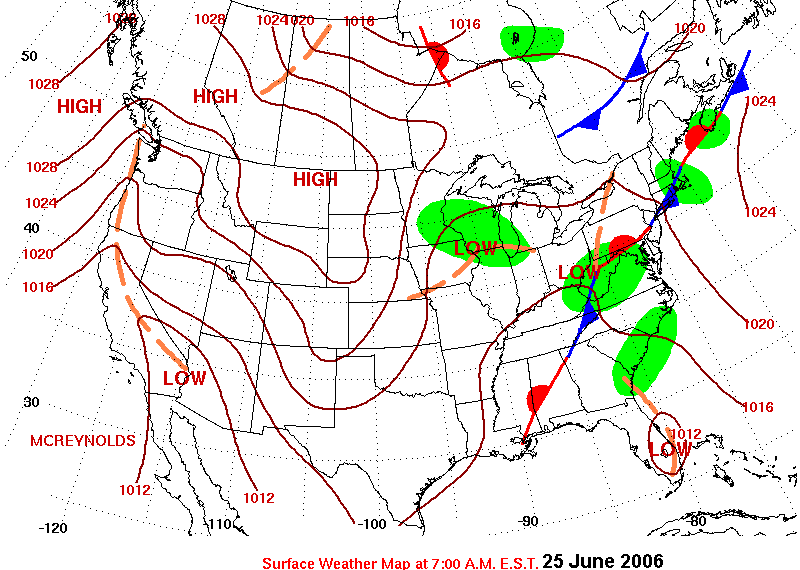
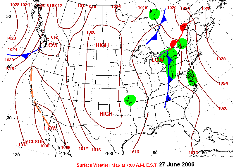
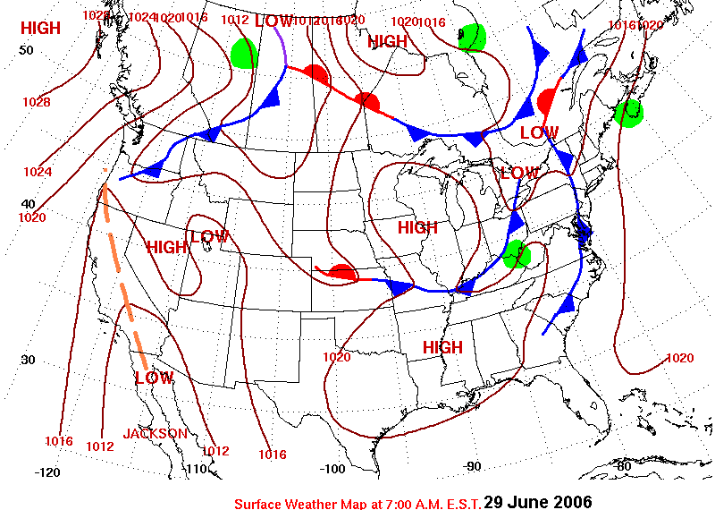
The combination of a stalled surface front, an upper trough over the Midwest, and an anomalous upper ridge over the western North Atlantic caused heavy rains and serious flooding over portions of Central Pennsylvania beginning on Tuesday 27 June, and continuing into the end of the week.
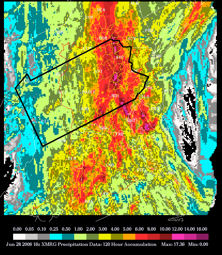
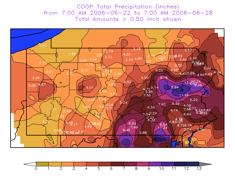
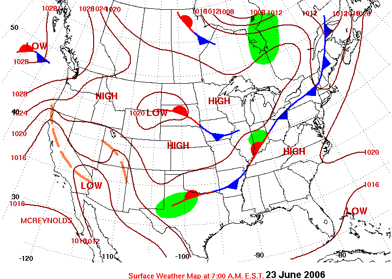
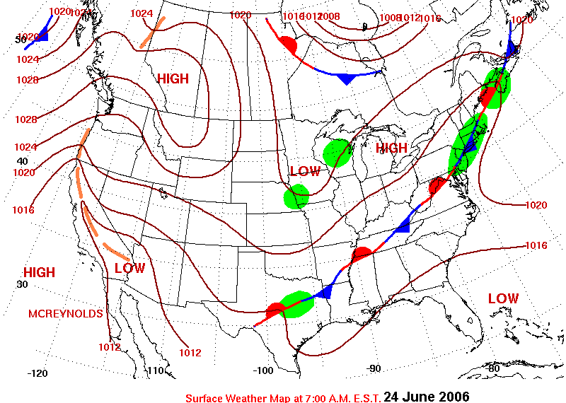
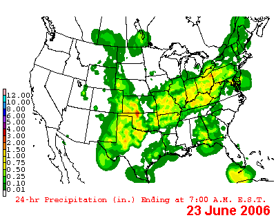
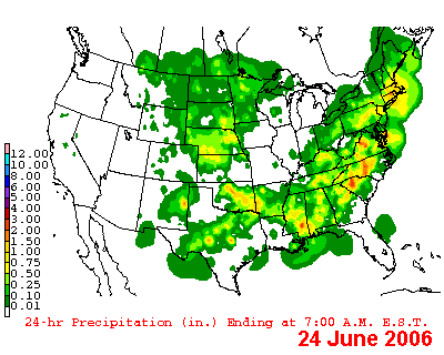
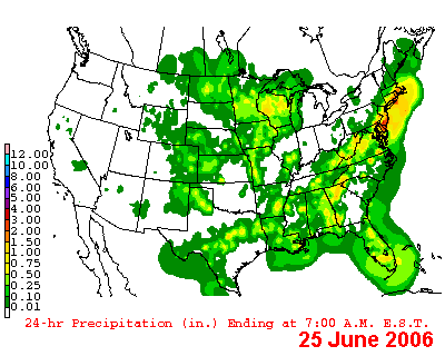
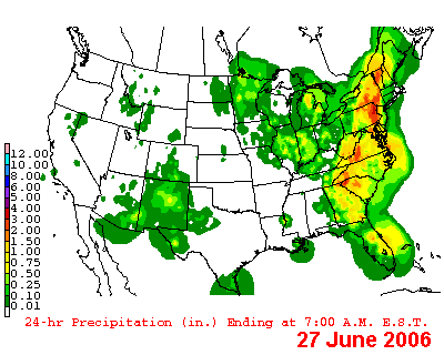
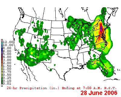
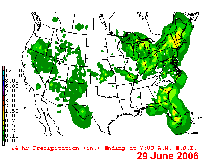
On Friday 23 June, a weak surface cold front moved through Pennsylvania accompanied by scattered convection. Parts of the central mountains and Laurel Highlands received more than an inch of rain, with most locations seeing a quarter to a half inch. The front then stalled just south of the region providing a focus for heavy convective rains that at first affected only far southeastern parts of the state, then gradually moved northward over the weekend resulting in more widespread heavy rains Sunday through Tuesday. Over a period of several days, beginning during the weekend, most locations in central Pennsylvania received more than 3 inches of rain (see graphics below), with some eastern locations seeing more than a foot of rain from the entire event (Holtwood Dam had 13.01 inches). See Table 1 for an unofficial list of the rain totals for the several day period of heavy rain, and the images below for plots/contours of precipitation reports and estimates.
Ensemble models, as well as NCEP operational runs of the GFS and NAM models, began zeroing in on the heavy rain potential days in advance. As early as the morning of 22 June, MREF forecasts began portraying the development of an anomalous ridge over the western Atlantic, and a trough over the Midwest which was forecast to become quasi- stationary throughout the weekend and continue into at least Tuesday of the following week. This resulted in the development of a strong low level jet on the order of 40 to 50kt out of the south-southeast (3-5 standard deviations above normal) along with a plume of deep tropical moisture as evidenced by precipitable water forecasts near or above 2 inches (2-3 standard deviations above normal) which persisted for several days.
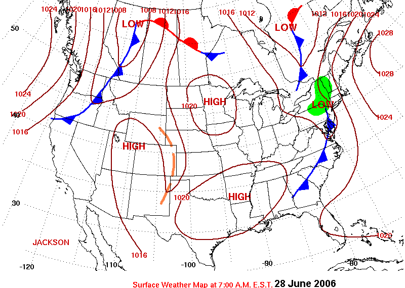
The last of the widespread heavy rain moved up and through the region during the day Tuesday before moving east of the region quicker than expected early Wednesday morning. Rainfall of between about 2 and 6 inches fell from Franklin County east and north up through Sullivan County in the northeast. This final slug of rain resulted in widespread county and flash flooding, as well as river flooding over much of the lower Susquehanna Valley.
 |
 |
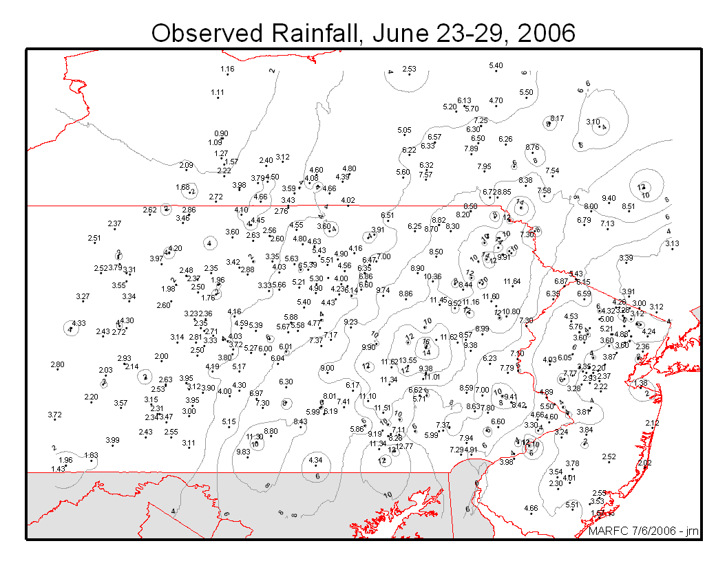 |
| MultiSensor Precipitation Estimate plot for the week. | CoOperative Observer Precipitation Totals for the week. | Point Plot of Observed Rainfall for the week, automatic and manual gages. |
Flooding
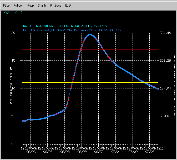
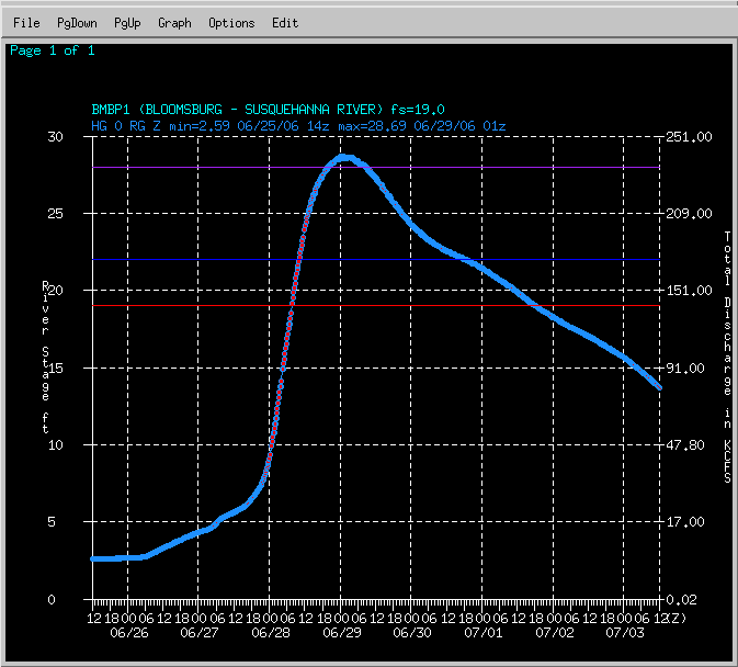
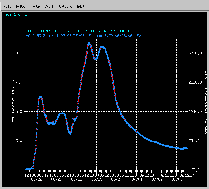
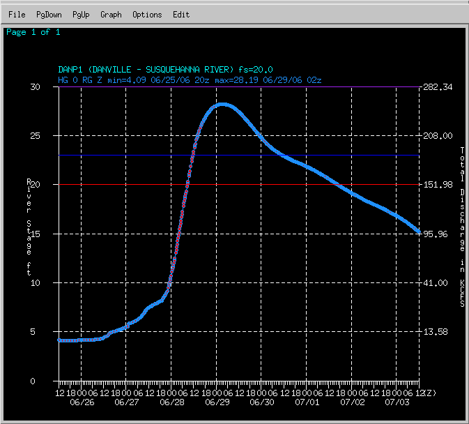
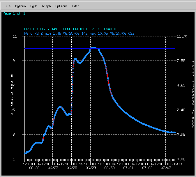
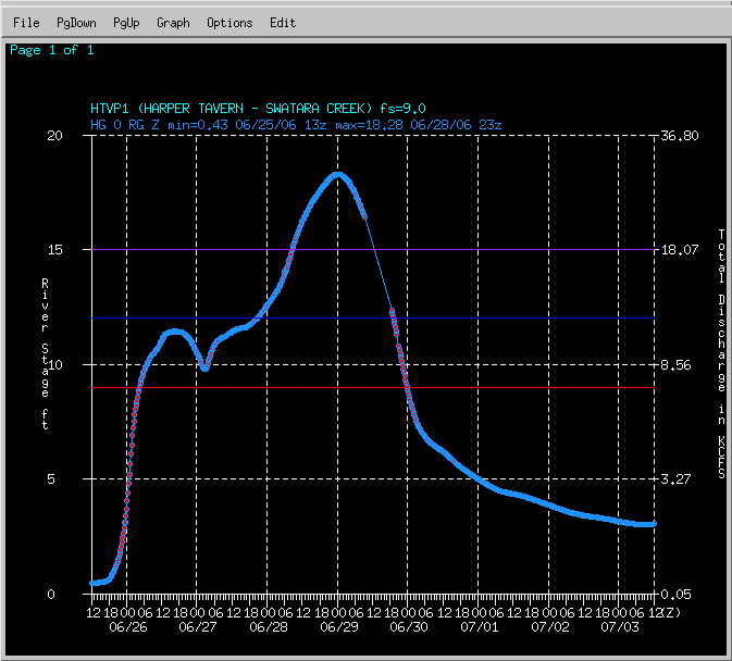
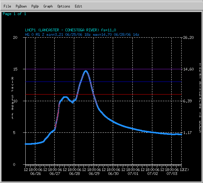
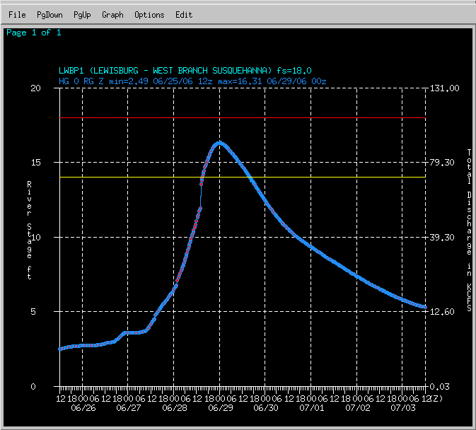
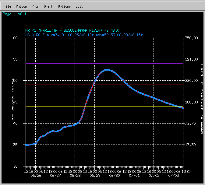
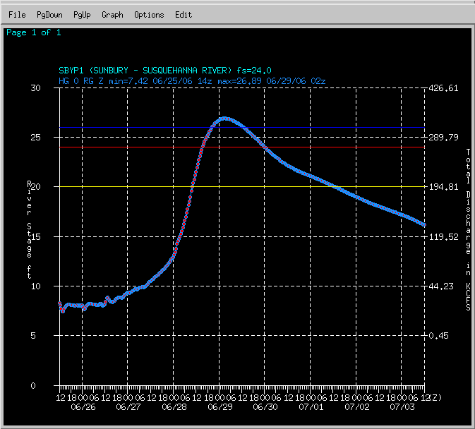
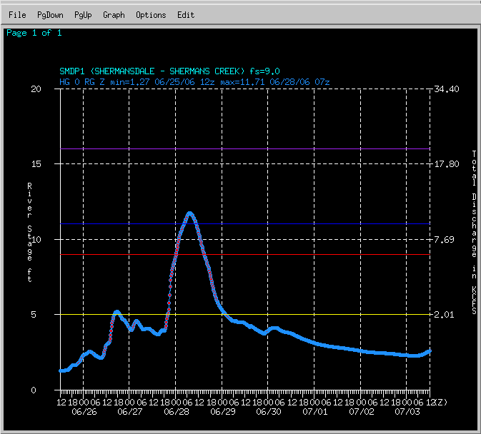
Hydrographs
 |
 |
 |
 |
| HARP1 | BMBP1 | CPHP1 | DANP1 |
 |
 |
 |
 |
| HGSP1 | HTVP1 | LNCP1 | LWBP1 |
 |
 |
 |
|
| MRTP1 | SBYP1 | SDMP1 |
Surface Plots
 |
 |
 |
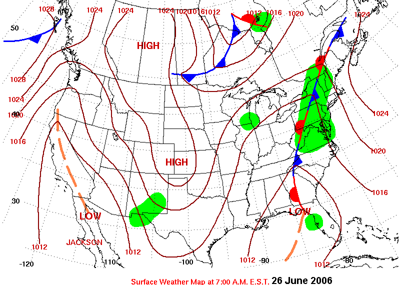 |
| Surface Plot June 23, 2006 | Surface Plot June 24, 2006 | Surface Plot June 25, 2006 | Surface Plot June 26, 2006 |
 |
 |
 |
|
| Surface Plot June 27, 2006 | Surface Plot June 28, 2006 | Surface Plot June 29, 2006 |
Rainfall Reports Table
| ADAMS COUNTY | |
| ORRTANNA | 11.53 |
| BIGLERVILLE | 7.49 |
| BEDFORD COUNTY | |
| BUFFALO MILLS | 4.49 |
| EVERETT | 2.83 |
| BLAIR COUNTY | |
| WILLIAMSBURG | 3.03 |
| TYRONE | 1.84 |
| CAMBRIA COUNTY | |
| PRINCE GALLITZIN STATE PARK | 3.00 |
| CAMERON COUNTY | |
| EMPORIUM | 4.06 |
| SINNEMAHONING | 2.14 |
| STEVENSON DAM | 2.14 |
| CENTRE COUNTY | |
| CLARENCE | 3.65 |
| PHILIPSBURG | 2.94 |
| CLEARFIELD COUNTY | |
| GRAMPIAN | 5.01 |
| CLINTON COUNTY | |
| LOCK HAVEN | 4.62 |
| RENOVO | 2.06 |
| COLUMBIA COUNTY | |
| BENTON | 9.75 |
| CUMBERLAND COUNTY | |
| PINE GROVE FURNACE | 8.84 |
| DAUPHIN COUNTY | |
| HERSHEY | 7.29 |
| HARRISBURG | 7.27 |
| ELK COUNTY | |
| RIDGWAY | 2.70 |
| FRANKLIN COUNTY | |
| SOUTH MOUNTAIN | 9.45 |
| HUNTINGDON COUNTY | |
| HUNTINGDON | 4.04 |
| HESSTON | 3.72 |
| LANCASTER COUNTY | |
| HOLTWOOD DAM | 13.01 |
| SAFE HARBOR DAM | 11.34 |
| MILLERSVILLE | 6.58 |
| LYCOMING COUNTY | |
| SOUTH WILLIAMSPORT | 4.90 |
| MCKEAN COUNTY | |
| KANE | 2.67 |
| PORT ALLEGANY | 2.61 |
| MIFFLIN COUNTY | |
| LEWISTOWN | 5.24 |
| MONTOUR COUNTY | |
| DANVILLE | 9.14 |
| NORTHUMBERLAND COUNTY | |
| SUNBURY | 5.66 |
| POTTER COUNTY | |
| OSWAYO | 2.79 |
| SCHUYLKILL COUNTY | |
| MAHANOY CITY | 8.40 |
| SNYDER COUNTY | |
| SELINSGROVE | 7.55 |
| SOMERSET COUNTY | |
| LAUREL SUMMIT | 4.48 |
| SOMERSET | 4.17 |
| CONFLUENCE | 3.56 |
| GLENCOE | 3.41 |
| MEYERSDALE | 2.48 |
| SULLIVAN COUNTY | |
| LAPORTE | 6.25 |
| TIOGA COUNTY | |
| COVINGTON | 10.40 |
| COVINGTON | 4.99 |
| SABINSVILLE | 4.50 |
| COWANESQUE DAM | 3.42 |
| WELLSBORO | 2.54 |
| UNION COUNTY | |
| LEWISBURG | 4.72 |
| YORK COUNTY | |
| YORK HAVEN DAM | 6.32 |
| HANOVER | 5.88 |
Rain Reports Maps
 |
 |
 |
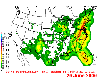 |
| 24 Hour Precipitation June 23 | 24 Hour Precipitation June 24 | 24 Hour Precipitation June 25 | 24 Hour Precipitation June 26 |
 |
 |
 |
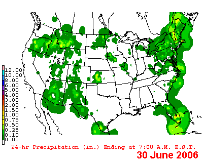 |
| 24 Hour Precipitation June 27 | 24 Hour Precipitation June 28 | 24 Hour Precipitation June 29 | 24 Hour Precipitation June 30 |
Hydrologic Impacts
Heavy rain associated with a stalled frontal boundary and the remnants from a weak tropical system affected the CTP Hydrologic Service Area (HSA) for about a week. Flooding came in several waves, with one round of Flash Flooding on Sunday June 25th, a second round of Flash Flooding and the onset of river flooding on the 26th, then significant widespread Flash Flooding and River Flooding on the 27th . Flooding from smaller streams and creeks subsided on the 28th , but River flooding persisted until the morning of July 1st .
Because of the nature of the rainfall, Flash Flood warnings were issued several times for many CTP counties. Flood waters would recede, only to once again rise with the next batch of heavy rain. A widespread rainfall during Tuesday and Tuesday night with the remnants of a weak tropical system (that was never a tropical depression or cyclone) ended the event.
River Flood Warnings were issued for several smaller Susquehanna tributaries on June 25th, only to be cancelled later when the first round of heavy rain was less widespread than originally expected.
A majority of the River Flood Warnings were issued on the 27th. Again, these were well in advance of any flooding. During the afternoon of the 27th, significant upward revisions to existing flood warnings were made. This was based on the inclusion of much higher and widespread QPF Forecasts than previously incorporated into the river model. Ultimately, the areal extent of the heavy rainfall was lower than projected, and shifted eastward by 50 to 75 miles. This shift brought considerably less rain (and hence runoff) into the West Branch and Chemung basins, which feed into the Main Stem Susquehanna. This made considerable differences in the hydrologic forecasts (lowered) for the Main Stem Susquehanna River in the CTP HSA, and updated forecasts were issued.
Even with the downward revisions, Moderate, Major and even Record category flooding was observed at 11 of the 12 CTP forecast locations which did flood. (Harrisburg only reached the Minor Flooding category). Hershey on Swatara Creek recorded a new record stage of 16.12 feet on the 29th. The old record was 15.4 feet set in 1975 due to the Remnants of Hurricane Eloise. It should be noted, however, that records at Hershey began after Hurricane Agnes, and anecdotal accounts rate that flooding as higher than the current event.
At this time there appear to have been no deaths in the CTP HAS related to flooding. However, several fatalities were being investigated as possible flood related deaths.
Widespread damage was noted throughout the eastern third of the CTP HSA, and throughout all of Eastern Pennsylvania. This included a number of washed out roads and bridges, as well as numerous water rescues.
Summary of River Flooding
Summary of Flash Flooding
 |
Media use of NWS Web News Stories is encouraged! Please acknowledge the NWS as the source of any news information accessed from this site. |
 |