
Widespread life-threatening flash and urban flooding continues in south-central Texas, with considerable flooding impacts possible across central Texas. Wildfire smoke is impacting air quality across much of the Great Lakes region into southern New England and the Mid-Atlantic. Monsoonal thunderstorms may produce isolated to scattered flash flooding across the Southwest into the Great Basin. Read More >
Overview
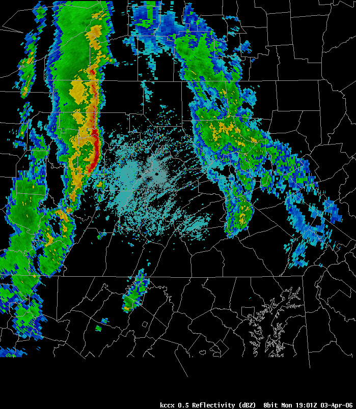
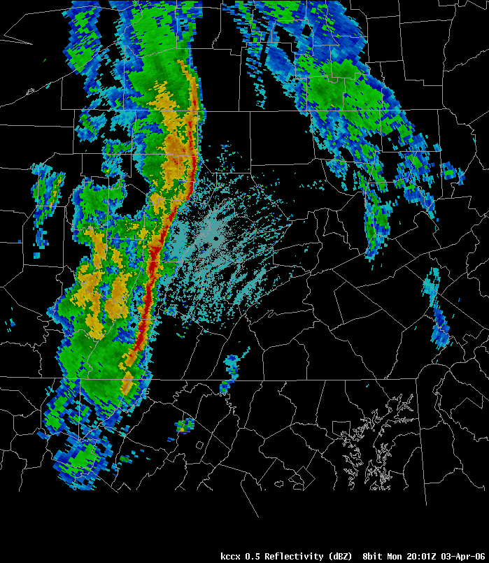
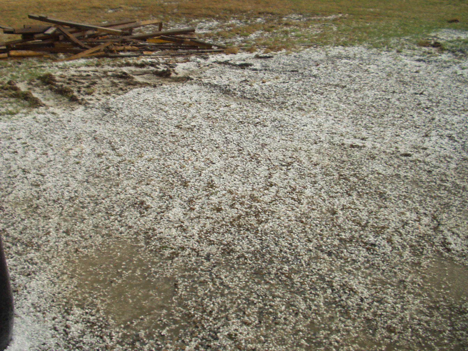
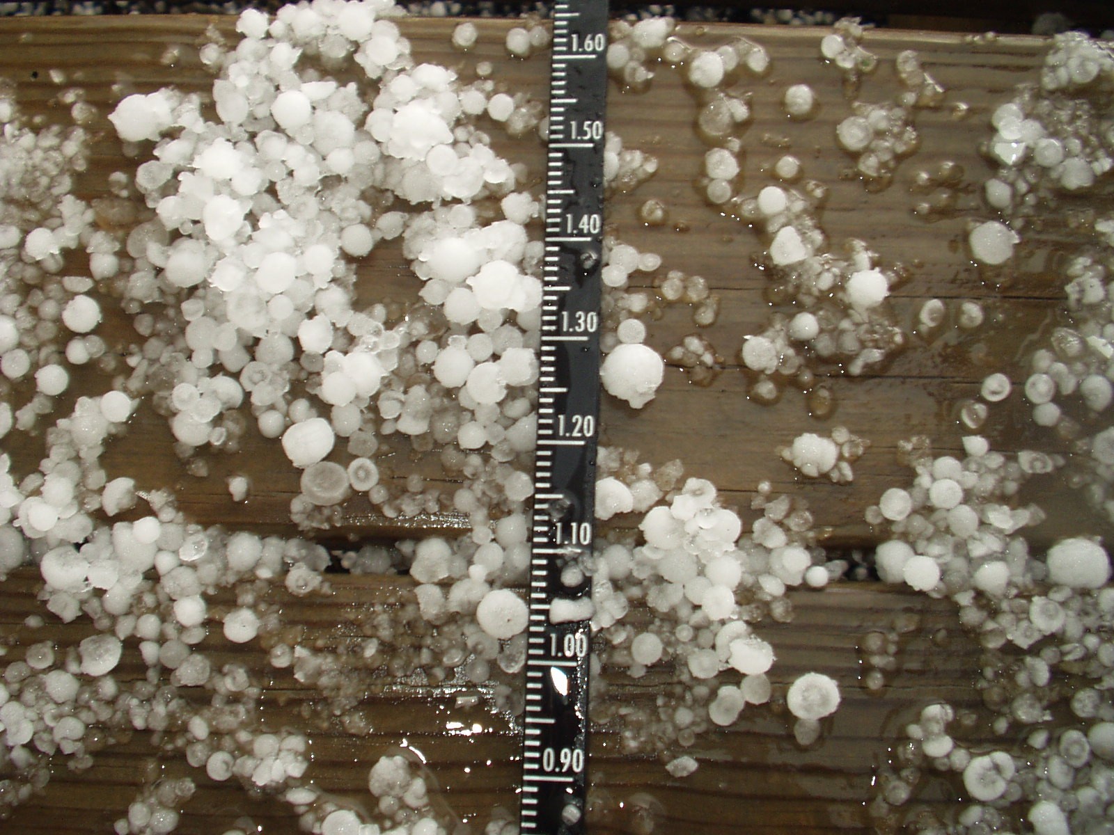
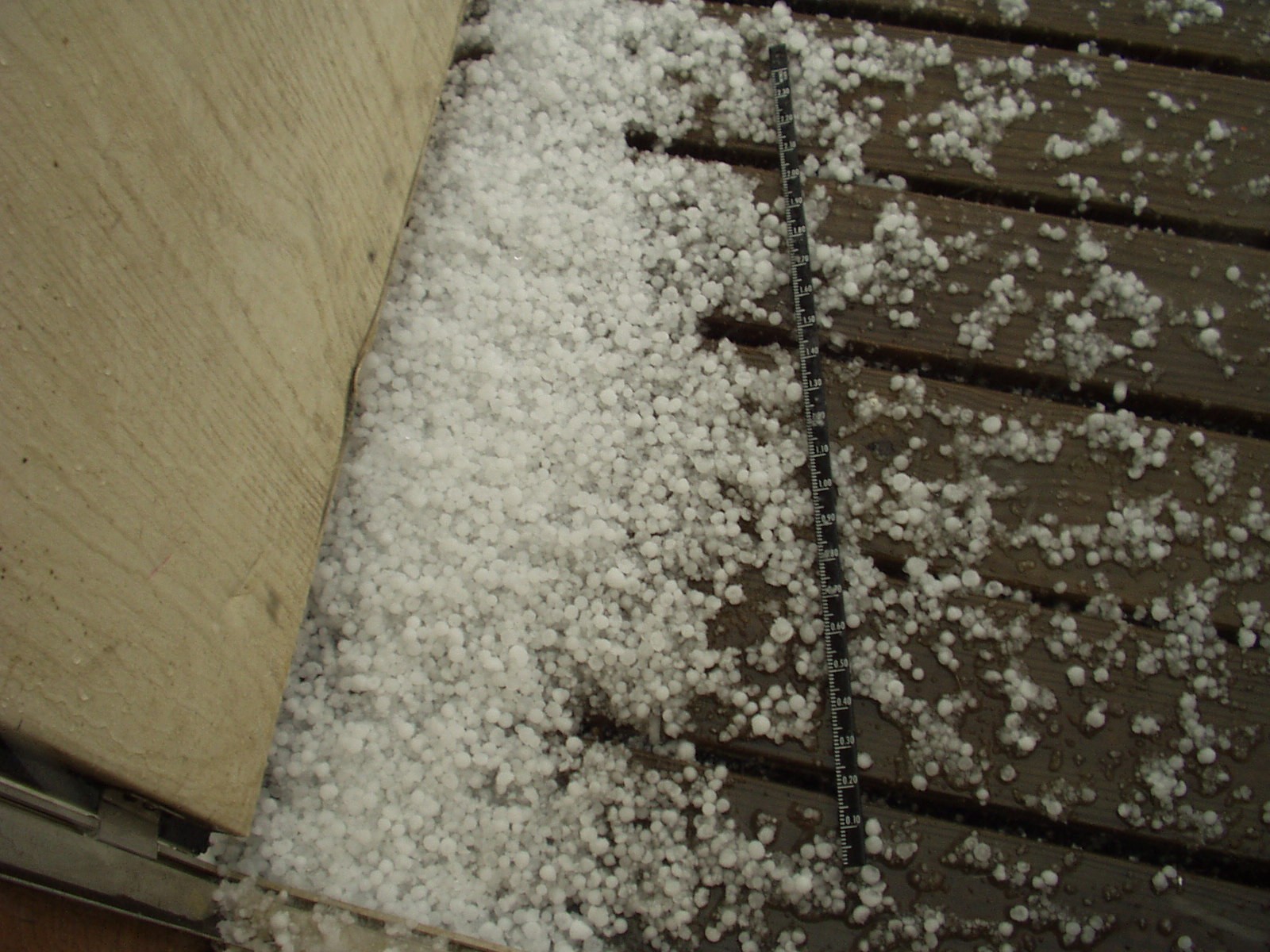
A line of storms moved into Western Pennsylvania during the afternoon of April 3rd, 2006, and produced large amounts of small hail. A few reports of wind damage in large/damaging hail were received from Warren County (Northwestern PA), but all the rest of the hail was smaller than pennies - which is the threshold for severe/damaging hail.
The unusual thing about these storms is that they made copious amounts of small hail - as it covered the ground in many places in the Laurel Highlands and Allegheny Plateau.
 |
 |
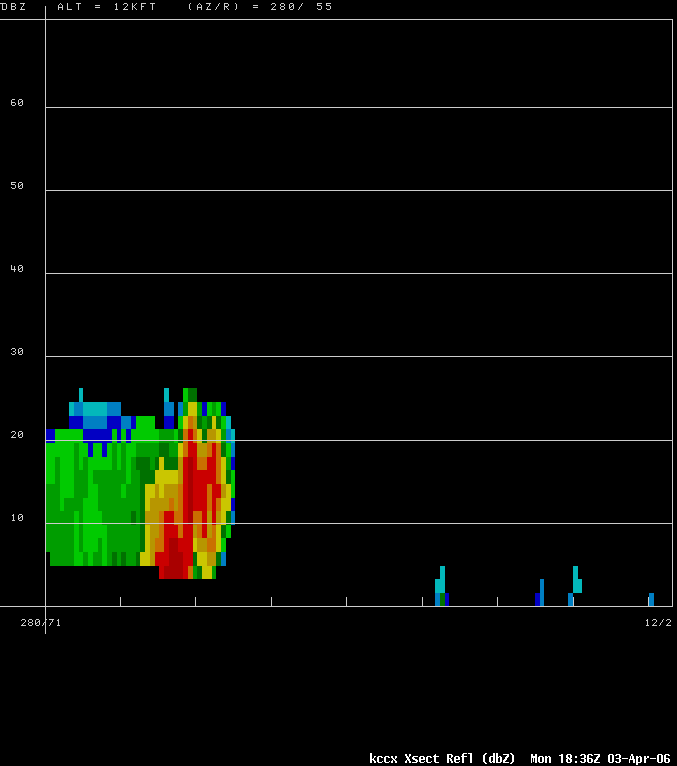 |
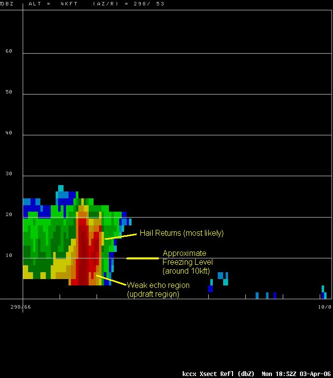
| Reflectivity plan view from 1901z with line of storms entering west-central PA | Reflectivity plan view from 2001z with line of storms producing lots of small hail | Reflectivity Cross Section through hail storm near DuBois, PA |
 |
 |
|
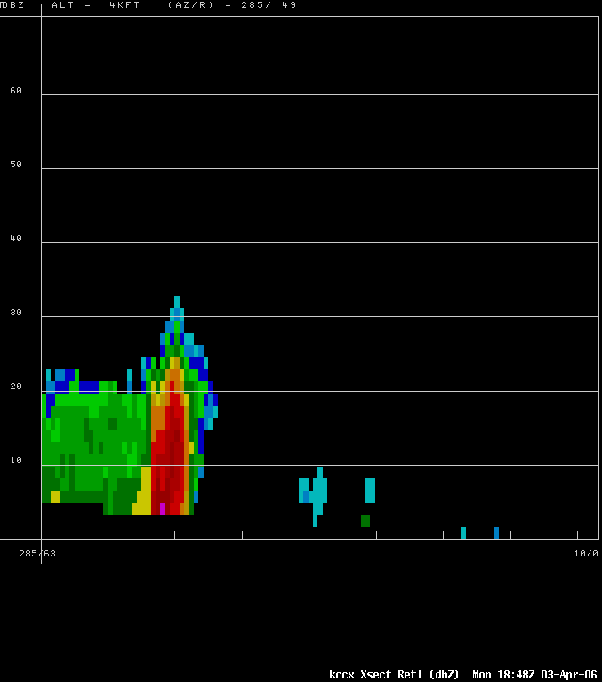
| Reflectivity Cross Section through hail storm | Reflectivity Cross Section through hail storm |
Photos & Video
 |
 |
 |
Storm Reports
NWUS51 KCTP 041103
LSRCTP
PRELIMINARY LOCAL STORM REPORT...CORRECTED
NATIONAL WEATHER SERVICE STATE COLLEGE PA
703 AM EDT TUE APR 04 2006
..TIME... ...EVENT... ...CITY LOCATION... ...LAT.LON...
..DATE... ....MAG.... ..COUNTY LOCATION..ST.. ...SOURCE....
..REMARKS..
0204 PM TSTM WND DMG 5 SE COLUMBUS 41.90N 79.51W
04/03/2006 WARREN PA EMERGENCY MNGR
TREES AND WIRES DOWN NEAR COLUMBUS ON RT 426
0242 PM HAIL WARREN 41.84N 79.14W
04/03/2006 M0.88 INCH WARREN PA TRAINED SPOTTER
0322 PM HAIL TREASURE LAKE 41.17N 78.72W
04/03/2006 E0.50 INCH CLEARFIELD PA TRAINED SPOTTER
PEA TO MARBLE SIZED HAIL COVERING THE GROUND.
0325 PM HAIL DUBOIS 41.12N 78.76W
04/03/2006 E0.25 INCH CLEARFIELD PA TRAINED SPOTTER
PEA TO MARBLE SIZED HAIL COVERING GROUND
0345 PM HAIL JOHNSTOWN 40.33N 78.92W
04/03/2006 E0.50 INCH CAMBRIA PA TRAINED SPOTTER
0350 PM HAIL STOYSTOWN 40.10N 78.96W
04/03/2006 E0.50 INCH SOMERSET PA TRAINED SPOTTER
0350 PM HAIL JOHNSTOWN 40.33N 78.92W
04/03/2006 E0.50 INCH CAMBRIA PA EMERGENCY MNGR
0354 PM HAIL RICHLAND 40.36N 76.26W
04/03/2006 E0.50 INCH LEBANON PA TRAINED SPOTTER
0356 PM HAIL JOHNSTOWN 40.33N 78.92W
04/03/2006 E0.25 INCH CAMBRIA PA TRAINED SPOTTER
PEA SIZED HAIL COVERING THE GROUND
0405 PM HAIL 4 S CURWENSVILLE 40.91N 78.52W
04/03/2006 E0.50 INCH CLEARFIELD PA TRAINED SPOTTER
0430 PM HAIL ALTOONA 40.51N 78.40W
04/03/2006 E0.50 INCH BLAIR PA TRAINED SPOTTER
0603 PM HAIL GREENCASTLE 39.79N 77.73W
04/03/2006 E0.50 INCH FRANKLIN PA TRAINED SPOTTER
0610 PM HAIL GREENCASTLE 39.79N 77.73W
04/03/2006 E0.25 INCH FRANKLIN PA TRAINED SPOTTER
&&
$$
GAD
 |
Media use of NWS Web News Stories is encouraged! Please acknowledge the NWS as the source of any news information accessed from this site. |
|


 Send Us a Report