
A slow moving front extending from the Great Lakes region into the Plains will bring snow, wintry mix, and ice accumulation north of the front from the Upper Midwest into New England, and severe weather and heavy rain south of the front. Scattered severe thunderstorms with damaging gusts, severe hail, and heavy rain are expected across parts of the Great Lakes/Midwest through tonight. Read More >
State College, PA
Weather Forecast Office
Overview
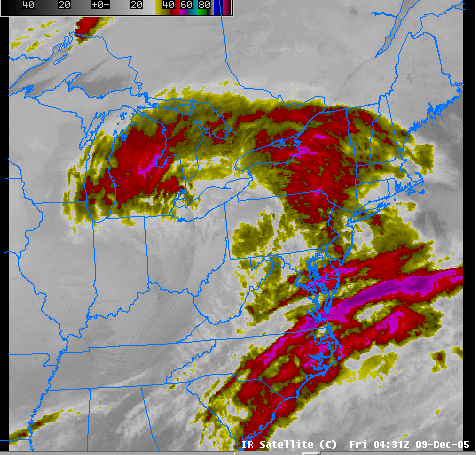
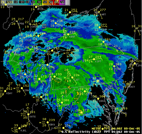
A dynamic and complex winter storm took shape over the Ohio Valley and East Coast during the day on Thursday (the 8th), and produced deep (but fluffy) snow over all of Pennsylvania Thursday Night and early Friday morning (the 9th). One- to Two- Inch PER HOUR rates were common during Thursday Night.
 |
 |
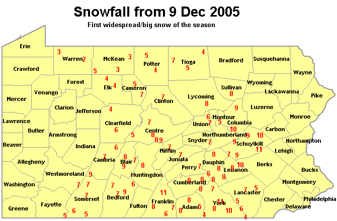 |
| Infrared Sat Pic during the height of the storm. | Radar Mosaic during the height of the storm. | Snowfall Reports Map |
 |
Media use of NWS Web News Stories is encouraged! Please acknowledge the NWS as the source of any news information accessed from this site. |
|
US Dept of Commerce
National Oceanic and Atmospheric Administration
National Weather Service
State College, PA
328 Innovation Blvd, Suite 330
State College, PA 16803
(814)954-6440
Comments? Questions? Please Contact Us.


 Send Us a Report