Overview
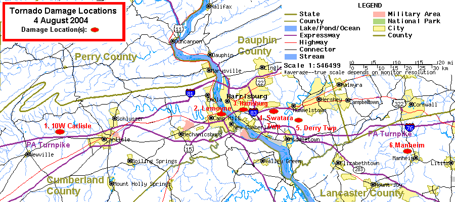
Six (possibly seven) locations in the lower Susquehanna Valley had tornado damage on the evening of August 4th, 2004.
Despite the fact that these tornadoes happened during the evening rush hour (between 5 and 7 PM EDT) and hit one of the most heavily-populated areas in Central Pennsylvania, NO deaths NOR even injuries were attributed to these storms!
Reasons for this may include the high level of attention given to the storms and tornado warnings by the local news media, coupled with the fact that many area residents had fresh in their minds a recent F3 tornado in Campbelltown, Lebanon County. The residents may have taken protective action based on the warnings, due to their recent reminder of the destructive potential of a tornado's fast winds.
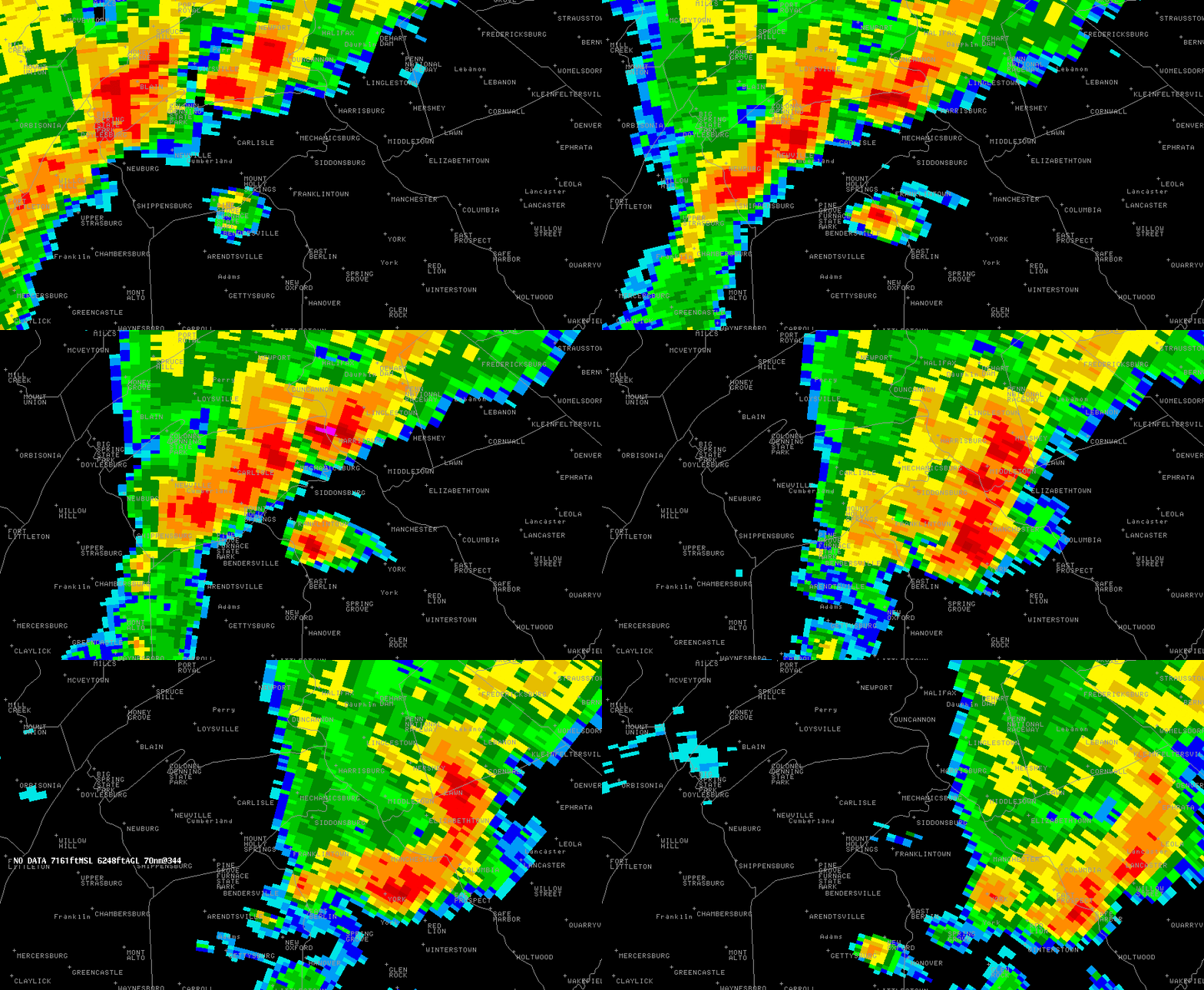
5 of these 6 locations (labelled #2 through #6 on the map below) may have received damage from the same thunderstorm cell that may have produced multiple tornadoes during it's lifetime. This is also known as a family of tornadoes. Radar images of that cell can be seen below.
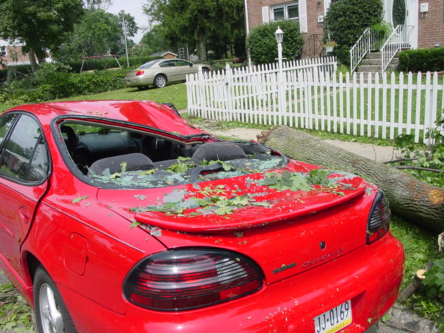
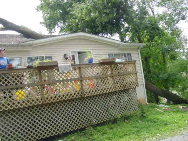
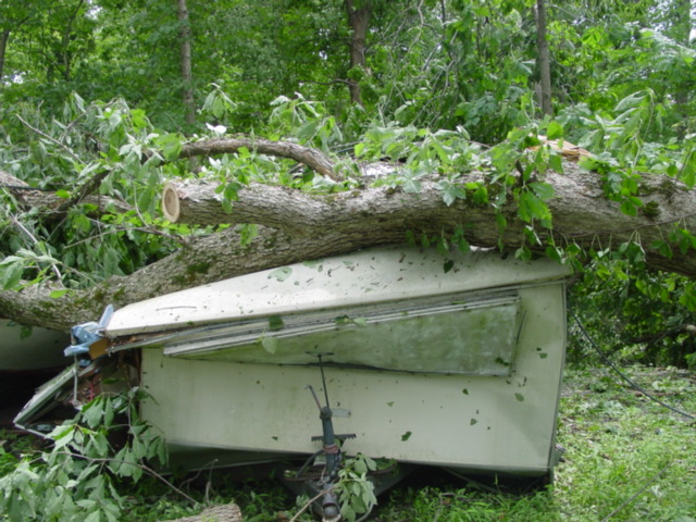
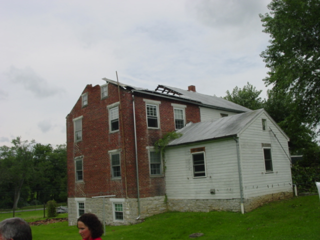
The first location to receive damage was just north of the Turnpike between Carlisle and Newville, Cumberland County (labelled as 10W Carlisle, Location #1). This tornado likely came out of a thunderstorm cell that was not the cell that most likely spawned the other five tornadoes.
The next location to receive tornado damage was the city of Lemoyne, just west of the City of Harrisburg (labelled Location #2). This was the first damage from the cell that most likely spawned the tornadoes that made damage at the next 4 locations, as well.
The main rotation of the storm cell that hit Lemoyne then moved to the east and then southeast. As it did so, damage occurred in Harrisburg, Swatara and Derry Townships (Dauphin County), and finally just northwest of Manheim (Lancaster County).
A seventh location of a possible tornado touchdown is currently under investigation, in Southeastern York County, near Felton. See corresponding radar pics: Reflectivity, SRM. Around 7:05 PM, a storm spotter in Felton snapped pictures of a funnel cloud that may have extended below tree-tops. It is unknown if damage occurred in that location, as this report was not available until after the storm damage surveys of the other sites had been completed.
 |
 |
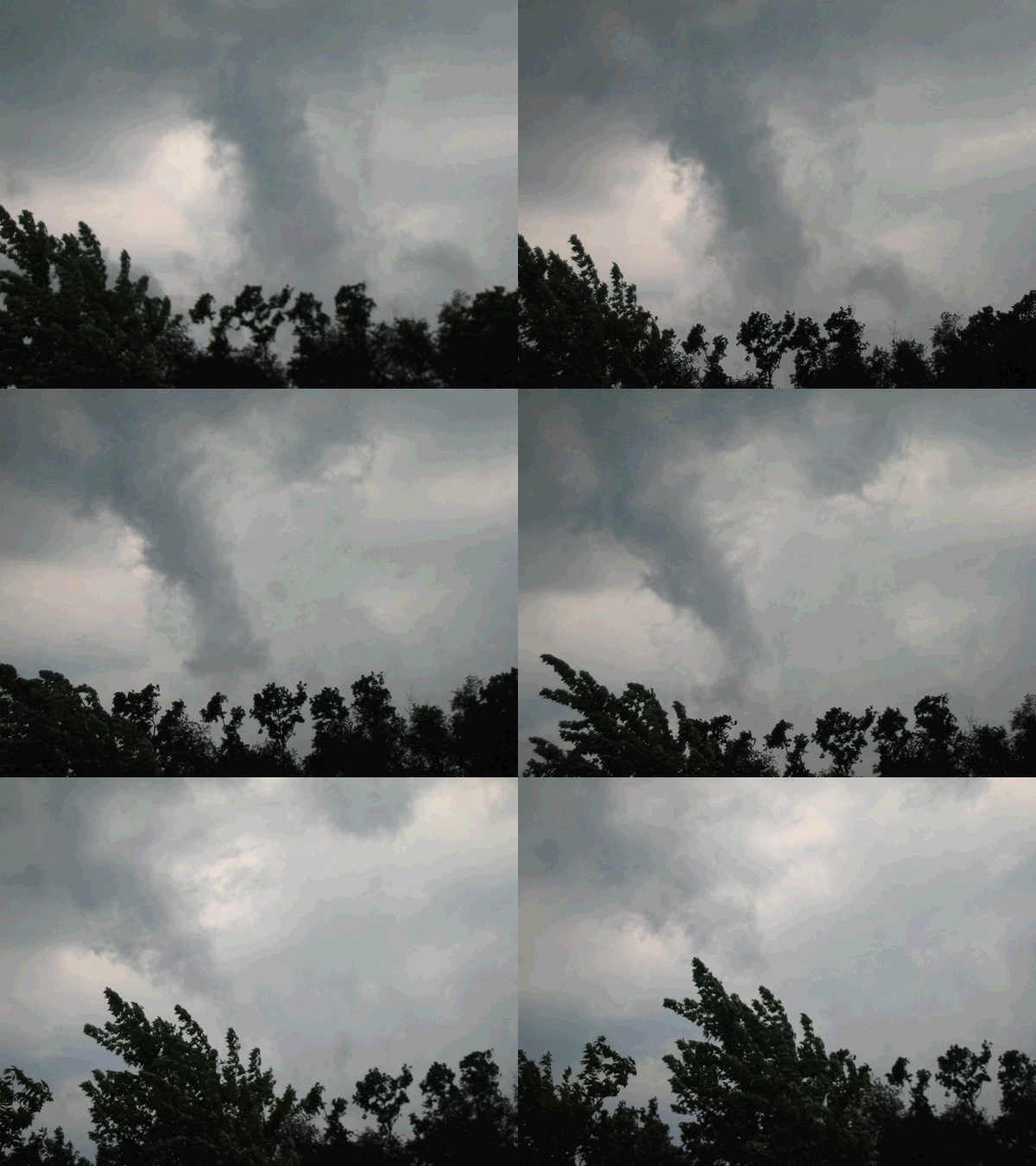 |
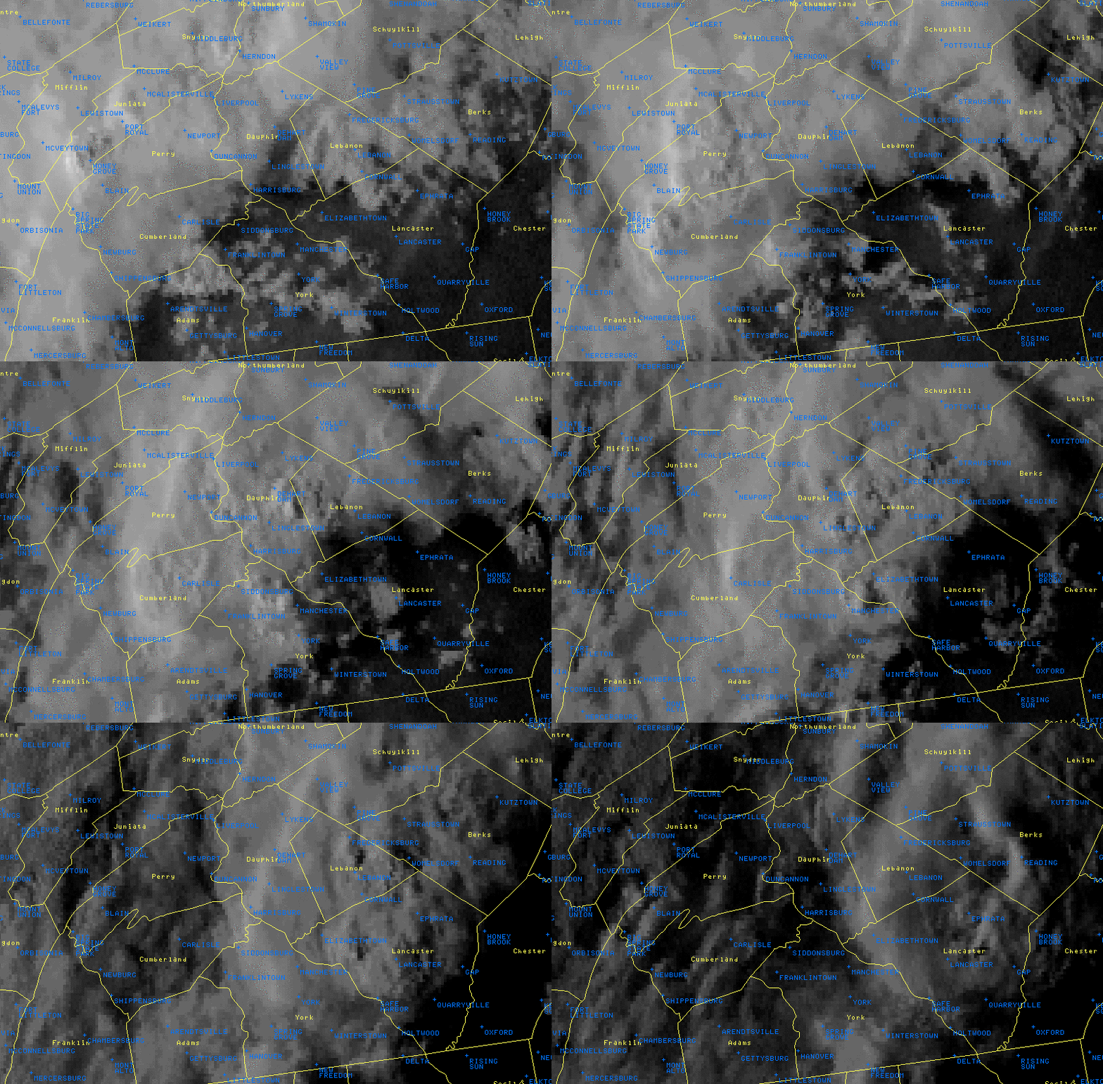
| Tornado Damage Locations | Satellite animation | Tornado Loop |
Tornadoes:
|
Tornado - CUMBERLAND
Track Map
|
||||||||||||||||
Radar & Damage Photos
 |
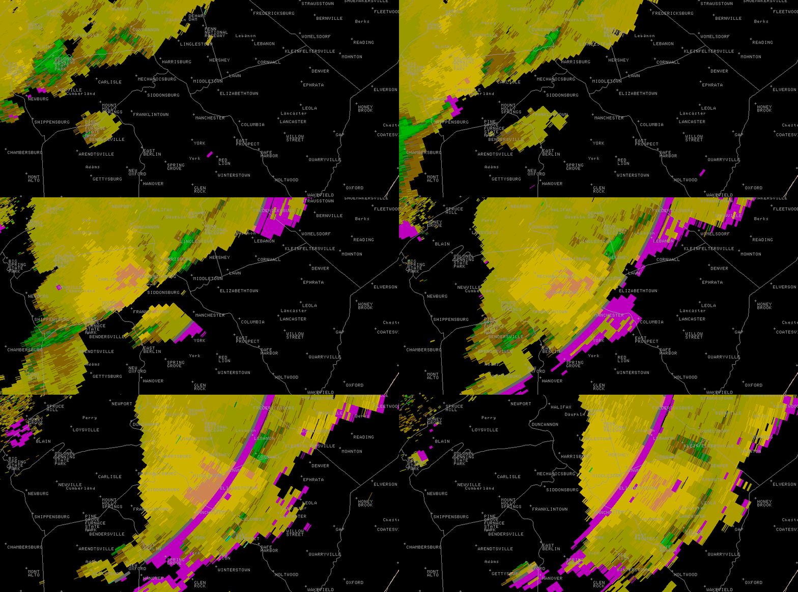 |
| KLWX Reflectivity Loop 2131Z to 2302Z (5:31 PM to 7:02 PM). (517 KB) | KLWC Correlation Coefficient Loop |
 |
 |
 |
 |
Storm Reports
PRELIMINARY LOCAL STORM REPORT ... SUMMARY NATIONAL WEATHER SERVICE STATE COLLEGE PA 1001 PM EDT WED AUG 04 2004 .
.TIME... ...EVENT... ...CITY LOCATION... ...LAT.LON... ..DATE... ....MAG.... ..COUNTY LOCATION...ST.. ...SOURCE.... ..REMARKS.
0300 PM TSTM WND DMG 10 SW CURWENSVILLE 40.87N 78.65W 08/04/2004 CLEARFIELD PA EMERGENCY MNGR LARGE TREE DOWN
0400 PM TSTM WND DMG JOHNSTOWN 40.33N 78.92W 08/04/2004 CAMBRIA PA EMERGENCY MNGR TREES AND WIRES DOWN
0410 PM TSTM WND DMG SNOW SHOE 41.03N 77.95W 08/04/2004 CENTRE PA LAW ENFORCEMENT TREES DOWN
0430 PM TSTM WND DMG 5 W OSTERBURG 40.18N 78.62W 08/04/2004 BEDFORD PA LAW ENFORCEMENT TELEPHONE POLE AND WIRES DOWN
0615 PM TSTM WND DMG CARLISLE 40.20N 77.20W 08/04/2004 CUMBERLAND PA BROADCAST MEDIA SEVERAL TREES DOWN ALONG BELVEDERE AVENUE
0620 PM TSTM WND DMG HARRISBURG 40.28N 76.88W 08/04/2004 DAUPHIN PA BROADCAST MEDIA SEVERAL TREES DOWN ON 14TH AND MARKET STREET...ALSO ON FRONT STREET.
0620 PM FLASH FLOOD YORK 39.96N 76.73W 08/04/2004 YORK PA TRAINED SPOTTER SEVERAL ROADS FLOODED COUNTY WIDE
0620 PM TSTM WND DMG NEWVILLE 40.17N 77.40W 08/04/2004 CUMBERLAND PA BROADCAST MEDIA STRUCTORAL DAMAGE
0628 PM TSTM WND DMG 1 N COLONIAL PARK 40.31N 76.81W 08/04/2004 DAUPHIN PA TRAINED SPOTTER SEVERAL TREES DOWN AT INTERSECTION OF HIGHWAY 322 AND HIGHWAY 83
0630 PM TSTM WND DMG 7 SE NEW CUMBERLAND 40.16N 76.78W 08/04/2004 YORK PA BROADCAST MEDIA STRUCTURAL DAMAGE SHEEPBRIDGE ROAD...POTENTIAL TORNADO
0655 PM TSTM WND DMG LITITZ 40.15N 76.31W 08/04/2004 LANCASTER PA LAW ENFORCEMENT SEVERAL TREES DOWN AND WIRES DOWN.
0658 PM TSTM WND DMG 2 N WAYNESBORO 39.78N 77.58W 08/04/2004 FRANKLIN PA LAW ENFORCEMENT SEVERAL TREES DOWN IN MT. JOY
0700 PM TSTM WND DMG YORK 39.96N 76.73W 08/04/2004 YORK PA LAW ENFORCEMENT SEVERAL TREES DOWN THROUGHOUT COUNTY.
 |
Media use of NWS Web News Stories is encouraged! Please acknowledge the NWS as the source of any news information accessed from this site. |
 |