Overview
|
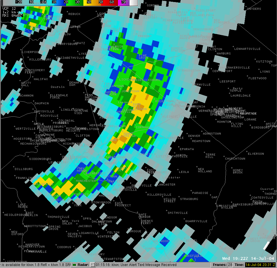
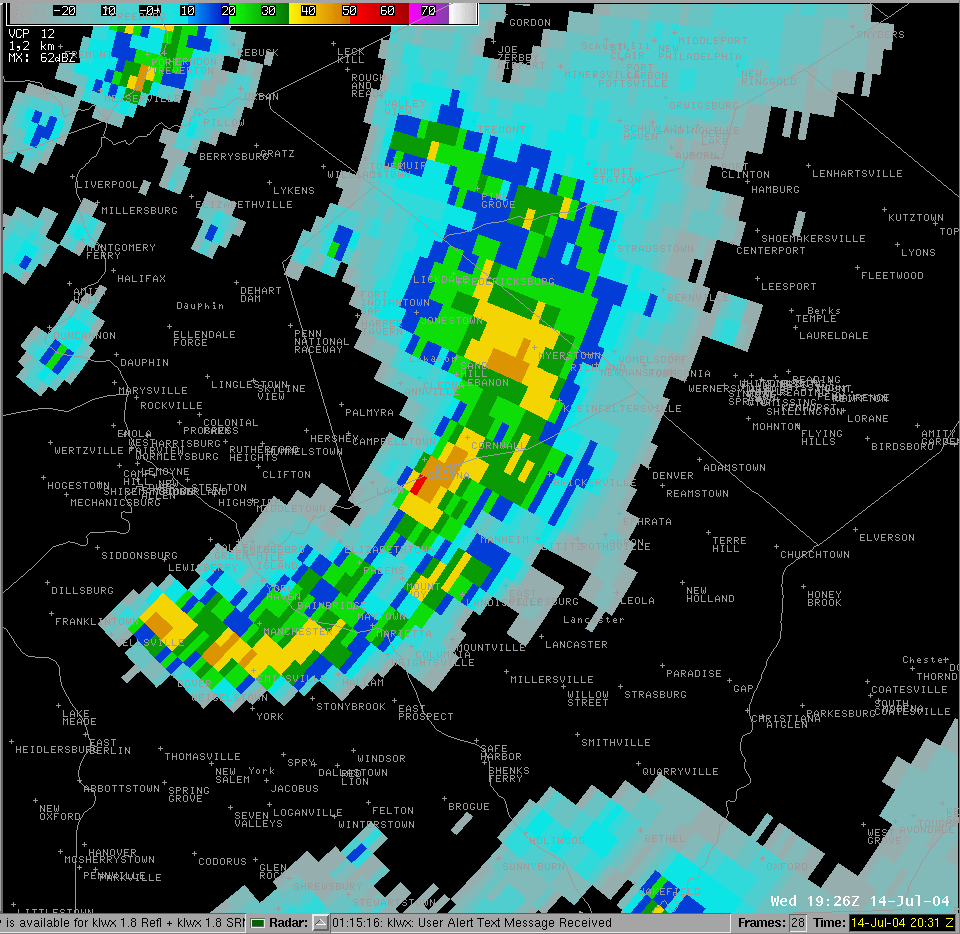
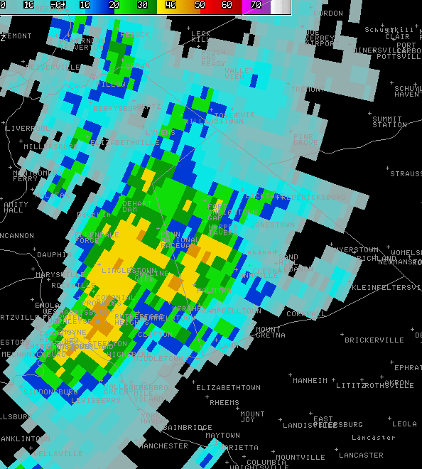
A strong F3-tornado ripped through the County Squire Estates sub-division in southern Lebanon County during the early afternoon of July 14, 2004. Over 100 homes completely destroyed, or severely damaged. Multiple injuries (one critical), but no deaths. The meteorological conditions were favorable for severe thunderstorms. However, they were not excessive as we have seen in larger (widespread) tornado outbreaks like May 31, 1985, May 31, 1998, and Jun 2, 1998 |
 |
 |
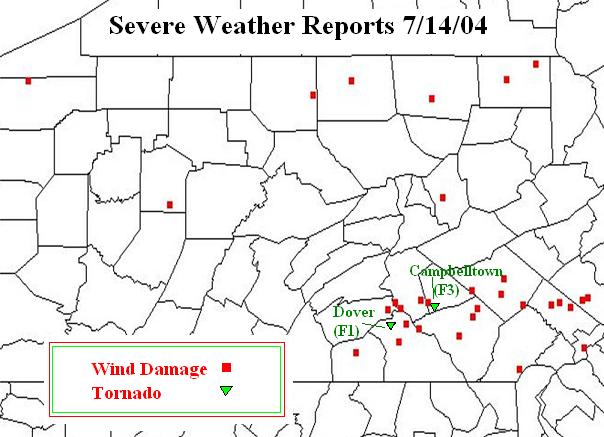 |
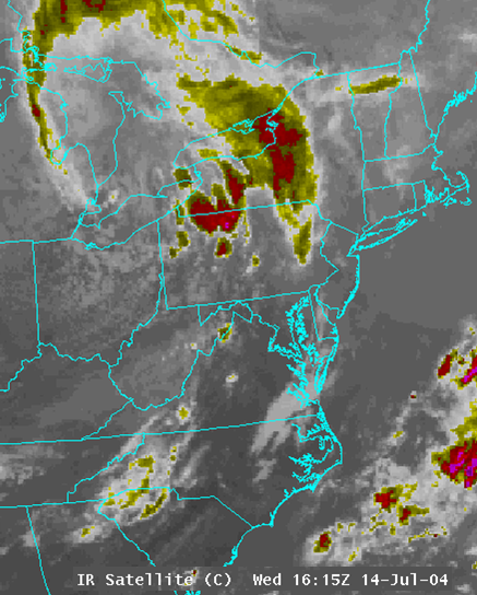
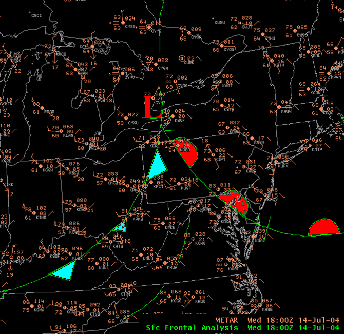
| Infrared Satellite Image around Noon Local | Surface Observations and Fronts around 2 pm | Storm Reports for the day |
Tornadoes:
|
Tornado - CAMPBELLTOWN
Track Map 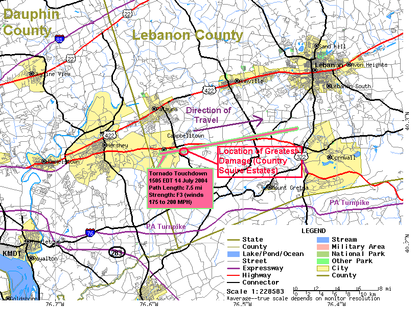 |
||||||||||||||||
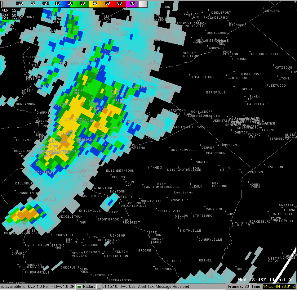
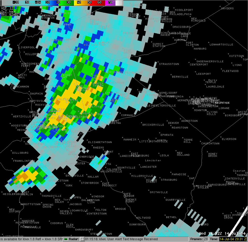
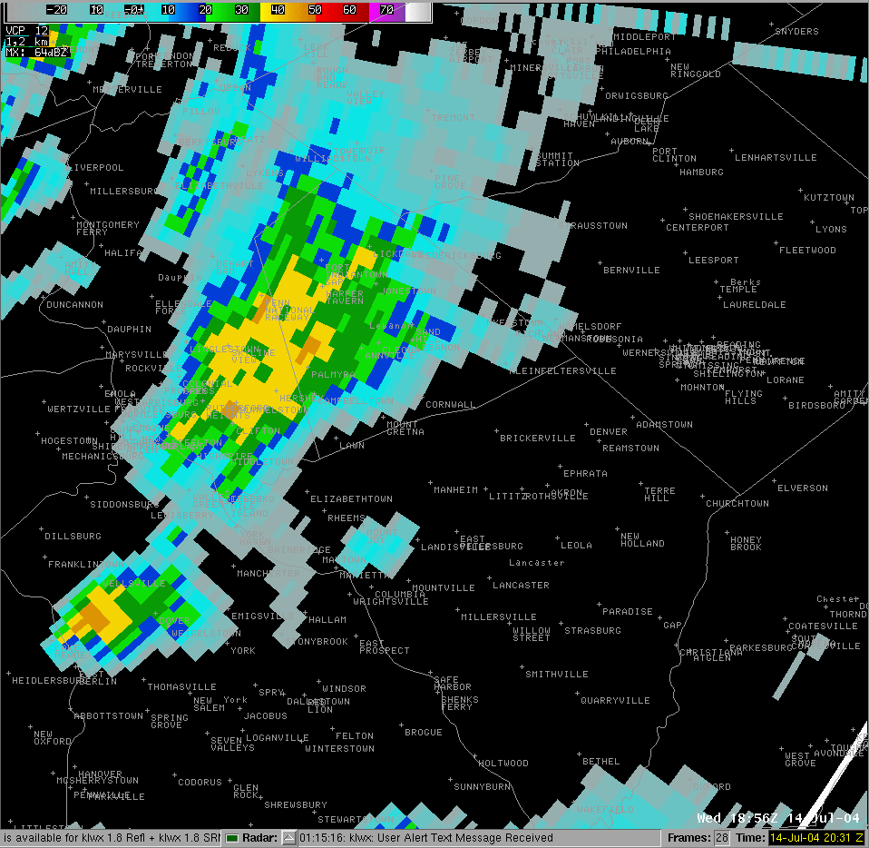
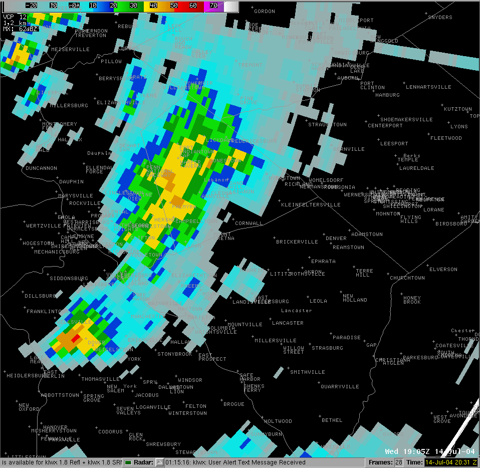
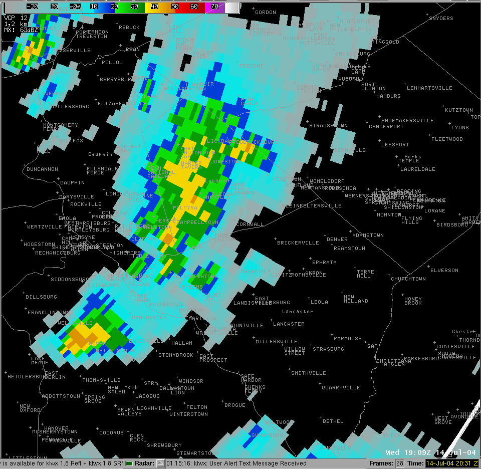
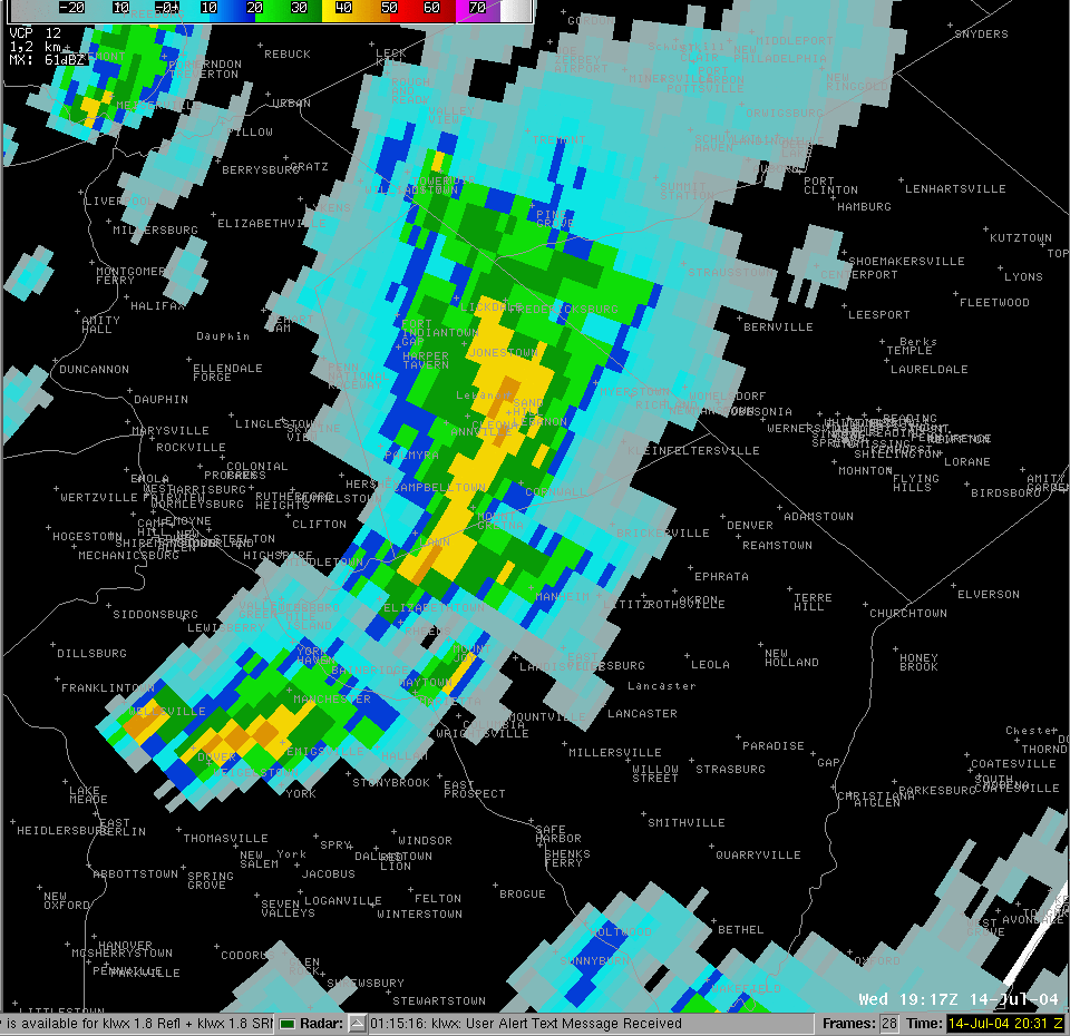
Radar
 |
 |
 |
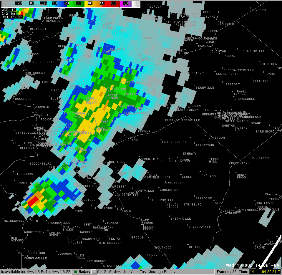 |
| 2:48 PM | 2:52 PM | 2:56 PM | 3:00 PM |
 |
 |
 |
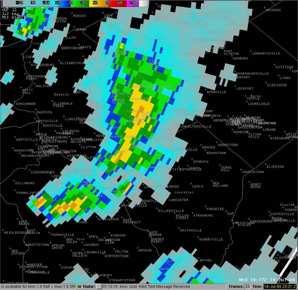 |
| 3:05 PM | 3:09 PM | 3:13 PM | 3:17 PM |
 |
 |
 |
| 3:22 PM | 3:26 PM | Animation Loop |
 |
Media use of NWS Web News Stories is encouraged! Please acknowledge the NWS as the source of any news information accessed from this site. |
|


 Send Us a Report