Overview
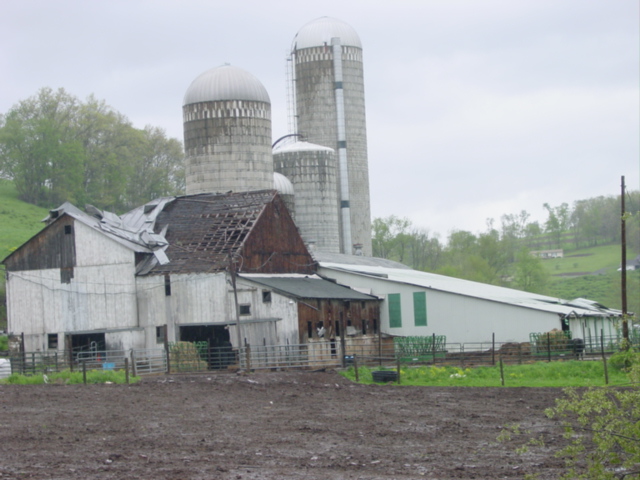
A weak tornado occurred near Cogan Station late in the afternoon of 5/11/2003 Residents in the area reported that they saw funnel clouds, and the folks at the farm below heard of the tornado warning from a relative in a nearby town who was concerned about their safety. They took shelter, and heard the winds shortly after.Photos
 |
 |
 |
 |
| Damage Photo | Damage Photo | Damage Photo | Damage Photo |
Radar
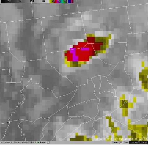 |
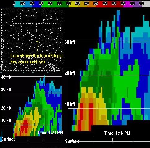 |
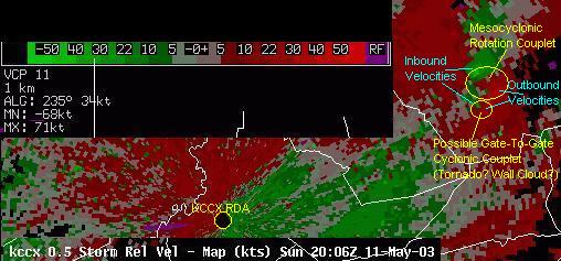 |
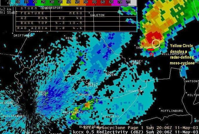 |
| IR Satellite May 11, 2003 1945Z | Reflectivity Cross Section | Velocity May 11, 2003 2006Z | Reflectivity May 11, 2003 2006Z |
Storm Reports
PUBLIC INFORMATION STATEMENT
NATIONAL WEATHER SERVICE STATE COLLEGE PA
345 PM EDT MON MAY 12 2003

...WEAK TORNADO DAMAGE CONFIRMED IN LYCOMING COUNTY...

A WEAK TORNADO OCCURRED YESTERDAY (MAY 11TH) IN LYCOMING
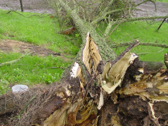
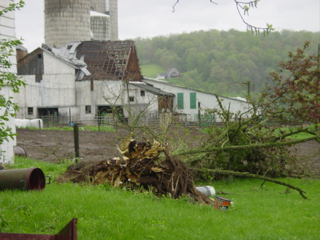
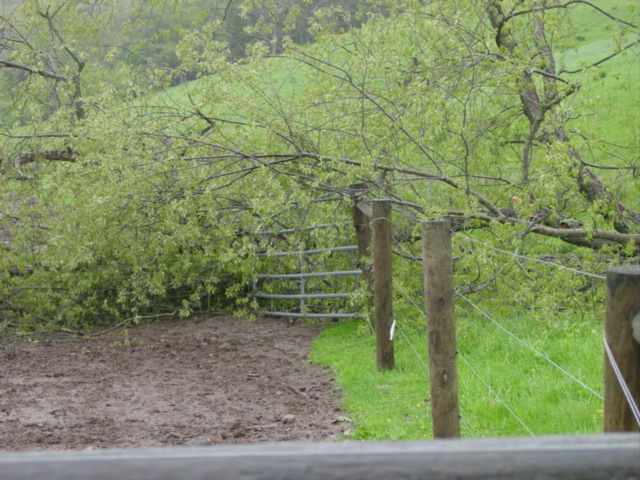
TOWNSHIP...LYCOMING COUNTY.  RESIDENTS OF THE LOVELL FARM ON MAPLE
SPRINGS ROAD HAD AT LEAST A DOZEN LARGE TREES DOWNED AND MOST OF THE
TIN ROOF BLOWN OFF OF A BARN.

A TEAM FROM THE NATIONAL WEATHER SERVICE OFFICE IN STATE COLLEGE
SURVEYED THE DAMAGE AND INTERVIEWED RESIDENTS IN THE AREA TODAY. THE
TEAM DETERMINED THAT THE DAMAGE OCCURRED AT APPROXIMATELY 410 PM.

THE TORNADO APPEARED TO TOUCH DOWN IN MULTIPLE LOCATIONS...PERHAPS
SKIPPING AS IT MOVED WEST TO EAST JUST A FEW MILES NORTH OF
WILLIAMSPORT. THE LOCATION OF MOST DAMAGE IS APPROXIMATELY 3 MILES
SOUTHWEST OF COGAN STATION.

THE TORNADO WAS NEVER MORE THAN 75 TO 100 YARDS WIDE...AND THE PATH
WAS AROUND 1 1/4 MILES LONG.

THE TORNADO IS BEING RATED (INITIALLY) FROM THE DAMAGE IT CREATED AS
F0 ON THE FUJITA SCALE OF TORNADO INTENSITY.  THIS MEANS THAT THE
MAXIMUM WINDS IN THIS TORNADO WERE BETWEEN 50 AND 72 MPH.

A SEVERE THUNDERSTORM WARNING WAS FIRST ISSUED FOR LYCOMING COUNTY
AT 336 PM...AND WAS UPGRADED TO A TORNADO WARNING AT 349 PM.

REMEMBER...THE BEST WAY TO STAY ON TOP OF WEATHER DEVELOPMENTS IN
YOUR AREA IS TO STAY TUNED TO YOUR LOCAL NOAA WEATHER RADIO.

$$

DANGELO/ONDREJIK
 |
Media use of NWS Web News Stories is encouraged! Please acknowledge the NWS as the source of any news information accessed from this site. |
 |