Overview
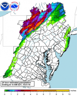
In the early morning hours of October 21st 2016, persistent and heavy rainfall in Northern Central PA led to major flooding in Lycoming, Centre, and Sullivan Counties. In the midst of the event, Centre County declared a disaster emergency. One fatality was reported and many other residents had to be rescued from their homes. Multiple homes and businesses sustaining significant flood damage.
Flooding
River Data (RFC)
 |
 |
 |
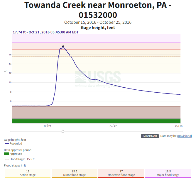 |
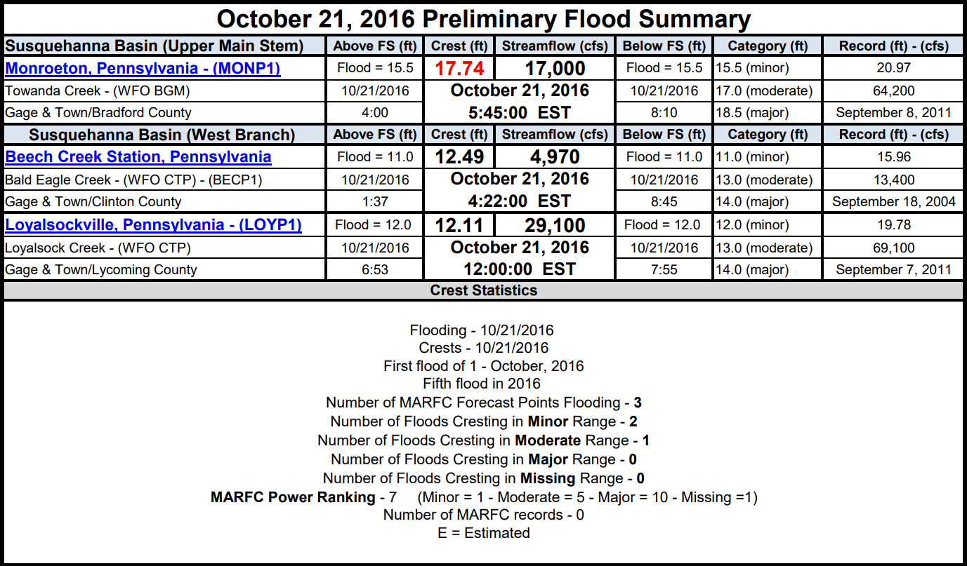
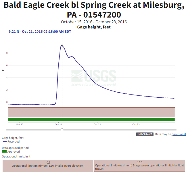
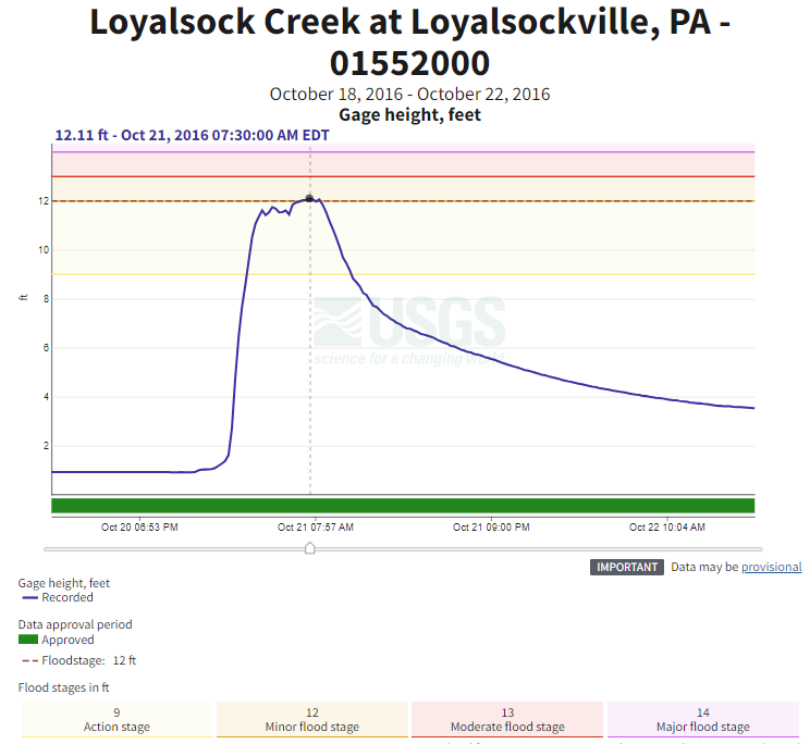
| River gauges near areas of excessive flooding recorded water levels that came within a few feet of record highs. |
Bald Eagle Creek Gauge Height Courtesy: waterdata.usgs.gov |
Loyalsock Creek Gauge Height Courtesy: waterdata.usgs.gov |
Towanda Creek Gauge Height Courtesy: waterdata.usgs.gov |
Social Media
 |
| Twitter post captures the hours following the early AM flooding. |
Radar/Satellite
 |
 |
|
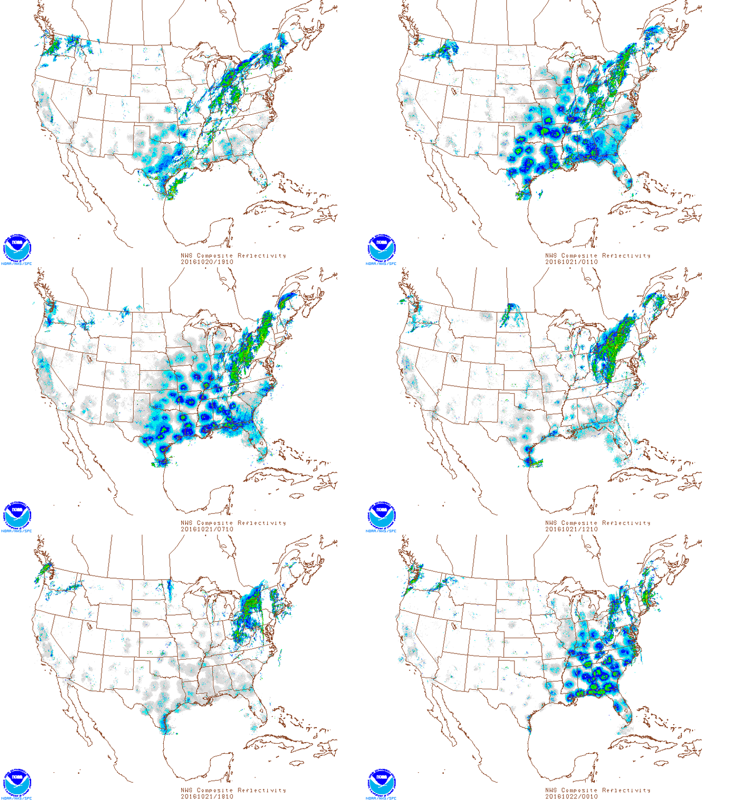
10/20/2016 3:10 PM EDT - 10/21/2016 8:10 PM EDT: NEXRAD MOSAIC Composite Reflectivity Courtesy: SPC Mesoanalysis Archive |
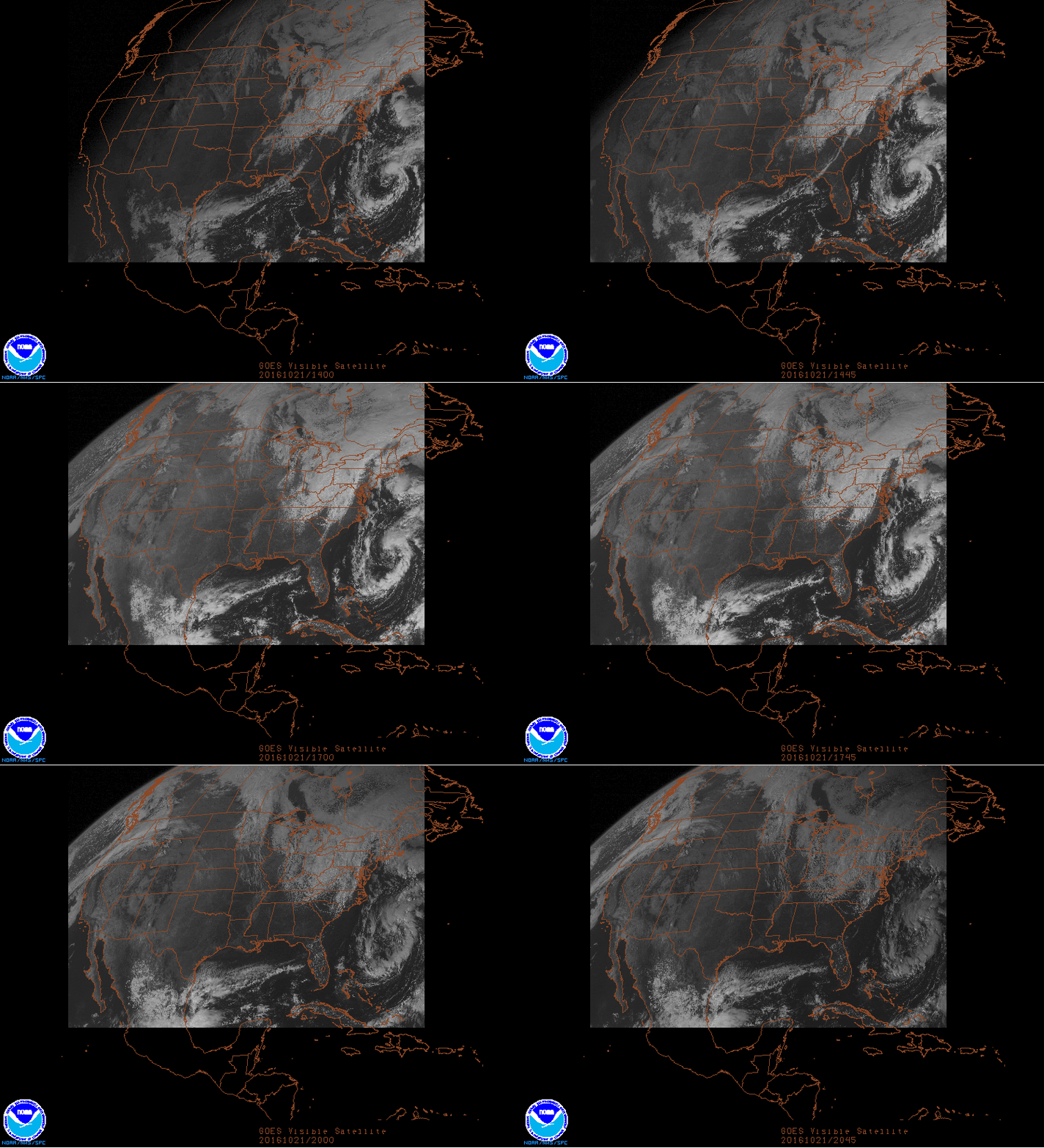
10/21/2016 10 AM - 4:45 PM EDT: GOES East Visible Band (day before major flooding) Courtesy: SPC Mesoanalysis Archive |
Radar & Reports/Warnings (GR2Analyst)
 |
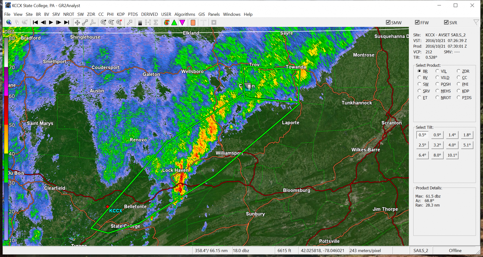 |
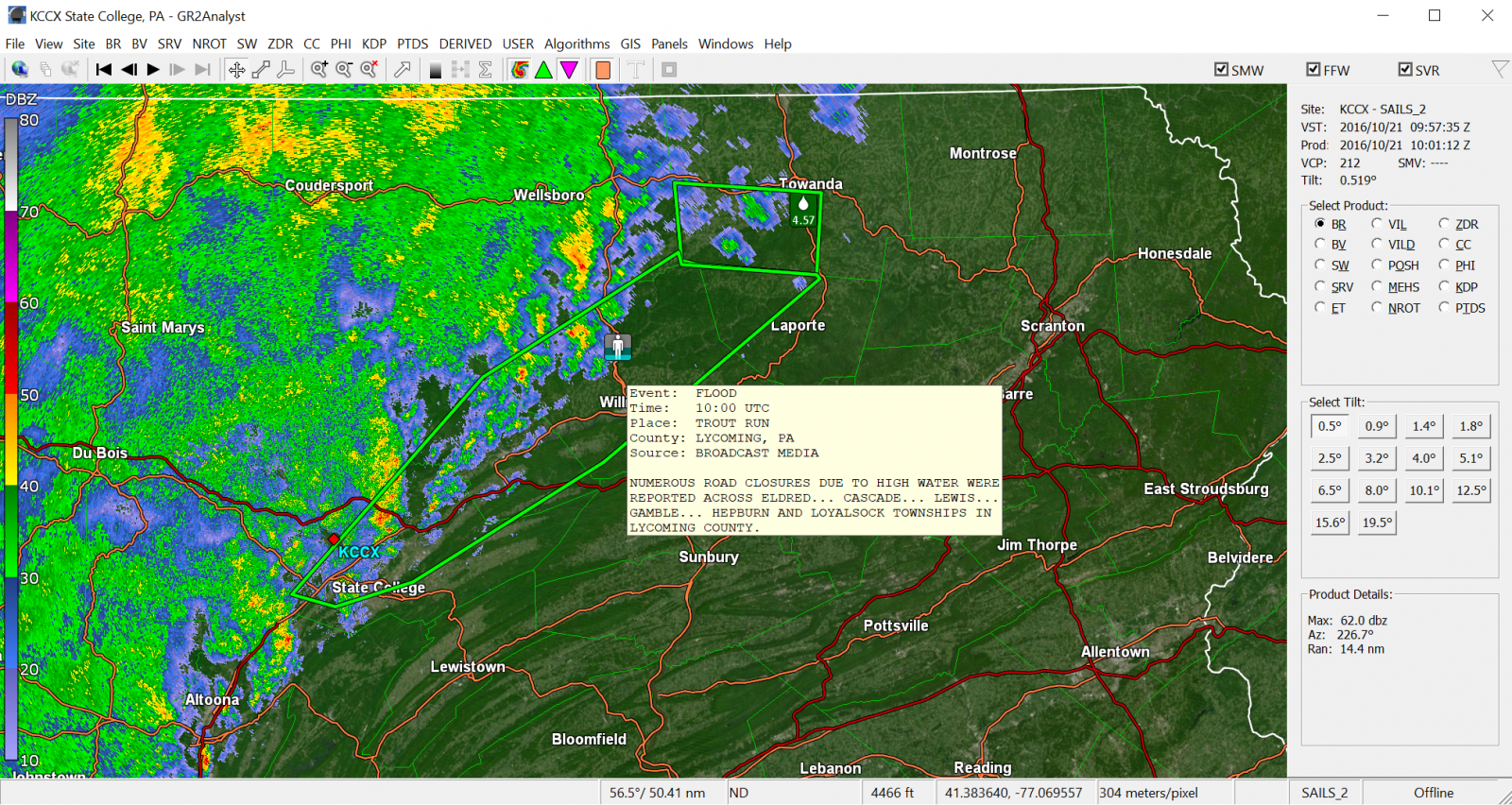 |
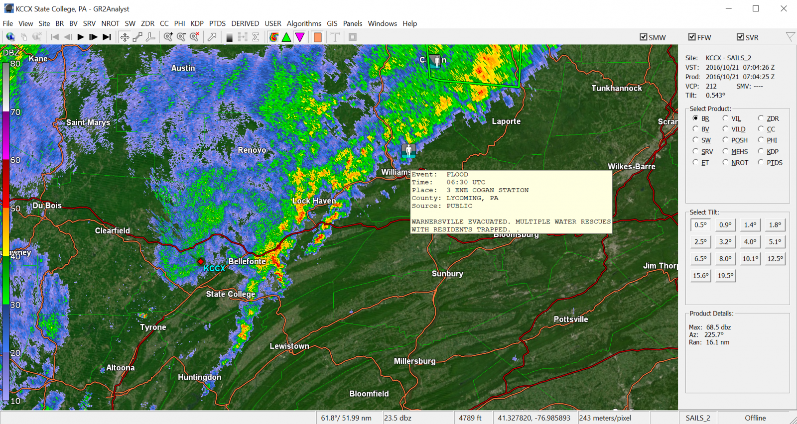
| 10/21/2016 2:30 AM EDT: First Flood Report issued in Lycoming county. Reports of evacuation in Warnersville and trapped residents being rescued. | 10/21/2016 4:30 AM EDT: Flash Flood Warning issued by NWS CTP expiring at 7:30 AM EDT | 10/21/2016 6AM EDT: Another flash flood report from Lycoming County issued. Reports of numerous road closures and high water across Eldred, Cascade, Lewis, Gamble, Hepburn, and Loyalsock Townships. |
Storm Reports
Public Information Statement (PNS) Issued at 9:54 AM EDT Oct. 21, 2016
740
NOUS41 KCTP 211354
PNSCTP
PAZ004>006-010>012-017>019-024>028-033>037-041-042-045-046-049>053-056>059-
063>066-220154-
Public Information Statement
National Weather Service State College PA
954 AM EDT Fri Oct 21 2016
...24 Hour Rainfall Reports 1.50 inches or greater...
Location Amount Time/Date Provider
...Blair County...
Tyrone 3.90 in 0734 AM 10/21 COOP
Tyrone 3.26 in 0937 AM 10/21 CWOP
...Cambria County...
3 S Coalport 2.11 in 0931 AM 10/21 CWOP
Belmont 1.50 in 0800 AM 10/21 COCORAHS
...Cameron County...
2 ESE Stevenson Dam 2.10 in 0900 AM 10/21 COOP
1 ESE Emporium 1.73 in 0916 AM 10/21 CWOP
...Centre County...
2 W Park Forest 7.20 in 0943 AM 10/21 CWOP
2 SE Unionville 7.11 in 0933 AM 10/21 CWOP
3 WNW Park Forest 6.75 in 0934 AM 10/21 CWOP
1 WSW Bellefonte 6.72 in 0721 AM 10/21 COCORAHS
2 SW Beech Creek 5.68 in 0931 AM 10/21 HADS
Park Forest 5.24 in 0936 AM 10/21 CWOP
2 ESE Port Matilda 5.01 in 0938 AM 10/21 CWOP
2 E Port Matilda 5.01 in 0943 AM 10/21 CWOP
State College 2.6 NW 4.91 in 0700 AM 10/21 COCORAHS
2 E Port Matilda 4.80 in 0700 AM 10/21 COCORAHS
Stormstown 4.43 in 0900 AM 10/21 SPOTTER
1 W Zion 2.53 in 0800 AM 10/21 COCORAHS
Clarence 1.76 in 0600 AM 10/21 COOP
State College 1.70 in 0945 AM 10/21 CWOP
3 ENE State College 1.69 in 0943 AM 10/21 CWOP
2 S Philipsburg 1.67 in 0800 AM 10/21 COOP
State College 1.54 in 0800 AM 10/21 COOP
...Clearfield County...
Piper 4.00 in 0730 AM 10/21 COOP
Kennedy Preserve 3.05 in 0908 AM 10/21 RAWS
1 N Dubois 3.00 in 0935 AM 10/21 CWOP
Clearfield Airport 2.23 in 0754 AM 10/21 ASOS
...Clinton County...
1 NW Mill Hall 5.34 in 0932 AM 10/21 CWOP
5 S Renovo 3.70 in 0730 AM 10/21 COOP
Lock Haven 3.22 in 0700 AM 10/21 COOP
Coffin Rock 3.08 in 0916 AM 10/21 RAWS
1 E Kettle Creek State Park 2.73 in 0900 AM 10/21 HADS
...Elk County...
E. Branch Clarion Lake 2.38 in 0915 AM 10/21 GOES
3 NW Saint Marys 2.21 in 0934 AM 10/21 CWOP
Glen Hazel 1.85 in 0700 AM 10/21 COOP
1 SE Saint Marys 1.78 in 0700 AM 10/21 COCORAHS
...Lycoming County...
1 NNE Williamsport 4.64 in 0700 AM 10/21 COCORAHS
Loyalsockville 3.63 in 0946 AM 10/21 HADS
Slate Run 3.60 in 0830 AM 10/21 COOP
Cedar Run 2.91 in 0915 AM 10/21 HADS
2 SSE English Center 2.69 in 0940 AM 10/21 CWOP
Duboistown 1.90 in 0944 AM 10/21 CWOP
...McKean County...
2 ENE Eldred 2.83 in 0930 AM 10/21 GOES
2 SSE Kinzua Bridge State Pa 2.39 in 0910 AM 10/21 CWOP
Port Allegany 2.15 in 0845 AM 10/21 HADS
4 W Bradford 1.90 in 0800 AM 10/21 COOP
1 SSE Rew 1.83 in 0939 AM 10/21 CWOP
Bradford Airport 1.62 in 0753 AM 10/21 ASOS
...Potter County...
5 SSW Galeton 3.02 in 0944 AM 10/21 CWOP
Coudersport 7se 2.58 in 0700 AM 10/21 COOP
1 N Shinglehouse 2.49 in 0845 AM 10/21 GOES
Cherry Springs 2.40 in 0800 AM 10/21 COOP
2 ENE Sizerville 2.40 in 0800 AM 10/21 HADS
3 ESE Coudersport 2.39 in 0942 AM 10/21 CWOP
Coudersport 1 SW 2.17 in 0700 AM 10/21 COOP
1 NE Oswayo 1.80 in 0800 AM 10/21 COOP
2 NNE Roulette 1.75 in 0700 AM 10/21 COCORAHS
5 SE Coudersport 1.63 in 1100 PM 10/20 COCORAHS
...Somerset County...
Seven Springs 1.61 in 0939 AM 10/21 CWOP
...Tioga County...
Old Mountain 2.76 in 0916 AM 10/21 RAWS
Mansfield 2.53 in 0931 AM 10/21 GOES
Covington 2wsw 2.50 in 0800 AM 10/21 COOP
3 SW Osceola 2.40 in 0700 AM 10/21 COOP
Cowanesque Dam 2.07 in 0700 AM 10/21 COOP
Wellsboro 4 SW 2.06 in 0700 AM 10/21 COOP
Cowanesque Dam 2.05 in 0900 AM 10/21 COOP
Tioga 1.58 in 0700 AM 10/21 COOP
Crooked Creek 1.54 in 0900 AM 10/21 COOP
...Warren County...
Warren 1.69 in 0700 AM 10/21 COOP
&&
Storm Details
Mesoscale Precipitation Discussions (MPDs) Issued by WPC
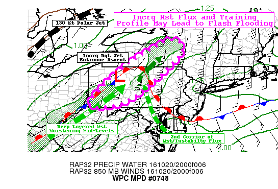 |
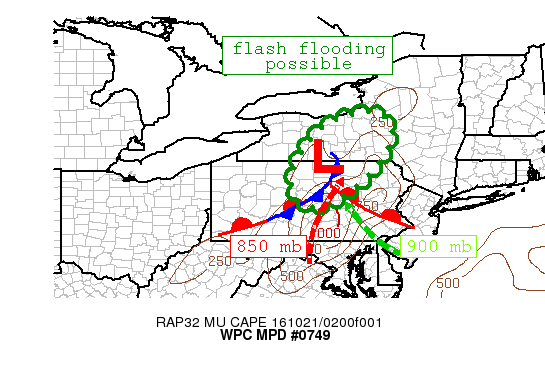 |
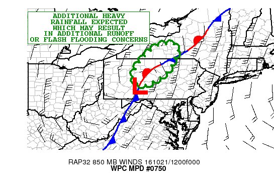 |
| MPD #748 | MPD #749 | MPD #750 |
Environment
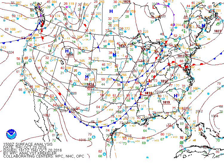
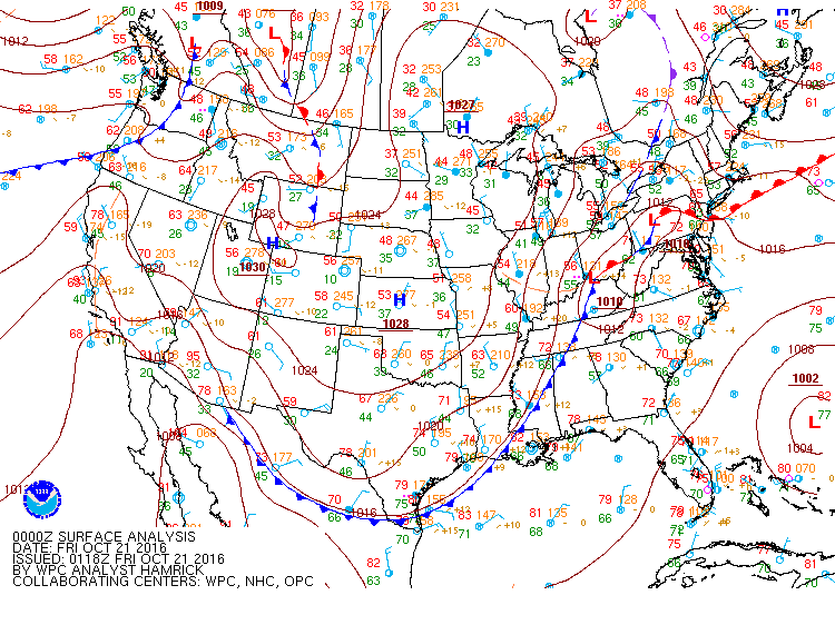
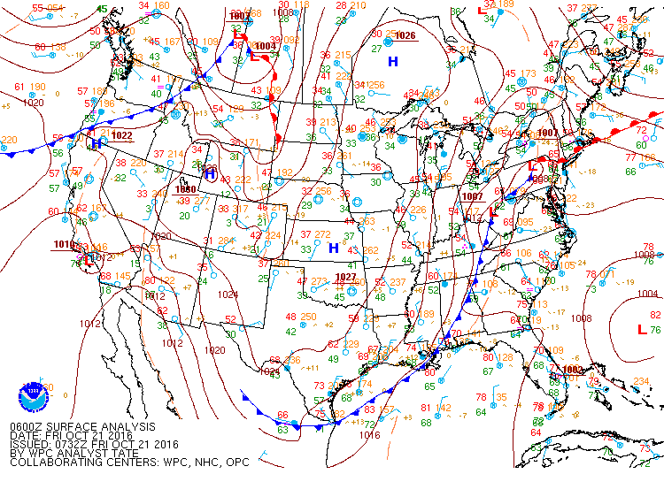
Surface analysis timeline leading into flooding event.
 |
 |
 |
|
10/20/2016 12:17 PM EDT: Early afternoon prior to the flooding event. Warm moist air moving along the Southerly warm front from the Atlantic coast would provide the necessary moisture transport to Central PA. Courtesy: WPC |
10/20/2016 9:18 PM EDT: Evening before event. As the warm front continued its Southerly track, the corresponding stationary front began its NE-SW extension across central PA. The slow moving nature of this front would provide a consistent lift for the transported moisture. Courtesy: WPC |
10/21/2016 2 AM EDT: Beginning of event. The stationary front was situated directly in position for cloud formation and heavy precipitation in Central PA. Courtesy: WPC |
PWATs and Moisture Transport
 |
 |
 |
|
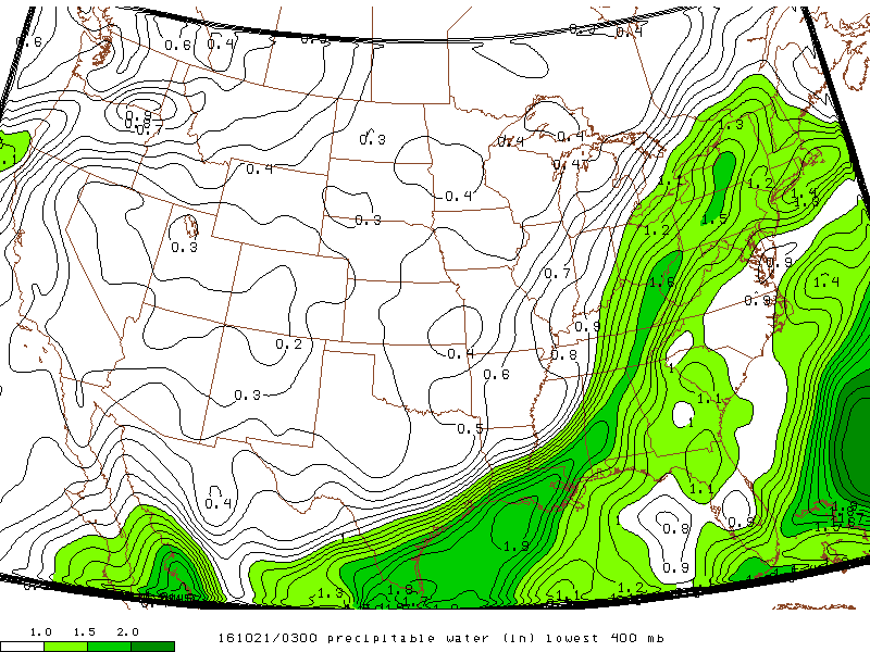
10/20/2016 11 PM EDT: Night prior to event. The available precipitable water (PWATs) in the mid-lower atmosphere was already in favor for the region of impact. Values of 1.5 inches were present in Central and Northern Central PA. Courtesy: SPC Mesoanalysis Archive |
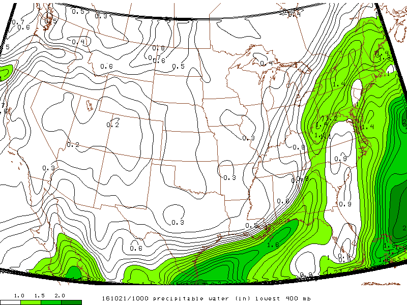
10/21/2016 6 AM EDT: Tail end of event. Most precipitation and flooding had already occurred by this point, yet PWATs remained in the 1.4 inch range in the affected area. Courtesy: SPC Mesoanalysis Archive |
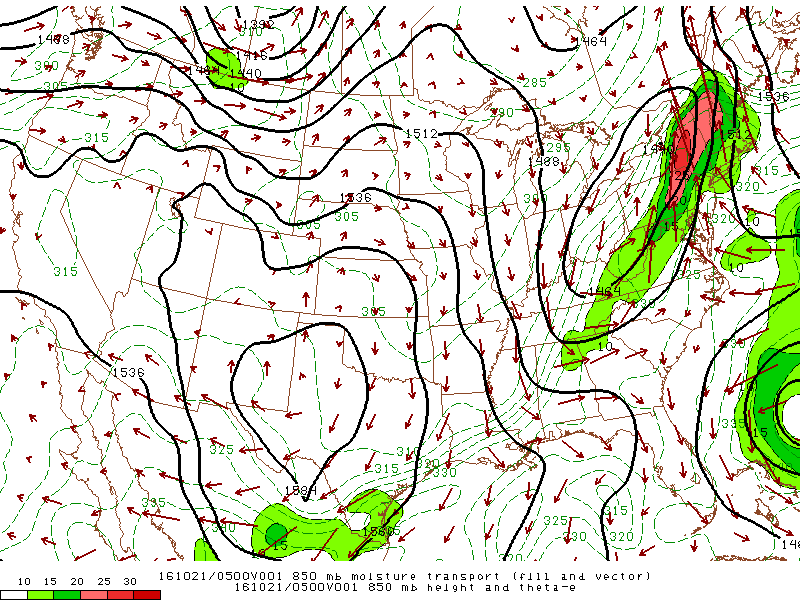
10/21/2016 1 AM EDT: Peak values of Southerly moisture transport were held within the closed low with its Eastern region centered over Central PA. Closed low systems like this typically coincide with heavy precipitation. Courtesy: SPC Mesoanalysis Archive |
300mb Height and Upper Level Jet
 |
|
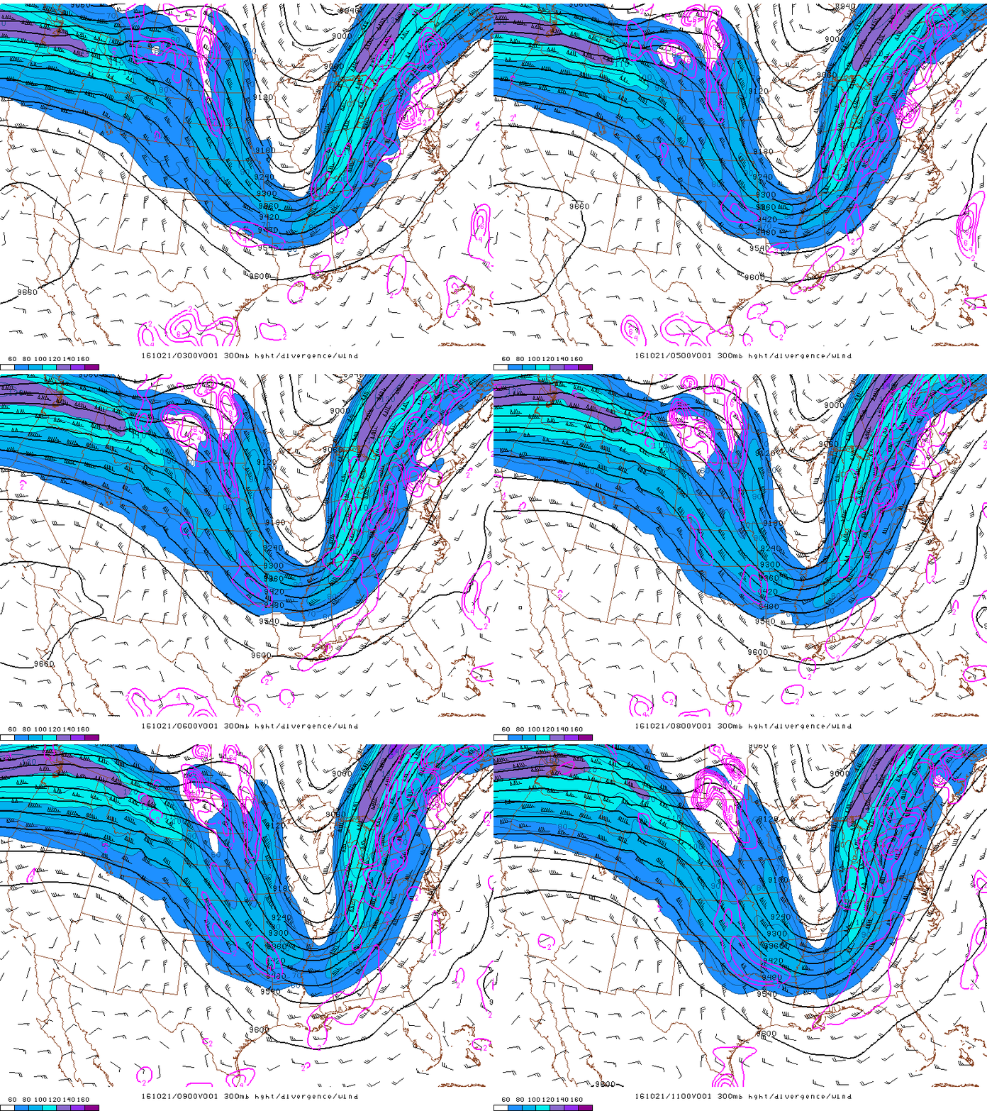
10/20 11 PM EDT to 10/21 7 AM EDT: Divergence associated with lifting was consistently present in the Central PA region. Courtesy: SPC Mesoanalysis Archive |
 |
Media use of NWS Web News Stories is encouraged! Please acknowledge the NWS as the source of any news information accessed from this site. |
 |