
A Moderate Risk of severe thunderstorms (level 4 of 5) is in the outlook across portions of the Midwest today. Damaging winds, a few tornadoes and frequent lightning with heavy rainfall are in the forecast. Meanwhile, dangerous heat across the southern Plains into the Great Lakes, mid-Atlantic and Northeast will expand into Friday. Risk for wildfires for the central Rockies and Sacramento Valley. Read More >
Overview
|
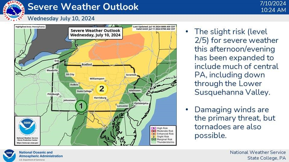
In the wake of a cold front resulting from the remnants of Hurricane Beryl, a convective severe weather threat existed for North-Central, Central, and South-Central PA. Straight-line wind gusts were the primary impact, though radar-indicated tornadoes/circulations were present over North-Central PA. A mid-level cap (milder air aloft), despite all other severe weather parameters being in place, kept the storms shorter and storms weaker. |
 Courtesy: NWS SPC |
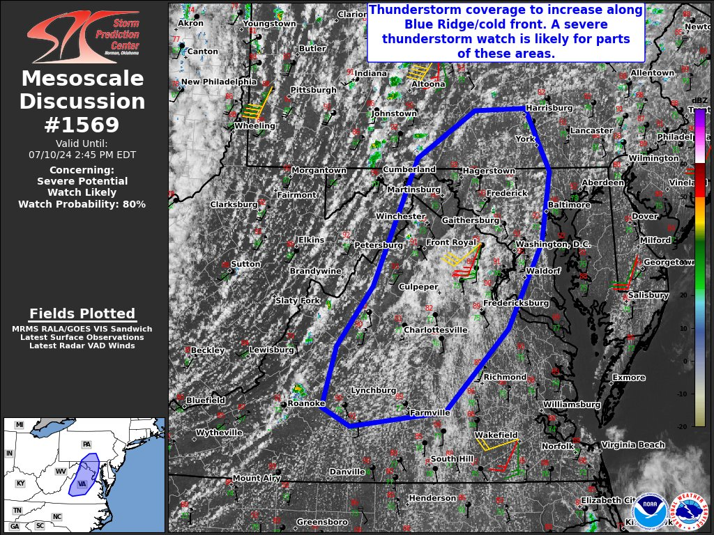
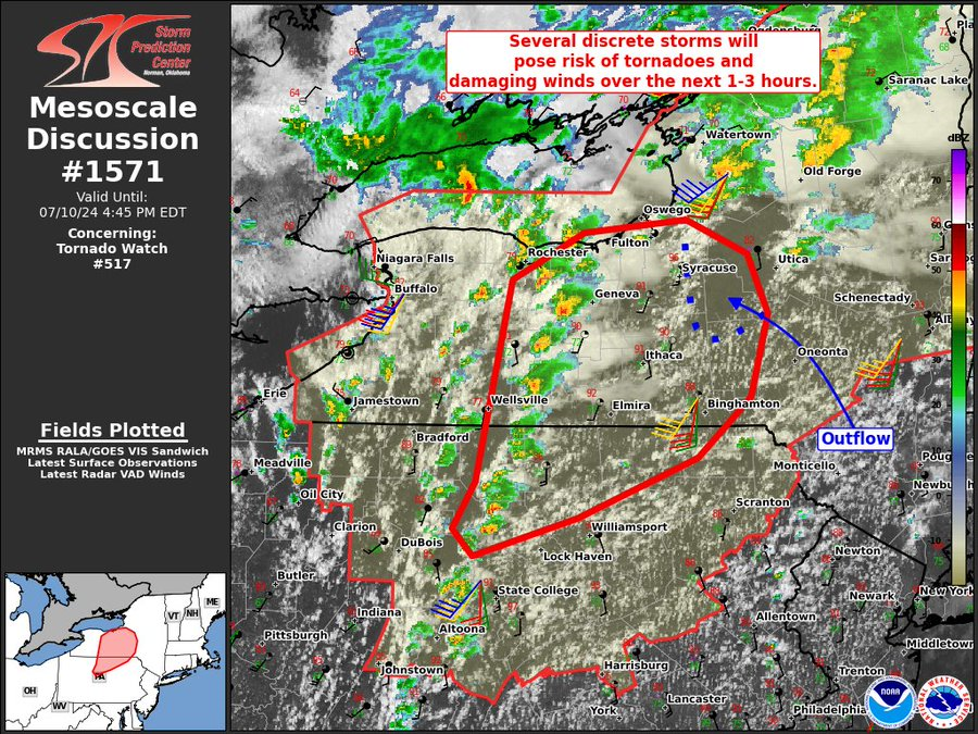
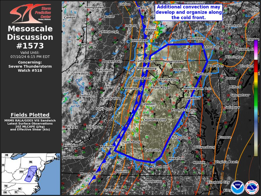
| SPC Mesoscale Convective Discussions |
 |
 |
 |
|
MCD #1569 Courtesy: NWS SPC |
MCD #1571 Courtesy: NWS SPC |
MCD #1573 Courtesy: NWS SPC |
Radar
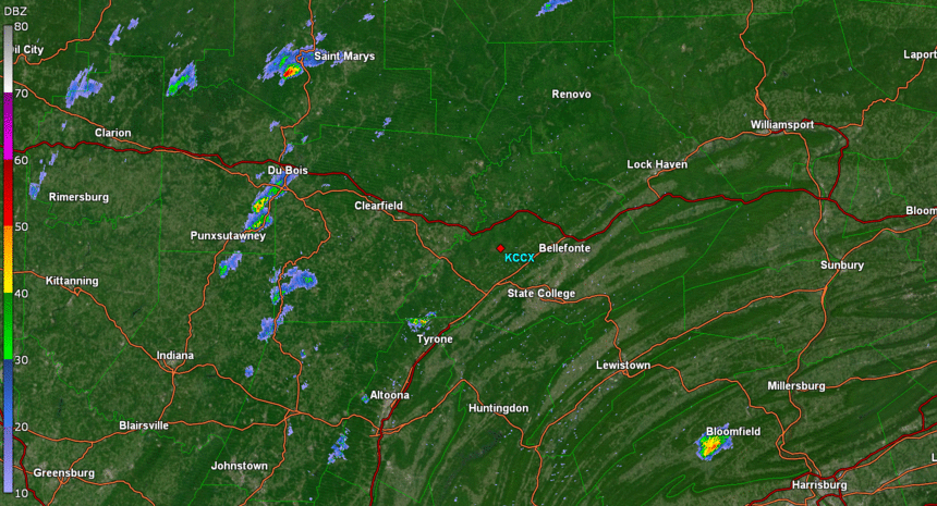 |
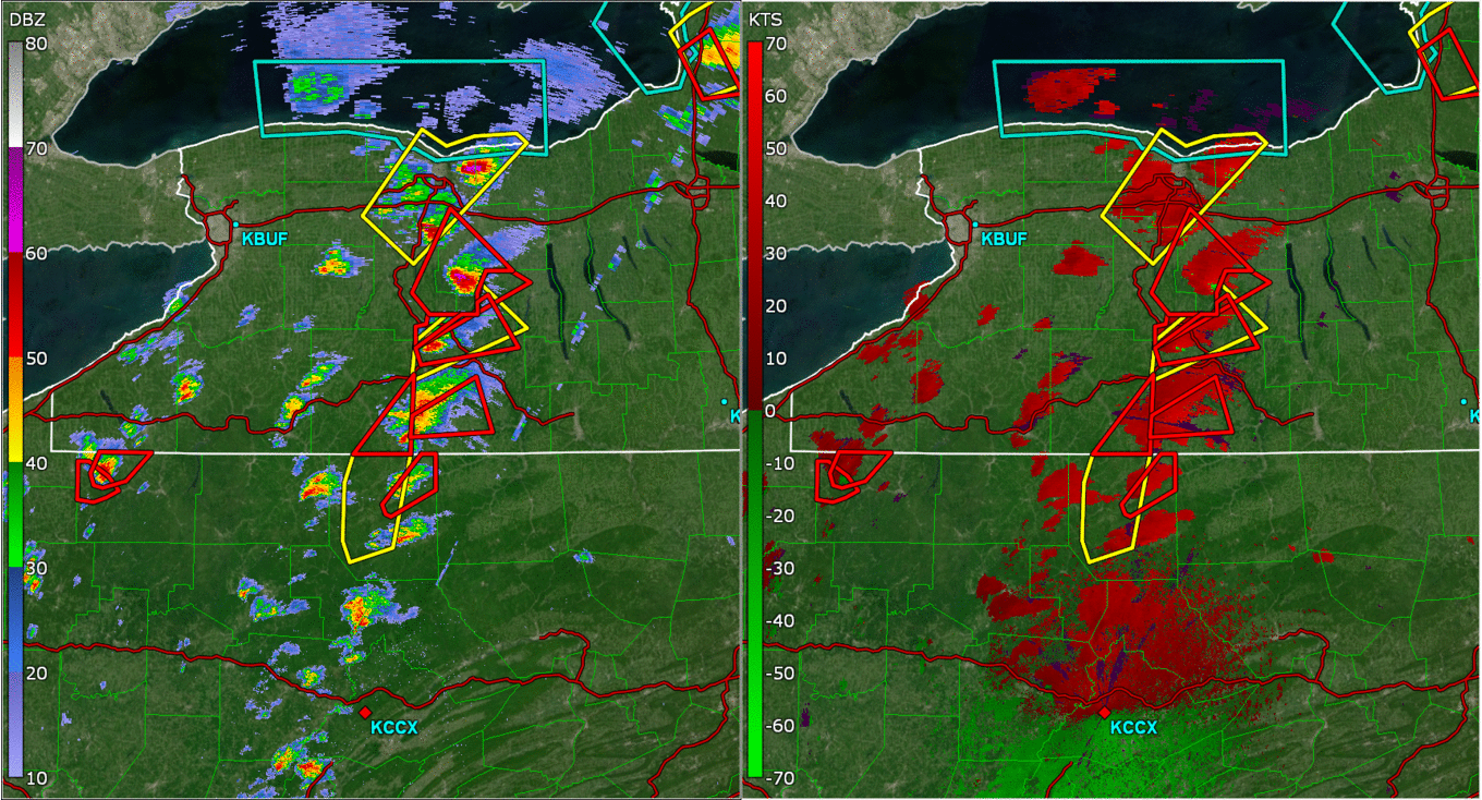 |
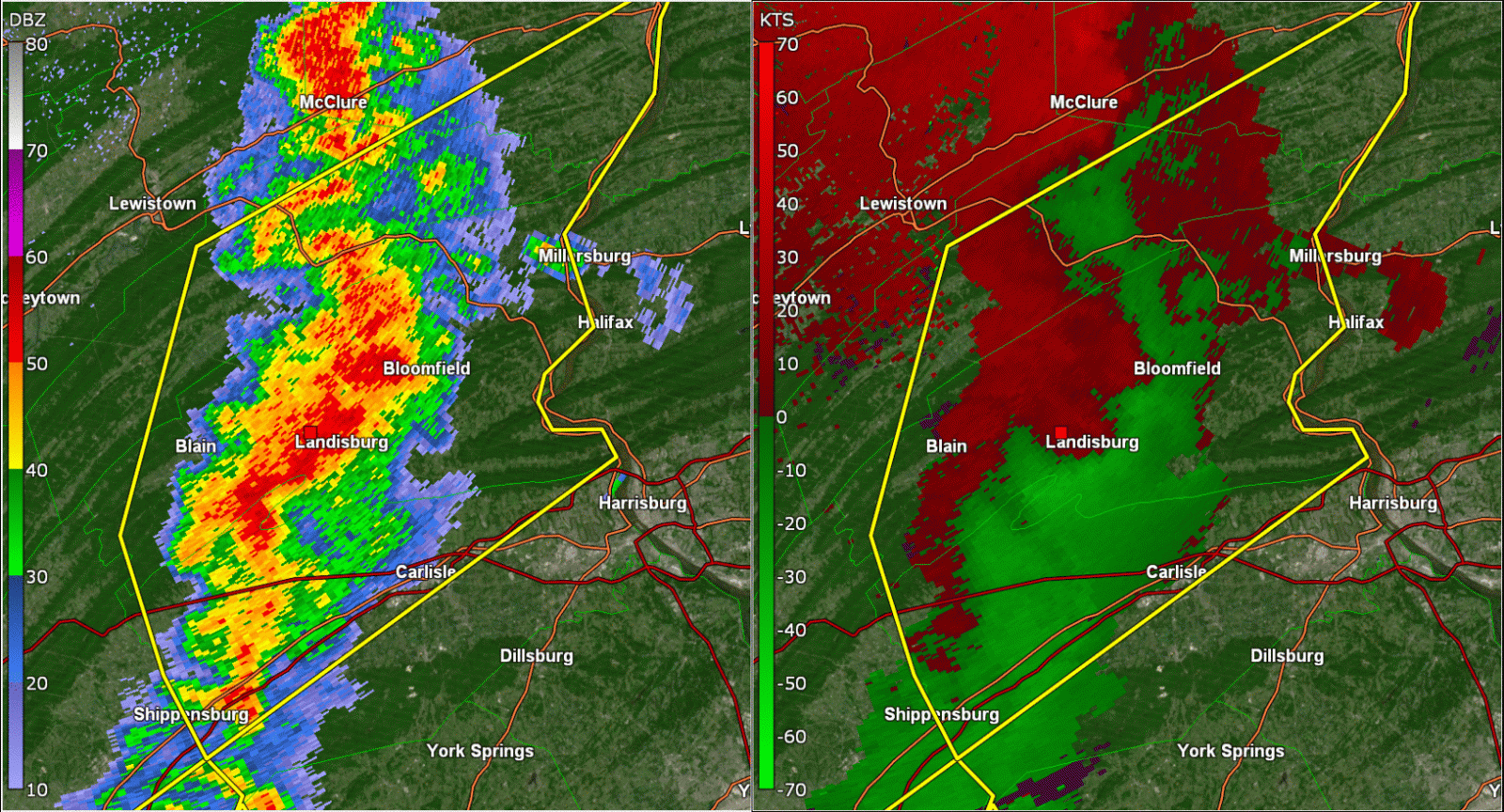 |
| The first line of convection initiated around 11:00 AM EDT (15:00 UTC) roughly 100 miles East of the cold front. | Peak tornadic activity took place around 2:30 PM EDT (18:30 UTC), though most of this occurred in upstate NY. | Near Landisburg, KCCX imagery showed a MARC (Mid-Altitude Reflectivity Convergence) signature indicative of strong downbursts. |
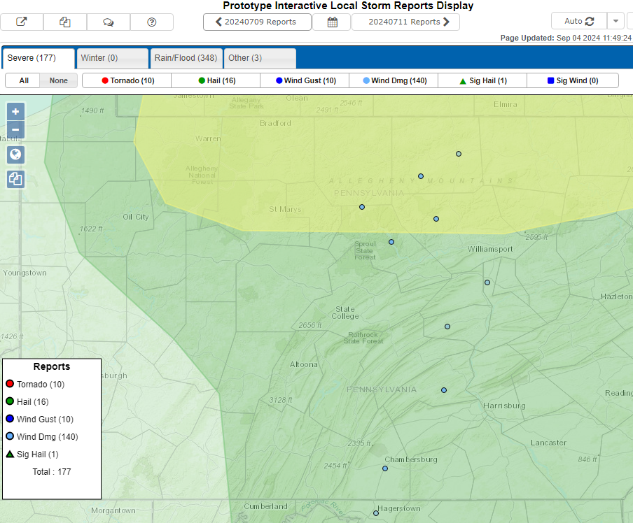
Storm Reports
Environment
 |
 |
|
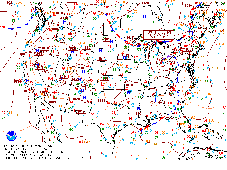
Figure 1: The strong cold front associated with post-tropical storm Beryl is seen in the 18z surface analysis. The line of convection is indicated as a squall line in this analysis. Courtesy NWS WPC |
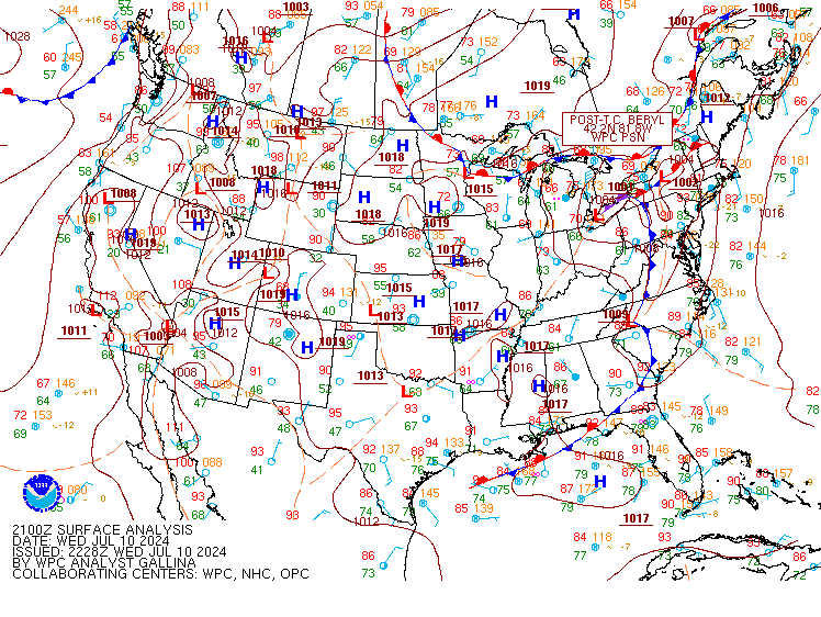
Figure 2: The cold front moved Eastward. Courtesy NWS WPC |
Near-storm environment summary.
 |
 |
|
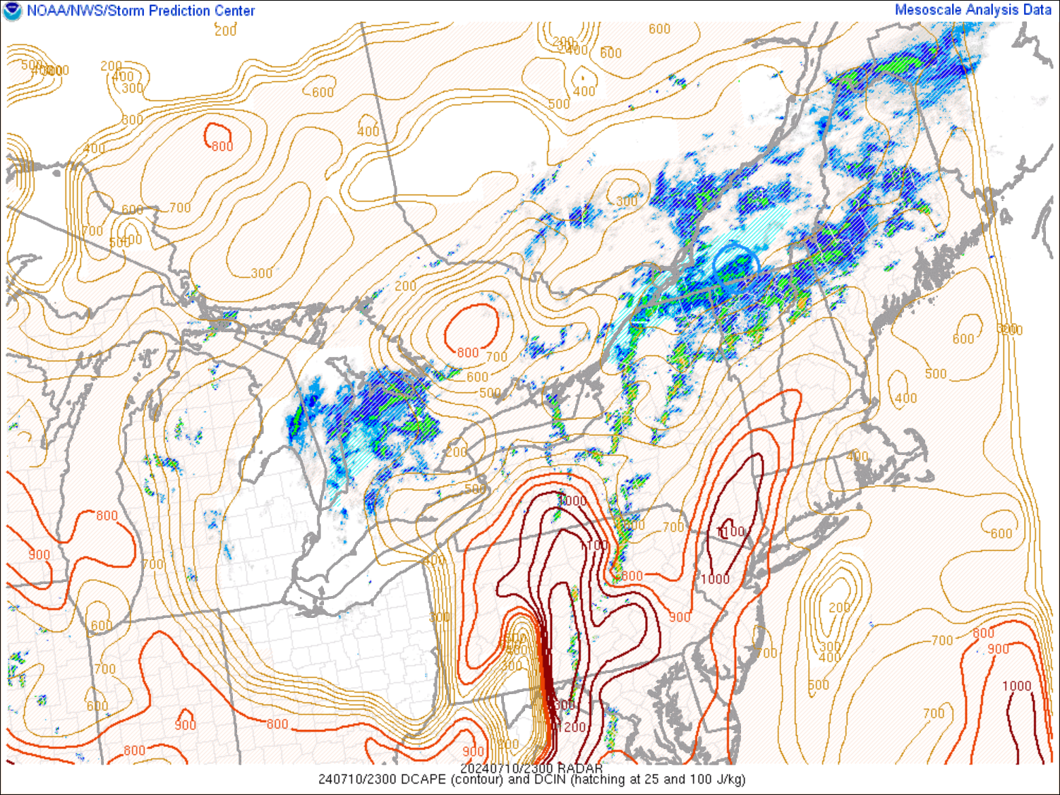
Figure 4: 7PM EDT Downdraft CAPE Courtesy NWS SPC |
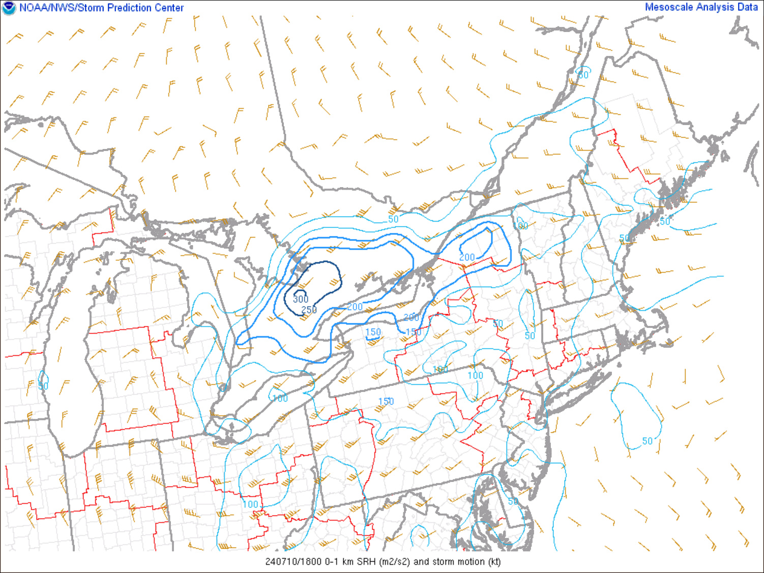
Figure 5: 2:00 PM EDT Storm Relative Helicity Courtesy NWS SPC |
 |
Media use of NWS Web News Stories is encouraged. Please acknowledge the NWS as the source of any news information accessed from this site. |
|


 Send Us a Report