
Dangerous, record-breaking heat will continue across most of the central and eastern U.S this week. Heat indices will exceed 100 degrees. Severe storms will be possible from the northern Plains into the Midwest and Great Lakes regions, as well as across the southern Appalachians Thursday, with the primary threat large to very large hail. Critical fire weather to continue in the Four Corners Region Read More >


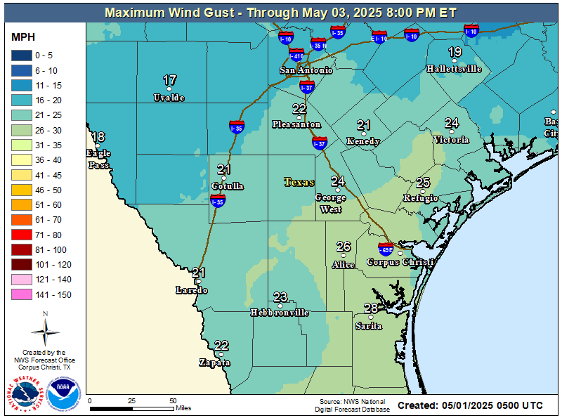
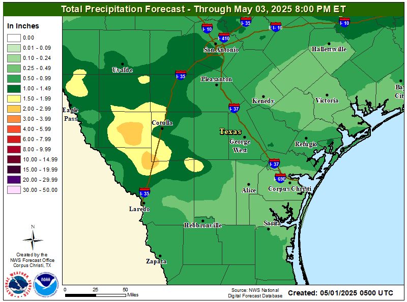
| 3-Day Wind Gust Forecast | 3-Day Rainfall Forecast |
 |
 |
| 3-Day Significant Wave Forecast | Convective Outlook - Day 1 |
 |
 |
 |
| Gulf of America | Caribbean | ||
|---|---|---|---|
 |
 |
||
| Visible Image Java Loop Flash Loop Animated GIF | Visible Image Java Loop Flash Loop Animated GIF | ||
| Infrared Image Java Loop Flash Loop Animated GIF | Infrared Image Java Loop Flash Loop Animated GIF | ||
| Tropical Atlantic | Central Atlantic | East Atlantic | |
 |
 |
 |
|
| Visible Image Java Loop Flash Loop Animated GIF | Visible Image Java Loop Flash Loop | Visible Image Java Loop Flash Loop | |
| Infrared Image Java Loop Flash Loop Animated GIF | Infrared Image Java Loop Flash Loop | Infrared Image Java Loop Flash Loop | |
| Floater Imagery | ||||
|---|---|---|---|---|
| NOAA/NESDIS/SSD | Tropical RAMSDIS - CIRA | Active Tropical Cyclones - CIRA | CIMMS | U.S. Navy |


| Regional Radars | |||
|---|---|---|---|
| Corpus Christi | Brownsville | Del Rio | New Braunfels |
| Houston/Galveston | Lake Charles LA | Slidell LA | Mobile AL |
| Foreign Radars | ||||
|---|---|---|---|---|
| Mexico | Cuba | Belize | Lesser Antilles | Curaçao |
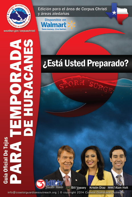
| Hurricane Guide | Spanish Hurricane Guide |
|---|---|
 |
 |
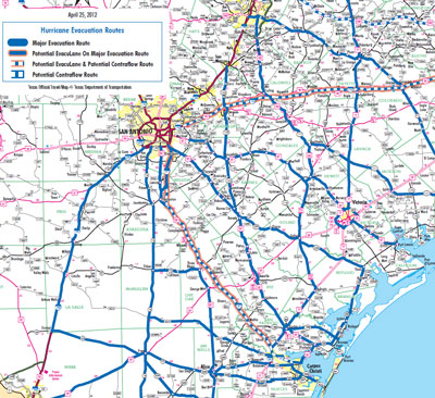
| Storm Surge Maps | Evacuation Map |
 |
 |
 |
|
|---|---|

