 Roof lifted off home of poorly constructed trailer home in La Joya, with wall damage and interior damage rendering property destroyed. Estimated wind speed from the damage and nearby damage to power lines/power poles and some trees was somewhere between 50 and 65 mph. Quick–forming Microburst Causes Some Damage in La Joya and Alton, Texas October 13th, 2015 Storms Follow Record to Near Record Heat |
|
|
The combination of an unstable air mass, just enough dry air in the mid levels of the atmosphere, a weak but dissipating front approaching from the north, and a hint of high level energy combined to produce thunderstorm clusters mainly along and west of U.S. 281/Interstate 69–C from Hidalgo and Brooks County west to the Rio Grande Plains of Jim Hogg, Starr, and Zapata County during the mid and late afternoon of October 13th. Initial storms formed in Brooks County and drifted into northern Hidalgo County by 230 PM; boundaries from these storms set off a cluster of storms that "pulsed" up and down as they moved into southwest Hidalgo County shortly after 3 PM. As the cells entered the colonias of Alton and La Joya, downburst winds estimated between 40 and 60 mph (pending additional information from Emergency Management surveys) accompanied them. 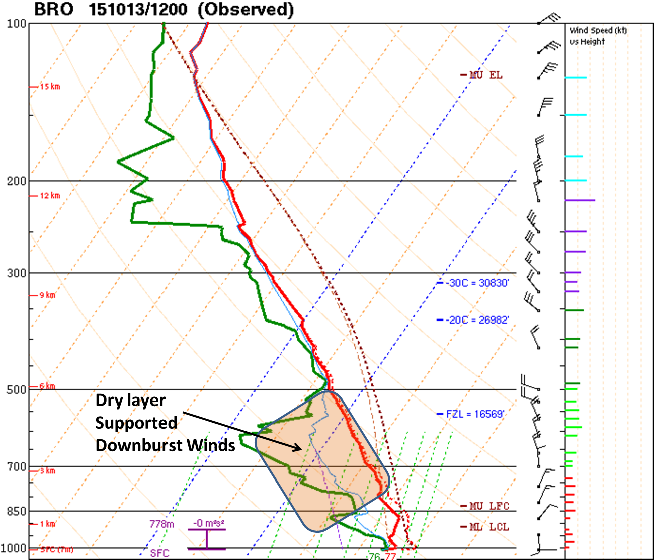 Atmospheric sounding from Brownsville, 7 AM October 13th, 2015. The combination of dry air in the mid levels (orange shaded area) with just enough overall moisture (above and below), the ability of the atmosphere to create thunderstorms, and an approaching disturbance and weakening front to provide lift were ingredients for heavy rain and gusty winds. |
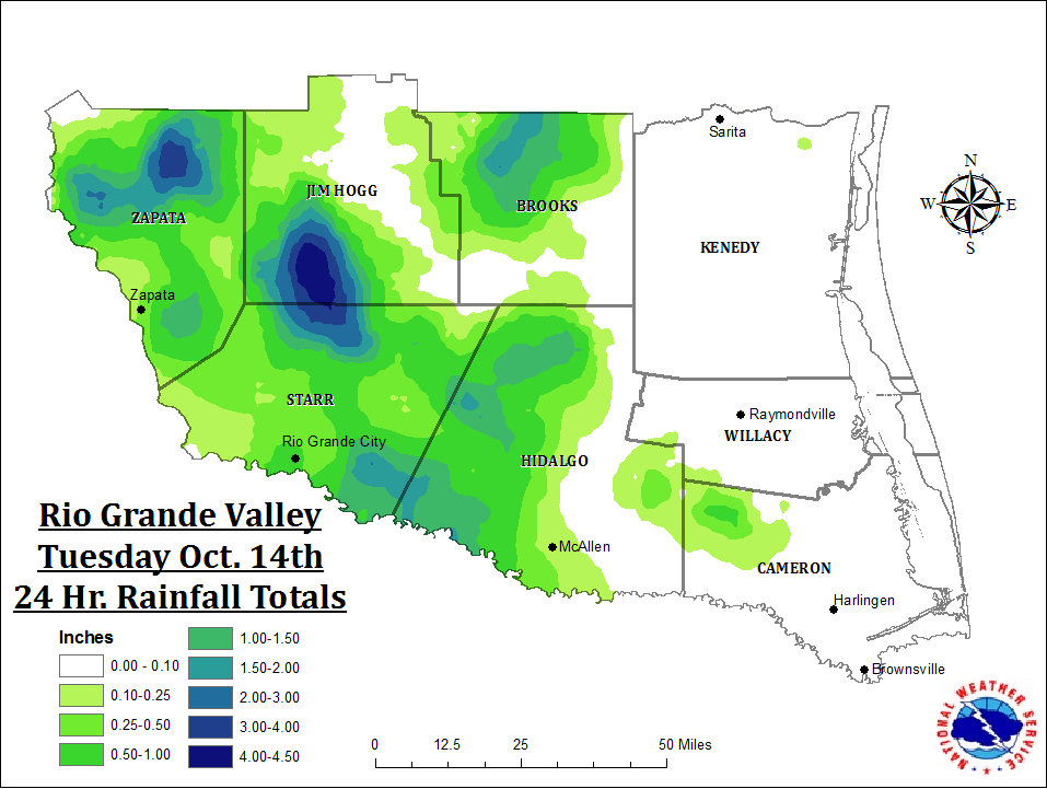
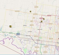 Map of preliminary reports of downburst wind damage in the Alton/La Joya area of the Rio Grande Valley. Times shown have been adjusted slightly (below) based on radar interpretation. The downburst winds tore the roof and at least one wall from a poorly constructed trailer at a colonia east of La Joya at around 330 PM CT; earlier damage at around 315 PM included two downed trees, one onto a recreational vehicle, in Alton, as well as five to seven power poles downed or snapped in the same area. Heavy rainfall estimated at 1 to 2 inches aroud Mission caused the typical nuisance urban flooding which timed out with the early commute and school release. Additional heavy rainfall dropped an estimated 4 to 4.5 inches in open ranchlands of southern Jim Hogg County (bottom). Nearly 10,000 AEP customers were without power at the peak of the storm, including more than 9,000 in western Hidalgo County alone. The outages were likely a result of frequent lightning strikes along with the gusty winds. |
 NWS Brownsville Doppler Radar 0.5° base velocity loop of thunderstorm cluster that caused minor wind damage from Alton to La Joya. Peak radar estimated speed (bright red) was 46 mph at around 4500 feet; more research is needed to correlate this unique storm motion and radar estimates with actual ground level wind speeds, which appeared to be higher in this case and similar cases since 2013. |
 NWS Brownsville Doppler Radar 1.8° base reflectivity loop of thunderstorm cluster that caused minor wind damage from Alton to La Joya. Note the "pulse" nature – oscillating higher (pink) and slightly lower values – of the individual cells as they scoot south by southwest toward the Rio Grande. |
 |
|

