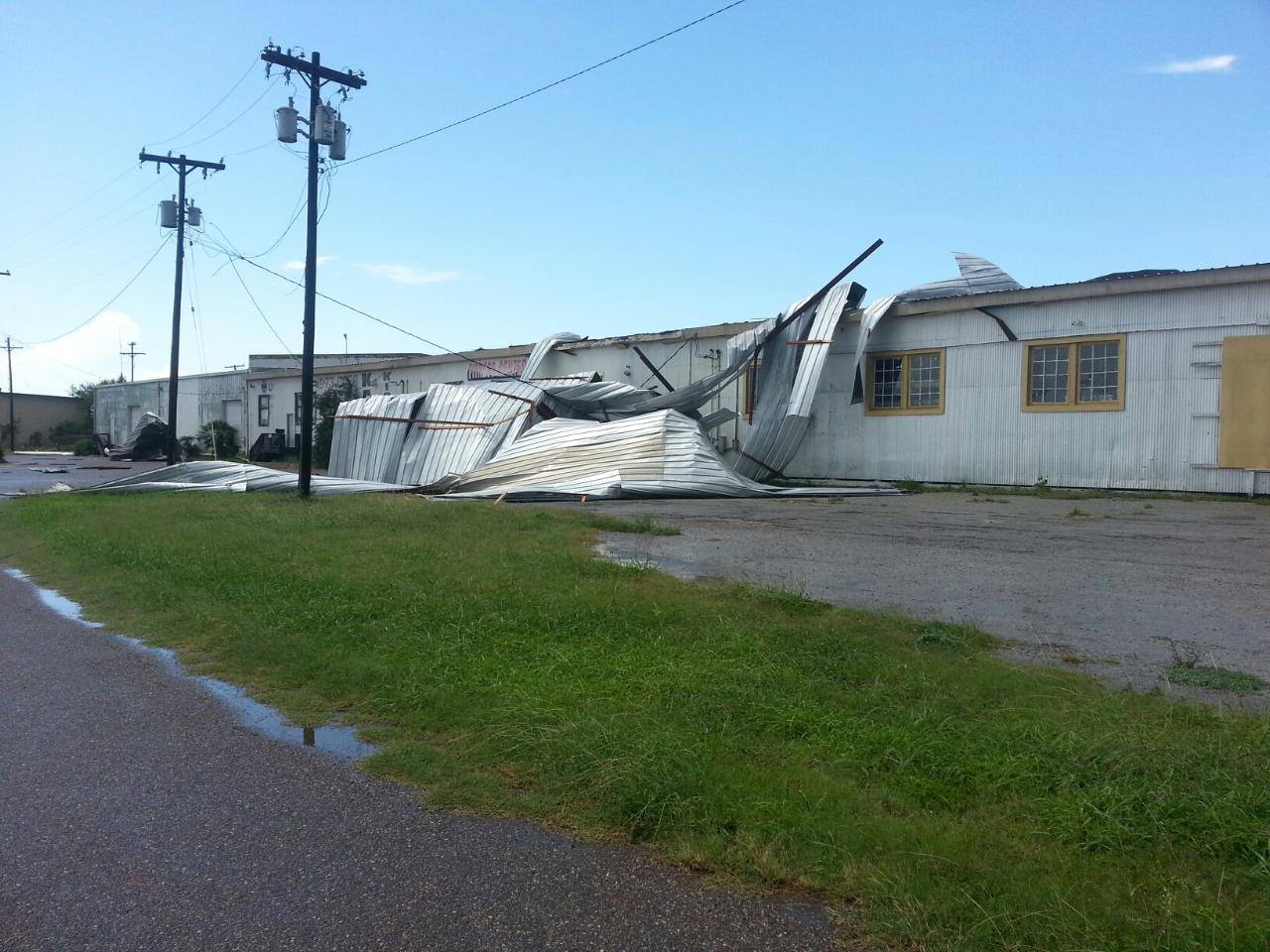
 Damage to a warehouse along Business Highway 83 and S. Utah Avenue on the east side of Weslaco, June 2, 2013. |
|
| Microburst Whips Weslaco, June 2, 2013 Relatively Rogue Thunderstorm Leaves Estimated $100,000 in Damage |
|
|
Event Summary The sudden burst of energy turned a summer storm into a short period of hell for travelers along Highway 83 and residents, business owners, and at least two aircraft. At the Weslaco/Mid Valley Airport Automated Surface Weather Observing System, a gust to 53 mph was recorded at 235 PM, as torrential rain was driven sideways and reduced visiblity to one quarter mile for a few minutes. On the tarmac, the first damage occurred when one small plane flipped into another, causing damage to each. An empty trailer was flipped on its side at a local dealership just south of the airport. The most notable damage occurred at a warehouse at the intersection of Business 83 and S. Utah Avenue at approximately 239 PM, where much of the tin roof was torn from the building. Diagonally across the street, part of the metal roof at the Economy Inn and Suites was torn off. About one and one half miles south, part of a tin carport was blown into nearby trees and a house in Ranchero Village Mobile Home Park, most likely around 243-245 PM. A dilapidated house in Mercedes also lost part of its roof, though wind speed was likely somewhat lower than estimated and observed in Weslaco. Weslaco Police initially estimated at least $100 thousand in property damage; winds were estimated to be 60 to 65 mph based on the photos, descriptions, and prior experience with similar past events in the Rio Grande Valley. Blinding rains in the core of the storm dropped a quick 1.5 to 2.22 inches (Santa Rosa, northwest Cameron County); nearby locations received little more than a trace. Unfortunately, the blinding rains contributed to two vehicle accidents along Expressway 83 between Mercedes and Weslaco. Frequent cloud to ground lightning strikes caused some power outages and started one small fire in a building. |
|
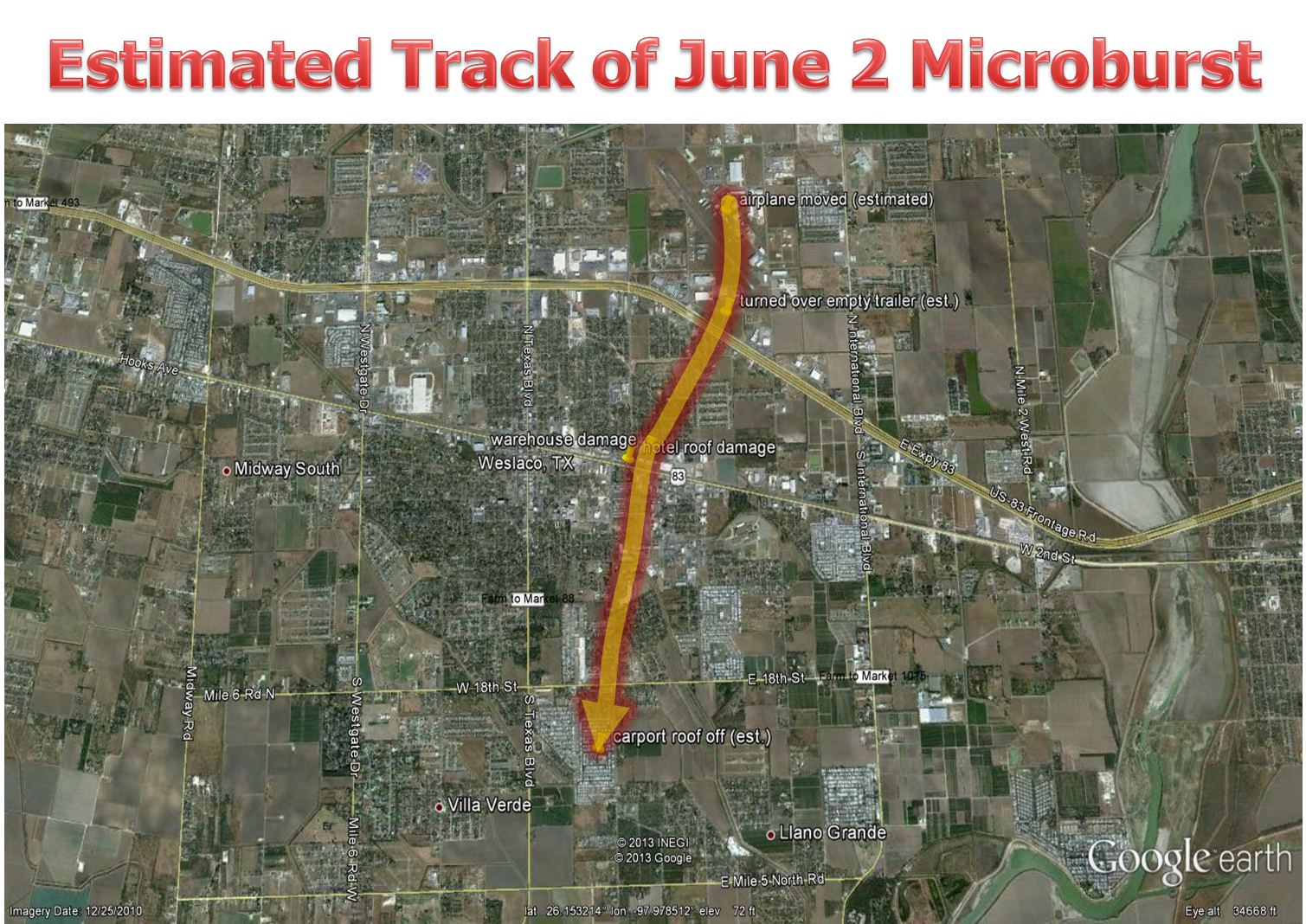 Estimated "best" track of 3–mile long microburst that caused numerous instances of roof and some structural damage in Weslaco on June 2, 2013. |
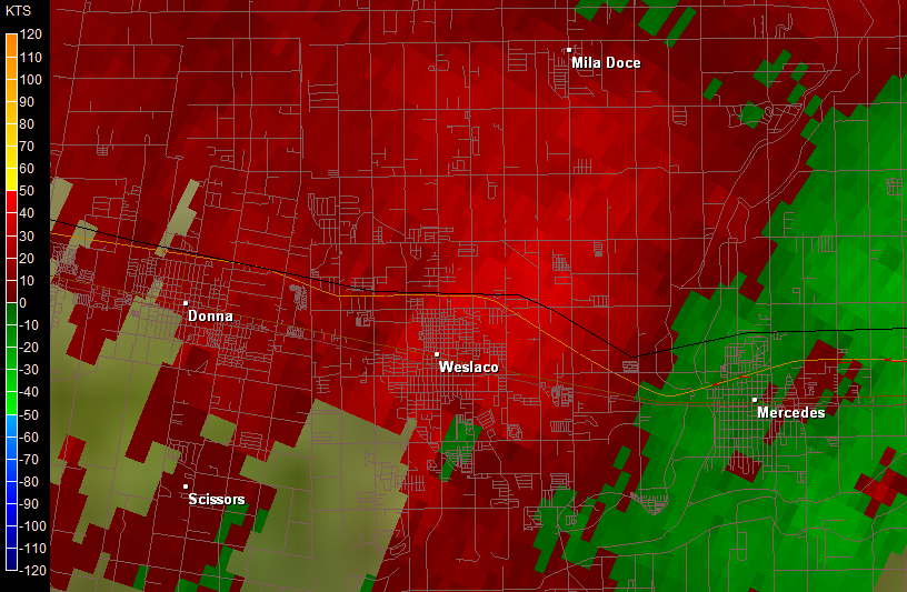 Storm Relative Velocity at 0.5° elevation across Weslaco at about the time of damaging winds. Red color indicates motion away from the radar. Radar peak speed near the damage location was around 43 mph. However, the height of the elevation slice (~5300 feet) and the movement of the storm perpendicular to the beam more than likely did not catch the true wind speed at the surface. |

