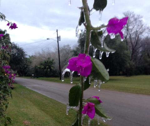
 Photos taken from around the Rio Grande Valley on January 29, 2014. Credits: NWS Employees, Emergency Management Personnel, and Social Media Followers. |
||||||||||||||||||||||||||||||||||||||||||||||||||||||||||||||||||||||||||||||||||
| Ice, Not so Nice Second Ice Storm in Three Years Coats Trees, Powerlines, etc. in Glaze |
||||||||||||||||||||||||||||||||||||||||||||||||||||||||||||||||||||||||||||||||||
|
|
||||||||||||||||||||||||||||||||||||||||||||||||||||||||||||||||||||||||||||||||||
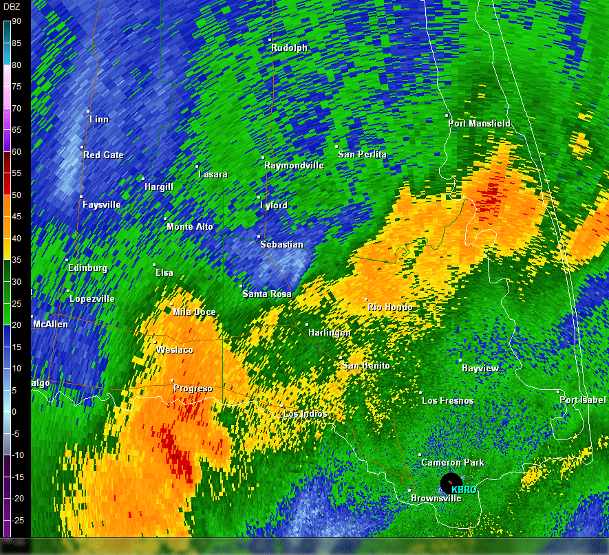 Loop of 2.4° reflectivity across Cameron, Willacy, and eastern Hidalgo County between 4 and 6 AM January 29 2014. Orange and red colors indicate a combination of large raindrops and ice pellets; much of the rain froze on contact with exposed, elevated surfaces. Summary In addition to the freezing temperatures and nasty precipitation, a stiff north wind, gusting over 25 mph at times across the Lower Valley and beaches, dipped the wind chill, or "feels–like" temperature, into the low to mid 20s for the second time in five days (below). The cold blase, one of three notable snaps in January, ensured a third consecutive month of significantly (~2°F or more) below average temperatures across the Rio Grande Valley for the first time in many years. 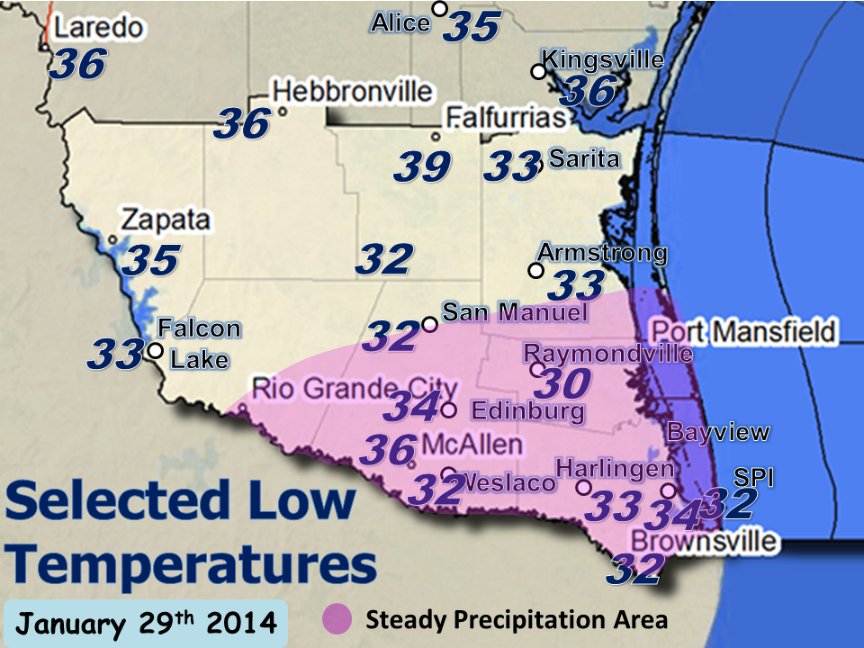 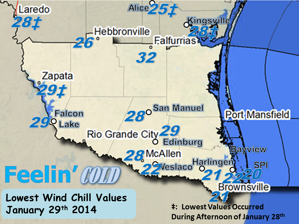 Top: Minimum temperatures on January 29th. Note the higher values farther north; the lack of precipitation combined with insulating cloud cover kept readings well above freezing compared to locations in the Rio Grande Valley. Bottom: Minimum "Feels like" (wind chill) temperatures on January 29th. Most occurred during the 3 to 8 AM period. |
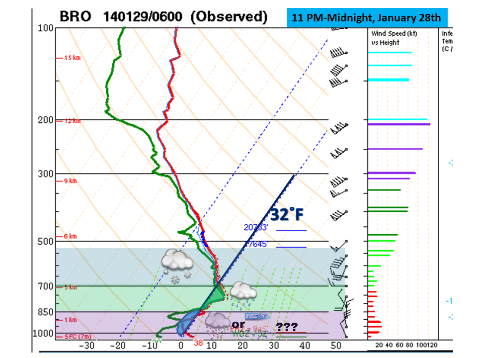 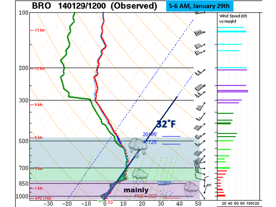 Top: Special atmospheric sounding taken at Brownsville between 11 PM January 28 and midnight January 29. Note the "nose" of warm air (green shade) which melted developing snow above into rain, which then refroze in some areas (sleet) or reached elevated surfaces and froze (glaze). Bottom: Atmospheric sounding taken at Brownsville between 5 AM and 6 AM January 29th. The "nose" was still evident, though had shrunk noticeably. Despite the smaller melting layer, the layer was enough to kill off any chance for snow at the ground. Across the Valley, generally minor inconveniences were noted, mainly from power outages. There will likely be some damage to young, tender tropical plants weighed down by the ice. Impacts were likely limited due to advance notice to schools, transportation managers, and utility companies who were given 12 hours of notice to make proactive decisions ahead of the first reports of icing. These decisions and impacts included:
What Happened to the Snow...and most of the Sleet? The ice storm was produced from a combination of cold high pressure near the earth’s surface combined with an upper level disturbance that moved across northern Mexico from late on the 28th through the early morning of the 29th. Model forecast trends through the morning and early evening of the 28th edged more towards sleet than glaze ice, as temperatures in the precipitation production zone (generally between 5 and 20 thousand feet) were expected to sit right along the freezing line. The upper disturbance, energetic enough to produce afternoon thunderstorms over the Sierra Madre Occidental in Durango and Chihuahua State (Mexico), likely weakened just enough to reduce the lift necessary to cool the entire column – even for a couple hours – to produce snowflakes. The 6 AM sounding (above, second image) showed just how close the region was to seeing a brief changeover and the first snow since Christmas 2004. Alas, it was not to be. |
|||||||||||||||||||||||||||||||||||||||||||||||||||||||||||||||||||||||||||||||||
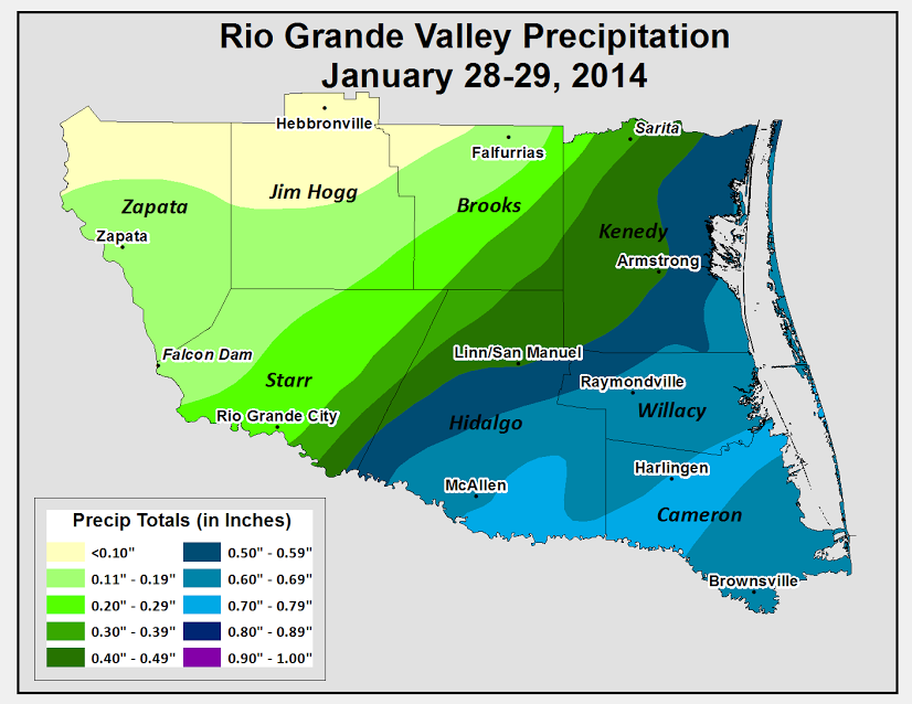
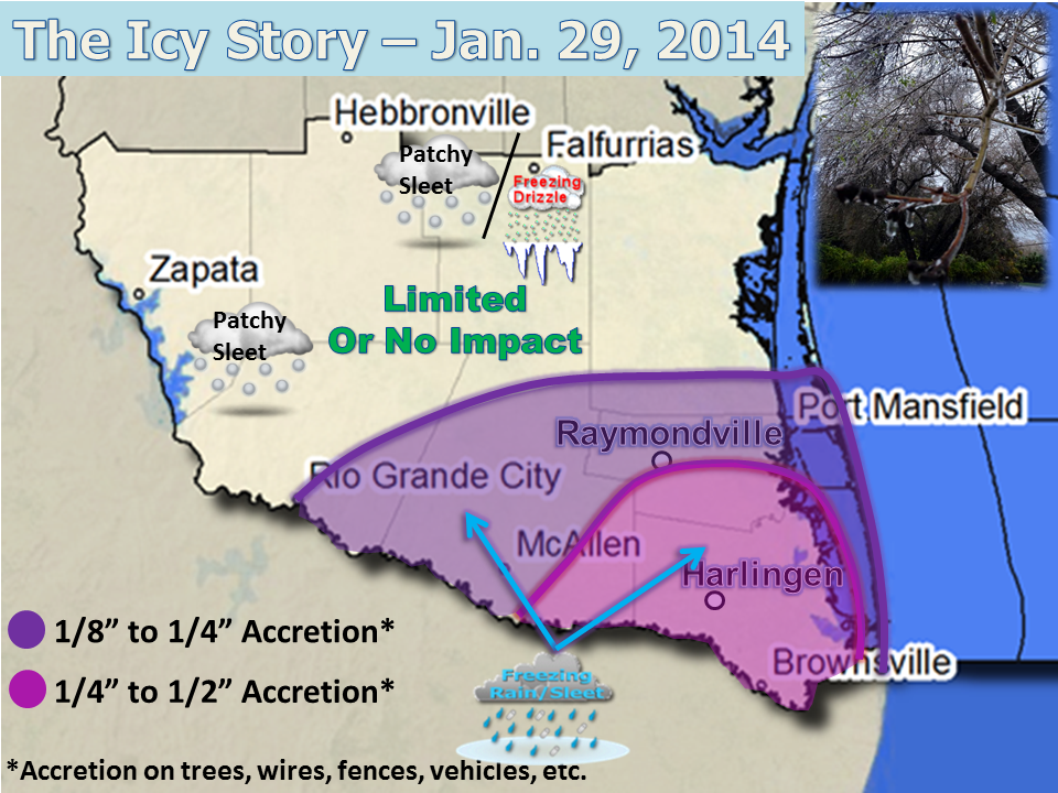 Measured and estimated ice accretion and impact map for the January 29, 2014 winter weather event. Data courtesy of NWS employees, Emergency Management and related staff, local media, and social media friends.  Time lapse of ice storm as seen from the Lone Star National Bank at the intersection of Boca Chica Boulevard and U.S. 77/Interstate Highway 69E (Expressway) in Brownsville, generally from midnight to noon on January 29th 2014. Note the icicle development and melt, and the weighting down of the palm trees (lower left) before "springing" back after melting is completed. Images courtesy of Weatherbug, Inc.. |
||||||||||||||||||||||||||||||||||||||||||||||||||||||||||||||||||||||||||||||||||
 |
||||||||||||||||||||||||||||||||||||||||||||||||||||||||||||||||||||||||||||||||||
|
||||||||||||||||||||||||||||||||||||||||||||||||||||||||||||||||||||||||||||||||||

