|
The Story
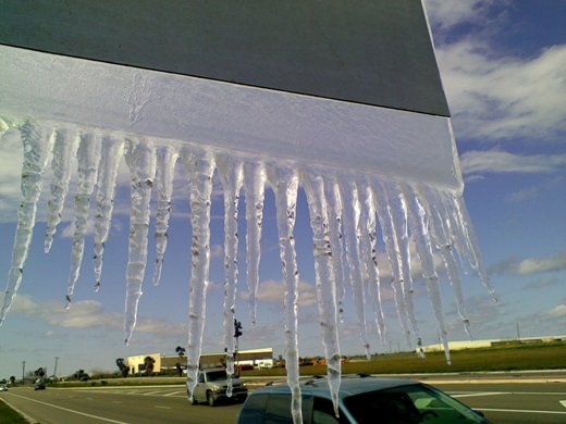
Arctic air plunged across Texas as February 2011 began, bringing a host of inclement weather to all of the state, including near blizzard conditions in the Panhandle, frigid temperatures behind ice and snow which ground the Dallas/Fort Worth Metroplex to a halt early on Super Bowl week, and icy rains to South Texas. The Valley experienced the longest, and coldest, period of winter weather in more than 20 years, with temperatures and weather conditions somewhat similar to the same week in 1989. Prolonged temperatures in the 30s and 20s, combined with persistent blustery northwest winds of 15 to 20 mph inland and 20 to 30 mph near the coast, made it feel like teens for much of the time between February 2nd and early on February 4th. An upper level disturbance combined with pooled moisture in the lower atmosphere to drop a crystalline glaze of ice on all exposed surfaces. The beauty of the ice on trees and grasses was matched by the danger the ice posed on the myriad overpasses and bridges, all which closed at one point or another during the peak of the storm on Thursday, February 4th.
February 2nd: Groundhog Felt at Home
As the core of Arctic High Pressure spread through the Great Plains (below, left), strong northwest winds turned what had been a balmy afternoon to open February into a dangerously cold for unprotected people, pets, and plants by daybreak. The combination of northwest winds 20 to 25 mph and gusty near the coast, and 15 to 20 mph and gusty inland, dropped "feels like" temperatures into the low to mid teens (below, right). The change from Tuesday afternoon to Wednesday morning was more than 40°F in air temperature, but a whopping 50 to 60° lower in how it actually felt – quite a shock to most residents of the Rio Grande Valley.
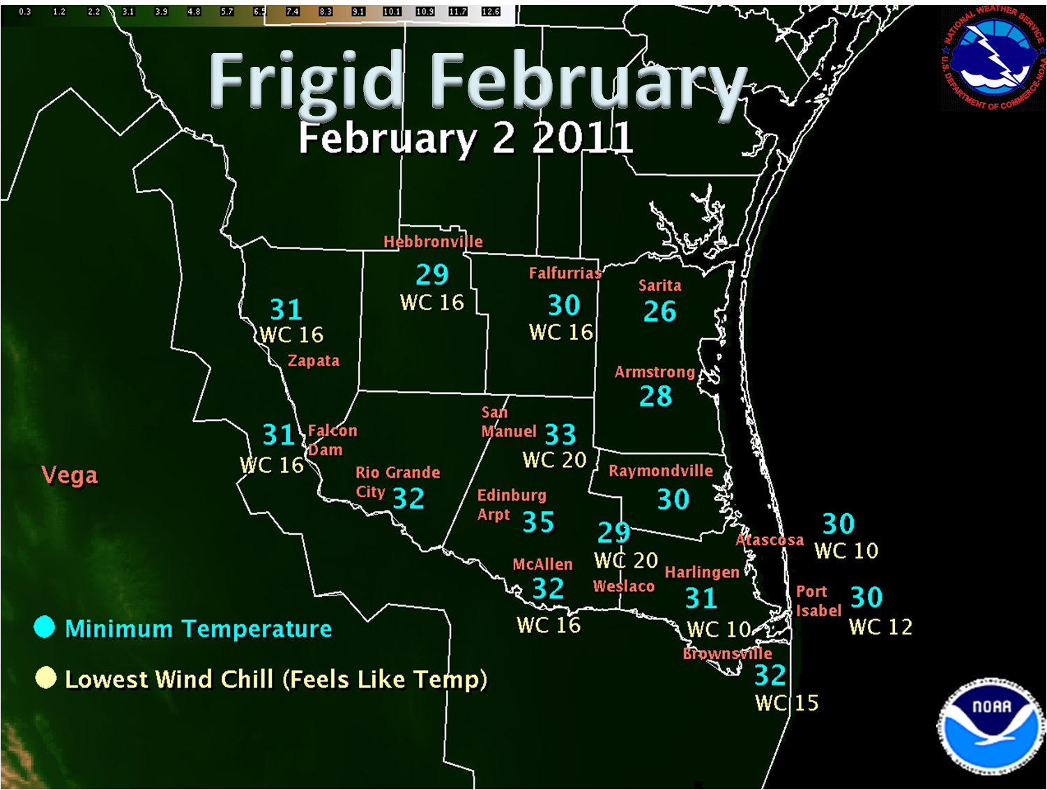
Stiff northerly winds persisted through much of the day. These winds combined with a steely gray overcast to hold air temperatures in the low to mid 30s. Dangerous wind chills held in the teens to lower 20s for the remainder of the daylight hours, one of the coldest feeling days in decades. A number of locations had temperatures drop to or below the freezing point (32°F) for several hours; a brief hard freeze occurred across the northern tier of the brush country and King Ranch. Full details can be found in the February 2nd Temperature Table.
|
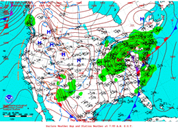
Surface U.S. weather chart, 6 AM CST February 2, 2011. Note center of arctic sourced high pressure spreading across the Great Plains. |
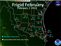
Deep South Texas/Rio Grande Valley map of lowest air temperature (azure) and wind chill, or "feels like" temperature (tan) on February 2, 2011. |


